The day had finally arrived: it was my last chance to attempt the Wyoming 13ers FKT in 2022, and the weather patterns were finally working in my favor. An abnormally strong ridge of dry, high pressure air was working its way into Wyoming, and the NWS forecasters expected zero storm activity for the foreseeable future, giving me at least 5-6 days of ideal climbing weather.
After countless iterations to the plan and two botched attempts, I had converged on a plan to knock out the cluster of 31 peaks in the northern Wind Rivers first, taking advantage of the stable weather to put in long days on committing routes. I would go southbound, starting with Downs, meeting my mom at a basecamp in Titcomb on day 2, and hopefully exiting to Elkhart Park on day 5. Going this direction has the disadvantage of extra elevation gain, but the northern section is especially exposed to the weather, so I wanted to get my Divide traverse done while the weather was most stable. That meant that today, I needed to start early and make it through all of the easy peaks north of the Dinwoody region.
After a short drive to the Trail Lake Trailhead, I officially start the clock on my 13ers FKT attempt when I leave the car at 2:01 a.m. on September 2.
The Old Glacier Trail begins with an icy ford of Torrey Creek; then I'm off, hiking into the darkness.
Not quite the glamour shot we expect from mountaineering, but this is what most of the first few hours looked like as I followed the Glacier Trail across the grassy slopes of Arrow Mountain.
Glacial rock flour makes Iceberg Lake look milky, but Baker Lake is free of sediment and its clear water looks dark blue.
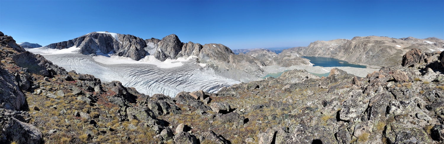
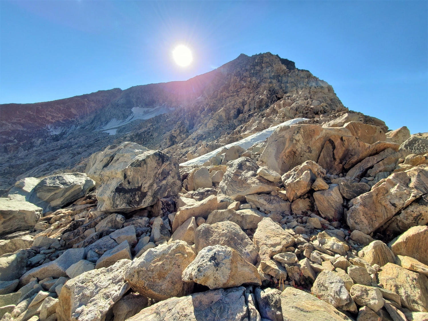
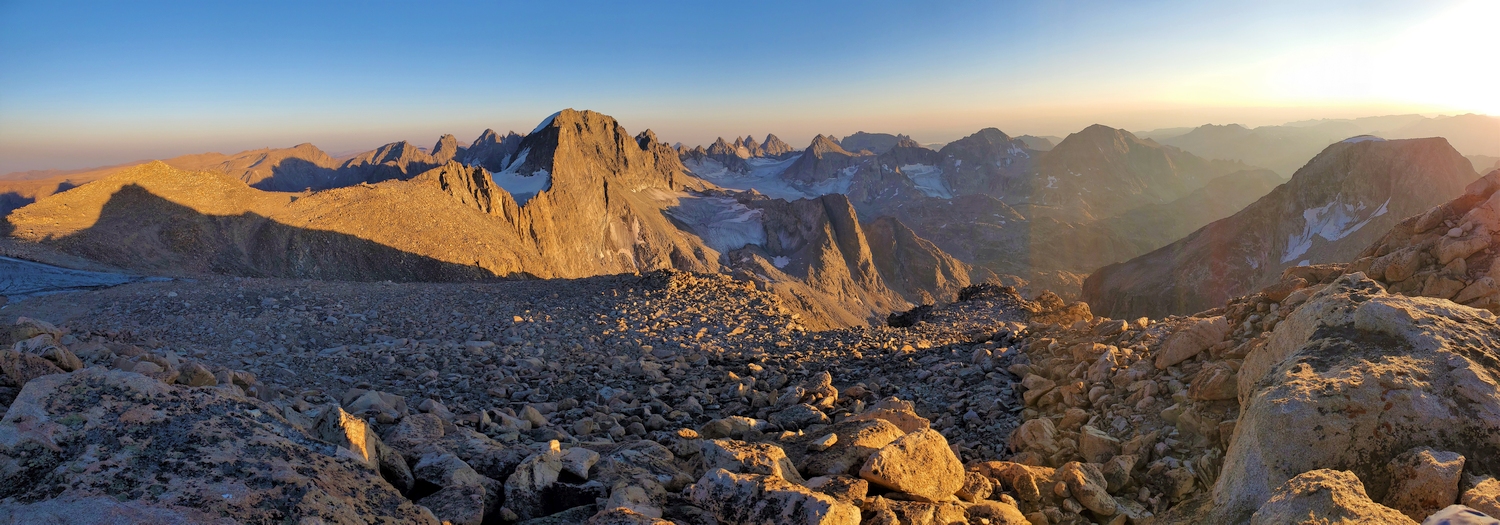
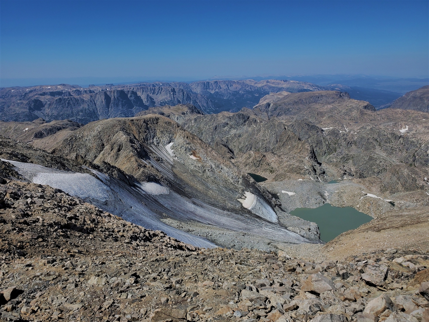
The Sourdough Glacier spreads out below as I hike up the Divide towards Klondike Peak. Most of the glacier is bare ice by this point in the summer, which means it is melting and won't be this big for much longer. Despite the stunning views, I started hitting a wall around here, probably because I wasn't eating enough.
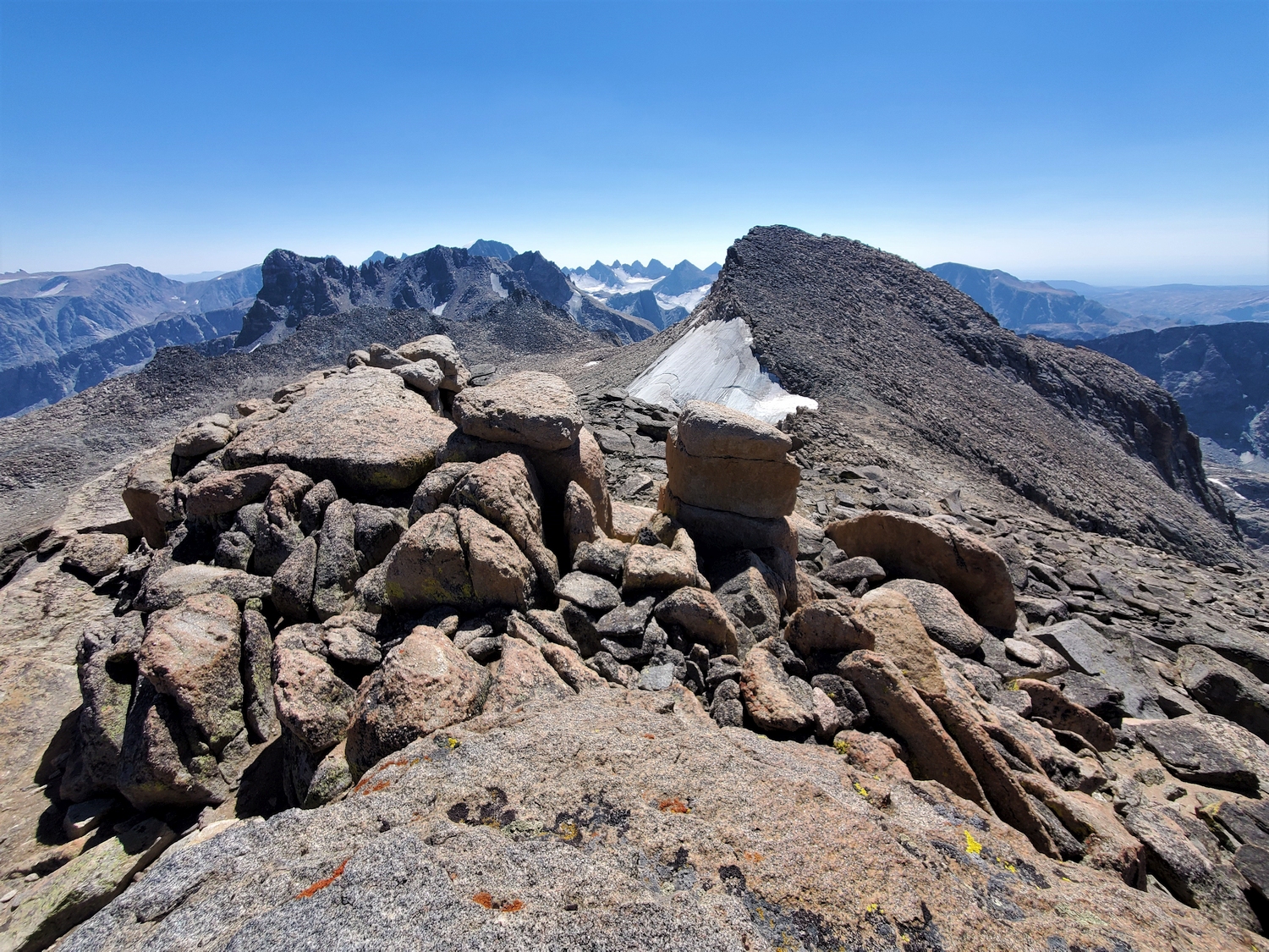
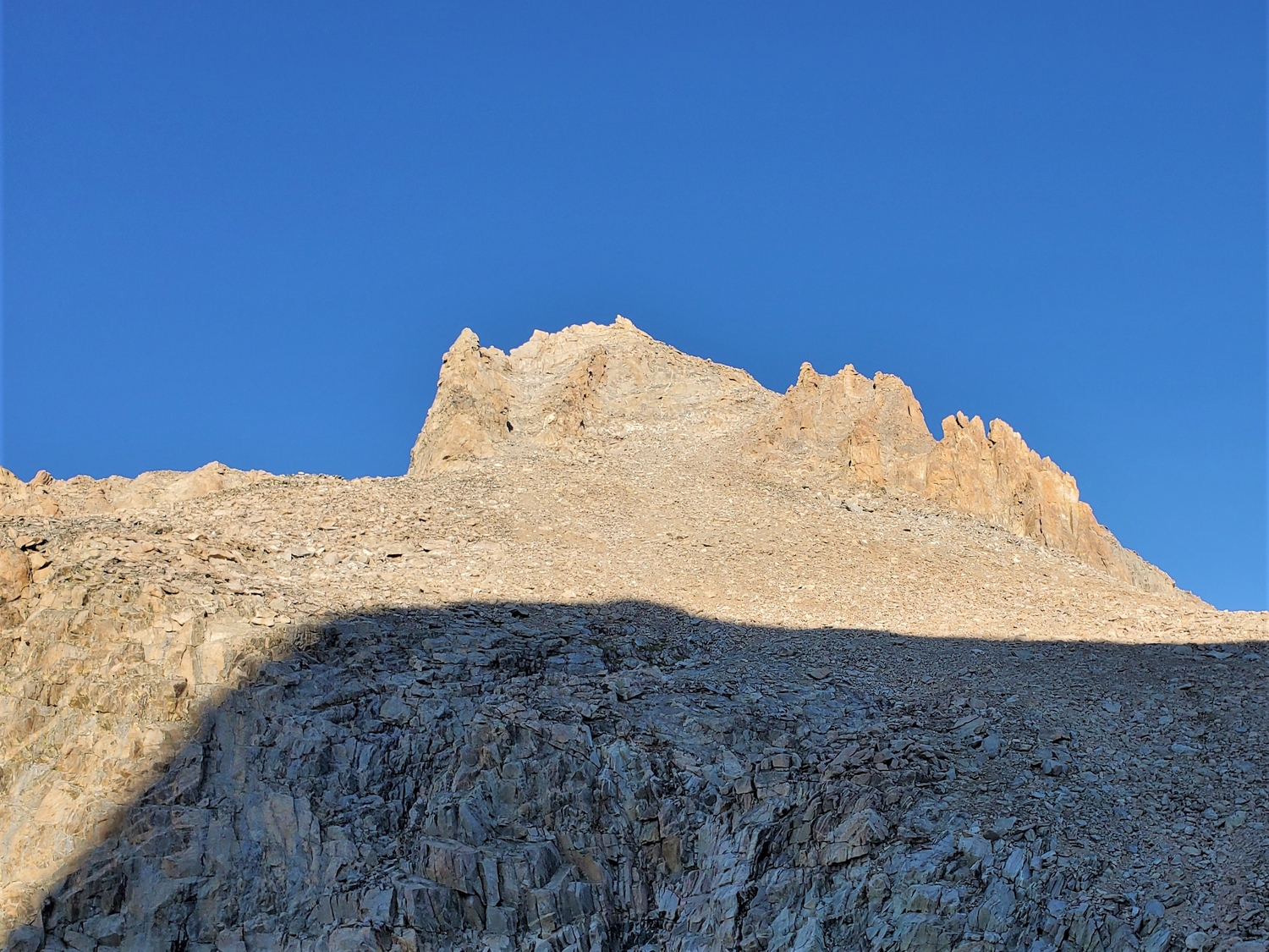
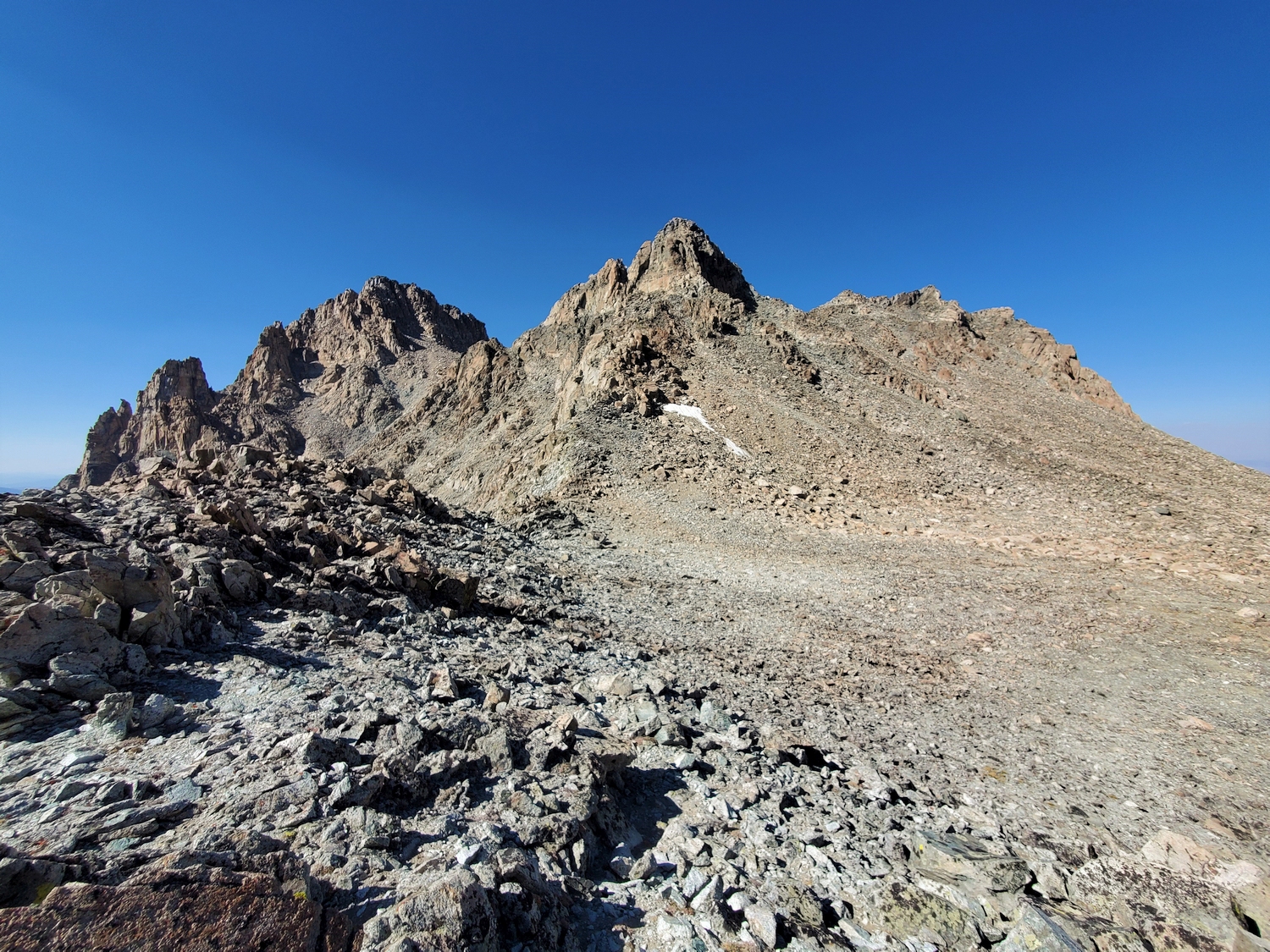
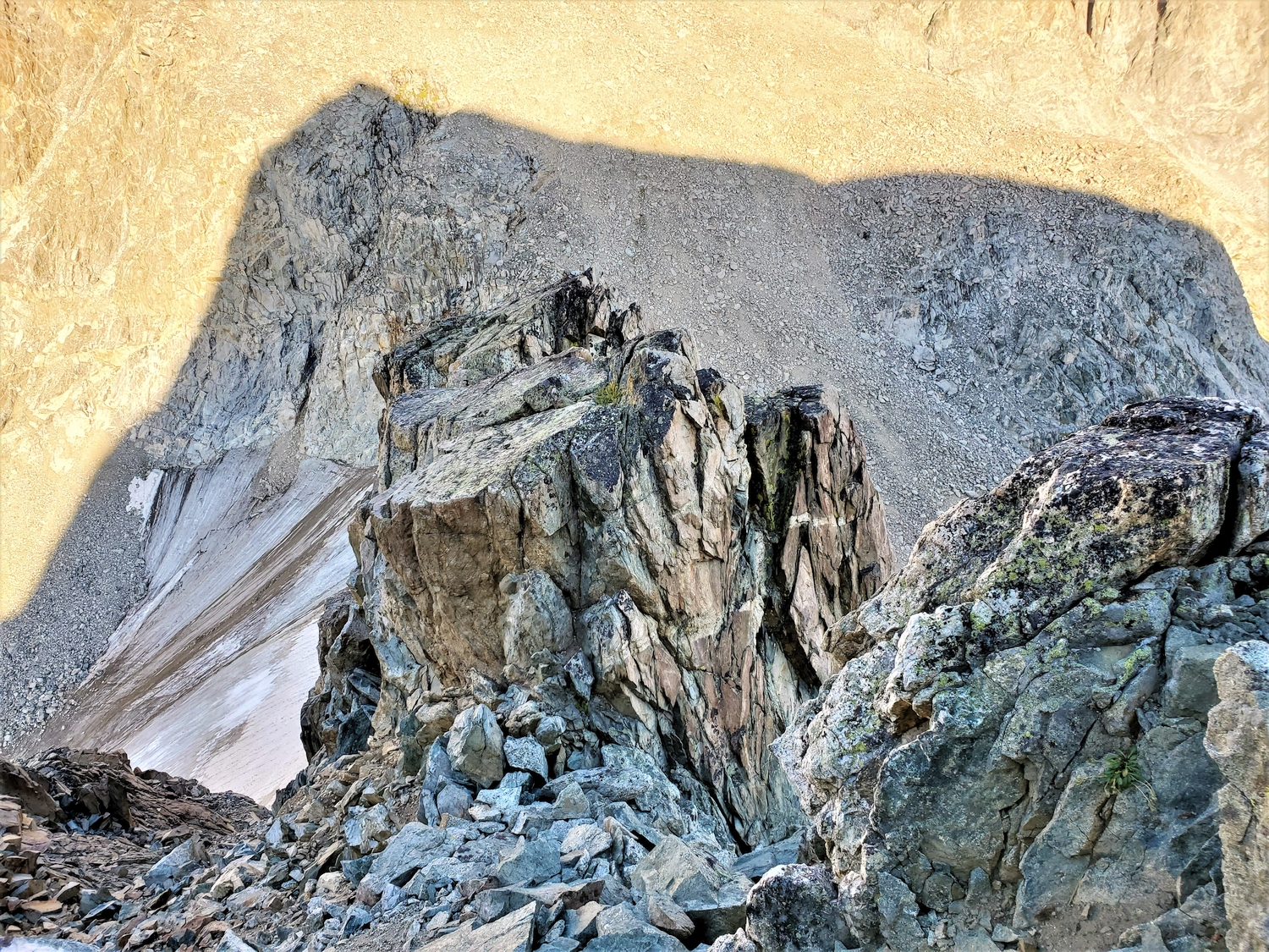
Looking towards Flagstone (close, right) and Bastion (distant, left) from the summit of Pedestal.
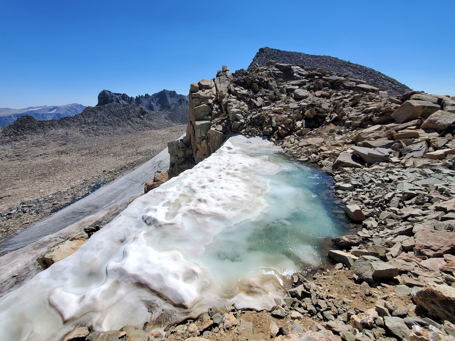
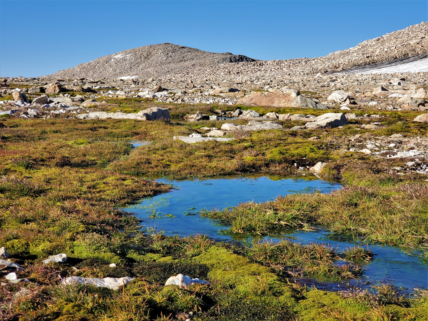
This meltwater pond at the Pedestal-Flagstone col was the best source of drinking water I could find. It was a bit stale, but I was just about out of water, and there is very little water up this high in the late summer.
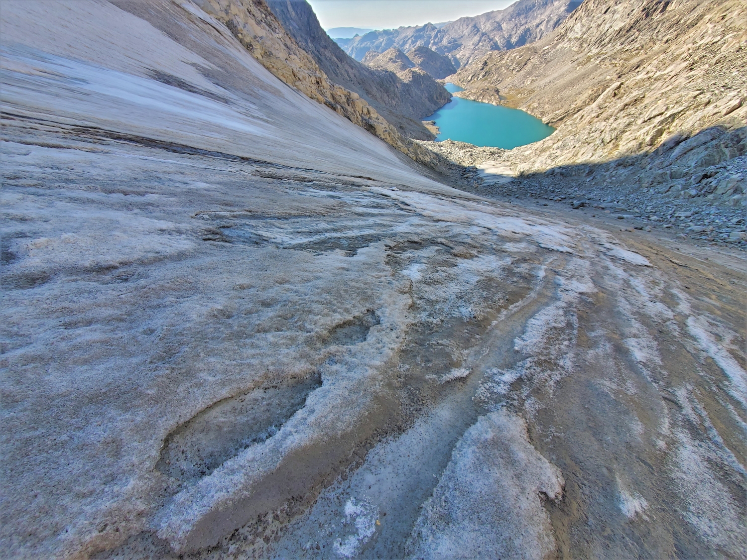
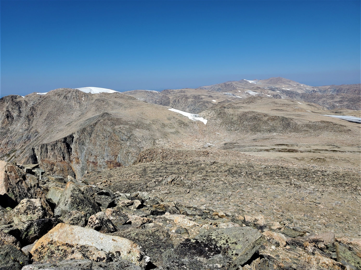
From the top of Flagstone, I peer down into the steep cirque at the head of Tourist Creek. I'm hoping to traverse across the left side of this bowl to get to Desolation Peak later this afternoon.
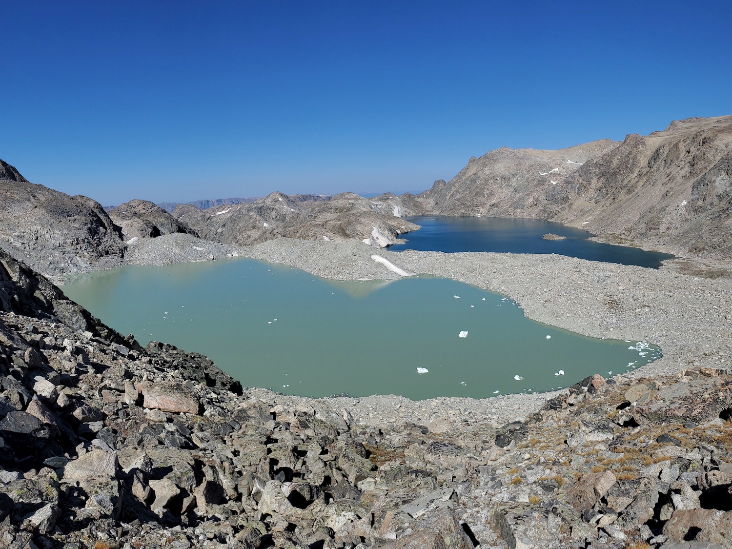
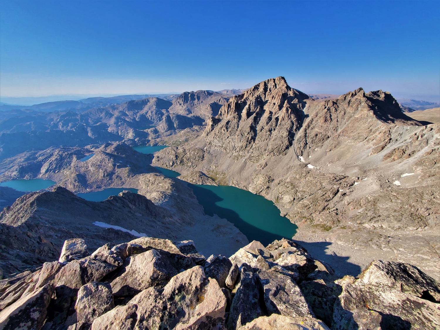
Lake 11,478, sometimes called Lake Solitude, glistens like a turquoise gem far below.
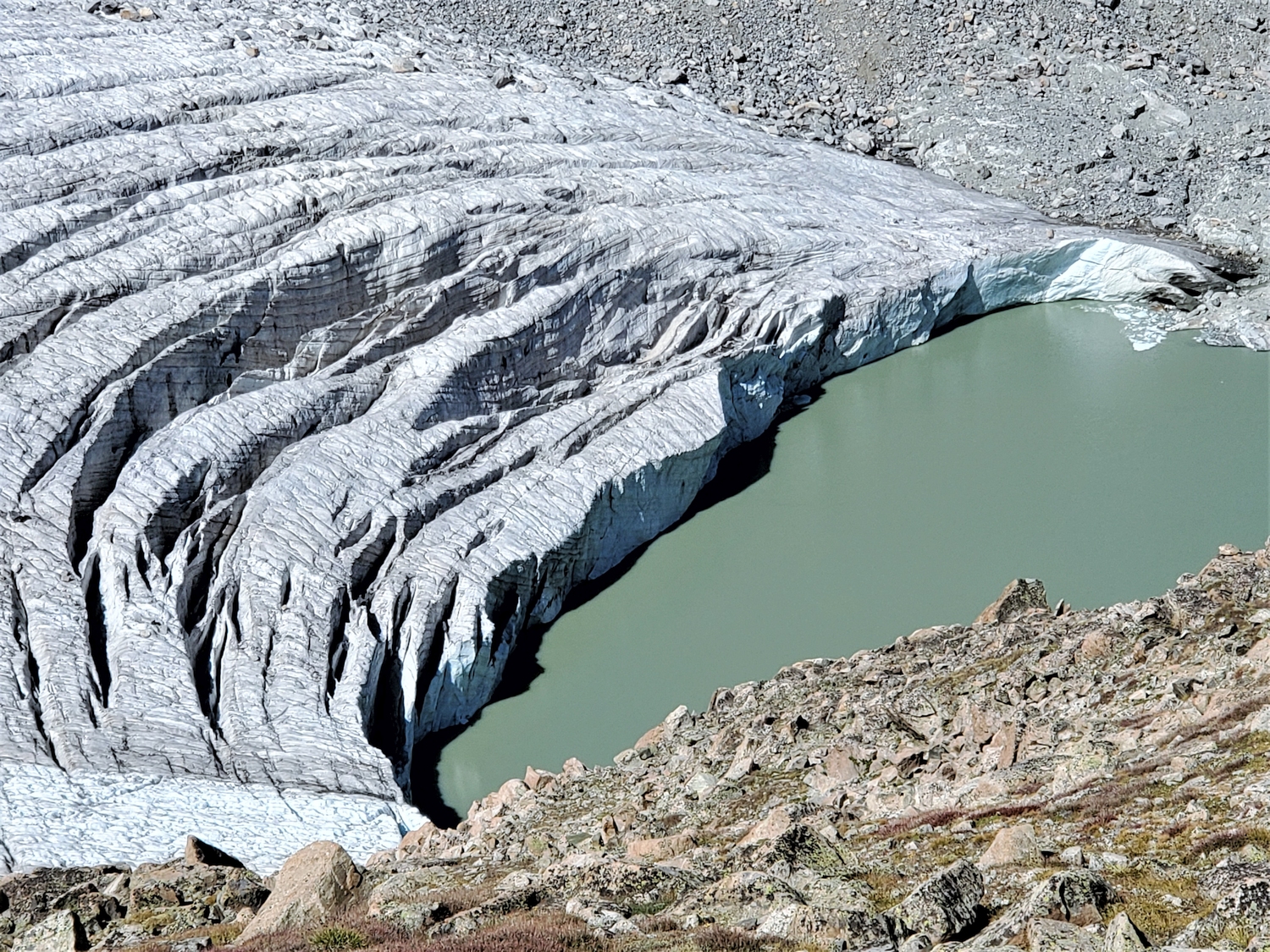
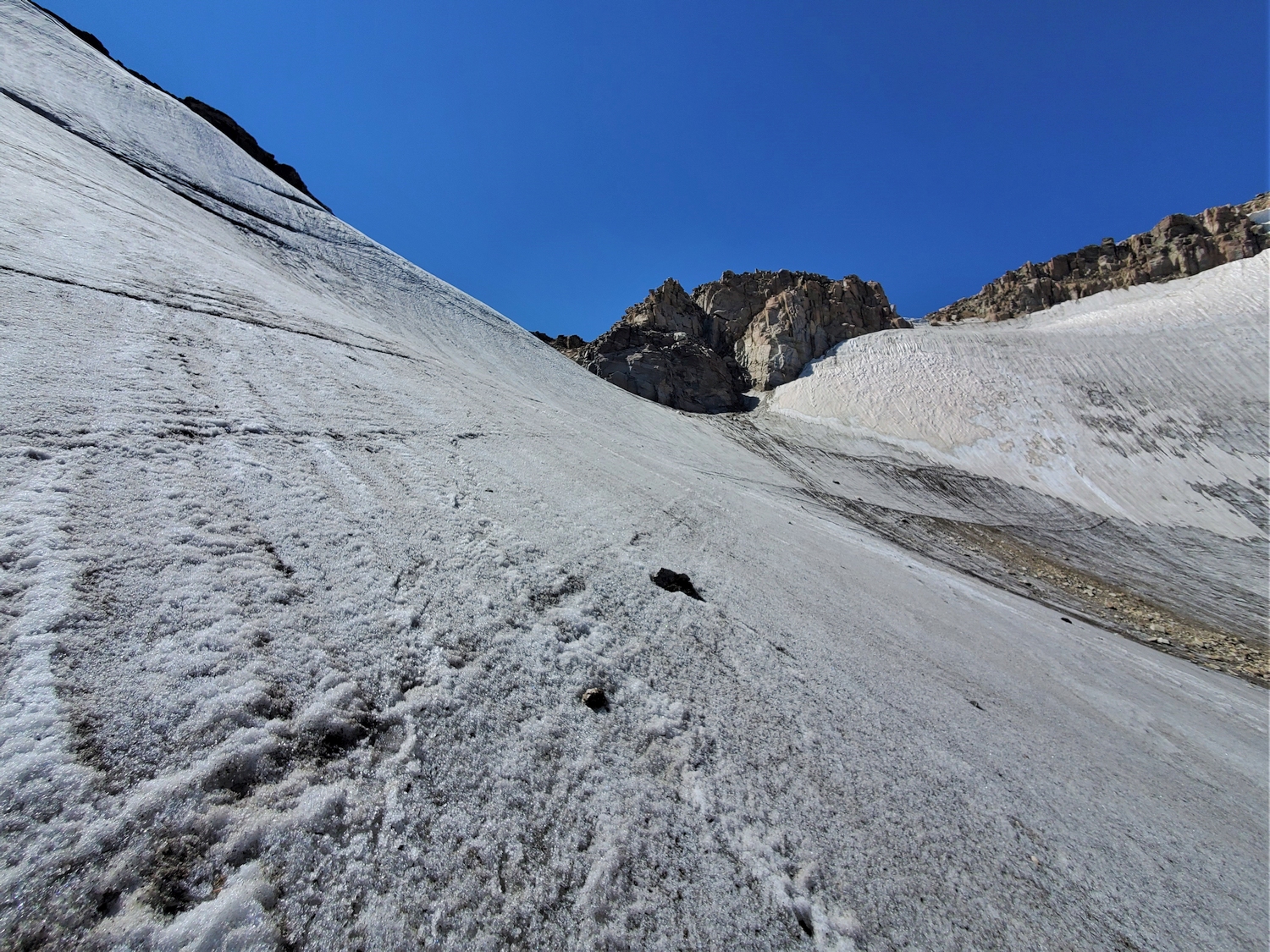
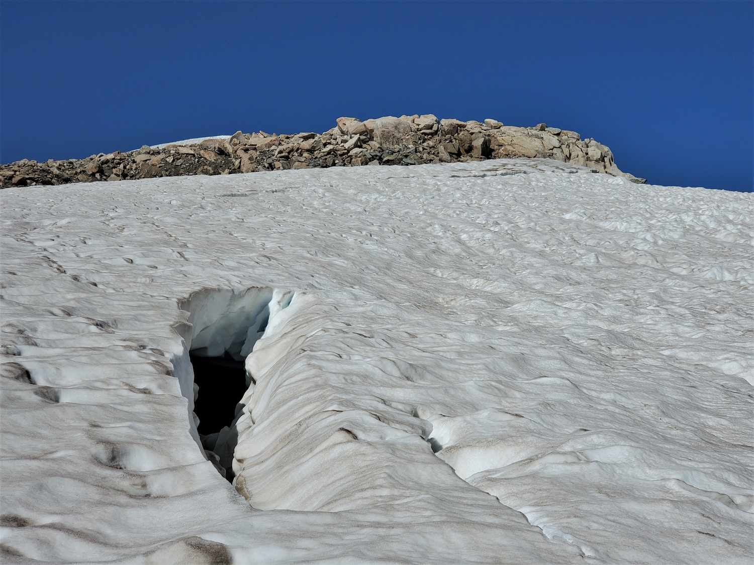
I break out my crampons for the first time this trip to descend the icy snowfield below the Flagstone-Pedestal col.
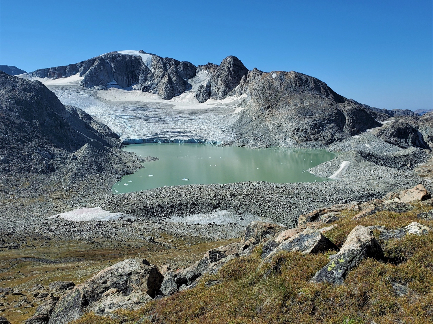
One of my biggest concerns going into this project was the condition of the glaciers, since I’d never climbed in the northern Wind River Range this late in the summer. This photo shows a zoomed view of the Twin Peaks and Split Mountain rising above the Mammoth Glacier (with American Legion and Henderson in the distance). This was my first look at the Mammoth Glacier, and I could tell it was very icy–a sign of trouble to come. Indeed, the small snowfield I descended below Flagstone was dishearteningly hard and icy, leaving me increasingly worried about the more serious upcoming glacier travel.
Getting drinking water is a big challenge on projects like this. Climbing these peaks so late in the summer meant that almost all of the snow was already melted, so the peaks were very dry, and I rarely dropped into valleys. Moreover, I decided not to carry a water filter, since stopping to filter would have cost me 30-60 minutes per day. Instead, I filled my bottles directly from streams, lakes, and snowmelt ponds. This stream, which I crossed while descending into the Tourist Creek valley, was one of the nicer spots I filled up, since it wasn’t covered in algae and the water was moving.
At this point, I had climbed six 13ers and hiked over 16 hours with only a few ~5 minute breaks. This was one of my most aerobically challenging days: in addition to snow gear and rappel gear, my pack was loaded down with a sleeping bag, bivy sack, and extra food, since it would take me two full days to reach basecamp in Titcomb Basin.
I had originally planned to bivy at the Desolation-Bastion col on the first night. However, since the sky remained perfectly clear and I still felt like I had some energy in reserve, I decided to climb Bastion and bivy near its summit to get a head start for tomorrow. I grabbed my pack and started chasing the sun up the steep west ramp of Rampart just over an hour before sunset.
Looking up at the sunlit slopes of Rampart from the base of Desolation's east ridge.
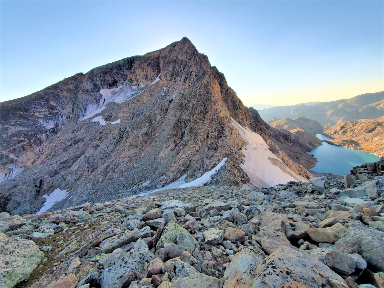
Looking back at Desolation Peak, with the east ridge rising prominently near the center.
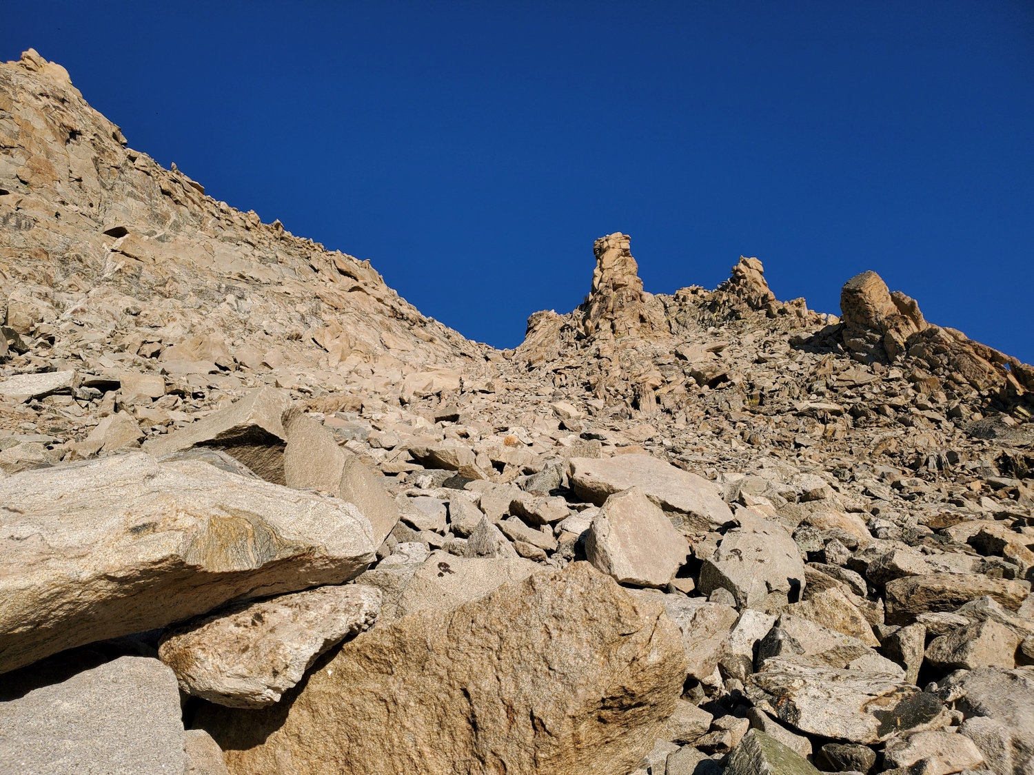
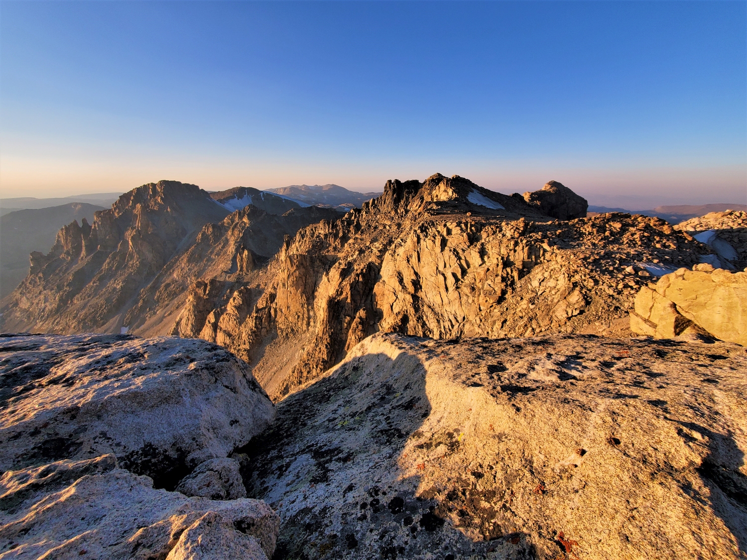
Back in the sun again as I near the summit plateau of the Bastion-Rampart massif.
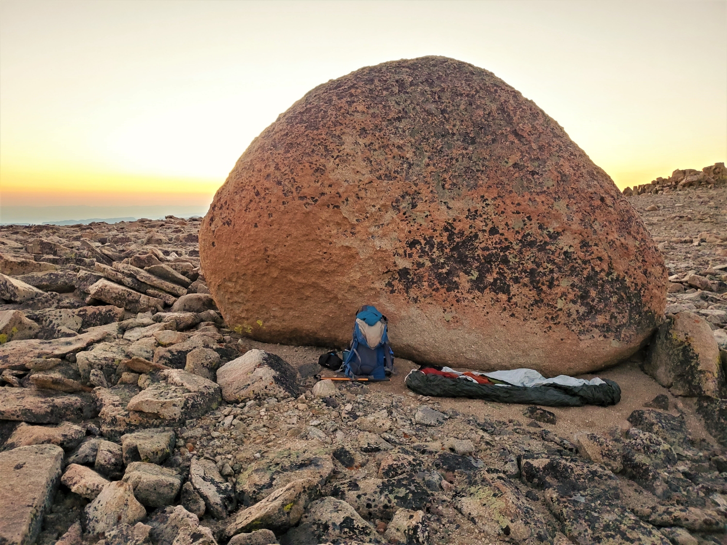
For the night’s campsite we found a big rock. ~ Carl Blaurock
My giant boulder makes for cozy camp given the calm wind and clear skies. At an elevation of 13,350 ft. on Bastion's wide-open summit plateau, I'm counting on the weather remaining perfect overnight. Camping here would be an entirely different prospect during a storm! The upside is that camping so high should help my acclimatization.
With 7 peaks in the bag, perfect weather, and a head start on tomorrow’s plan, I was pleased with the day’s work. Day one would end up being one of my longest days (25.2 miles) with the most elevation gain of any day (13,700 ft.). It was also my longest day as measured by “climbing time” (elapsed time from trailhead/camp to trailhead/camp), taking just over 18 hours, from 2 a.m. to 8 p.m.
I was far from done though, and there was no room for premature celebration. Tomorrow, I needed to climbed several of the hardest 13ers: Mount Koven, a jagged fin of rock with mandatory 5th class climbing; Mount Woodrow Wilson, a steep spire rising at the apex of three major glaciers; and several other semi-technical peaks in between.
More than anything, the conditions had me worried–I had already experienced how icy the glaciers were, and I wasn’t sure if I could safely access Woodrow Wilson from the Dinwoody Glacier, since a massive crevasse usually stands in the way. Koven was a big unknown too–last time I had used a steep snow couloir to access the upper ridge, but it would certainly be melted out by now. How big of a risk would I be willing to take to reach the summit?
Mount Koven in late-season conditions as seen with a telephoto lens from Blaurock Pass (2016)
I managed to get spotty cell service and chatted with my parents for a bit before bed. I tried to rehydrate and forced down as much bagel and pepperoni as I could stomach, which admittedly wasn’t that much since 18 hours of strenuous exercise tends to make me lose my appetite. I did enjoy snacking on my bag of jelly beans and smarties though. Despite my fear about tomorrow’s peaks, before long I was fast asleep. I slept surprisingly well, oblivious to my slightly ridiculous position, perched on the summit plateau of Wyoming’s 10th highest mountain. Outside of my bivy sack and backpack (repurposed as a windbreak for my head), there was no sign of humans as far as the eye could see.