I love the sound of rain, but not when I wake up on the morning of a big hike. The big cold front had moved south over Wyoming, reaching the edge of the Winds, and rain showers gave way to fog as we drove up the Sinks Canyon road to the Worthen Meadow Trailhead. I frantically double-checked the forecast, and the rapid refresh models assured me that it was supposed to be cloudy, but convection would be limited by the cold temperatures (keeping lightning at bay), and it wasn’t supposed to rain much until the afternoon. Despite the generally unfavorable weather, I was a lot less anxious about this day since I would have company most of the way: my mom would hike with me to treeline, waiting there while I raced up and back to the summit. So much of this game is mental for me, and it was a real relief to have someone to talk to instead of getting lost in a spiral of unconstrained worries.
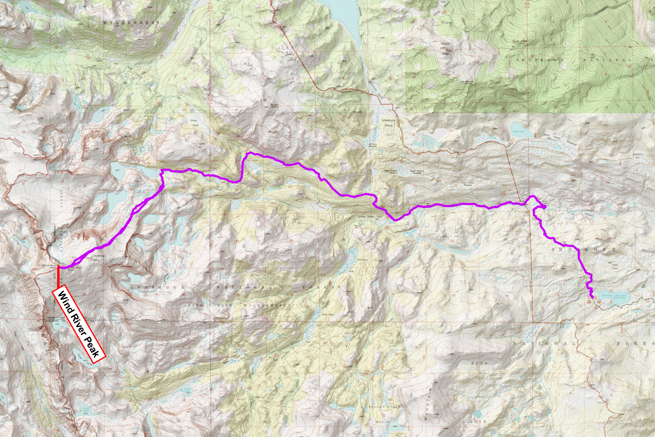
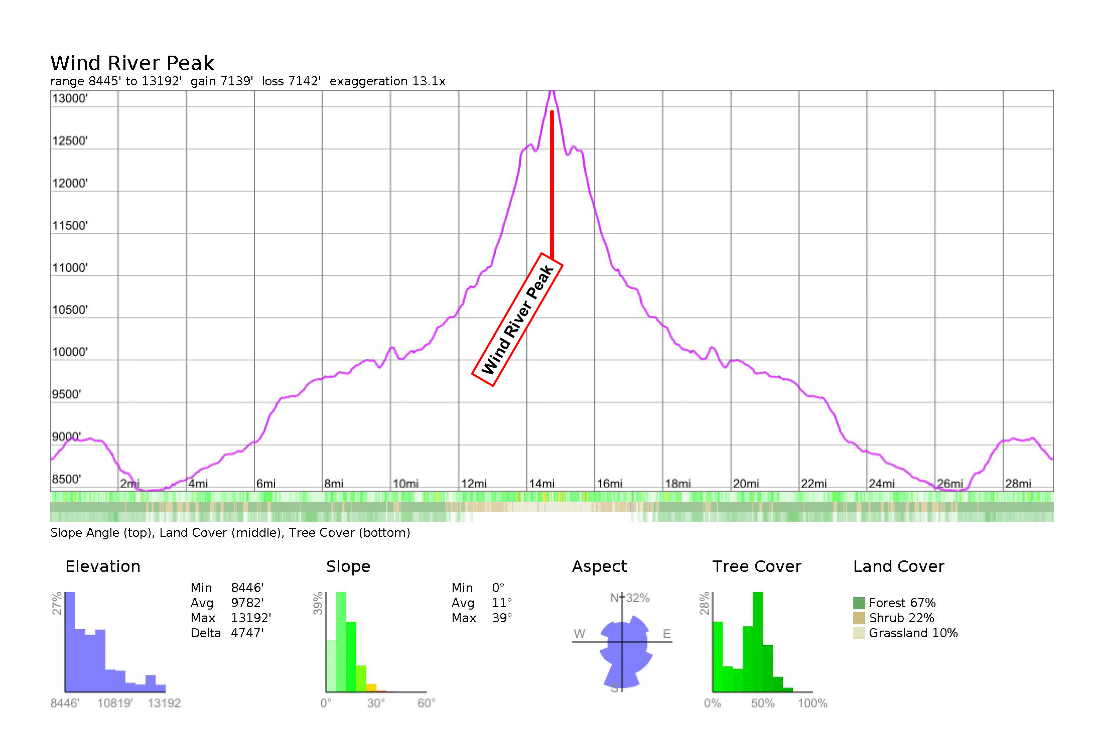
There are two main ways to approach Wind River Peak. Eric and Sean both chose to approach from west of the Divide via Little Sand Creek, but so far I’ve only ever climbed Wind River Peak from the east. The west-side route is considerably shorter, but getting to the trailhead requires a serious 4wd vehicle, a bike ride, or a long road walk, and the upper route is mostly off trail, requiring lots of bushwhacking and routefinding. I already knew the east-side route, the east-side trailhead was much more convenient for my wacky driving logistics, and the route itself is just a well-maintained trail to treeline, so it was a no-brainer for me to choose this route once again.
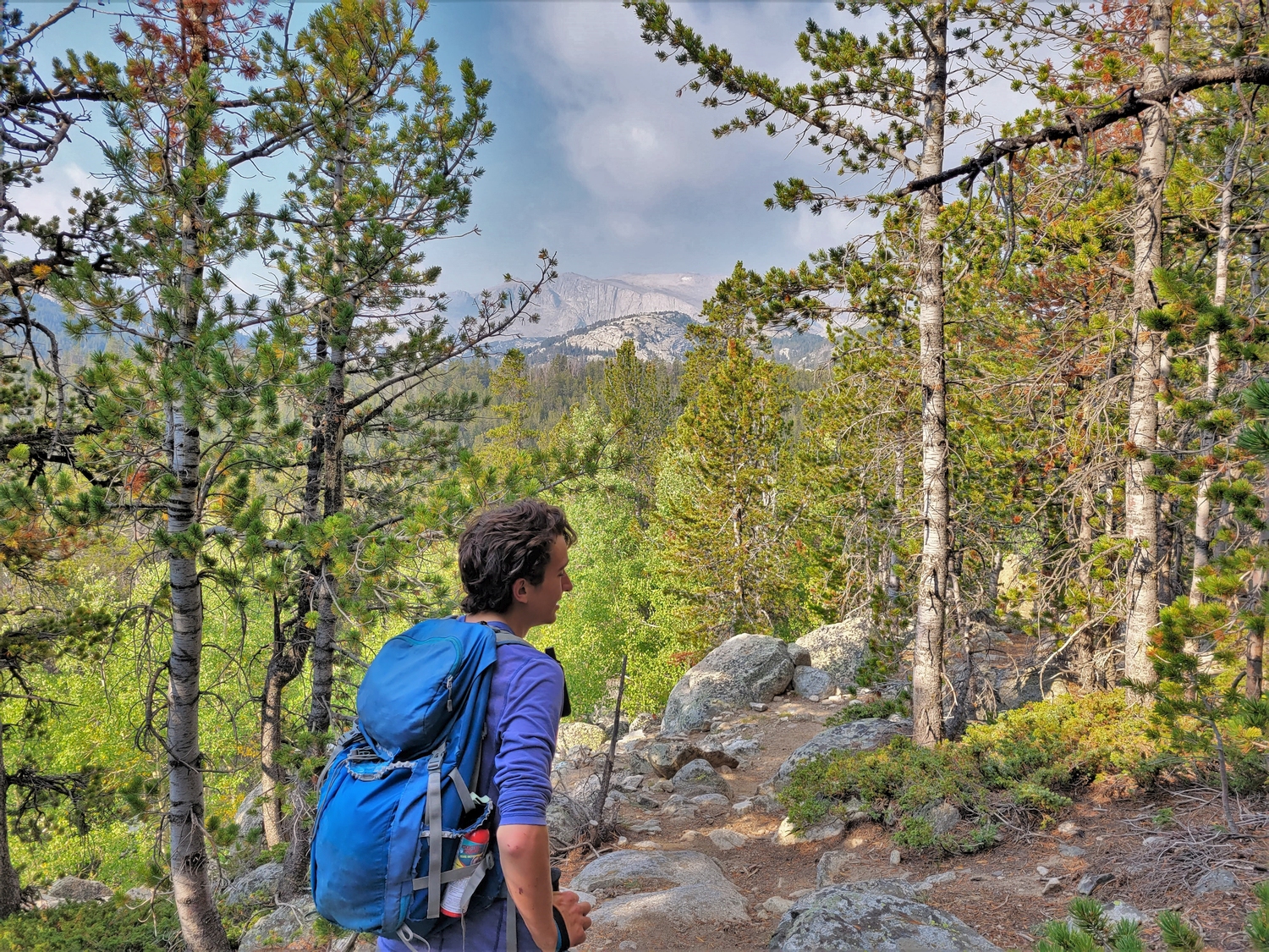
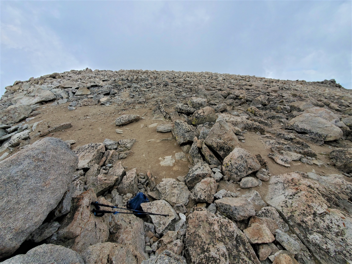
It's rare for me to have photos of myself on the trail, since I'm so often solo. It was fun to get some action shots today, even if the "action" is mostly just eating snacks on the side of the trail.
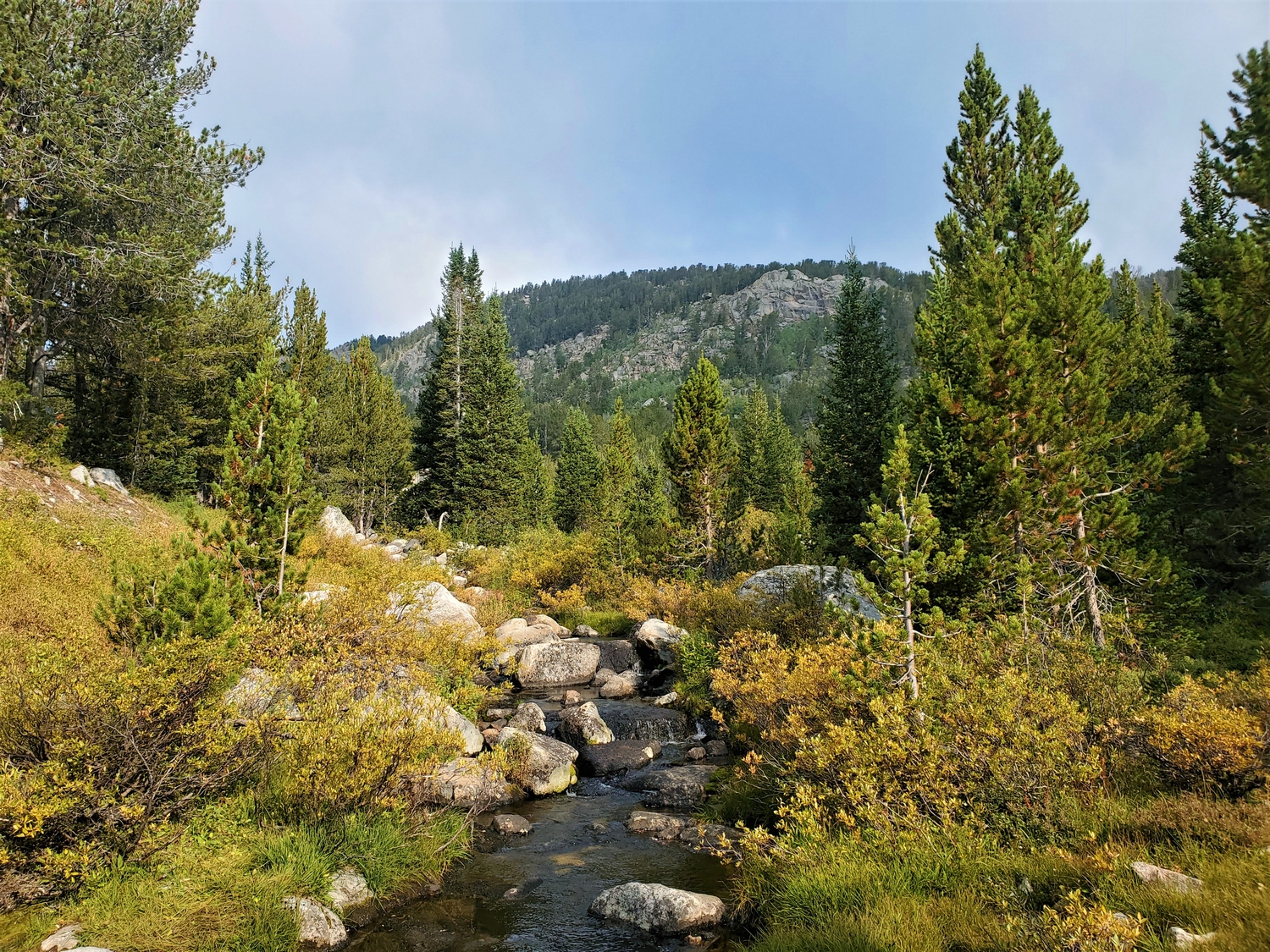
As we hiked up the Pinto Park Trail, the fog started to lift, and we got some partial views of Wind River Peak off in the distance.
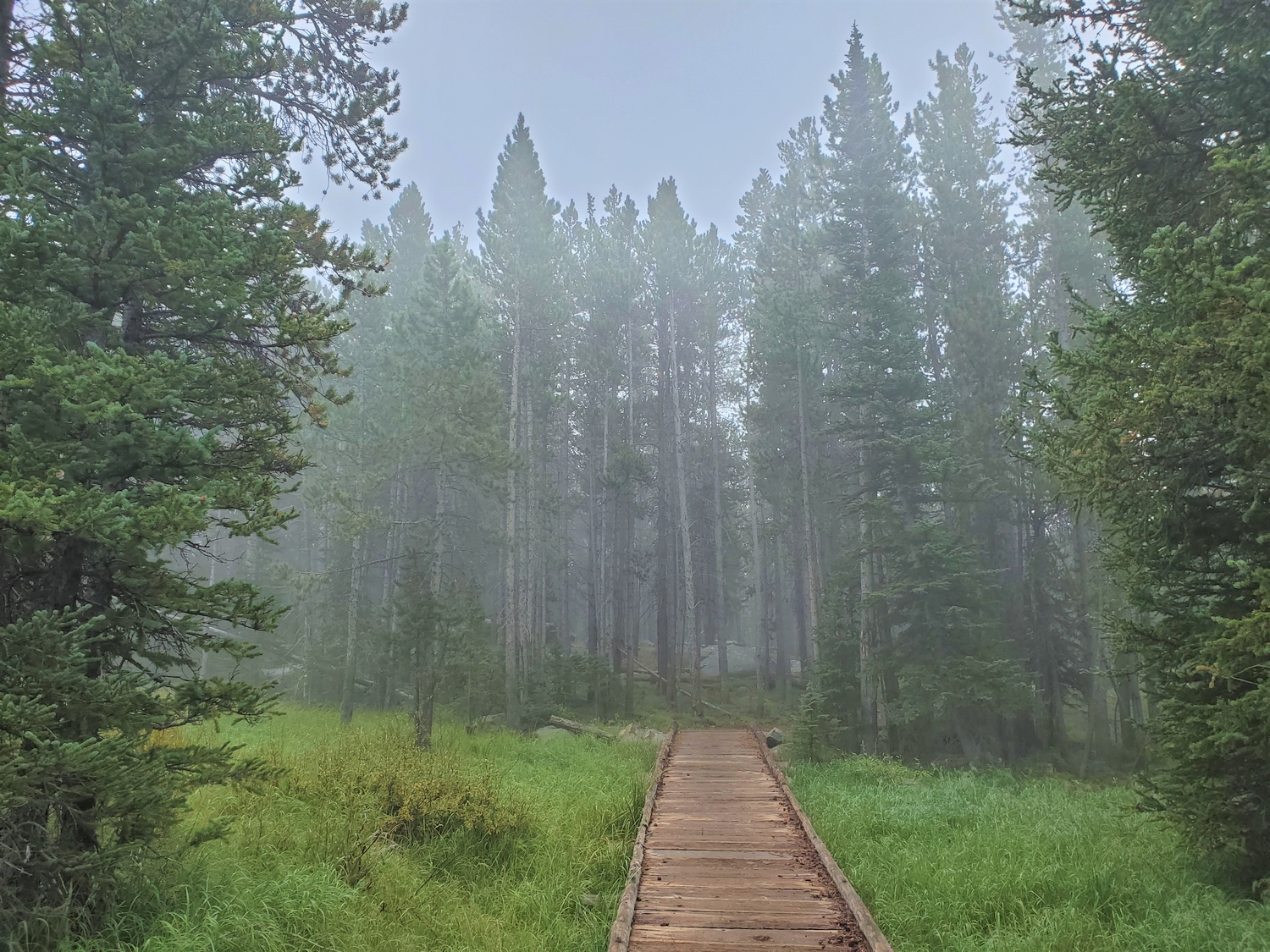
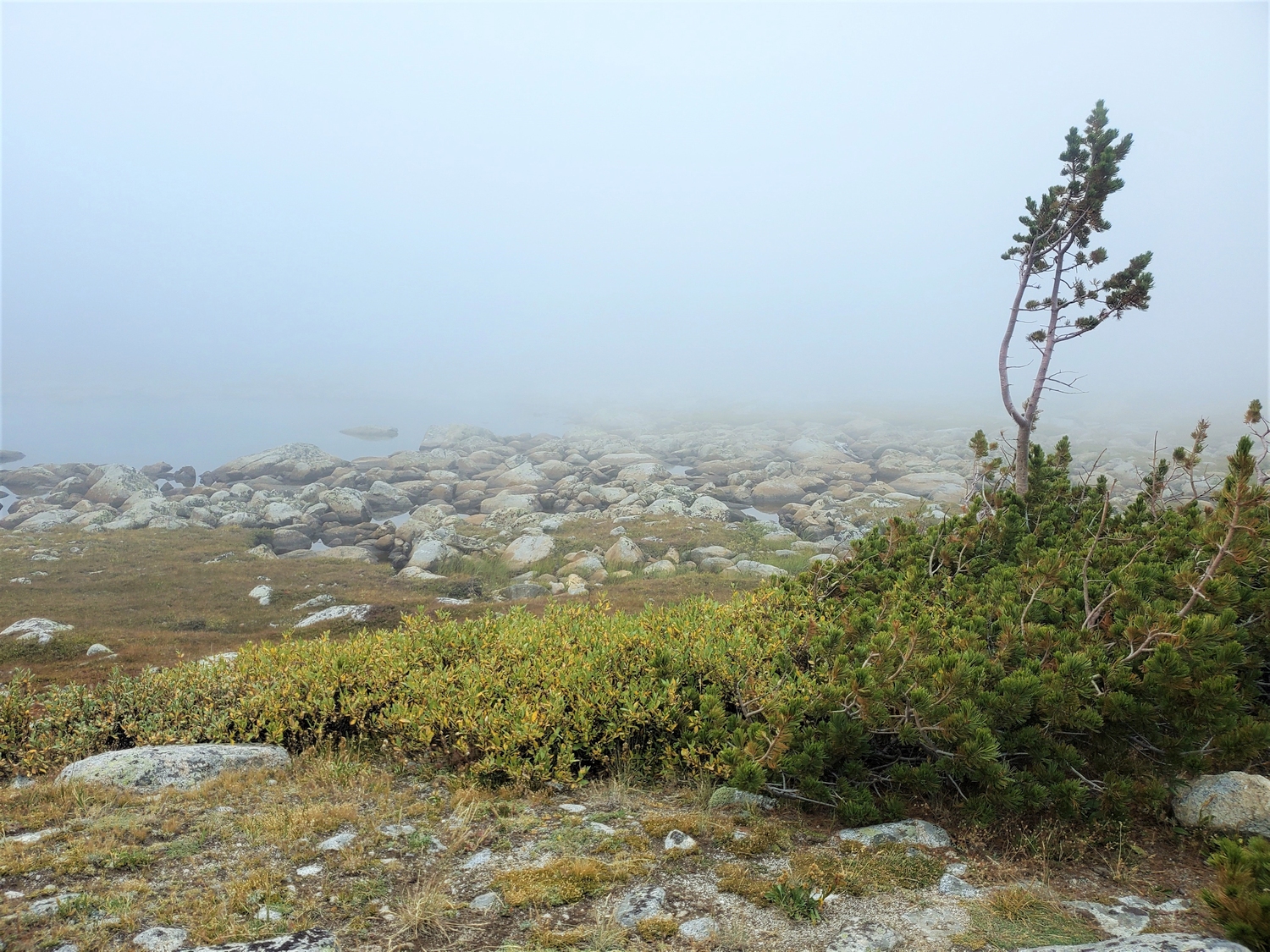
I've always liked foggy weather in the autumn. While I wished for good climbing conditions, I couldn't help but enjoy the softness of the autumnal scenery all around.
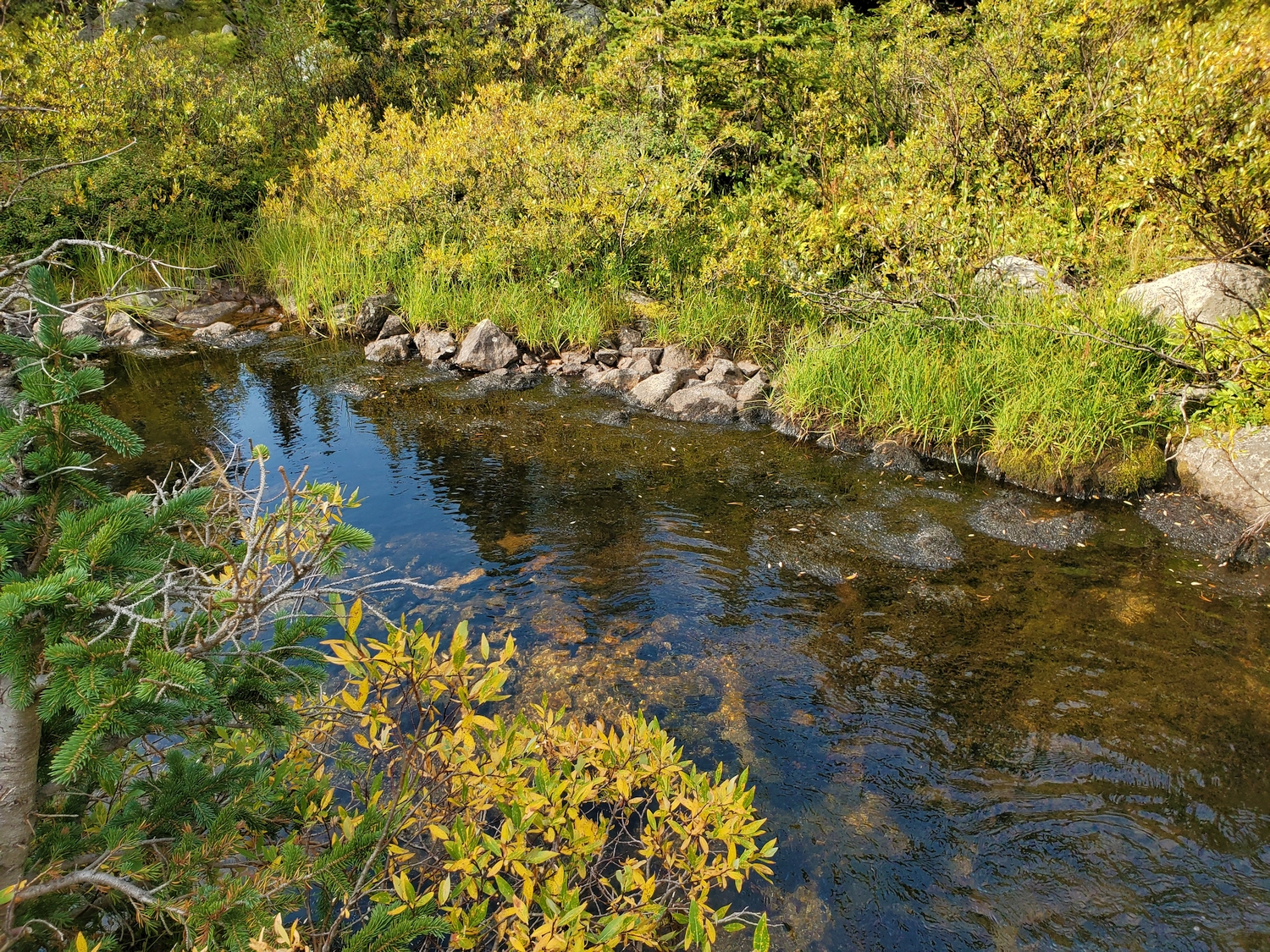
Just enough blue sky broke through to reflect in this tributary of Deep Creek, nicely contrasting the yellow willows and grasses.
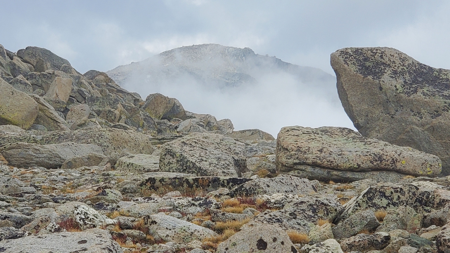
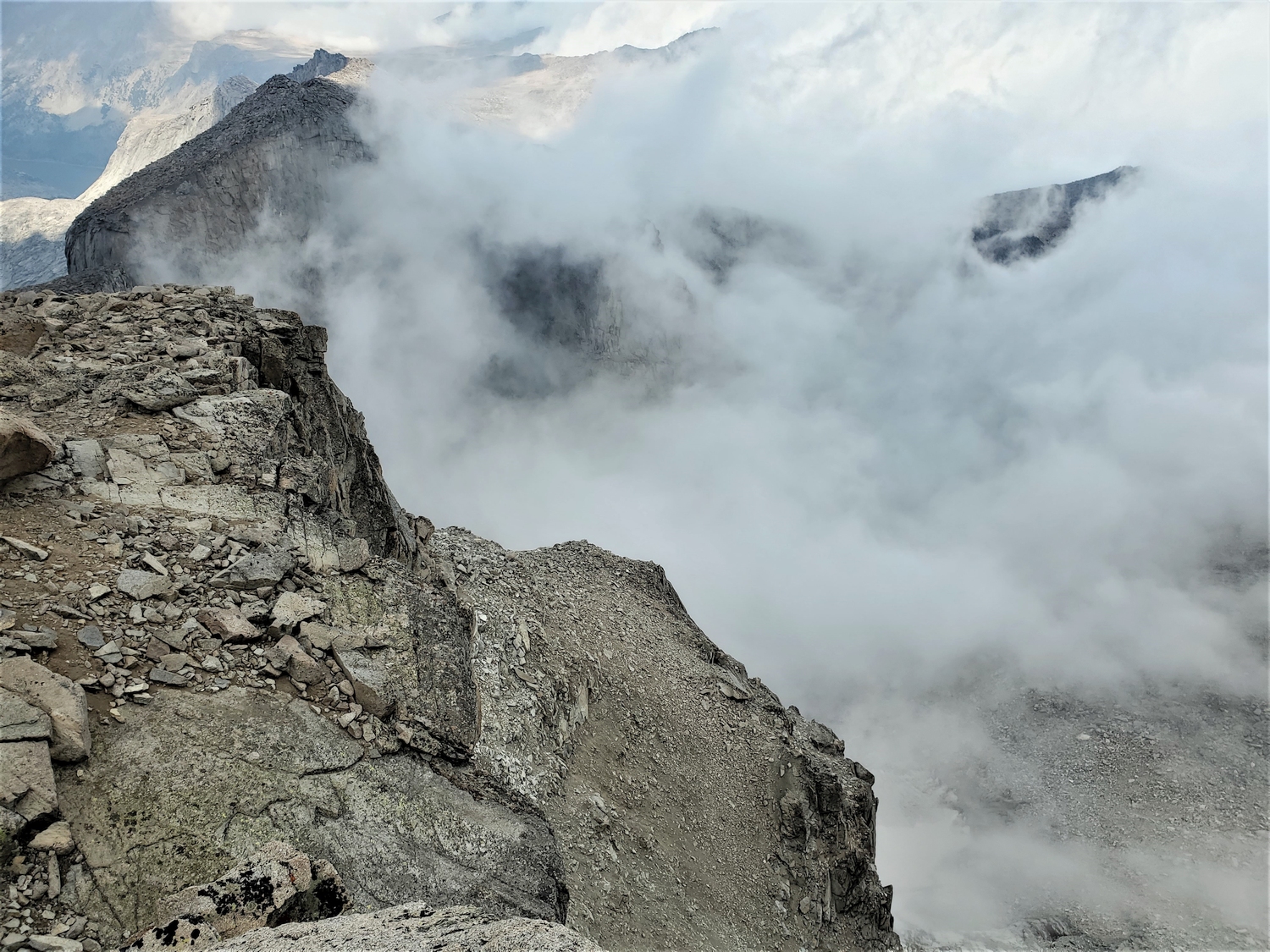
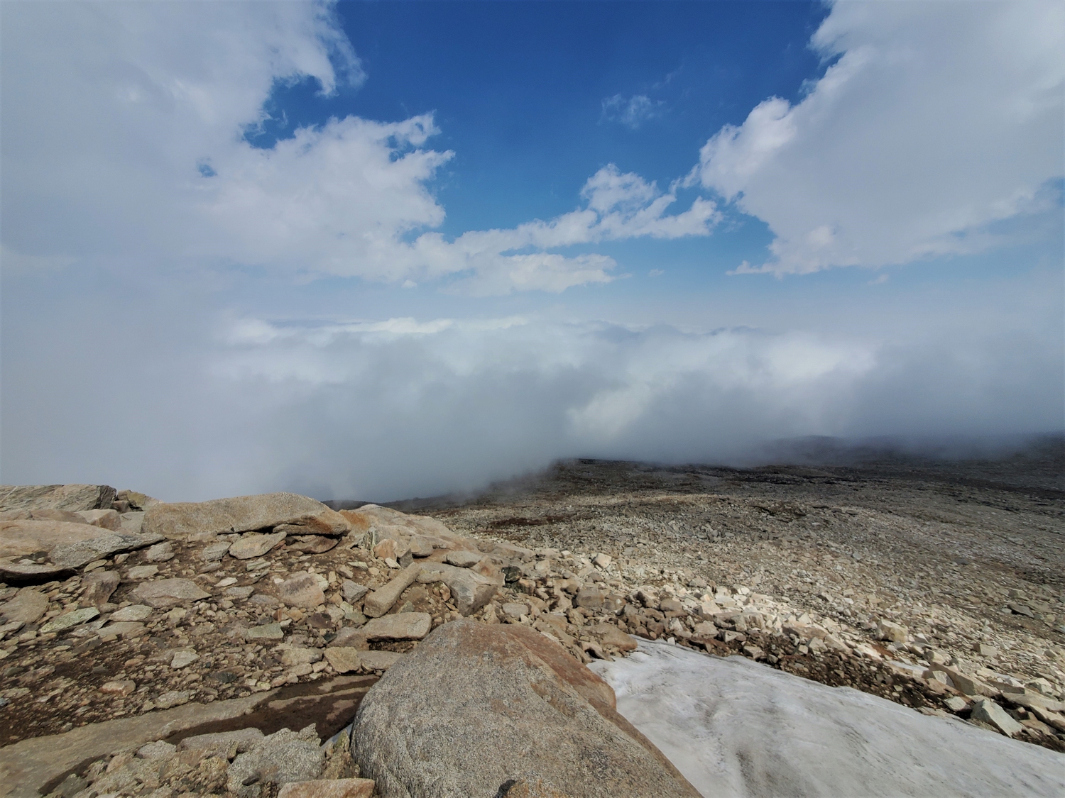
I got my first view of the summit as I bypassed Chimney Rock. Wind River Peak is one of the most mellow Wyoming 13ers, but fog can alter the perception of scale, and it seemed like a towering giant from this perspective.
I reached the summit of Wind River Peak a little after noon. I had covered the 14.5 miles from the trailhead in just under 7 hours, not terribly fast considering that most of it was on a trail, but good enough for the time being. I called my dad and texted my mom an update from my Delorme to hers. Despite the fact that the peak was completely wrapped up in clouds, I wasn’t at all worried, because these weren’t the sort of clouds that produce lightning. It was actually pretty cool to be up on a remote summit in the midst of the fog–it felt kind of like I was floating in the sky.
I was also becoming increasingly confident that I could finish. The forecasts called for the storm to move out of Wyoming overnight, giving way to clear skies for my last day. My biggest concern now was whether the Tetons had gotten any snow or freezing rain that could make the route dangerously icy. I tried not to imagine slipping in an icy chimney, and I refused to seriously let myself consider carrying a rack of cams in case I needed to French-free my way up any icy cracks. Enough! It’s going to be fine. I just need to hike 14.5 miles back down, try to get some sleep, drive to the Tetons, solo one of the most famous technical peaks in America, drive through Yellowstone, climb the most notorious grizzly-infested 13er in Wyoming (probably in the dark), and do it all in time to beat an arbitrary record. Yeah, this is fine…
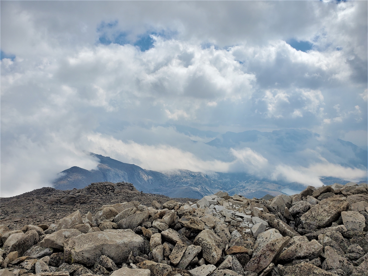
It's always fun to look down at a cloud from above. This view looks towards Little El Capitan, a 12er separated from Wind River Peak by a huge notch called Surveyors Gap.
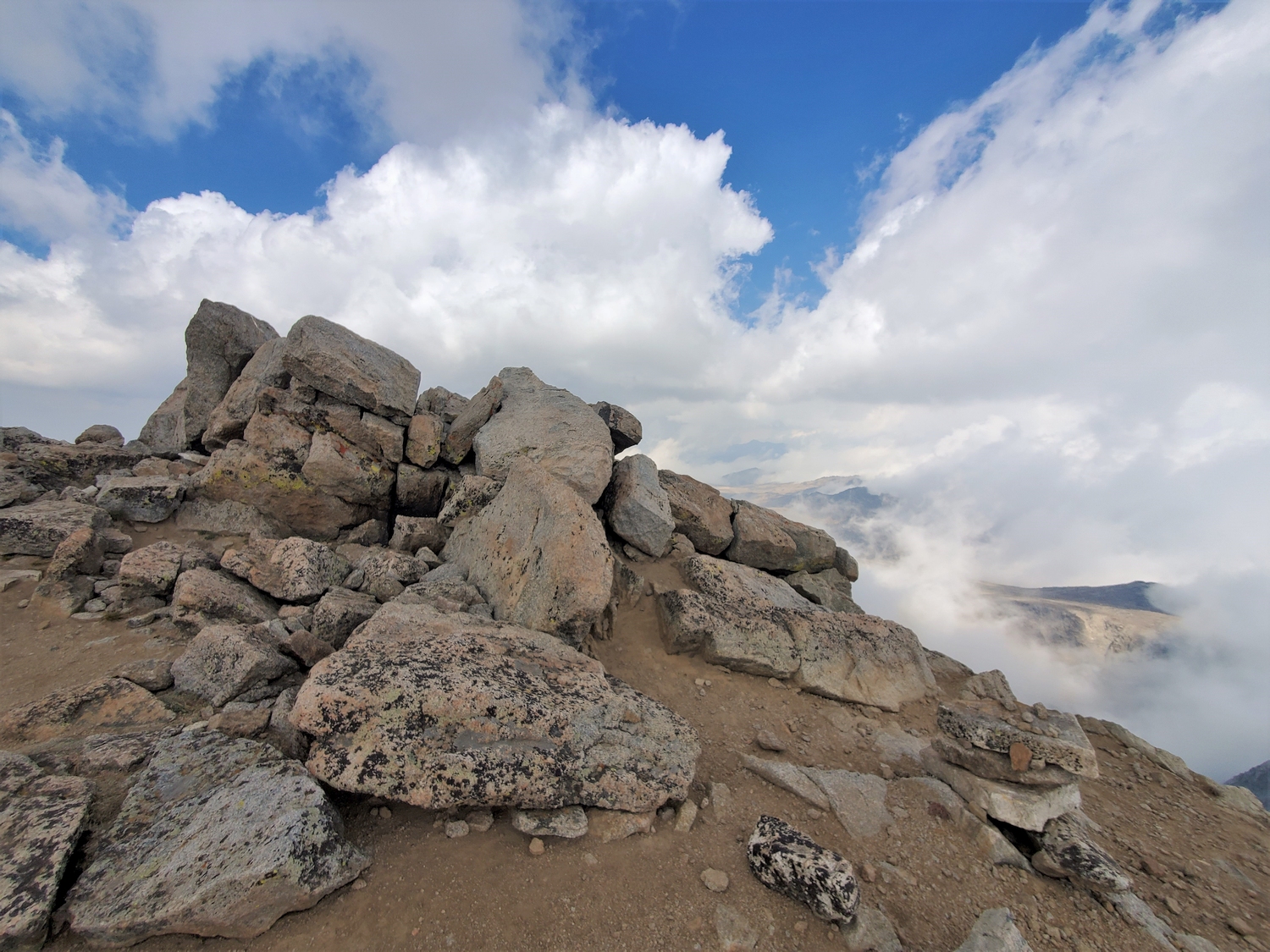
Wide-angle view from the high point overlooking the summit plateau. Despite being fairly flat on top, the summit boulders stick up enough that they're the clear high point.
Closeup of the summit boulders. I spent almost a half hour on top, eating some snacks and letting my surroundings sink in.
As the cold front moved in from the north, it ran into the steep spine of the Wind Rivers. This resulted in a sharp dividing line along the range crest, with dense fog on the northeast side and light, puffy clouds floating over the southwest side.
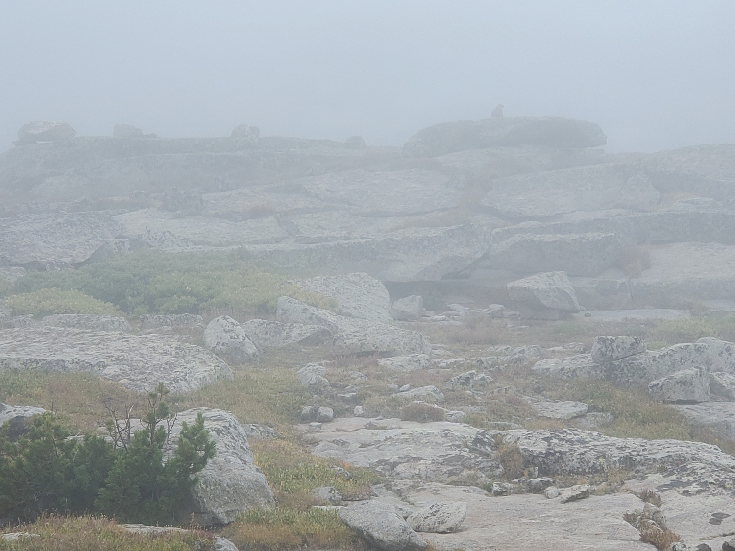
Once again, I relied on GPS to navigate the foggy lower mountain. Here, a marmot is barely visible on the skyline, the only sign of animal life above treeline.
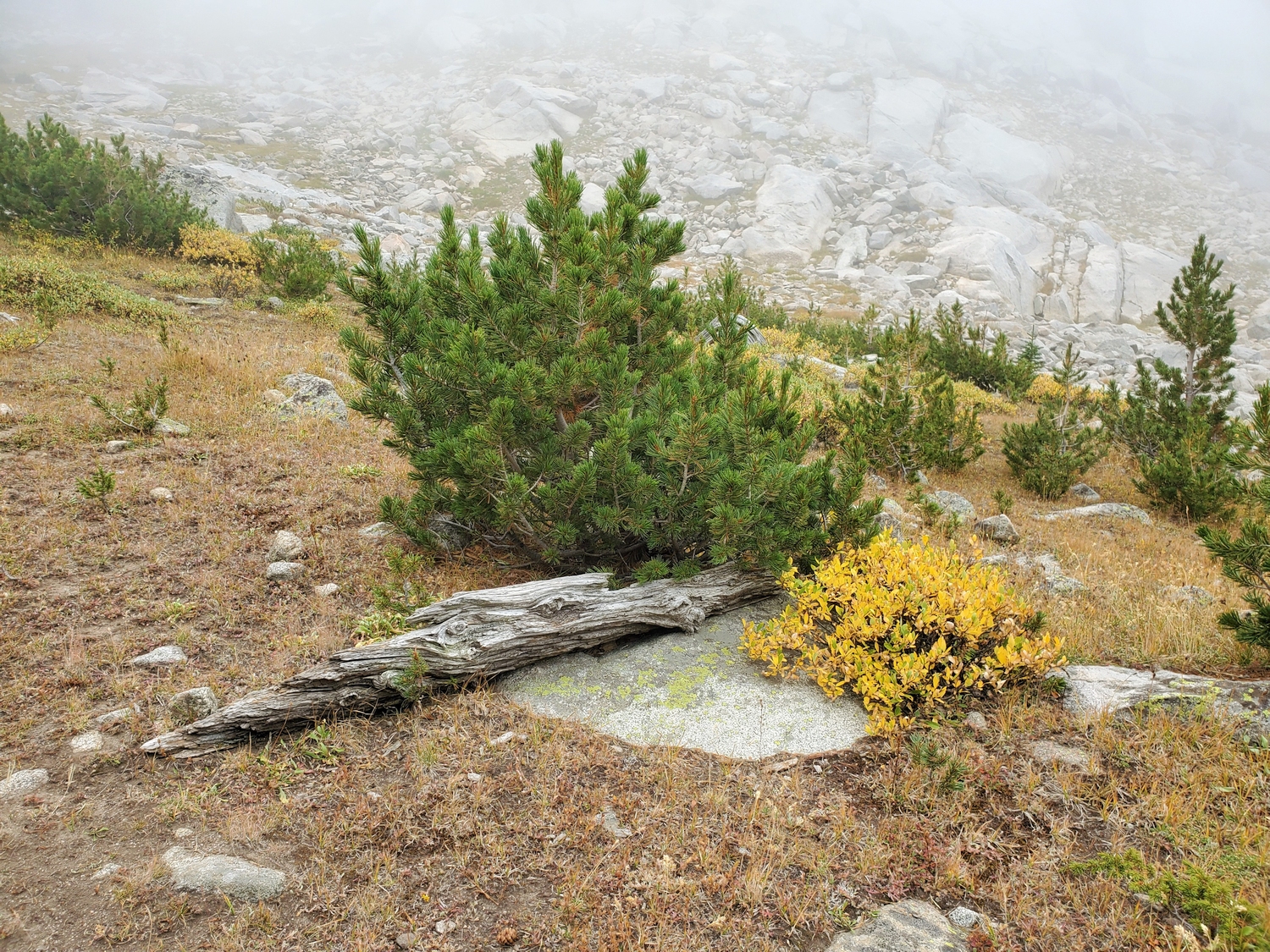
I really enjoyed watching autumn arrive in the alpine during this project. This willow and pine made an elegant deciduous/evergreen contrast.
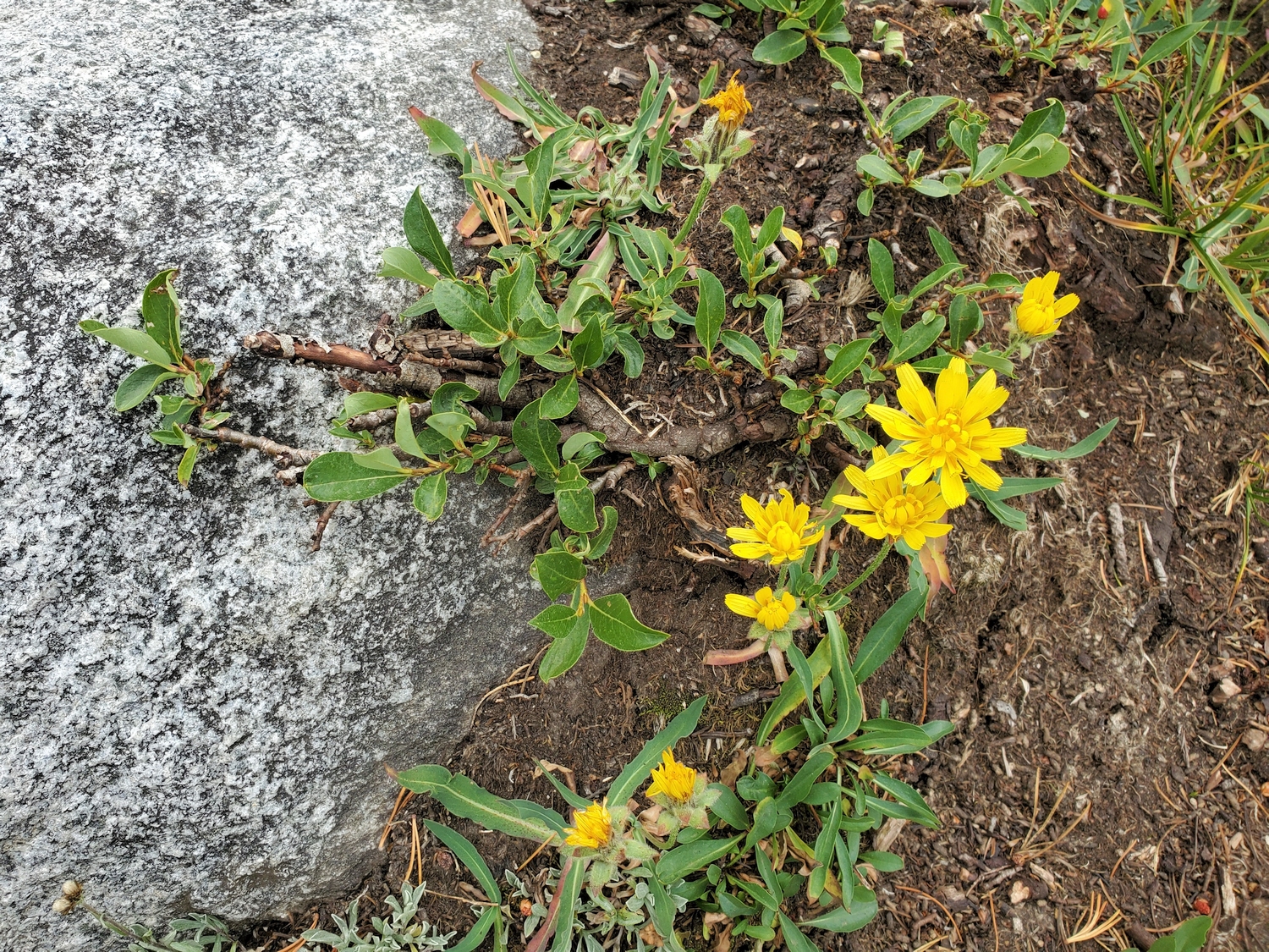
These horned or alpine dandelions were the last blooms of summer. It was interesting to see yellow flowers and yellow autumn leaves on the same hillslope.
My mom and I reunited around 2 p.m. when I returned to her waiting spot at treeline. I felt bad making her wait around in the cold fog with not much in the way of views or other entertainment, but she was kind to go along with it. In turn, I think she felt bad for me having to keep climbing–at one point on the way up, she half-jokingly said that she hoped this didn’t make me hate hiking forever. Alas, no such luck. We filled up our water (using a filter now) and headed back down the trail, eager to get to see if there was still a lower limit to the fog.
On the hike down, we spotted this ptarmigan hunkered down just off the trail. Its plumage was still mostly summer-brown, but bits of winter-white were starting to creep in. It was just one more reminder that the Starks are always right in Wyoming: winter is always coming. Pure luck saved me from a different outcome on this project with regards to weather. If the storm had been a bit farther west and dumped snow on the Tetons, or arrived a day earlier in the Bighorns, or if any storms at all had arrived while I was in the northern Winds, my chances of a successful FKT would have been nil.
Winter is coming. ~ Stark house words
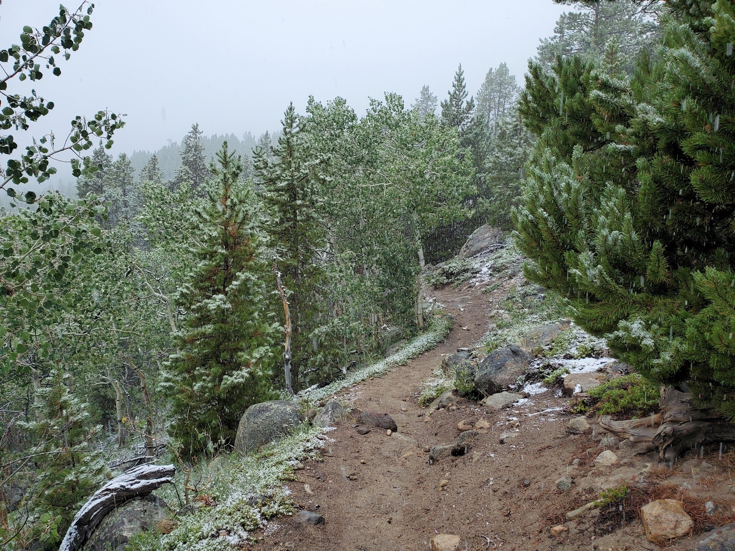
The fog seems to have descended lower while we were on the mountain, and we continue through a cold mist for most of the hike out. Even with raincoats, we get rather wet from the ambient moisture.
Due to some strange quirk of the weather or topography, the light drizzle turns to snow as we reach lower elevations. Normally, if it snows at lower elevations if will also be snowing up high, but I even confirmed with satellite imagery after the fact that it only snowed along the foothills of the Wind Rivers. One way or another, it starts sleeting and snowing lightly around 5 p.m., and by 6:30 the ground is mostly white. The first snowfall of the autumn is always a magical moment, with a light dusting of flakes over the tawny ground and a sense of urgency in the air. I try to enjoy it, even though I’m pretty sore and tired at this point.
Luckily, we only have a few more miles to go by the time it starts coming down more heavily. We were planning on stopping for one more break near Sheep Bridge, but since everything is soaked and we’re getting cold, stopping now sounds miserable. The annoying thing about this route is that it requires 700 ft. of elevation re-gain at the very end, and it seems like forever before we finally crest the last rise. Meanwhile, our thoughts turn to the Tetons–if it’s snowing there too, soloing the Grand would be a dicey proposition. Thankfully, I get a bit of cell service and confirm that the weather maps don’t show any precipitation to the west.
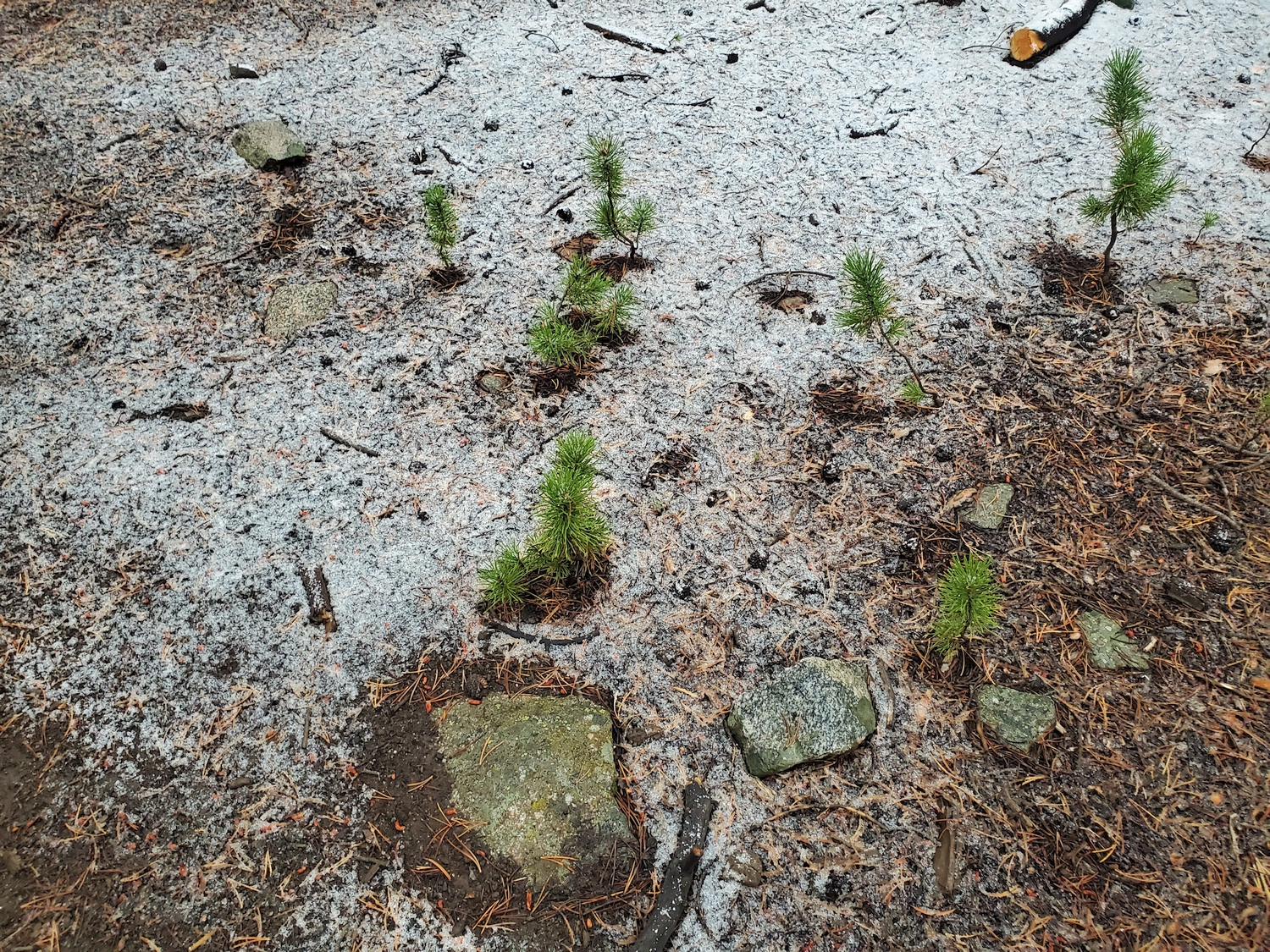
Baby pine trees, each casting their own "shadow" of bare ground where they intercept the snow.
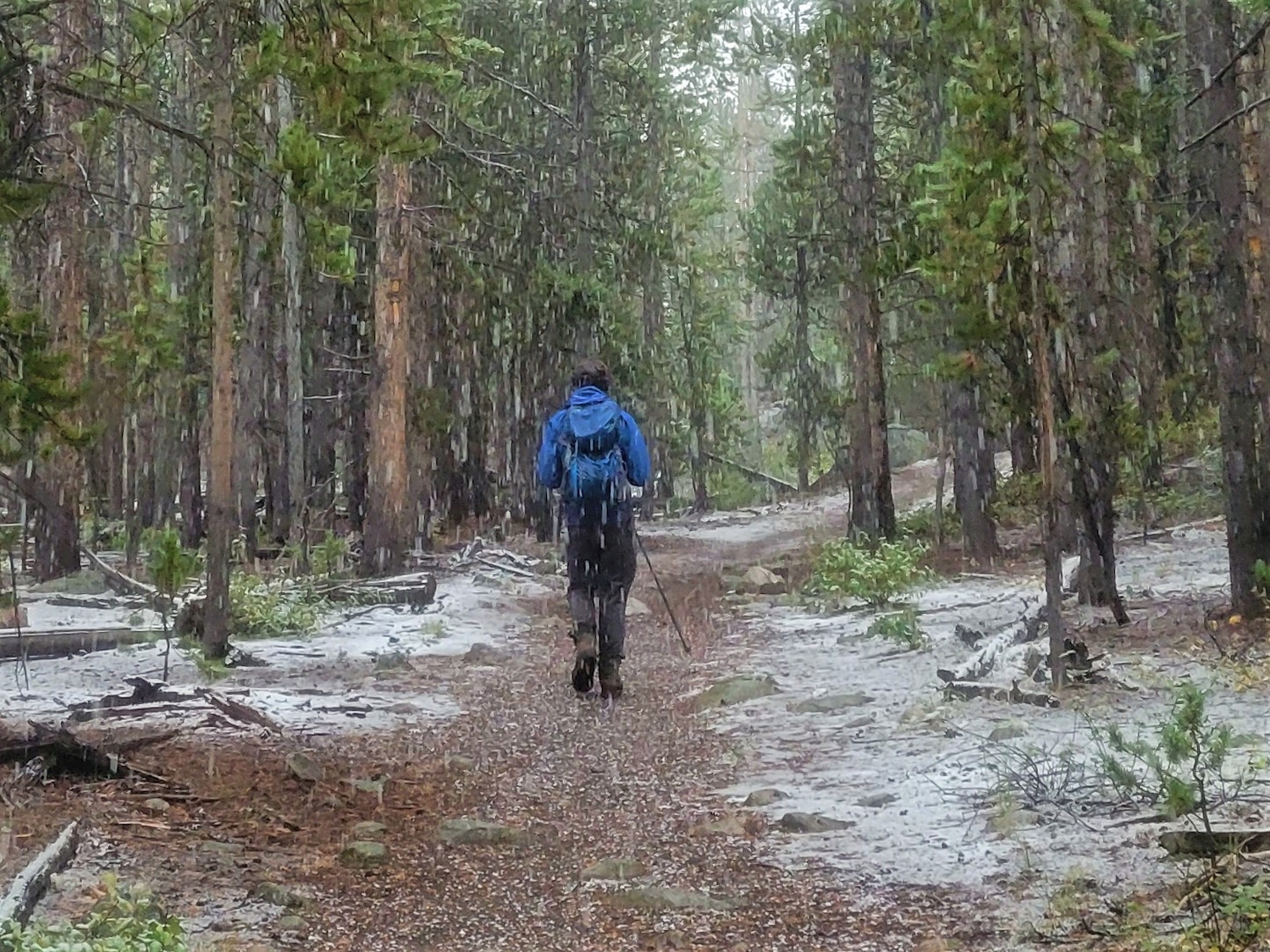
Down the trail I go, already soaked and just trying to get to the RV before I get too much colder.
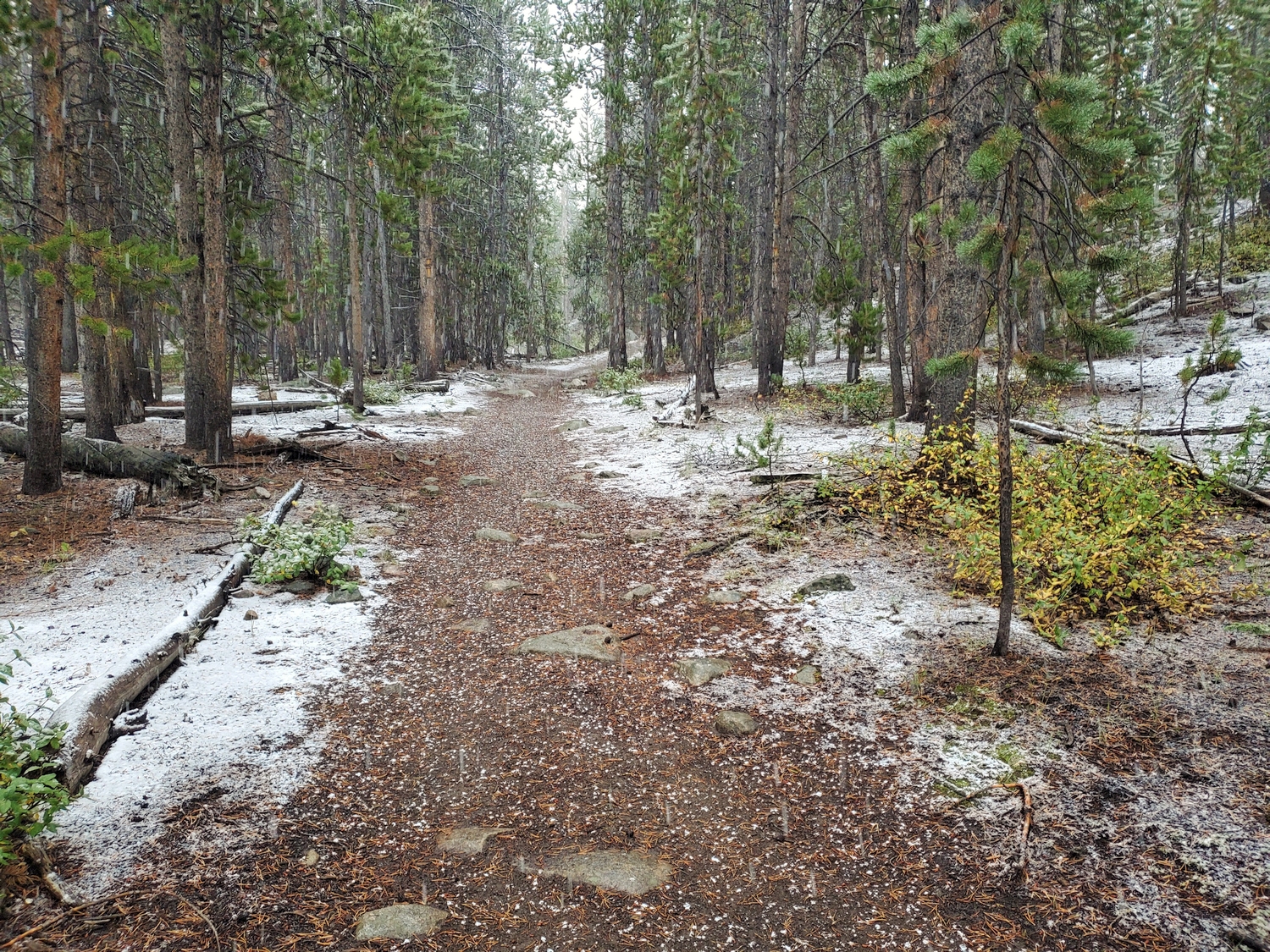
The first snowfall dusts the trail and brings a feeling of magic to the woods. It's a gentle reminder that everything flows forward, everything changes, everything is on the clock.
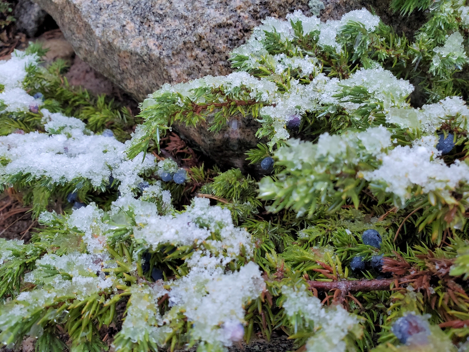
Juniper berries bring a pop of blue to the snowy scene.
It was really coming down fast by now, but we were only a few minutes from the parking lot and didn't care about staying dry anymore.
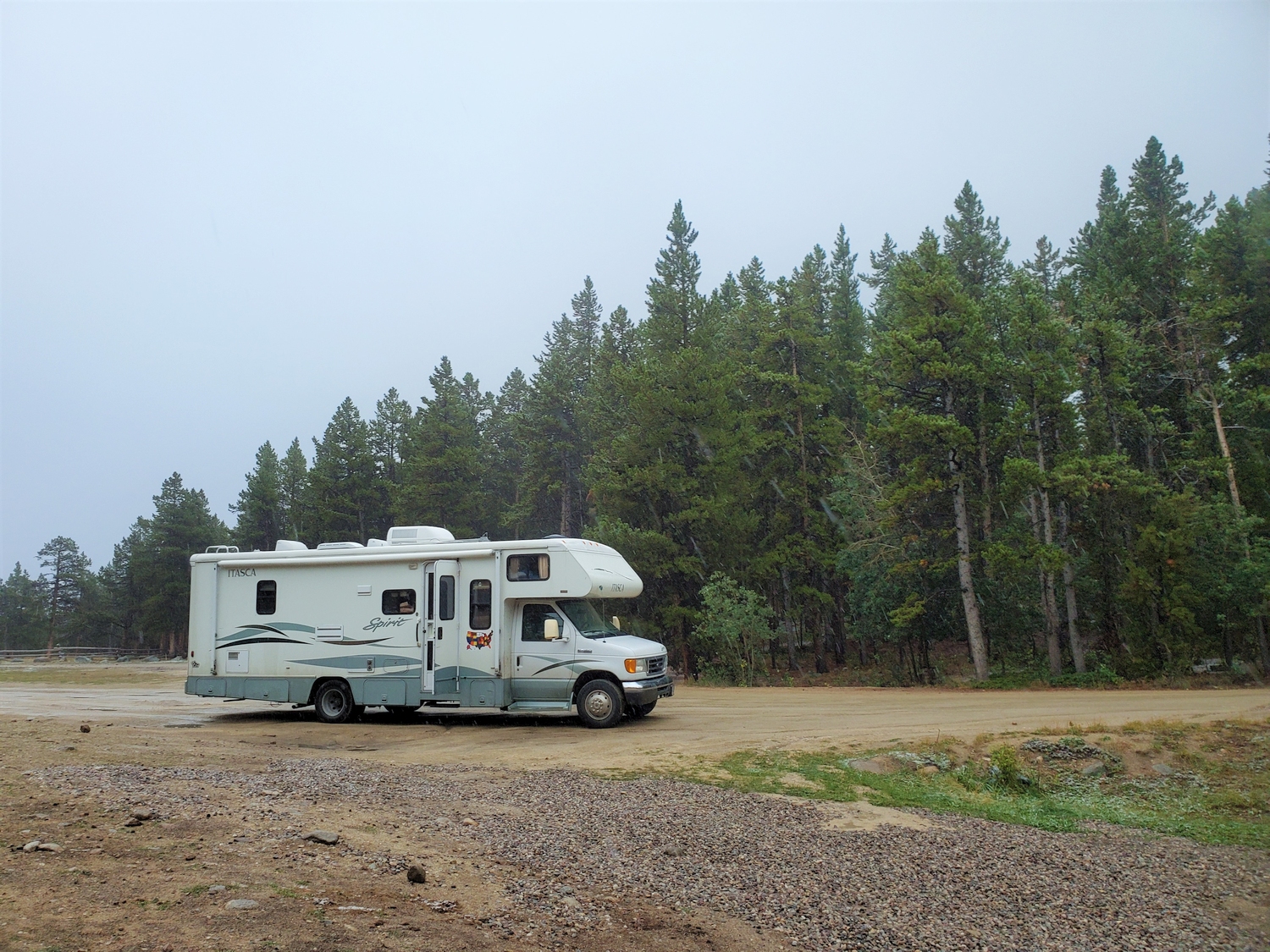
The RV awaits.
Chicken nuggets and ranch dressing--the comfort food of champions.
Driving down Sinks Canyon in the fog.
We arrived back at the Worthen Meadow just after 7 p.m. with a round-trip time of about 13.5 hours, my shortest day so far. My dad had spent the day in Lander and picked up dinner, including the chicken nuggets that I had started dreaming about yesterday. We took a few minutes to dry off and get situated, and then began the next leg of driving. The valleys were completely socked-in by now, and my poor dad could barely see to drive down the steep and windy road into Sinks Canyon. Moreover, there were open range cows all over the road, and it was an interesting game of see-and-avoid to get safely back to the main roads.
Now, the plan got even weirder. It would only be a few hour drive to the Tetons, which meant I’d get there too early to start climbing immediately since I didn’t want to solo the hard part in the dark. Instead, we opted to stop by the ranch, where we’d sleep for an hour or two and swap vehicles. The RV had served us well so far, but for Francs Peak it would be beneficial to have a more capable vehicle, namely the old Chevy Blazer we inherited from a family friend a while back. The ranch just happened to be conveniently located halfway between Wind River Peak and the Tetons, making the funky logistics work out strangely perfect.
I fell asleep as soon as we hit the highway, and continued to sleep in the RV for a bit even after we arrived while my parents kindly unpacked and reorganized gear for our final mad dash to the finish. At some point I moved inside my cabin and set the alarm for an hour or two of sleep. These memories are groggy–but I remember how weird it felt to be at home in my real bed in the middle of a supposed mountaineering speed record. We all got up again sometime after midnight and bundled into the car, where I slept against a pillow on the window for the remaining drive over Togwotee Pass to the Tetons.