Introduction
Few summits in Wyoming need less introduction than Gannett Peak, the state’s highpoint. Fabled among outdoors people of many callings, Gannett lives up to its reputation, dominating the view from countless summits and valleys in the northern Wind Rivers. The standard Gooseneck Couloir route on Gannett Peak is difficult by hiking standards and easy by mountaineering standards. This is one of the few Wind River peaks that might feel crowded from time to time. However, do not be lulled into a false sense of security on this serious mountain.
As discussed in the history section of this guide, Gannett Peak was named for the topographer of the Hayden surveys, which mapped much of western Wyoming. Henry Gannett went on to become the chief geographer of the early U.S. Geological Survey.
General Considerations
Gannett Peak is less technical than many of the Wyoming 13ers, but like all peaks, it still must not be underestimated. Hazards are innumerable, and like any of these peaks, a proper evaluation of safety can only be carried out on an individual, day-by-day basis, drawing on previous experience in similar terrain.
Route 1: (Standard) Gooseneck Route – Class 3, Moderate Snow
Despite a wide variety of route choices on Gannett Peak, most climbers converge on the Gooseneck, and for good reason, since this route is highly enjoyable and delivers you to one of the best summits in the continental U.S. Thus, a few other routes are mentioned, but the Gooseneck is emphasized. However, do not blindly trust the routefinding or risk-management decisions of other climbers; other parties you see in the Dinwoody region may be headed for non-standard objectives.
Approach A: Glacier Trail
The Glacier Trail provides stunning views of Gannett during the approach up the Dinwoody Valley and allows for a shorter summit day, but it is considerably longer in terms of mileage than the approach via Titcomb Basin. A description of both approach hikes can be found in the trails section of the printed guidebook.
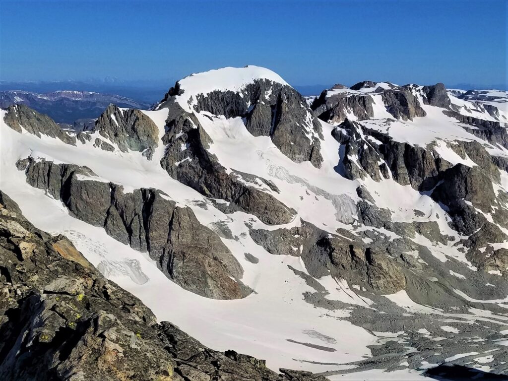
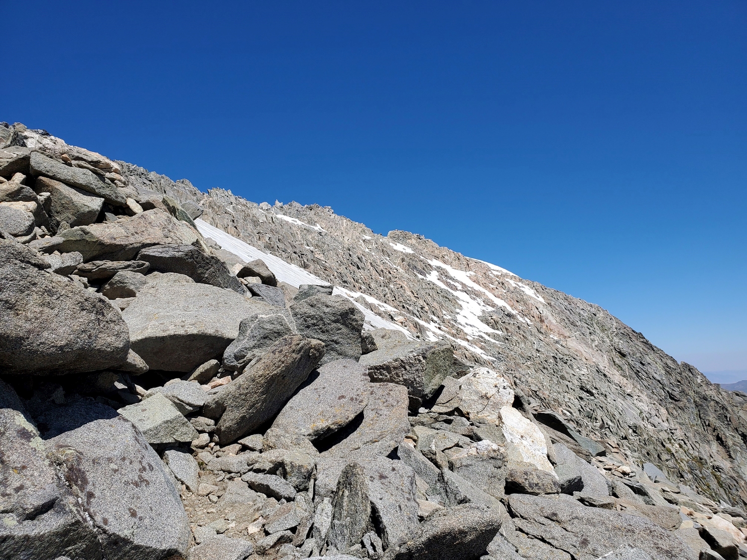
Once you reach the end of the trail at the edge of the Dinwoody moraine, climb through huge boulders past several tarns to reach the upper moraine. Cairns are usually found in this area, though the cairned path may not be the best way. Head towards the Gooseneck Glacier, but veer southeast before reaching the glacier’s terminus and use a left-angling snow ramp or scramble on the rocks to gain the “upper bench,” a low-angled rock rib dividing the Gooseneck Glacier on the north from an arm of the Dinwoody Glacier on the south.
Approach B: Titcomb Basin
Climbers who choose to approach Gannett via Titcomb must climb over Bonney Pass to reach the Dinwoody cirque, adding significant elevation gain to the summit day, and the peak is hidden during the approach. However, Titcomb Basin is spectacular and well worth visiting, and approaching Gannett from this side generally requires less backpacking than the Glacier Trail. See the trails section for a longer description of the approach routes.
From the head of Titcomb Basin, climb snow or scree to Bonney Pass, descending talus on the other side to reach and cross the Dinwoody Glacier. Aim for a break in the cliffs along the lower part of the rock rib dividing the Gooseneck and Dinwoody Glaciers, climbing up this break to join Approach A and gain the “upper bench.”
Final Ascent, Both Approaches
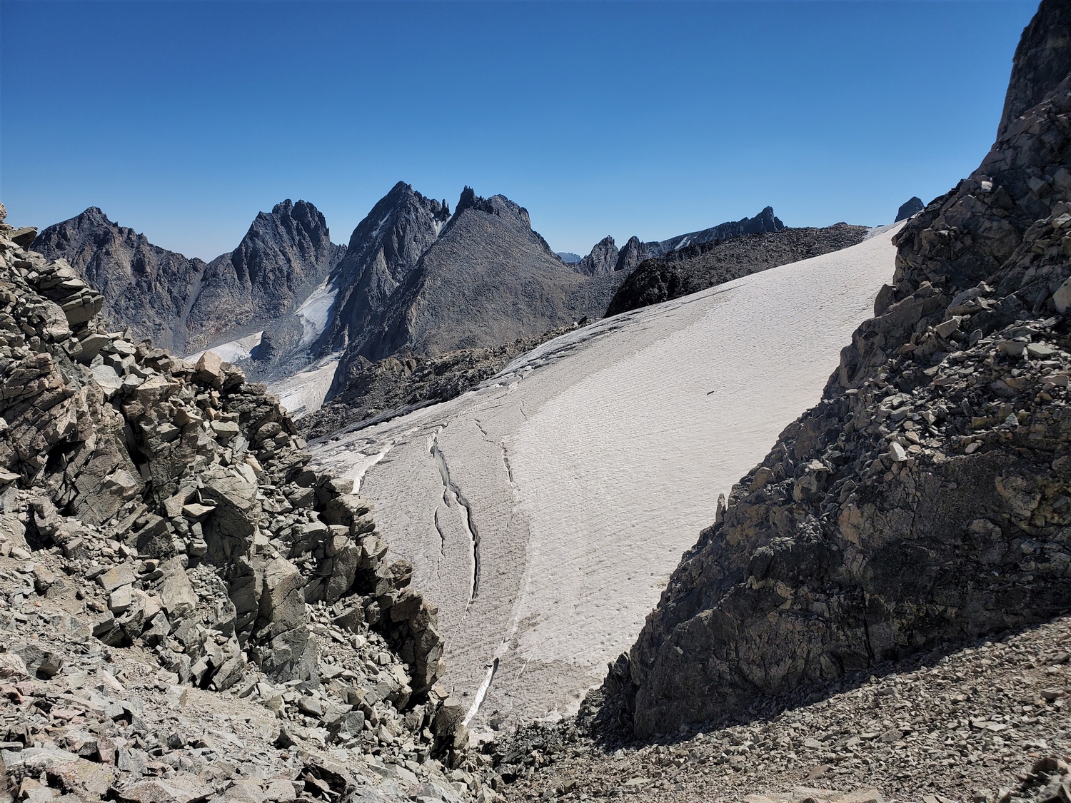
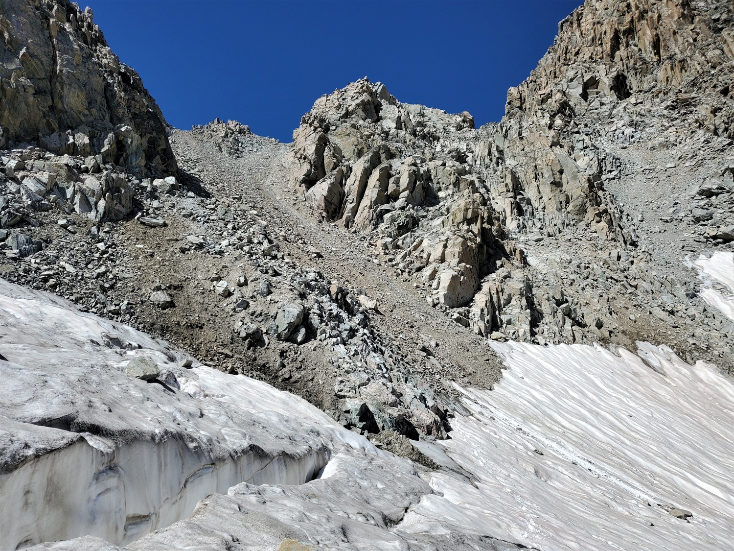
Make your way to the “upper bench” as described above. Leave the rocks near the top of the Gooseneck Glacier and contour northwest across its top until you are below the first large couloir on climber’s left. Cross the bergschrund (crux) to enter the couloir. This usually involves a snowbridge which may become dangerously thin—evaluate carefully. When the bergschrund is impassable in late season, consider alternative routes, or engage the rock face to the south of the couloir.
The Gooseneck Couloir itself tends to an angle around 40 degrees and is less than 300 feet long. It tops out just north of the famous Gooseneck Pinnacle, the route’s namesake. Follow class-3 rubble slopes northwesterly across the top of a second couloir (not to be mistaken for the Gooseneck on the descent) to reach a section of easy walking around 13,300 feet.
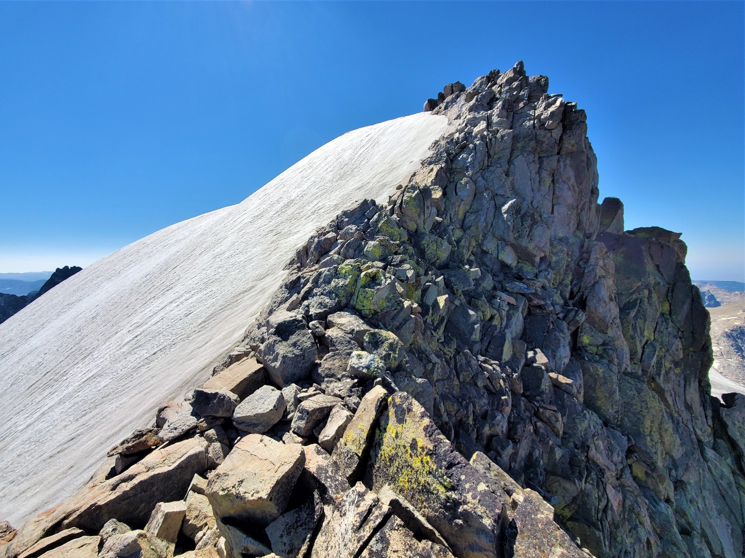
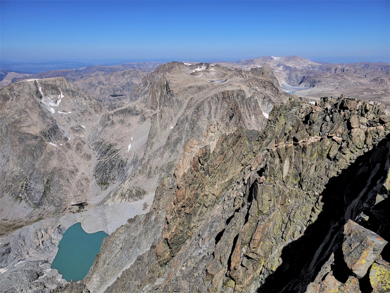
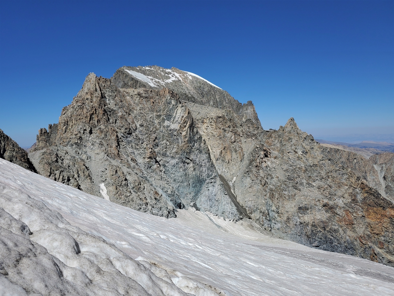
From here, the summit ridge is in plain view: climb up moderate snow or talus to reach it, then follow the exposed ridge a quarter mile north to the summit. Pay particular attention to safety along this section (and everywhere), as a slip in the snow could send you off the east face cliffs. The summit consists of a few rounded boulders, with plenty of room nearby to eat lunch and trade group photos.
Route 2: Southeast Couloir – Class 3, Serious Snow
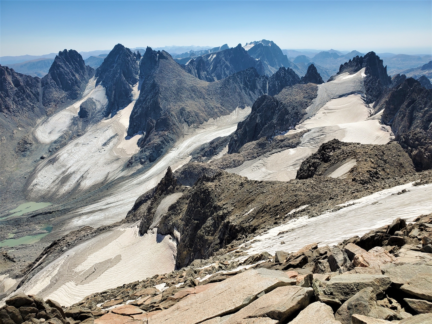
This route is sometimes used for spring ski descents on Gannett, but it is also a worthy snowclimb in its own right. From either of the standard approaches, stay south of the “upper bench” and climb through crevassed terrain along the north side of the Dinwoody Glacier, approaching as you would for Pinnacle Ridge.
From the upper glacier, the couloir is obvious on climber’s right; while only marginally steeper than the Gooseneck Couloir, this one is much more sustained and is unlikely to have the boot-steps usually present in the Gooseneck, making it a considerably more serious undertaking. It tops out just below Gannett’s summit ridge, where it joins Route 1. The bergschrund on this route is usually less obvious than the Gooseneck bergschrund and may even be imperceptible. Some climbers have reported alpine ice conditions late in the season.
Route 3: Western Gully – Class 3, Moderate Snow
Numerous approaches have been used to climb Gannett from upper Wells Creek, though this is done much less frequently than either of the main Gooseneck approaches. For approach descriptions to reach this area from the west, see the Green River Cirques section. The most common route is via Tourist Creek and a long, high traverse around Desolation Peak, but the route could also be reached from Split Mountain Pass above Peak Lake or Glacier Pass from the Dinwoody environs.
Regardless of the approach, the route begins above Lake 11598 near the northeast edge of the Mammoth Glacier. Climb talus slopes northeast towards Gannett, reaching the base of the cliff bands north of Glacier Pass. A rubble gully (perhaps filled with some snow early in the season) breaks the cliff bands and leads to the saddle between Gannett Peak and its south summit (Point 13295 on maps). Most of the gully is loose and somewhat unpleasant, but the difficulty is usually only class 2. Several small cliff bands separate talus sections and require class 3 climbing on dirty slabs. The couloir tops out a bit above 13,200 ft., just south of where Route 1 joins the summit ridge. In late season, when the summit ridge melts out to reveal blocky class 3 rocks, it is sometimes possible to climb Gannett without ever touching snow.
Route 4: North Ridge – Class 4, Moderate Snow
This route has been favored by those intent on climbing Gannett as fast as possible, because when combined with an approach up Tourist Creek, this route is slightly shorter (but much more rugged) than the east-side approaches. The first step is getting to the vicinity of Scott Lake—either via Tourist Creek (as described for Desolation Peak), via the technical Wells Creek canyon, or after traversing from another peak. From here, continue up to Lake 10795, unofficially called Skinny Lake. Ascend a headwall and cross the rapidly retreating Minor Glacier to reach the base of the route. Alternatively, from the unnamed lake in the bowl at the base of the Minor Glacier, it is possible to climb talus and class 2 slabs around the glacier’s northeast side, avoiding any ice on this route in late summer.
Aim for a large scree ramp leading northeast towards the Divide, which begins near 12,400 ft. and tops out at a subtle col on Gannett’s north ridge above 13,400 ft. For the easiest route, make sure to stay in the main (northernmost) couloir, eschewing more technical options to the south. From the col on the north ridge, a few hundred feet of steep class 4 scrambling leads to a final airy ridge traverse along the upper edge of Gannett’s signature snowcap—a sublime finish to a classic climb.