Introduction
Lower than its neighbors and not officially named, Grasshopper Peak is easily missed. One wonders how many legendary alpinists may have climbed almost all of the Wyoming 13ers, perhaps only to miss climbing a few hidden peaks like this one. There would be little reason to seek out this peak unless you are already in the area and have a penchant for completeness.
Formerly unnamed and known as Point 13180, I named this summit Grasshopper Peak due to its proximity to the head of the Grasshopper Glacier, a notable ice body responsible for releasing a glacial lake outburst flood (jökulhlaup) in 2013 which reshaped the Downs Fork Meadows region. A side-trip to view the Grasshopper Glacier and its impounded lake is a worthwhile adventure.
General Considerations
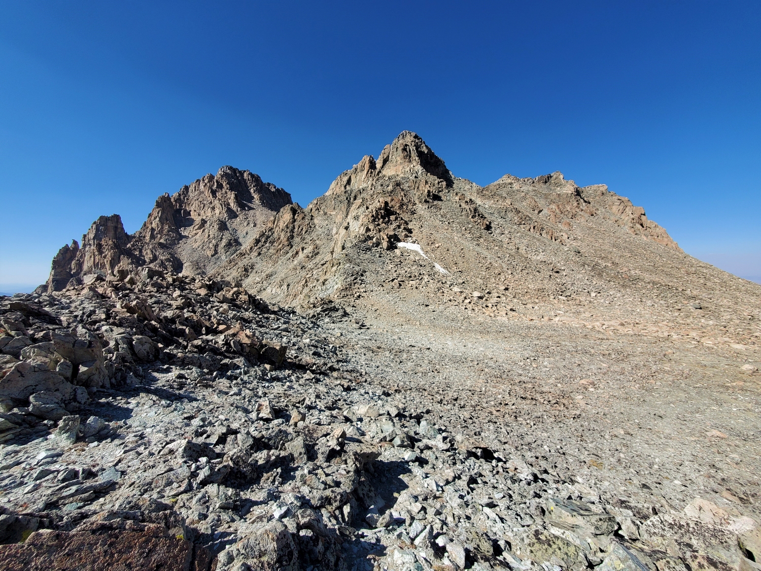
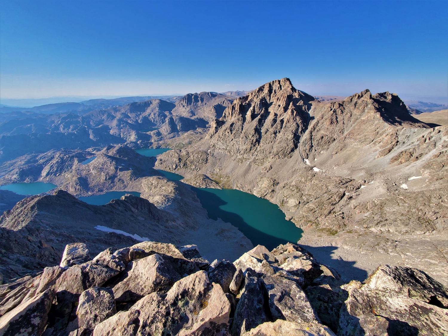
Grasshopper Peak consists of an outcropping granite ridge oriented crosswise to the Continental Divide, rising only a few hundred feet above the region’s high plateaus. The highest point is on the Divide, at the west end of the ridge. It is most convenient to cross the summit while hiking between Bastion and Flagstone or vice versa. To approach either of the main routes, find your way onto the plateau between the Grasshopper Glacier and the Gannett Glacier, as described for Koven.
Route 1: North Side – Class 3+
Reach the flat, talus-strewn plateau between Grasshopper Peak and Flagstone any way you choose (perhaps via Flagstone’s Route 2 if making a traverse). From here, head for the triangular summit pyramid at the edge of the plateau on the Divide. Most of the climb is over talus, but the last hundred feet or so involves some moderate scrambling on slabby blocks. When the author visited, the summit had a remarkably sharp cairn.
Route 2: South Side – Class 4
From the private alpine corridor east of Bastion Peak, walk up to the flat, frost-shattered hanging valley between Bastion and Grasshopper Peak (or reach this area by descending Route 1 on Bastion). A talus slope presents itself to the north, rising to a saddle on the ridge between two apparent highpoints. Climb up this talus (class 2), then scramble westward along the narrow summit ridge, passing several short blocky towers (class 4).
Route 3: Western Gullies – Class 4
It would be hard to find a more obscure route, but this route nevertheless merits inclusion because it is the most direct route connecting Grasshopper Peak with points west of the Continental Divide. From Lake 11478 at the head of Tourist Creek, a broken wall of small cliffs and interconnected talus gullies rises steeply to the Divide. Head for the broad saddle between Grasshopper and Bastion. The final few hundred feet consists of very loose scree in a steep, narrow gully. Although the terrain is very rough, the difficulty never exceeds class 3 on the easiest route.
From the Divide, contour around to the north and join Route 2 (class 4).