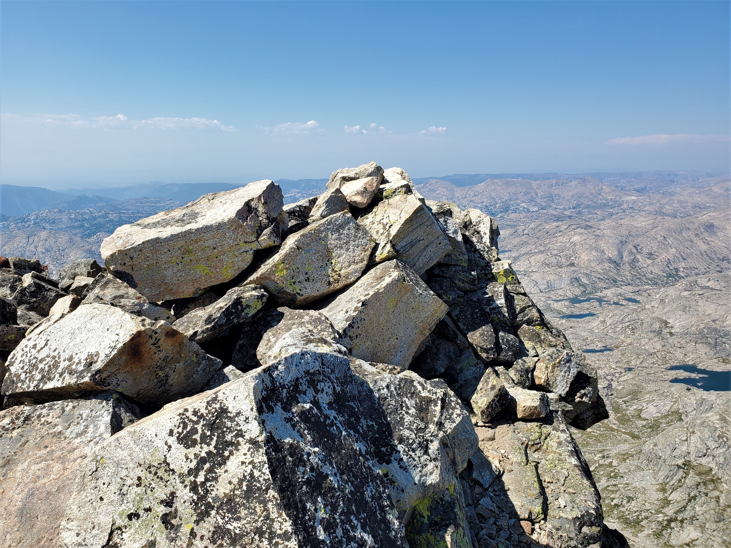
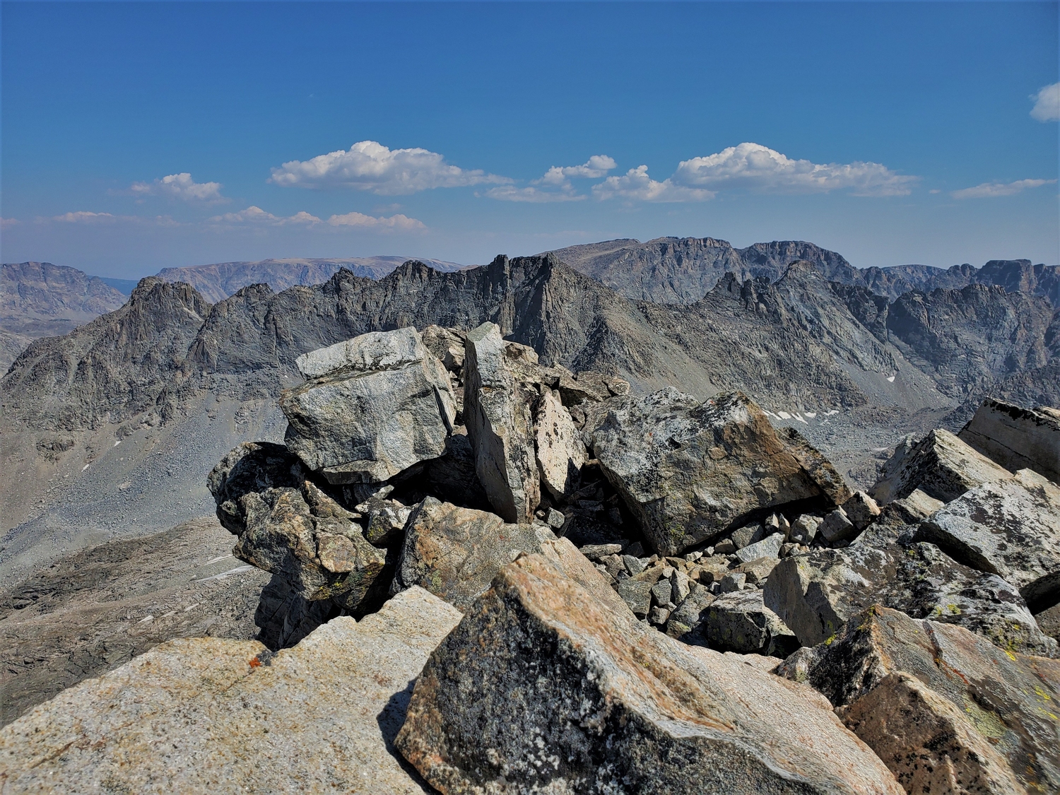
Harrower Peak
Elevation: 13,054 ft.
Prominence: 918 ft.
Isolation: 1.8 miles
Technical Difficulty: Class 4


Harrower Peak Guidebook
Introduction
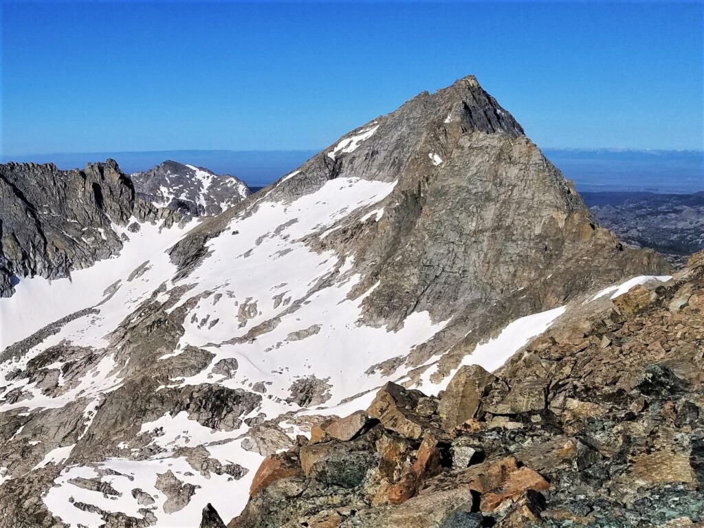
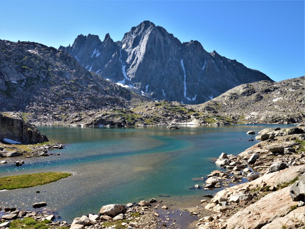
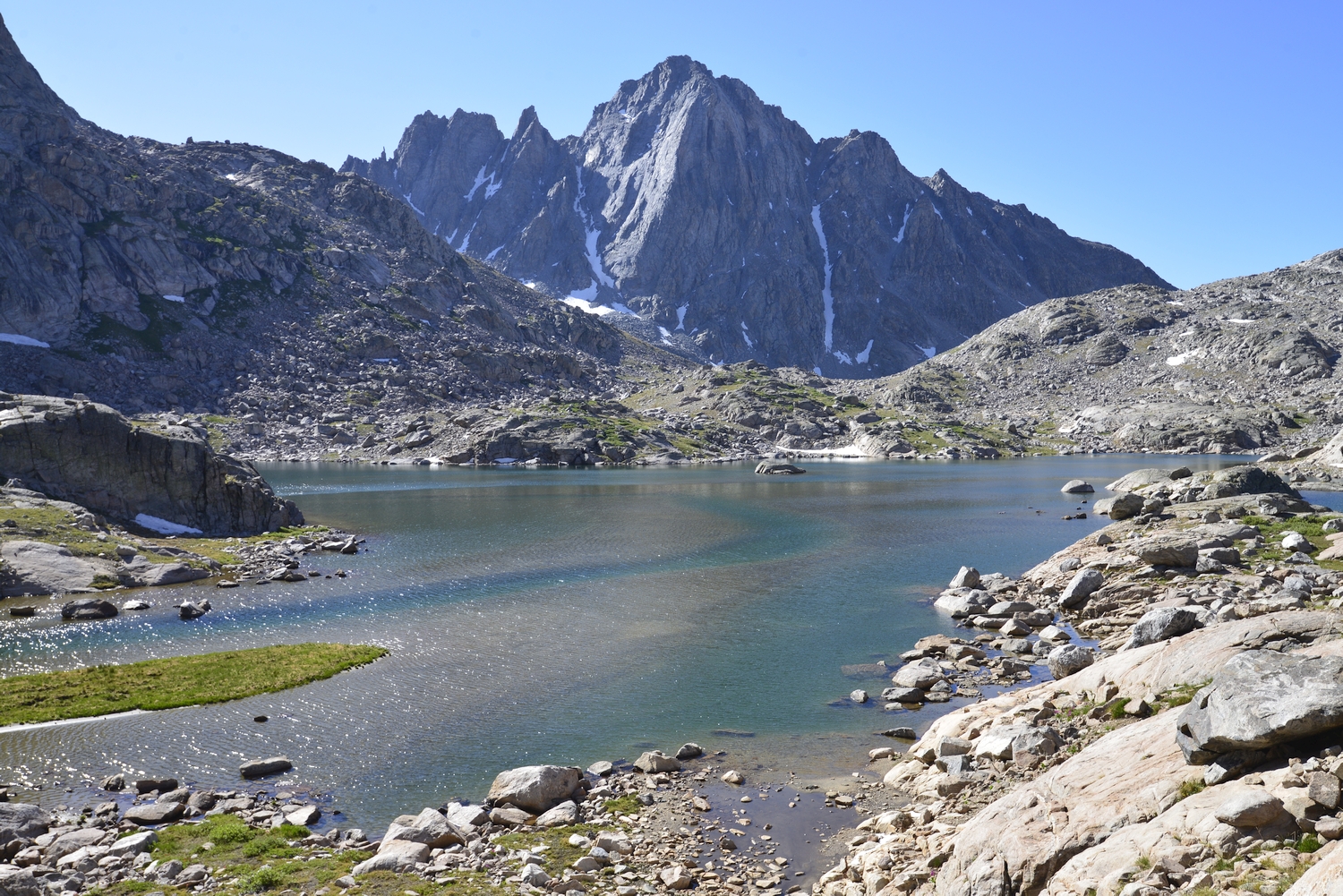
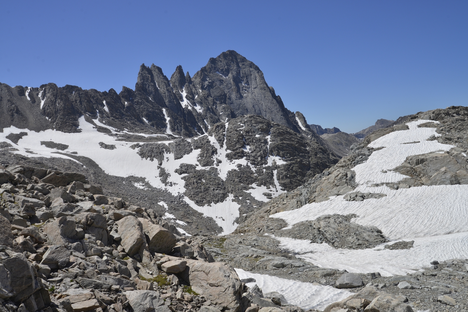
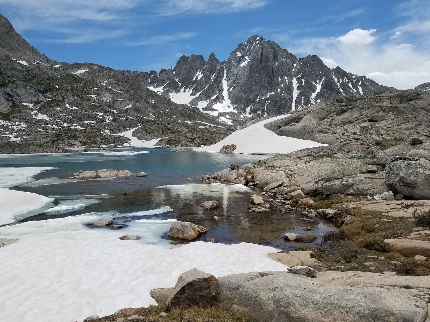
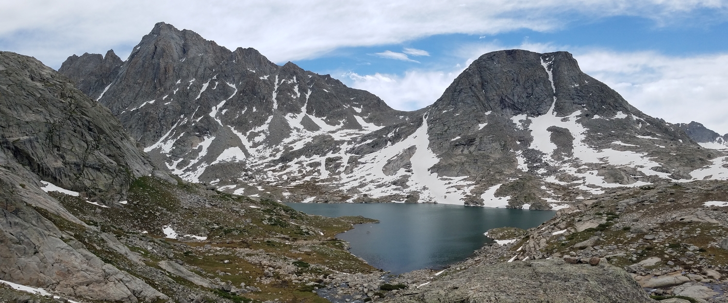
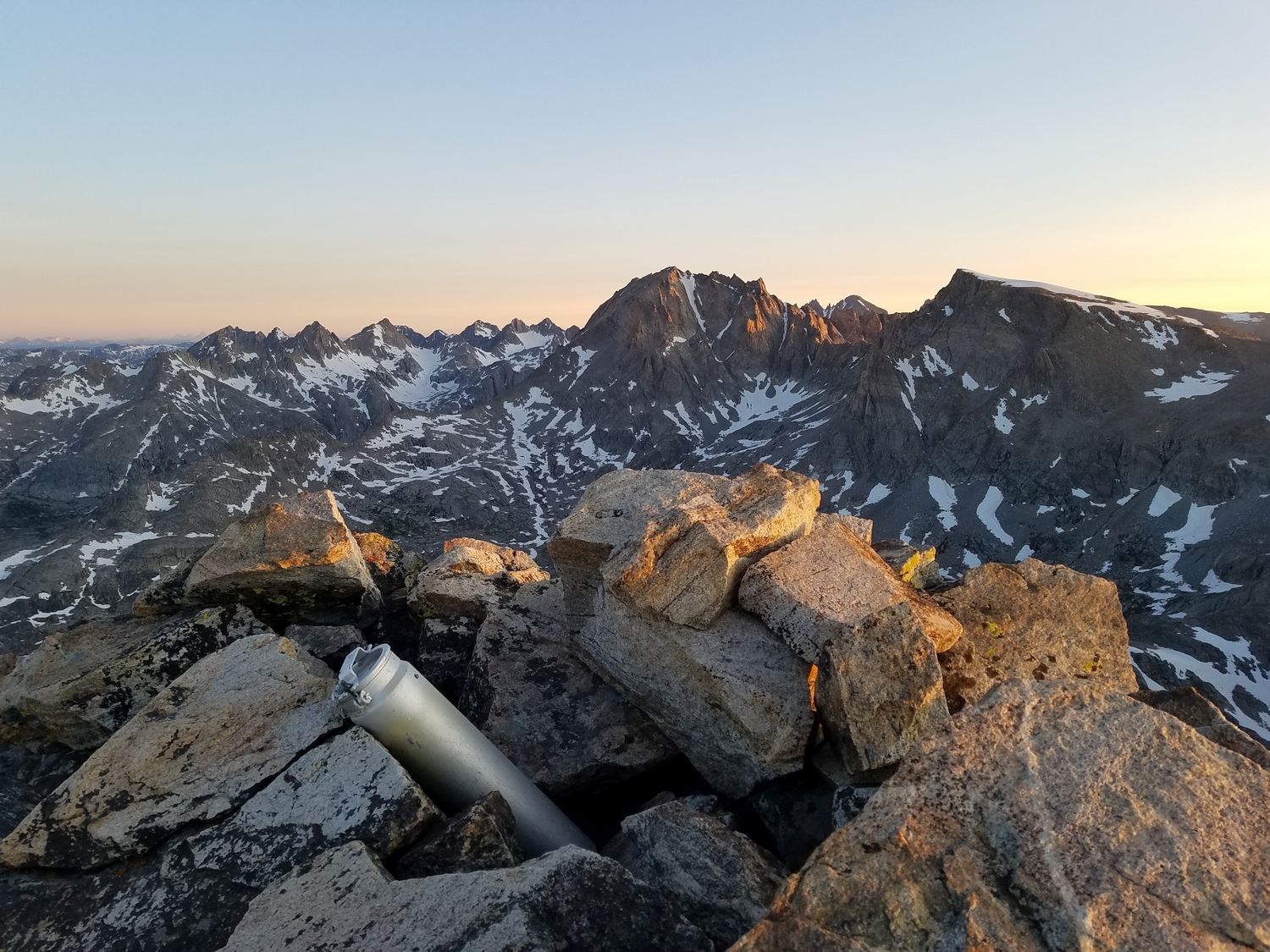
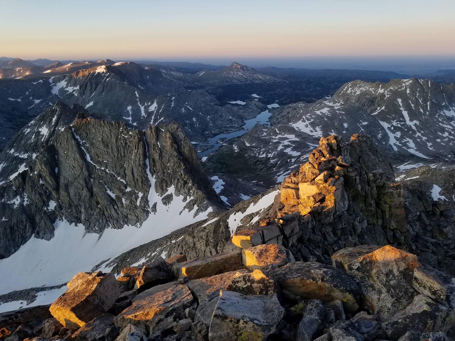
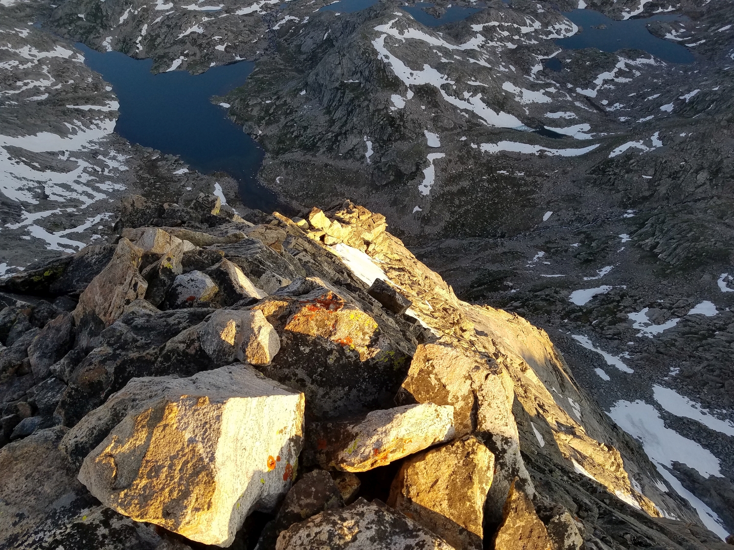
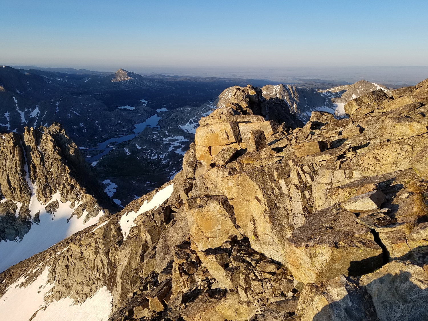
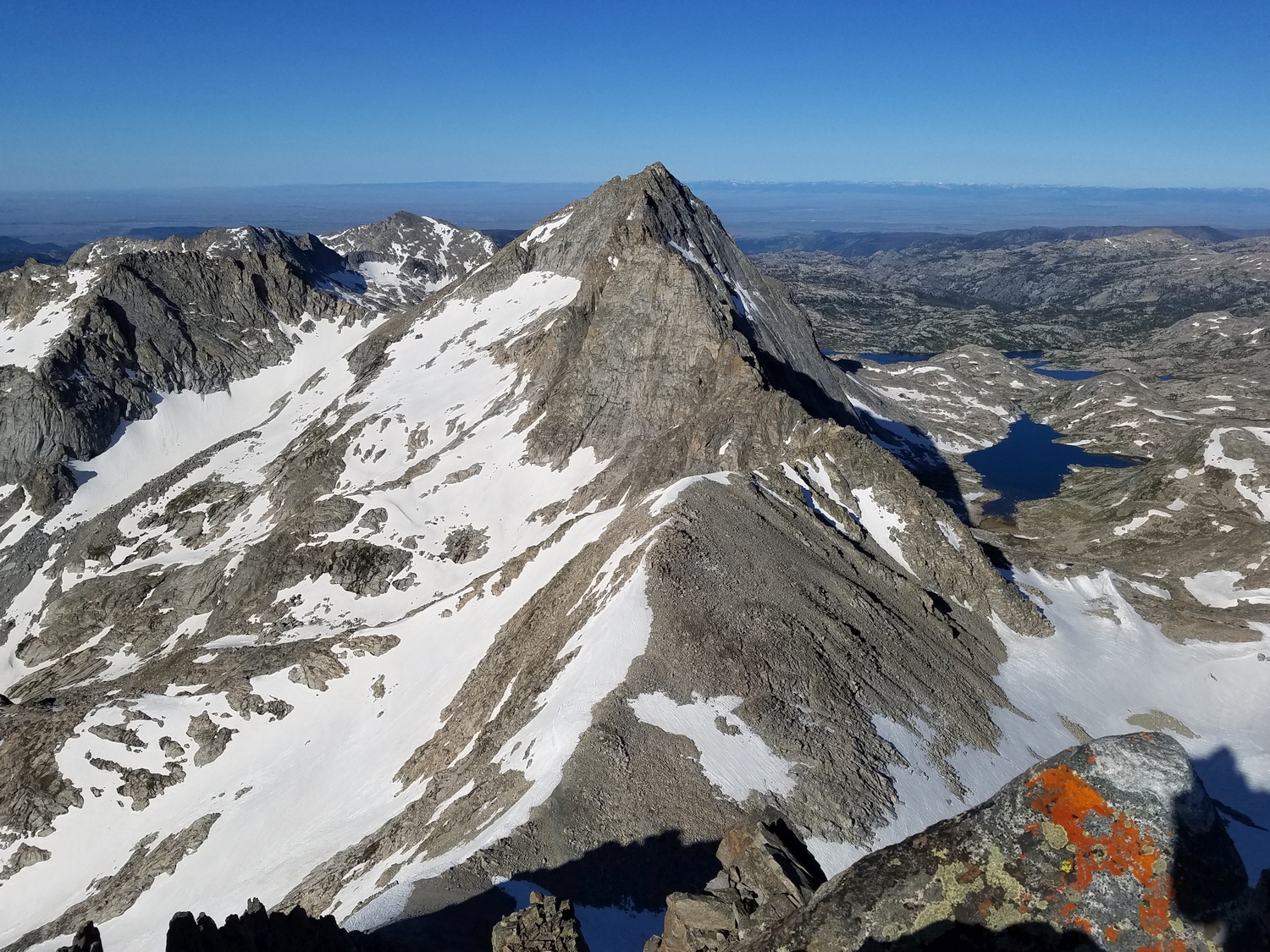
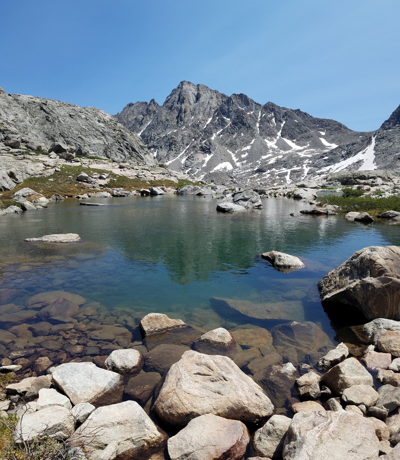
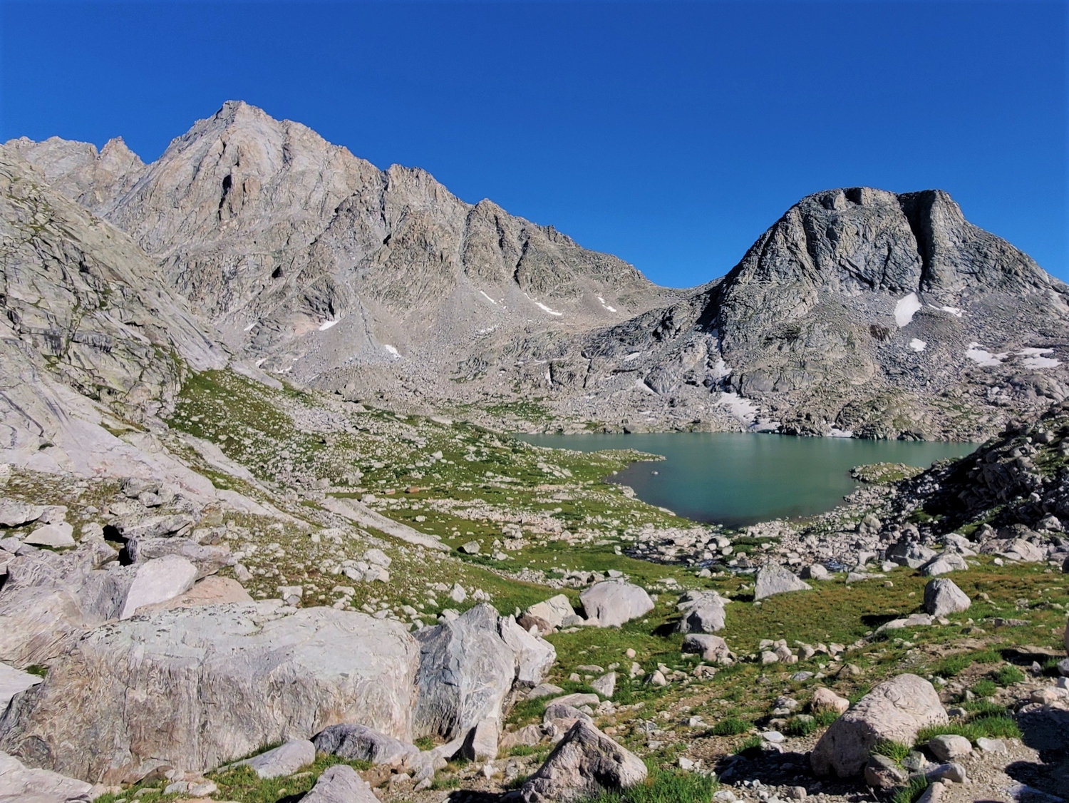
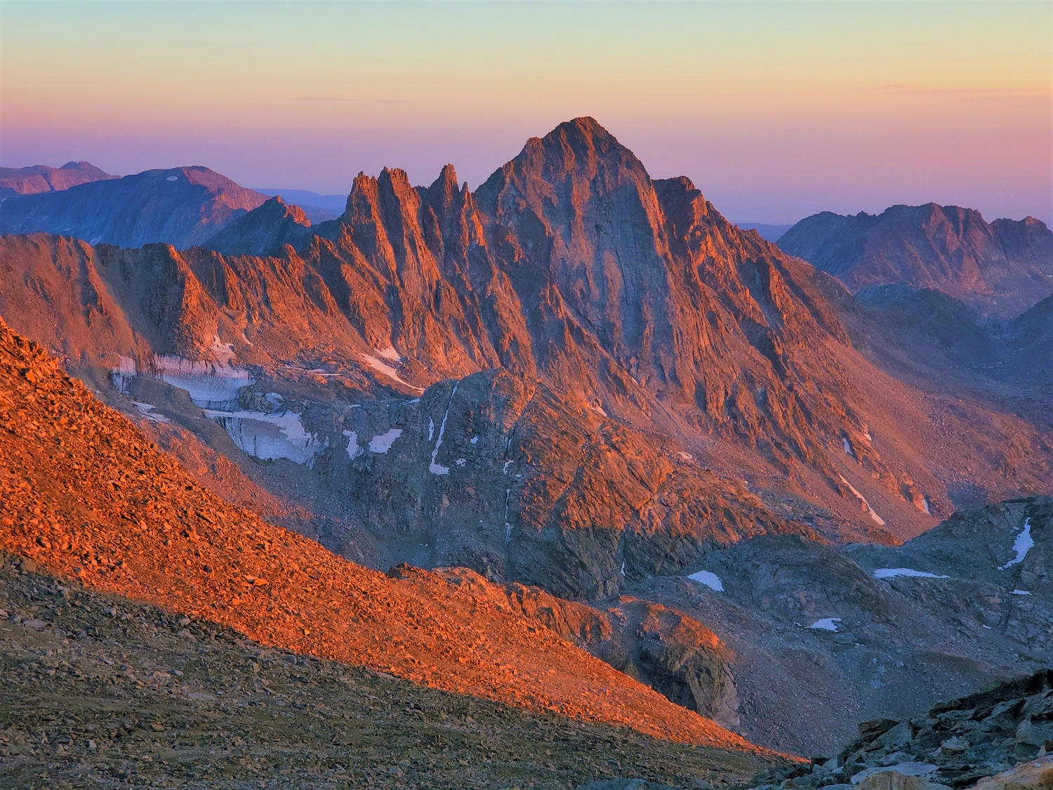
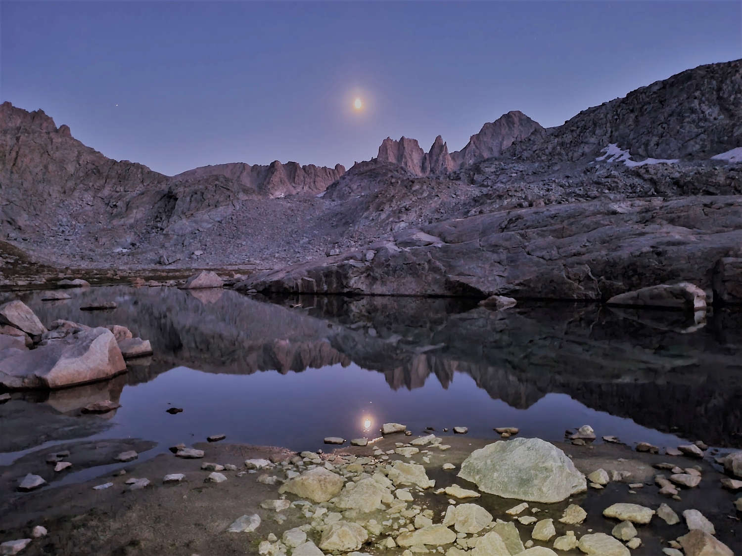
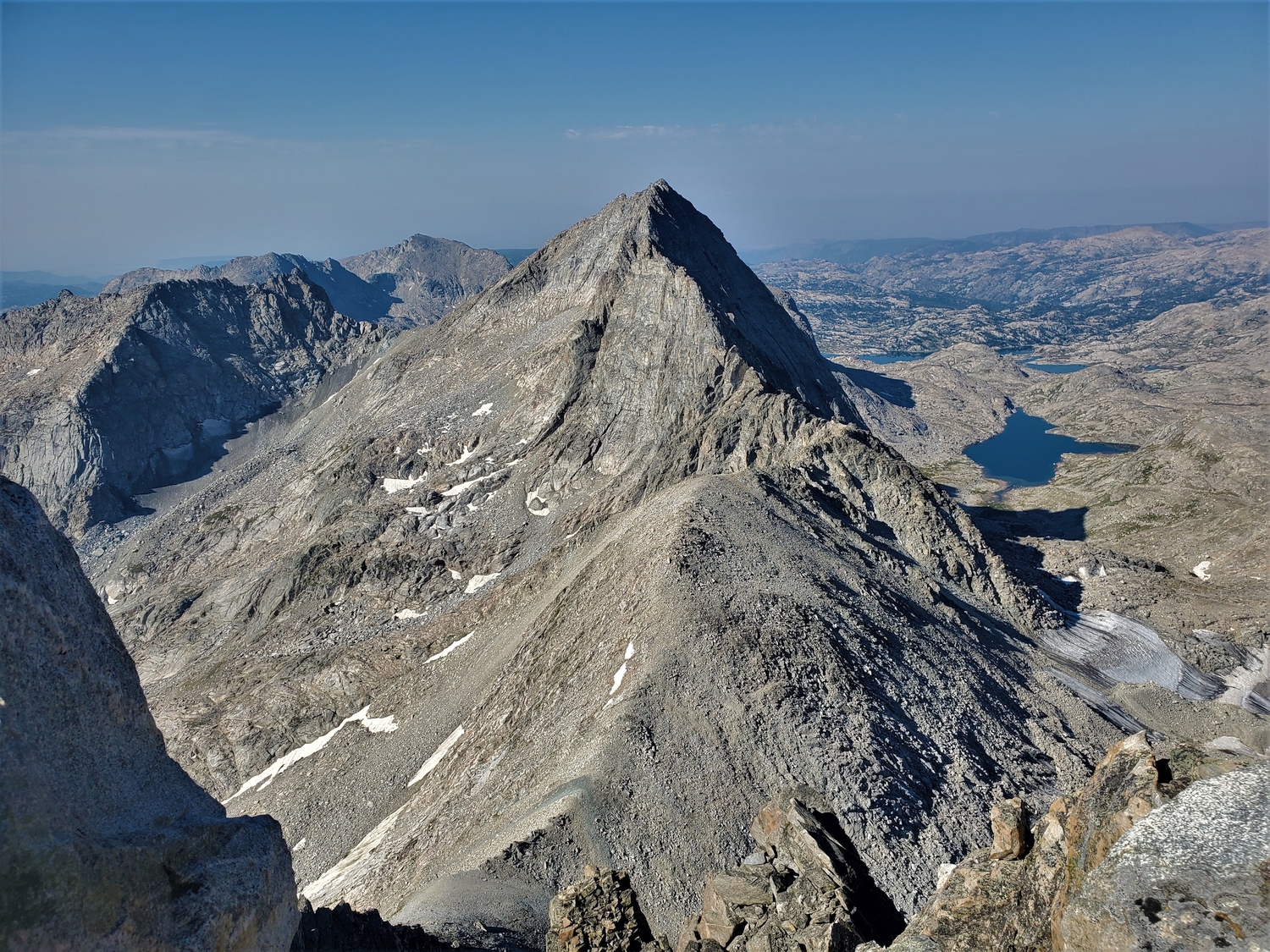
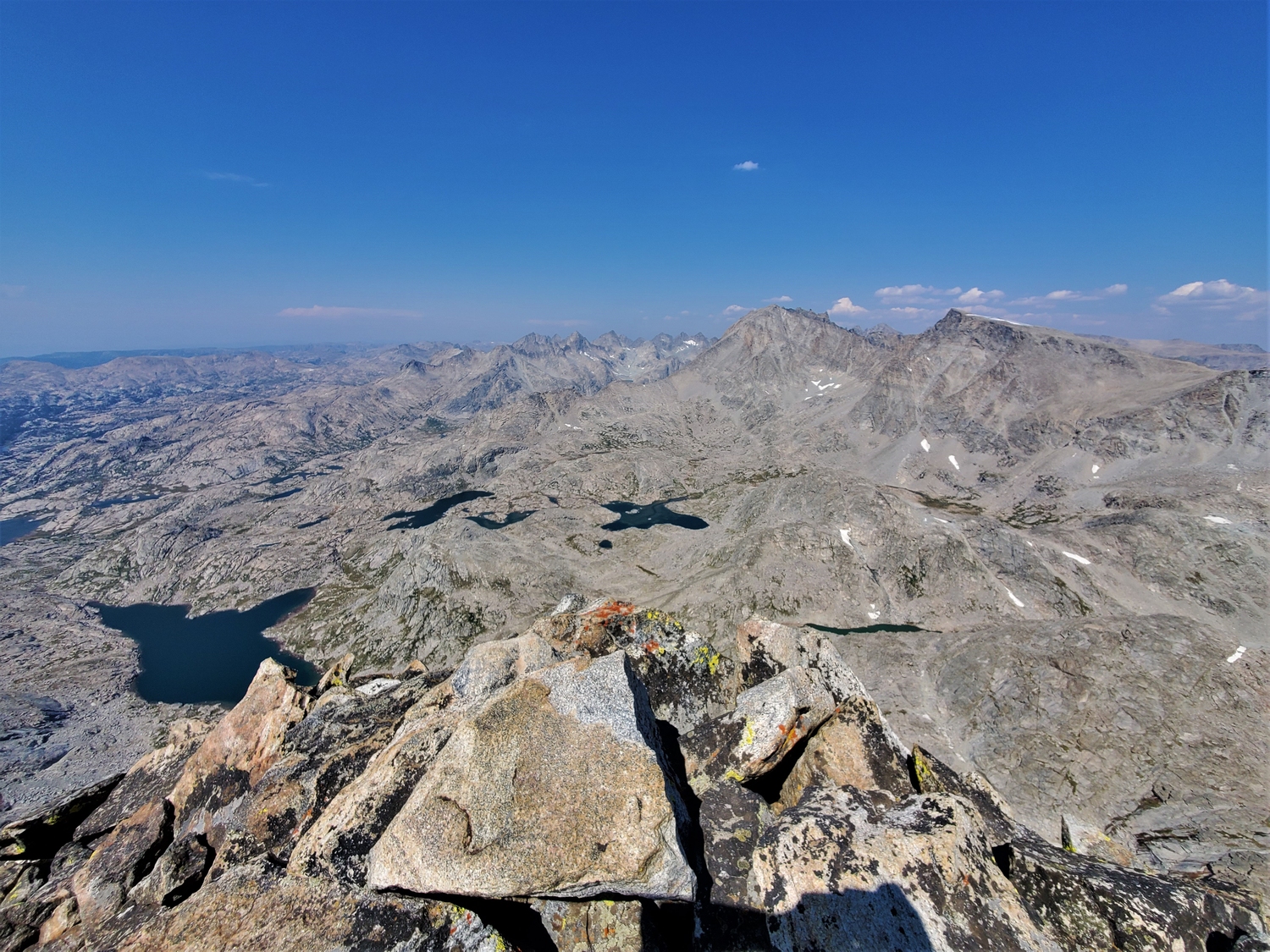
This fine summit is officially named Harrower Peak, but climbers have long called it Ellingwood Peak in association with the famous climber who made its probable first ascent. The family of the late Harrower, disappointed at climbers’ refusal to honor the official name, placed a memo in the summit register explaining that Harrower was an early backcountry ranger and mayor of Pinedale who contributed to early conservation of the Wind River Range. In the author’s opinion, plenty of things are named after Ellingwood already. Harrower Peak is a beautiful peak, especially when reflecting in one of the shallow, blue-green lakes of Indian Basin, and it is a favorite target of climbers.
General Considerations
The dramatic north face is Harrower’s most distinguishing feature, but the peak is much easier to climb from the south side. Due to its relative proximity to Island Lake, this peak is both more accessible and more crowded than other summits in the region. It is also the closest 13er to the Elkhart Park Trailhead, but with a one-way distance of more than 14 miles, most people will still want to climb Harrower as part of a multi-day trip.
Route 1: Southwest Ridge – Class 4
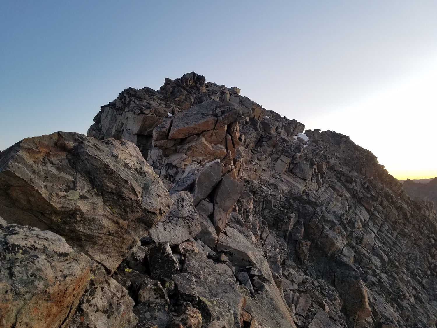
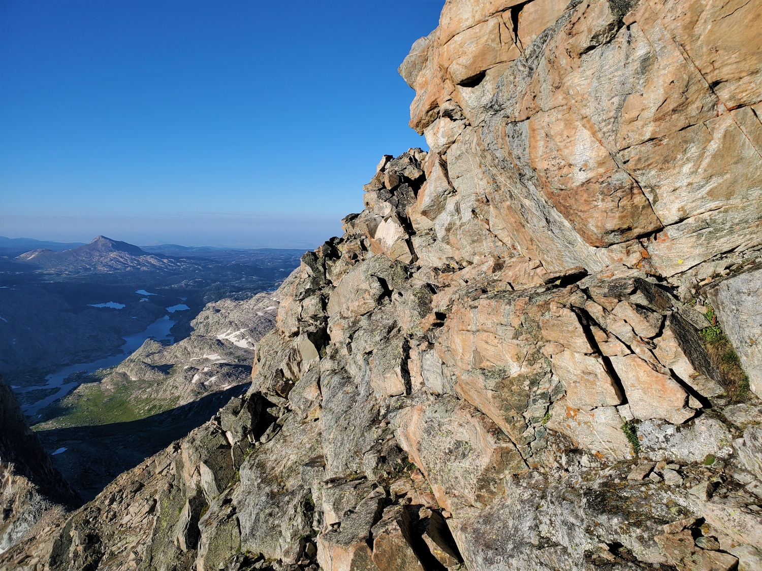
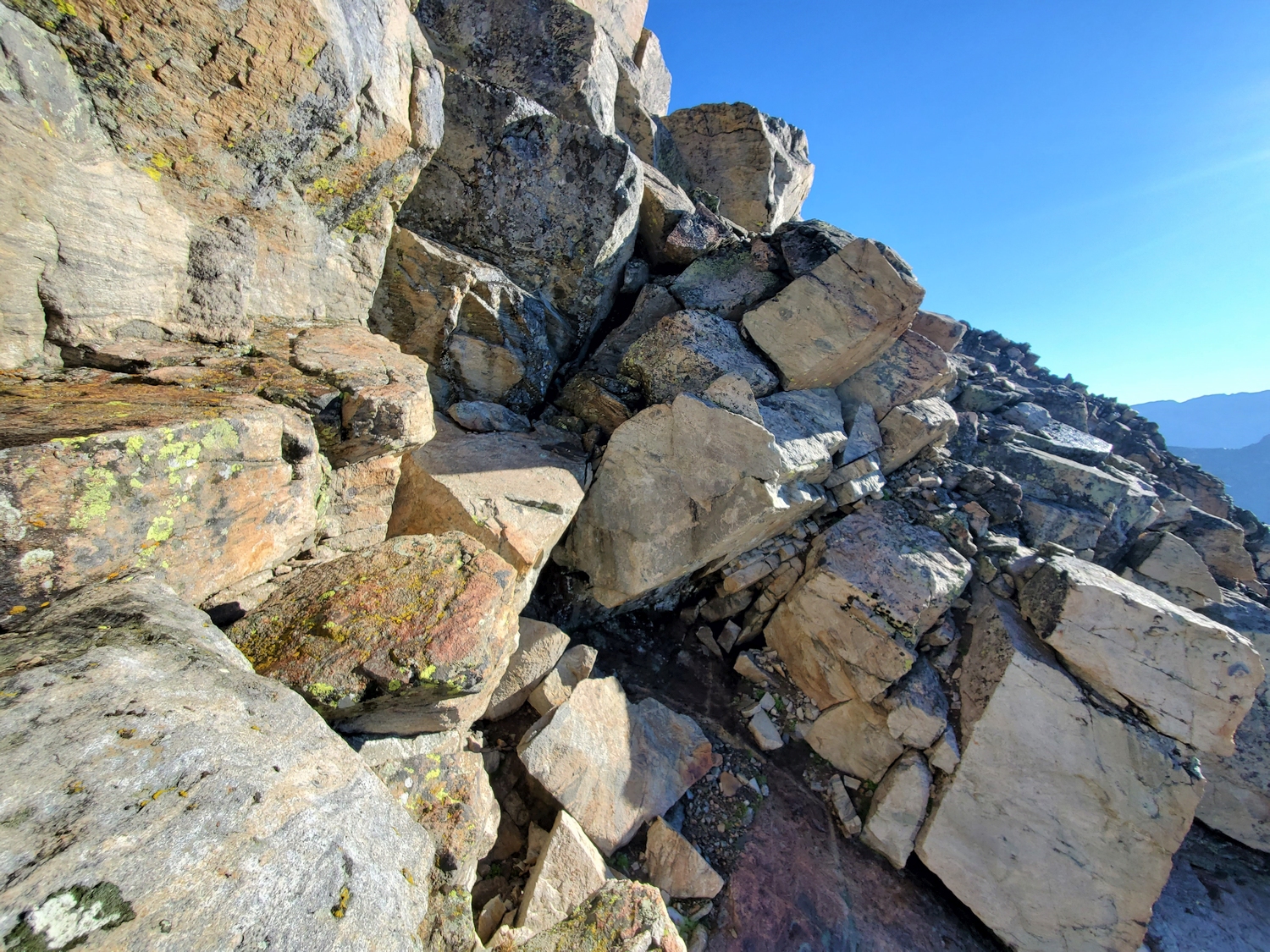
This is a strange “ridge” route, since very little time is actually spent on the ridge crest. The approach is convoluted, and once near the summit, it is generally easier to traverse somewhat below the ridge instead of following it directly. Regardless, the route does generally climb the peak from the southwest aspect, and climbers have long known it as the southwest ridge.
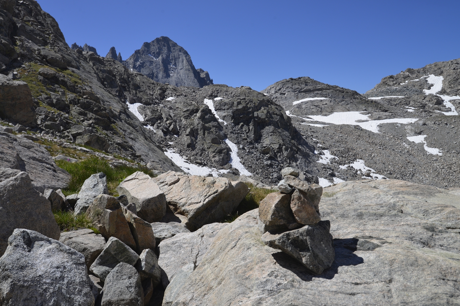
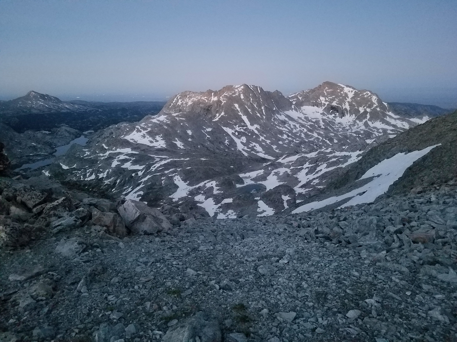
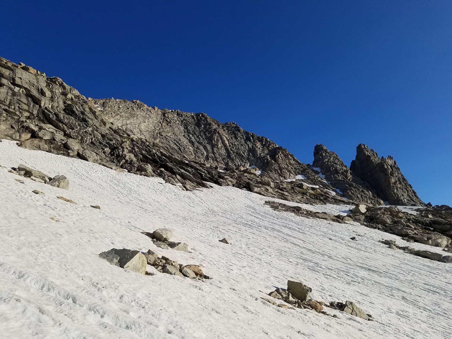
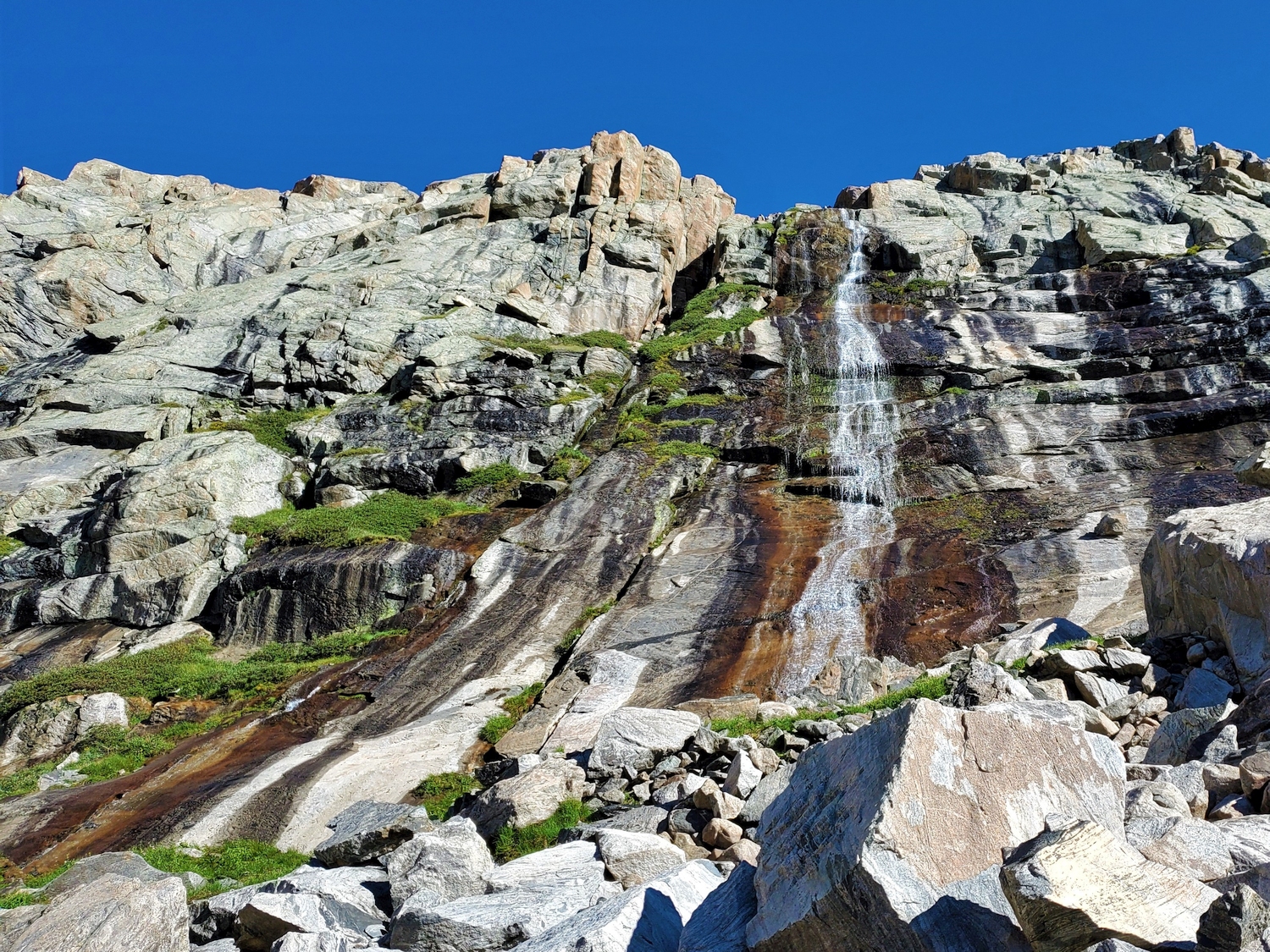
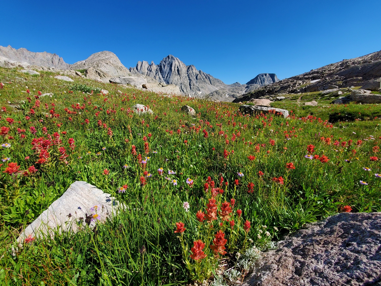
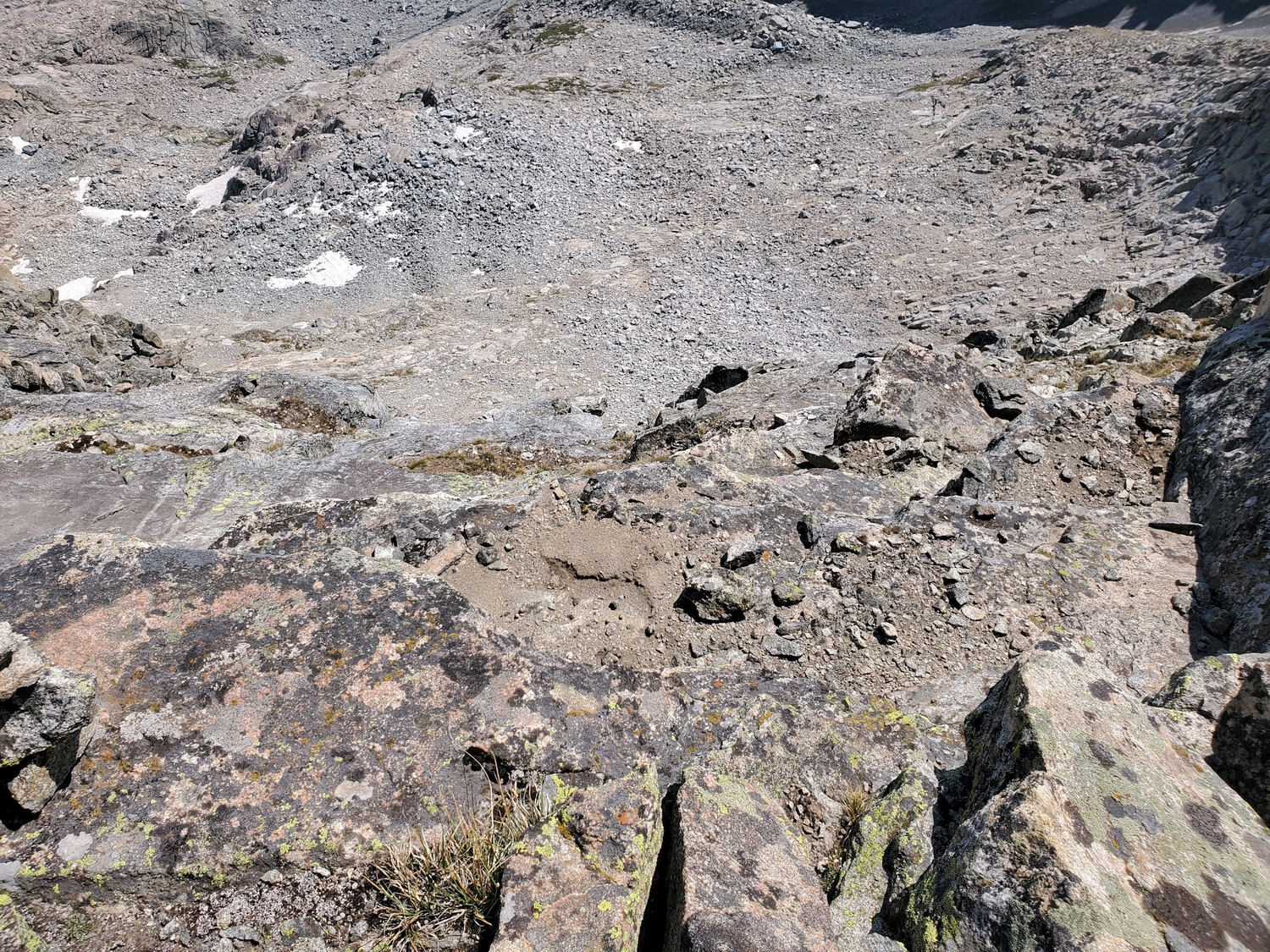
From the Indian Pass Trail at the south end of Island Lake, a trail branches off to the south, climbing past picturesque waterfalls to reach treeline in a gentle grassy valley leading to the off-trail pass between Island Lake and Wall Lake. From any convenient point in this valley before reaching the crest of the pass, start hiking north up a mix of grass, talus, and scree slopes.
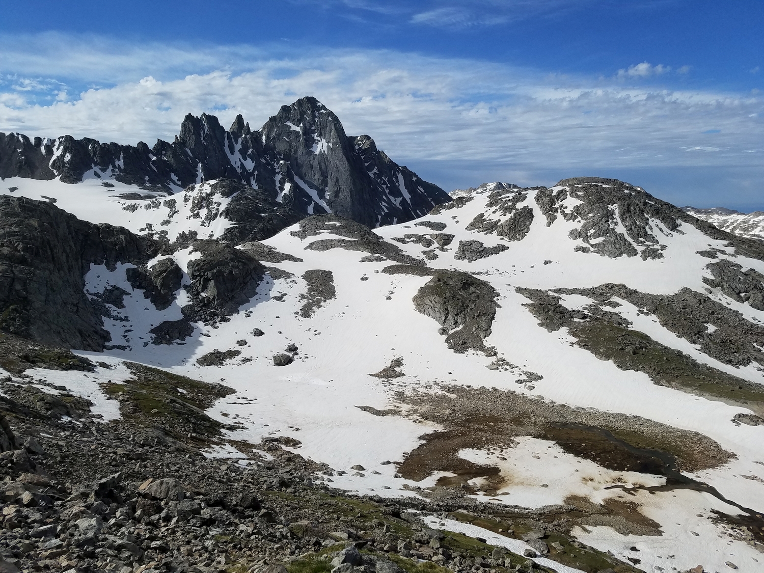
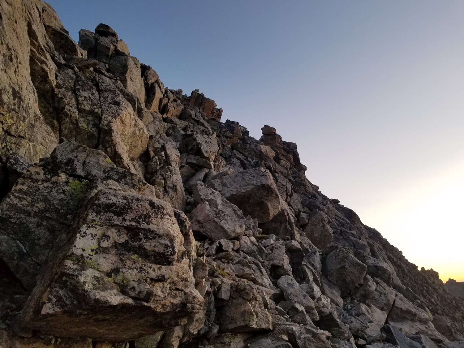
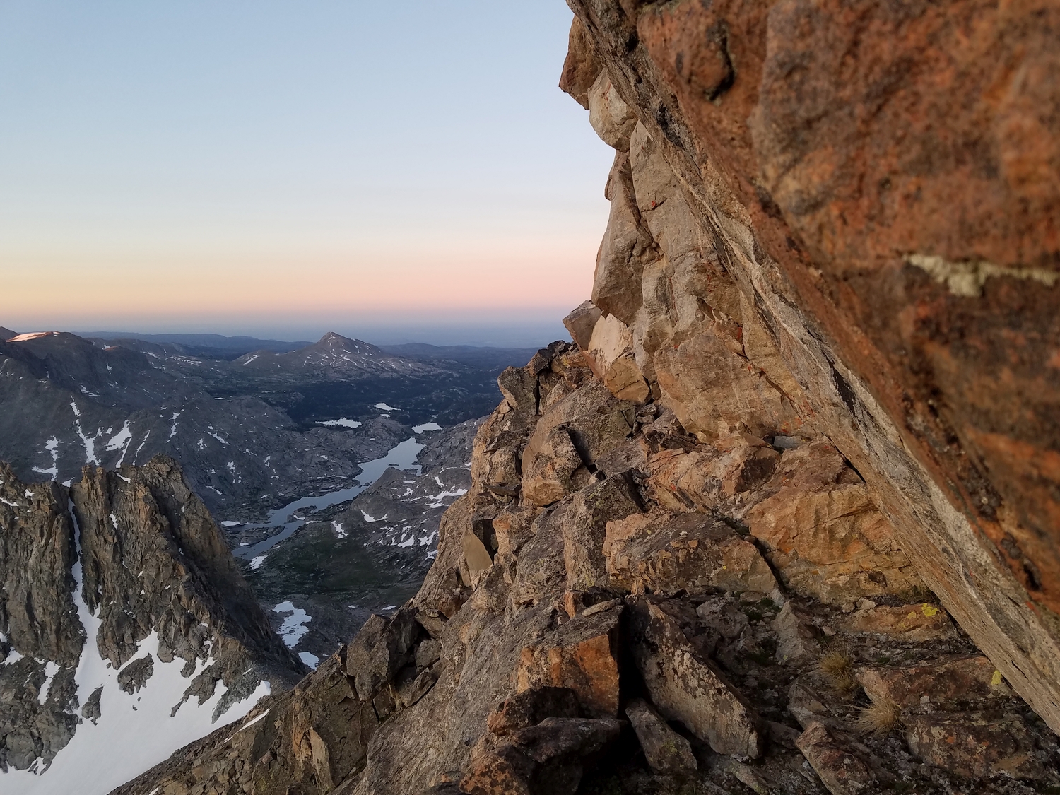
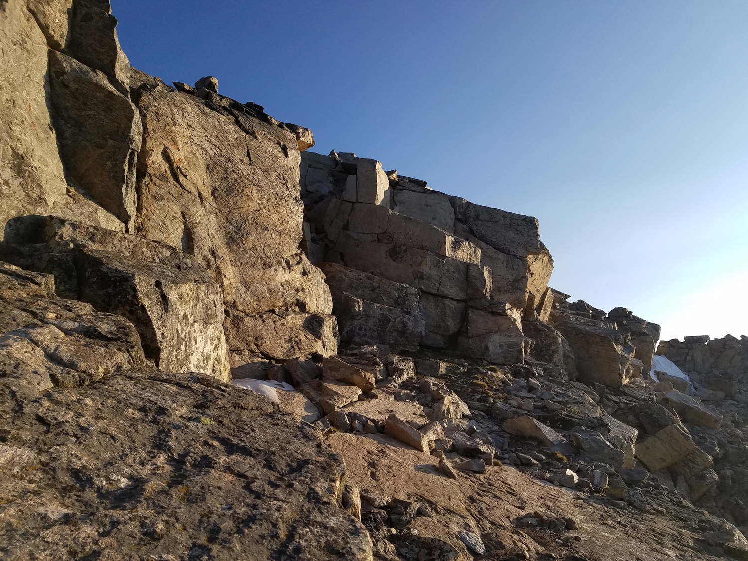
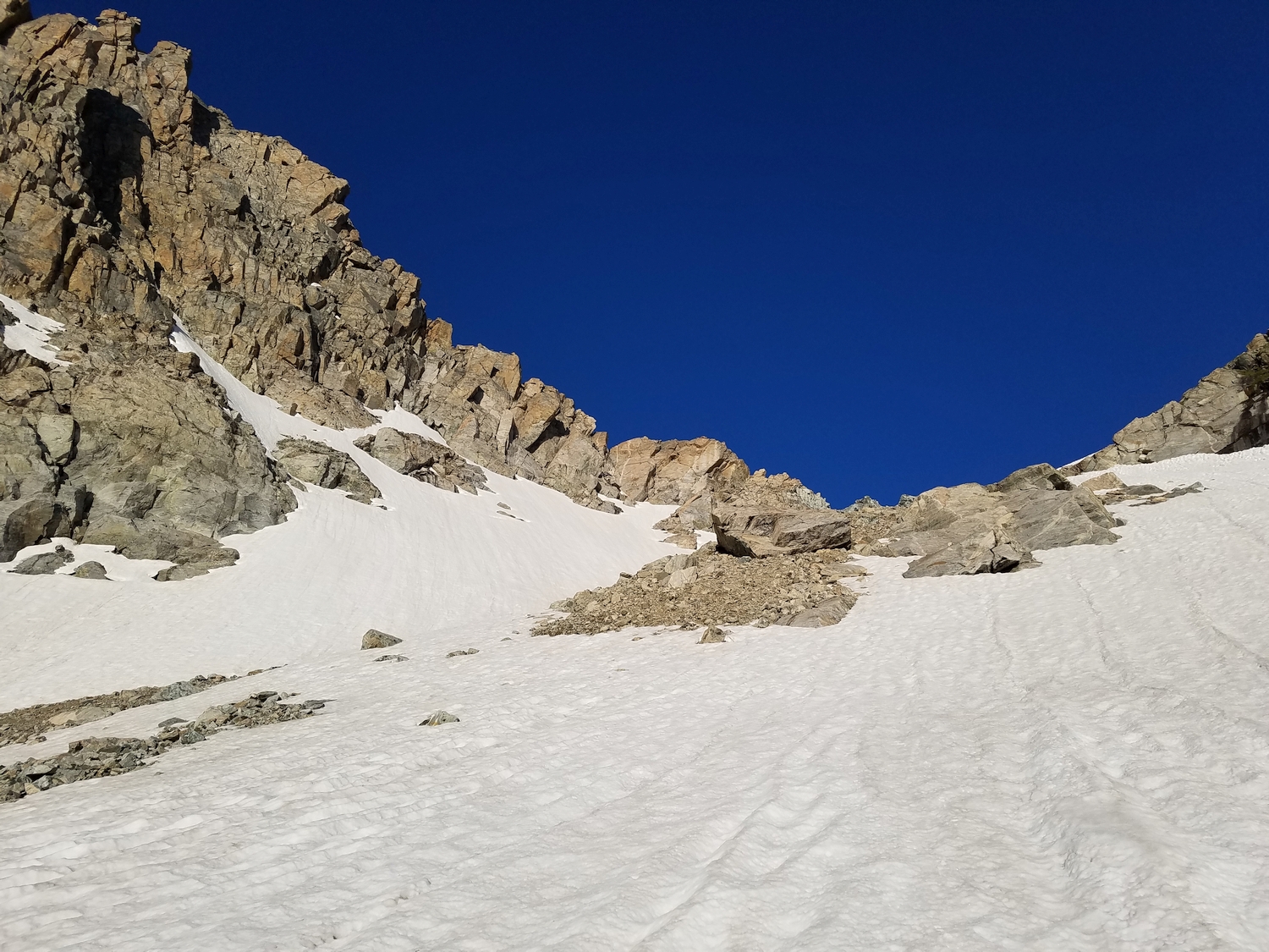
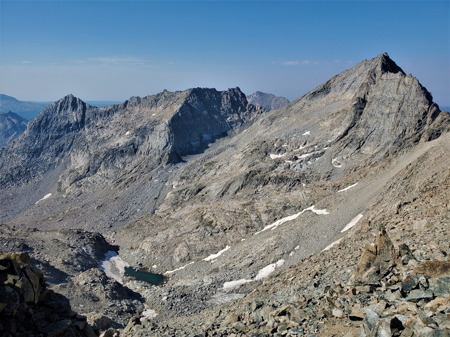
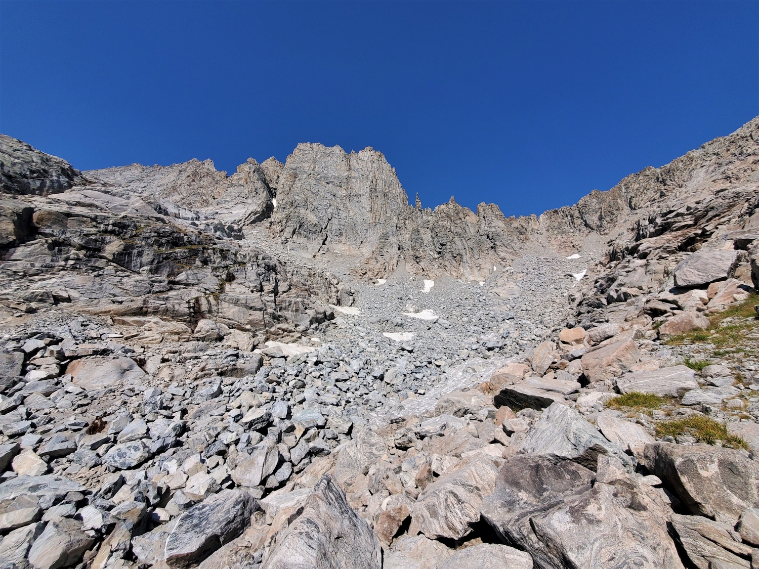
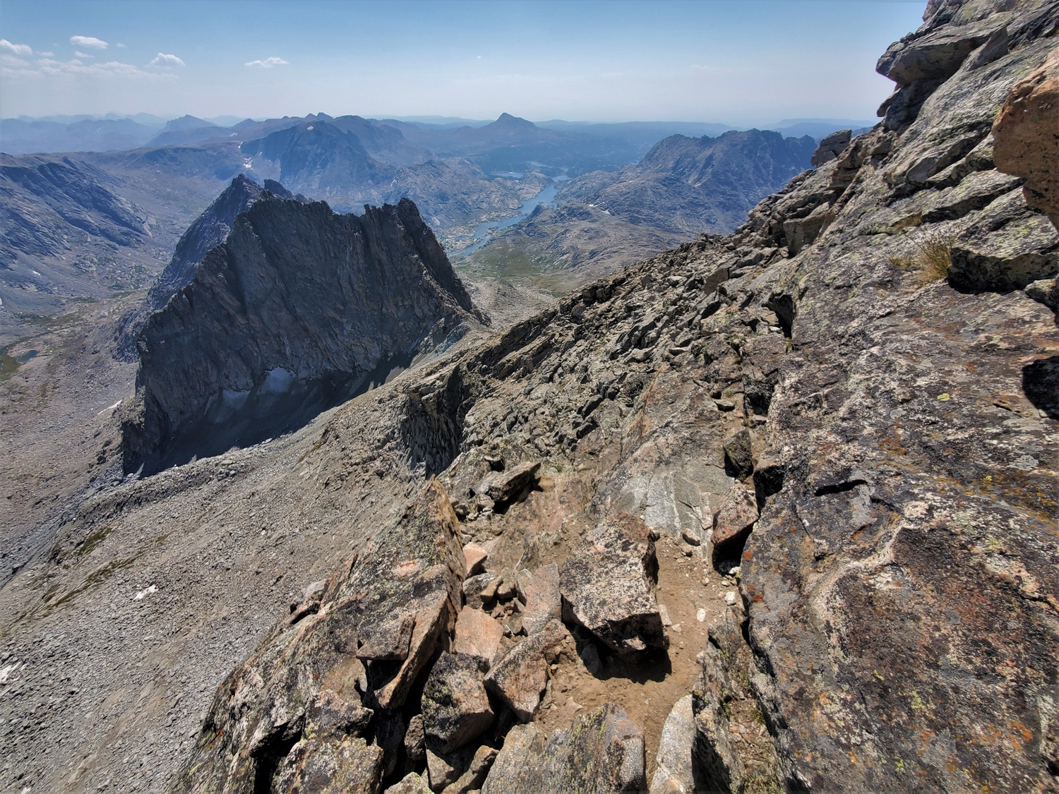
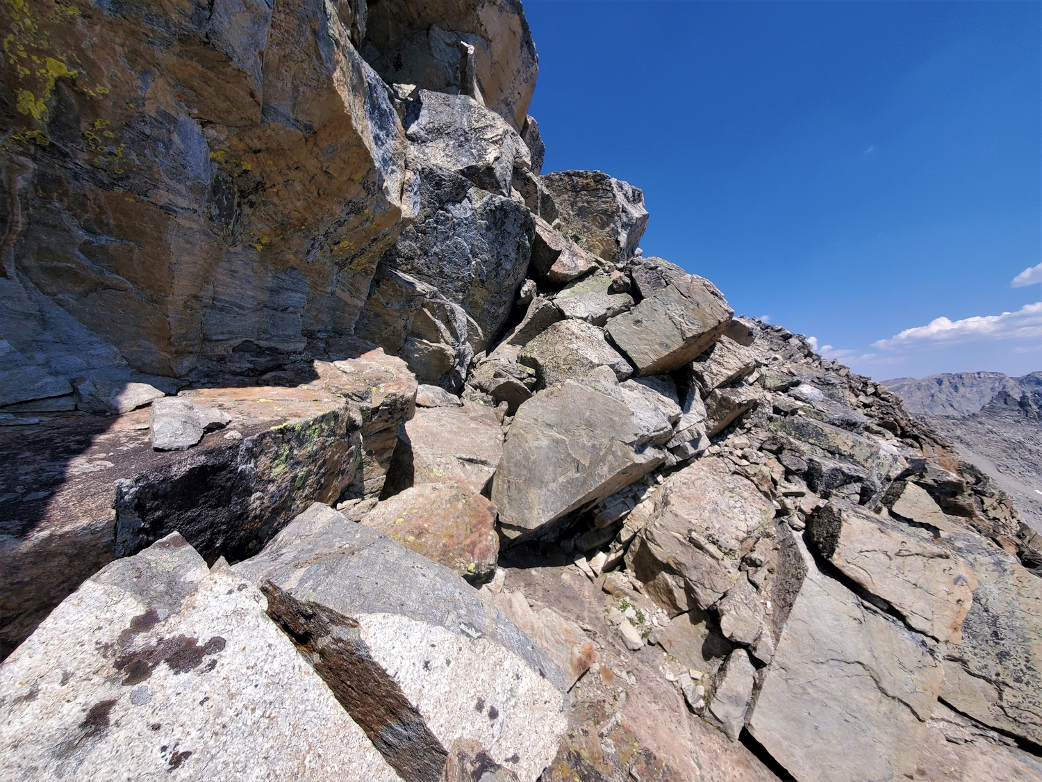
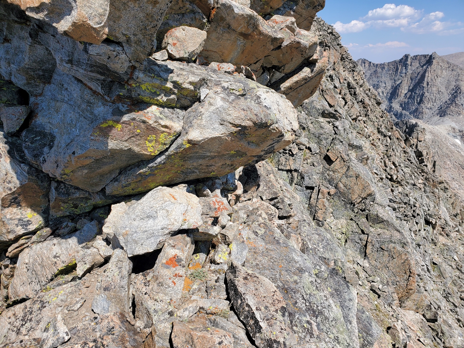
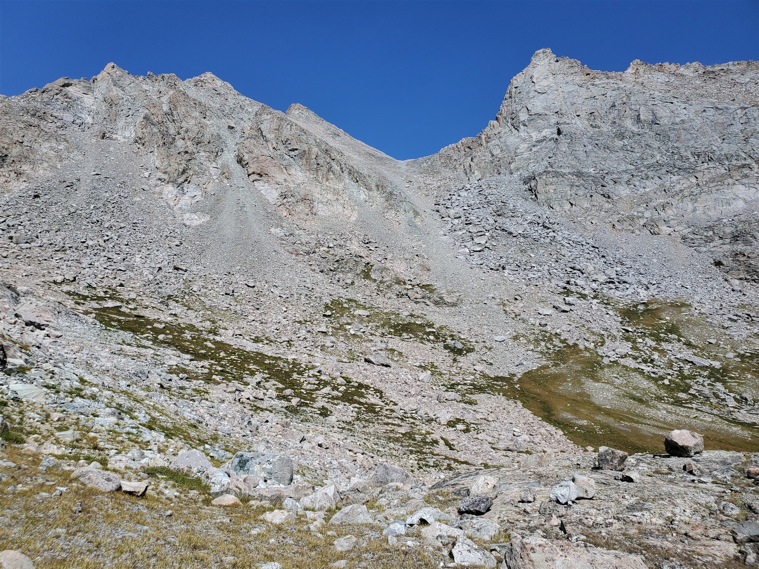
Aim for the col between Harrower and Faler Tower (Point 12607 on maps). From this lofty pass around 12,200 ft., continue up 500 ft. scree towards Harrower’s summit ridge. Before reaching the crest of the ridge, traverse climber’s right on a mix of broken terrain and large, slabby ledges. When short vertical steps block easy progress, climb up closer to the ridge and traverse exposed ledges under and around overhanging alcoves. The route gains the ridge crest briefly to avoid especially steep sections on the lower face, ultimately reaching the summit from the east side. The specifics of the route are left as an exercise to the reader, since the terrain is so broken that a more detailed description is neither necessary nor possible.
Route 2: Eastern Cirque – Class 4
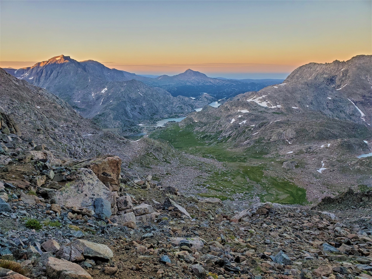
This route is convenient for those desiring to combine Harrower and Knife Point in one day, but neither this route nor the second half of the traverse back up Knife Point is particularly enjoyable. From the remote cirque at the head of Pole Creek, far above Wall Lake, a plethora of rock slabs, small snowfields, and loose scree fields provide many options for a route up Harrower from the east. One option follows gullies and waterfall-covered slabs to gain the col between Harrower Peak and Faler Tower (Point 12607). Another option traverses several rock steps and a hanging talus field across the upper face below Harrower’s eastern cliffs. Either way, the goal is to join Route 1 before the beginning of the final ridge.
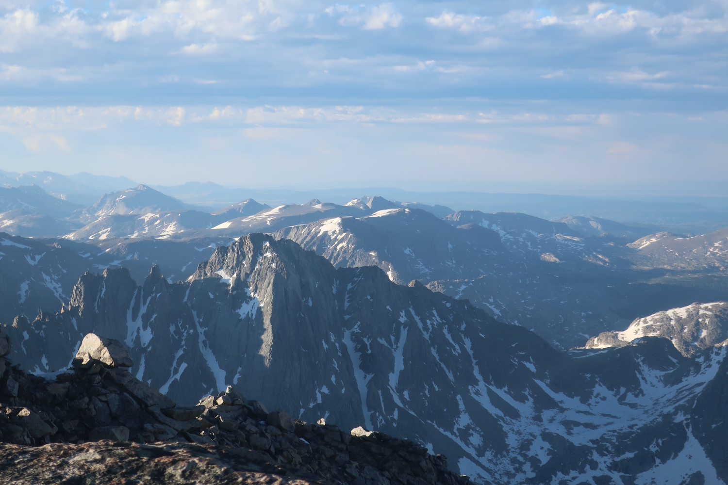
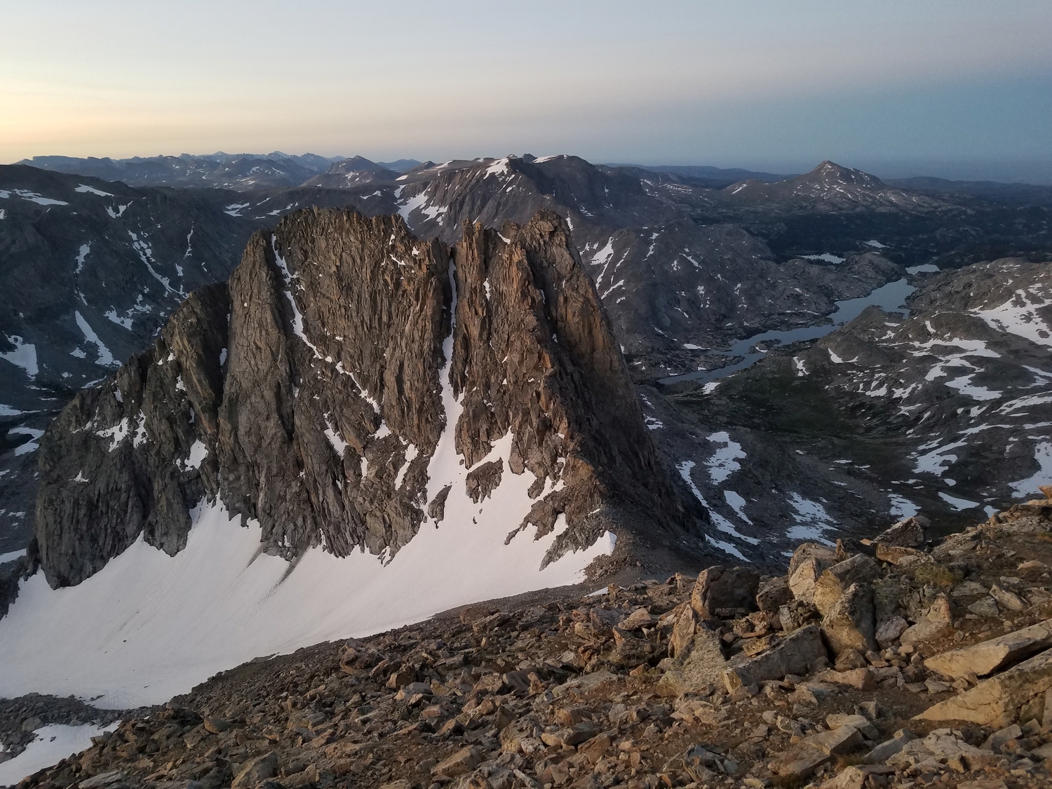
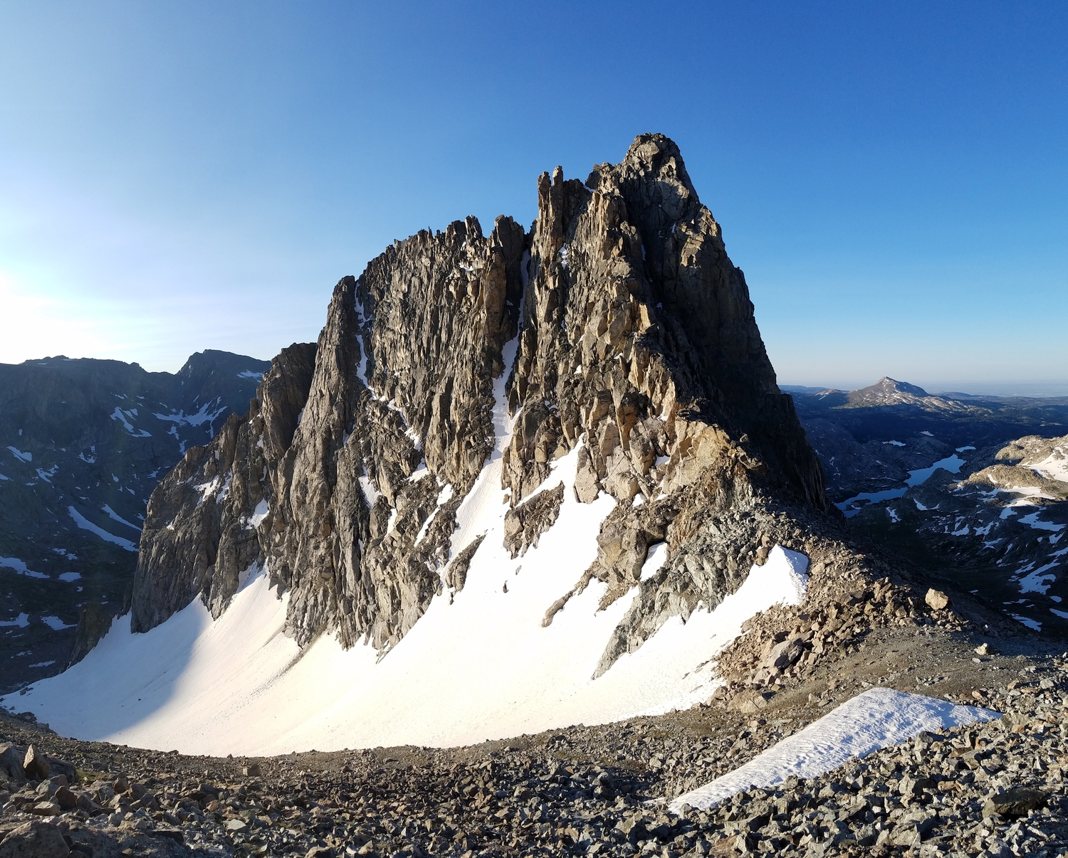
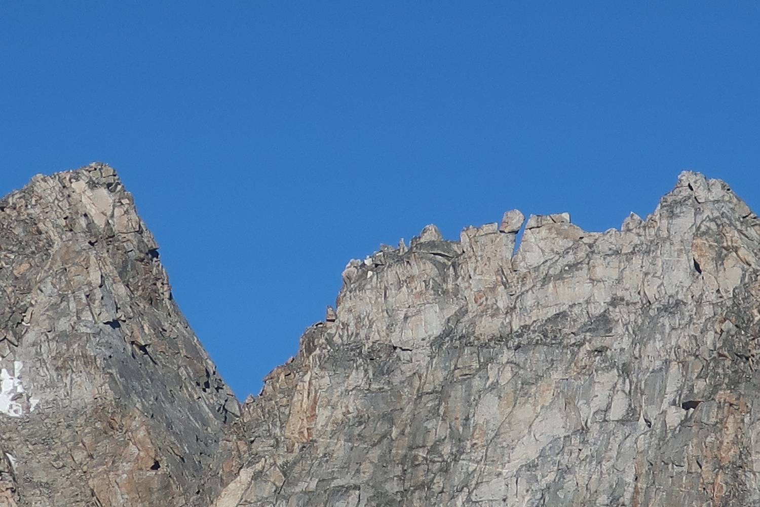
Route 3: North Arete – Class 5.6
One of the most classic rock routes in an area known for classic rock routes, the north arete is a many-pitch trad climb up Harrower’s most distinguishing feature, cutting a profile which can be seen from many vantage points around Indian Basin. Climbers report beginning on easier terrain left of the arete, then following the narrow crest to top. It reportedly involves highly varied climbing including cracks, slabs, and overhangs. Although the route has been soloed, it is usually climbed in 9-13 belayed pitches. The climb ends at the summit, and climbers usually descend Route 1. Consult rock climbing guidebooks and trip reports for further details.
Harrower Peak Map
Harrower Peak Panorama
Harrower Peak Photos
-
- Harrower Peak (center) and Elephants Head (a 12er, right) as seen from the creek crossing above Island Lake (2020)
-
- Another view of Harrower and friends from nearby camp at the Indian Basin-Titcomb Basin trail junction (2020)
-
- Golden light on the summit rocks with Fremont Peak and the rest of Titcomb Basin in the background (2020)
-
- My descent route from the Faler-Harrower col followed snow and talus slopes into the bowl south of Knife Point Mountain, my next objective (2020)
-
- Looking back to Harrower (right) and Faler Tower (dark ridge just left of center) while climbing Knife Point (2020)
-
- Harrower Peak is equally symmetric and beautiful in this less common view from the summit of Knife Point Mountain (2020)
-
- The bigger issue that I soon ran into was the wet rock. The upper part of Harrower requires exposed class 4 climbing on down-sloping ledges and smooth blocks, and it was completely covered in water from the torrential rain the day before.
-
- I wasted an hour trying to find a safe way to the summit and ended up pulling some moves on slick holds that I wasn’t really comfortable with, but eventually I made it.
-
- Looking back at one of the upper scrambling sections on the descent. By the time I started down, the rocks were already starting to dry out in the sun, and it wasn’t nearly as dangerous.
-
- This huge waterfall between Harrower and Knife Point shouldn’t have been flowing this late in the summer, but it was reactivated by the heavy rain.
-
- I had planned to continue to Fremont and maybe even Sacagawea this day, and technically I still had time, but I was too beat to go on. Instead, I bailed out on the Indian Basin Trail. My compensation prize was this stunning view of Harrower Peak above a field of Indian Paintbrush.
-
- I descend to the southwest down a scree slope, then traverse along the eastern cirque of Harrower to approach its southwest ridge route.
-
- Harrower is a steep peak, with sharp ridges and intimidating towers. Luckily, there’s a comparatively easy route up the other side.
-
- The summit of Harrower Peak. I did it–I climbed all of the northern Wind River 13ers in a single trip!
-
- One last look at the summit (and the oversized summit register) before I head down. I could spend all day up here enjoying the views and relishing in the past 6 days, but the clock is still ticking and it’s a long hike out.
-
- Looking west from the summit, I could see most of the route I would have to hike this afternoon. The trailhead is on the low, dark ridge in the distance on the far right.
-
- Looking back at Knife Point and Bete Noire. A few clouds have developed today, the most I’ve seen all week. It wasn’t threatening yet, but the weather was clearly changing.
-
- Indian Pass is visible here near the center, below the horizon. The giant peaks on the left are Fremont and Jackson.
-
- Climbing just below the summit. These blocks are bigger than they look, and it feels closer to slab climbing than talus hopping.
-
- The exposure can sneak up on you on this route, and I try to remain vigilant even though I’m already celebrating in my mind.
-
- The easiest climbing is usually below the ridge crest on climber’s right. Here, I bypass a gendarme by ducking under some protruding blocks.
-
- The southwest ridge itself is a fairly short but stiff 4th class climb. Since the rock is dry this time and the routefinding is fresh in my mind from August, I cruise right up.
-
- I descend as quickly as possible, with a new boost of energy from finishing the core 13er cluster. This view looks back over the route down from Harrower, with Faler Tower (a 12er) on the right.
-
- Unnamed lake along my descent route where I stopped to grab some water and cool off, since it was getting hot at the lower elevations.
-
- Descending the use trail towards Island Lake, it feels like I’m sneaking through just under the wire, as clouds gathering overhead and the autumnal tundra underfoot both signal the end of summer. The high peaks are forecast to get snow in the next couple days.
DISCLAIMER: Mountain climbing is dangerous. Activities described on this page may lead to serious injury, death, and property damage. This webpage is presented with no warranty express or implied. Pictures and text are for entertainment purposes only. No commercial use allowed; all rights reserved.