Mount Woodrow Wilson
Elevation: 13,512 ft.
Prominence: 547 ft.
Isolation: 1.2 miles
Technical Difficulty: Class 5.1


Mount Woodrow Wilson Guidebook
Introduction
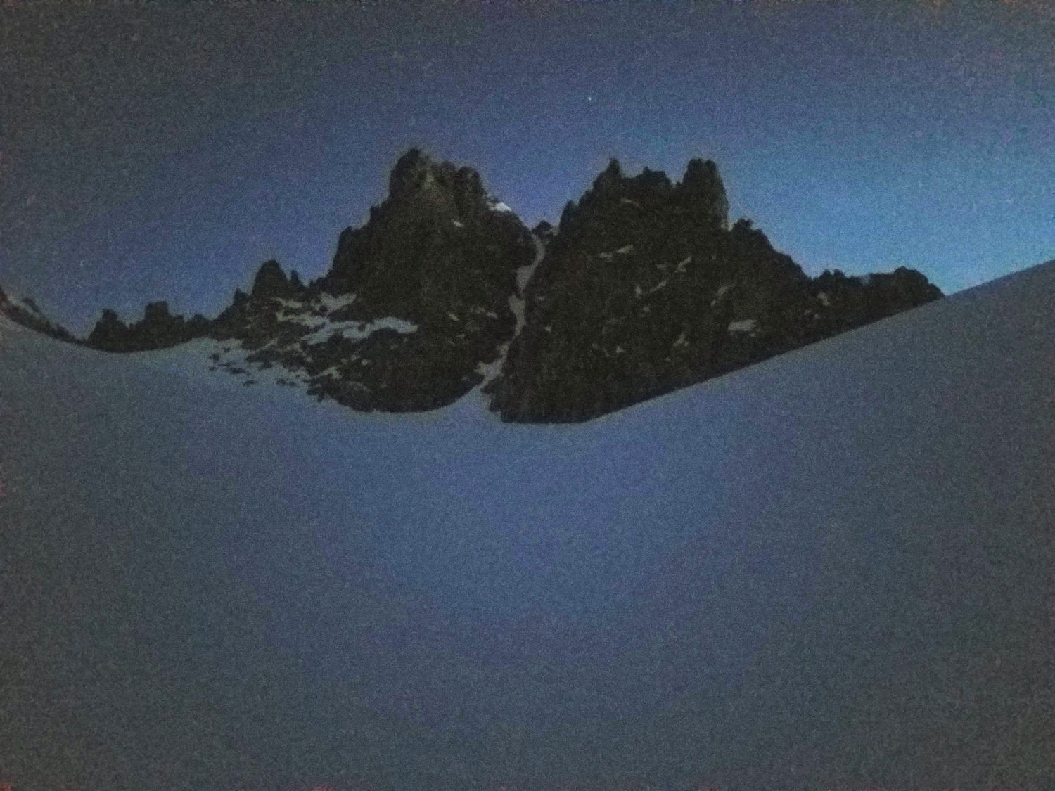
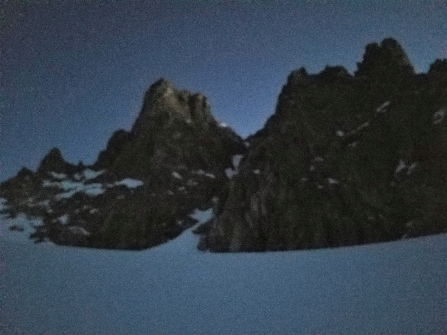
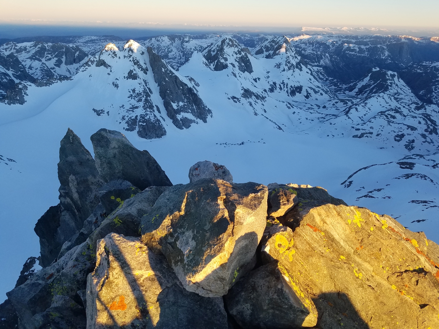
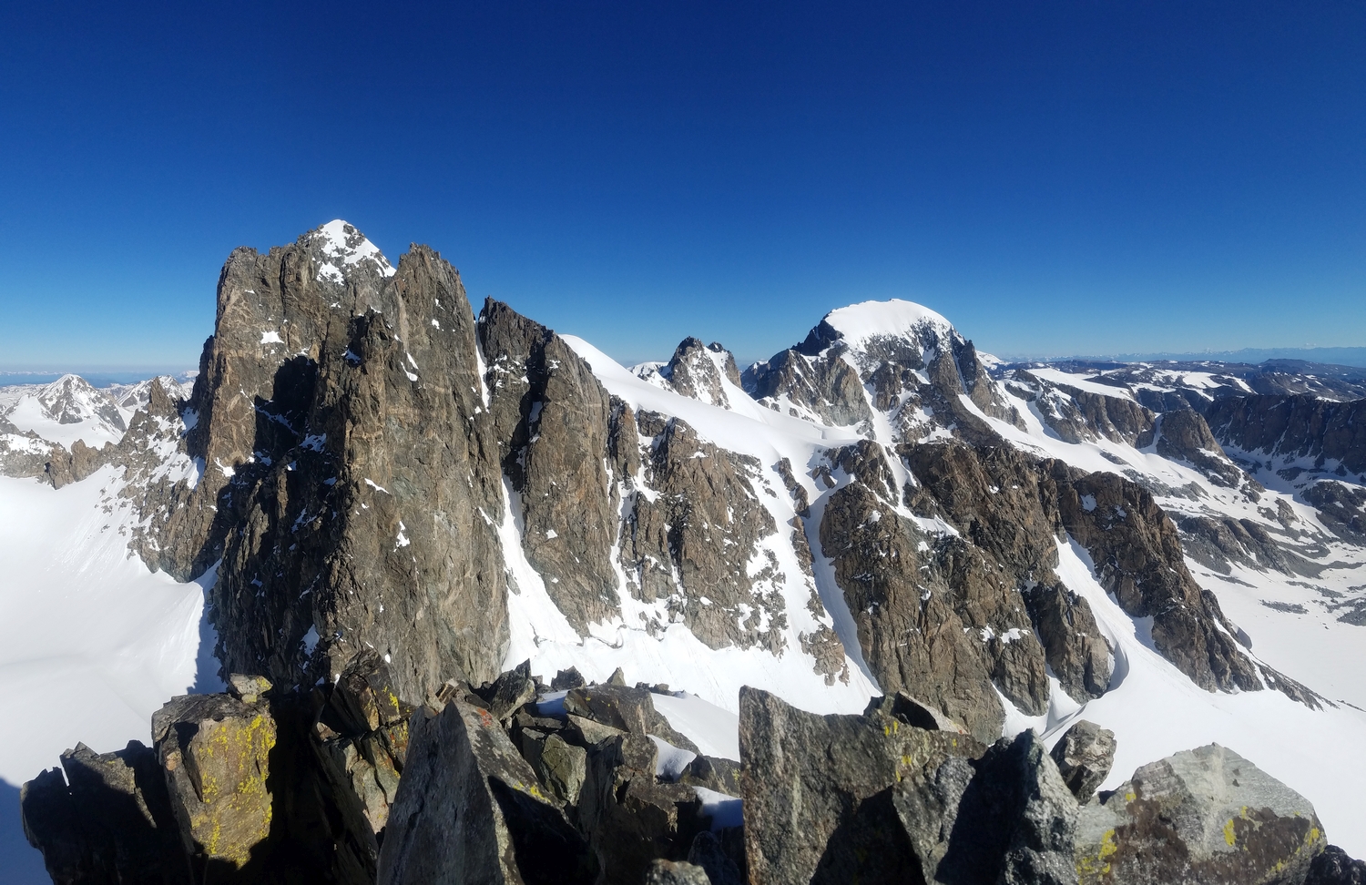
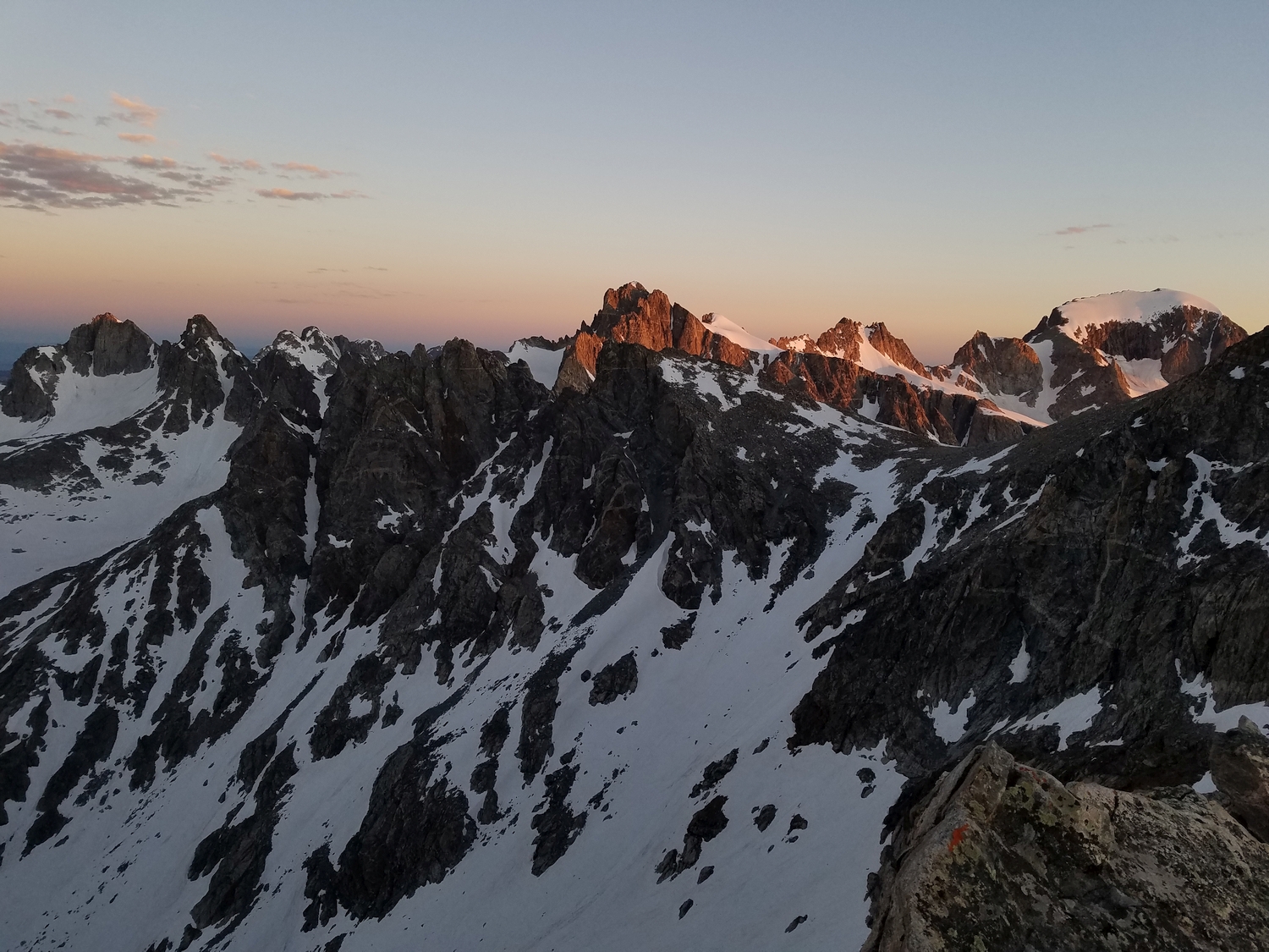
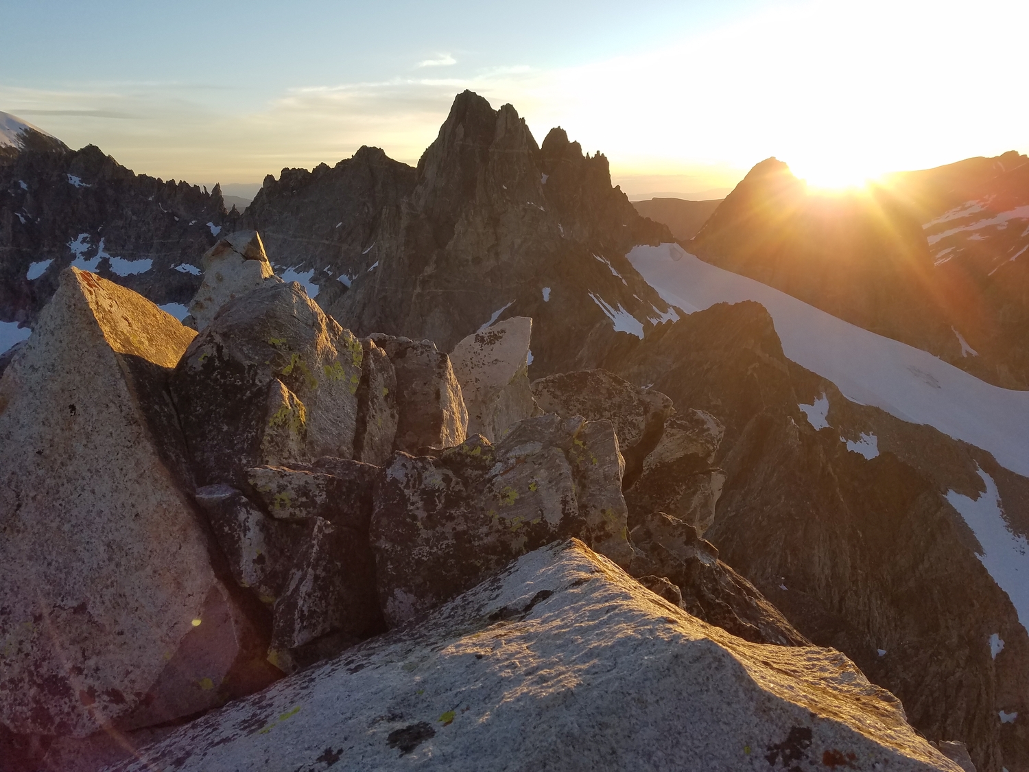
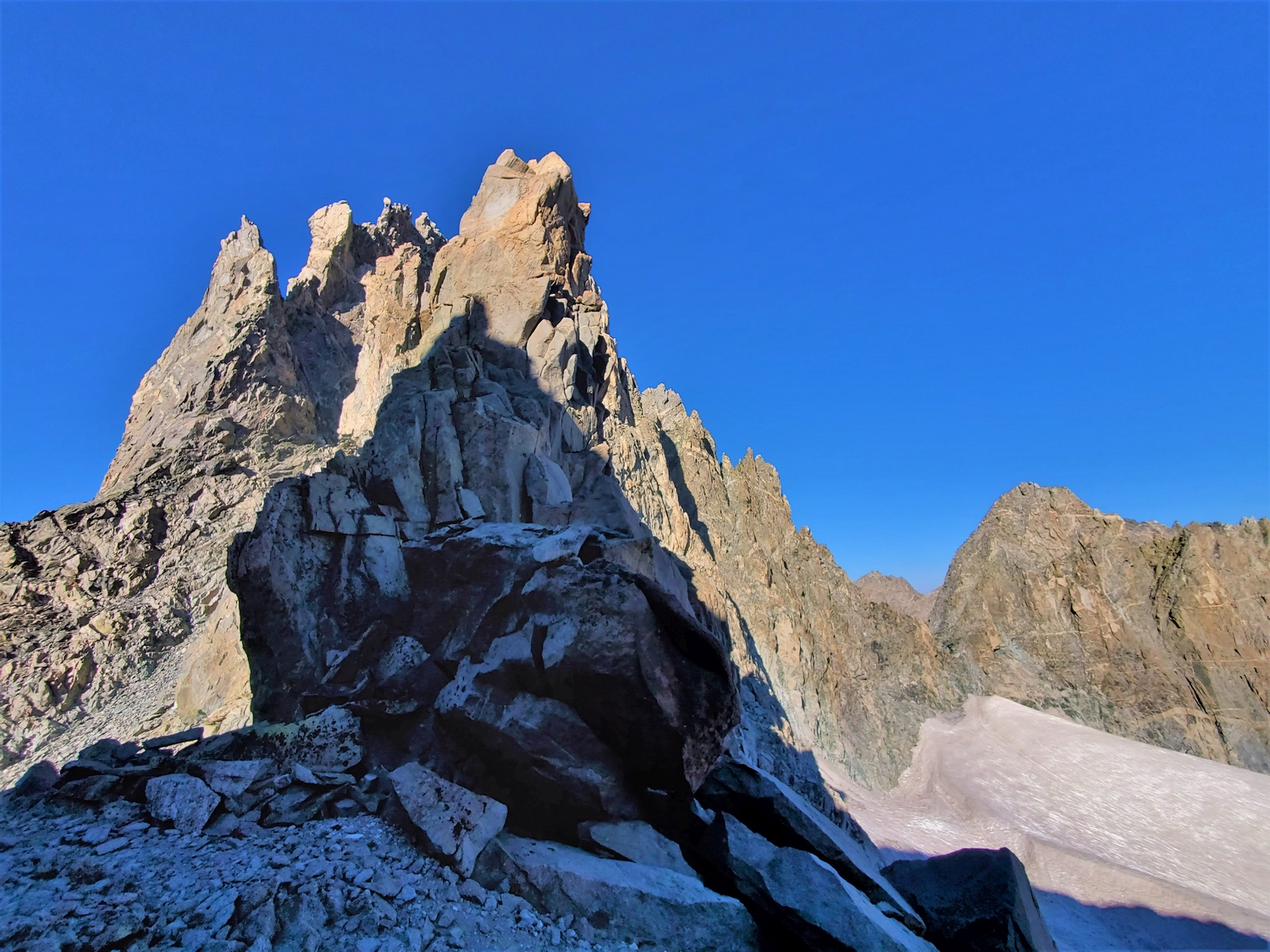
Mount Woodrow Wilson is one of the true monarchs of the Wind River Range despite being lower than many of its neighbors. Situated at the triple-divide between Titcomb Basin, Dinwoody Valley, and the Mammoth Glacier cirque, no other peak commands such a central position in the northern Winds. The peak was named in honor of Woodrow Wilson’s Fourteen Points for post-WWI diplomacy, but its pinnacles seem more warlike than peaceable, and it is one of the hardest 13ers.
General Considerations
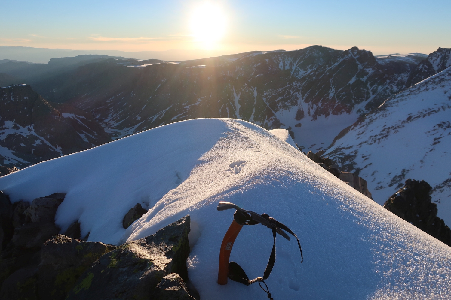
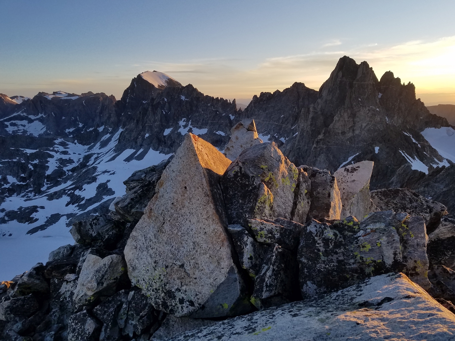
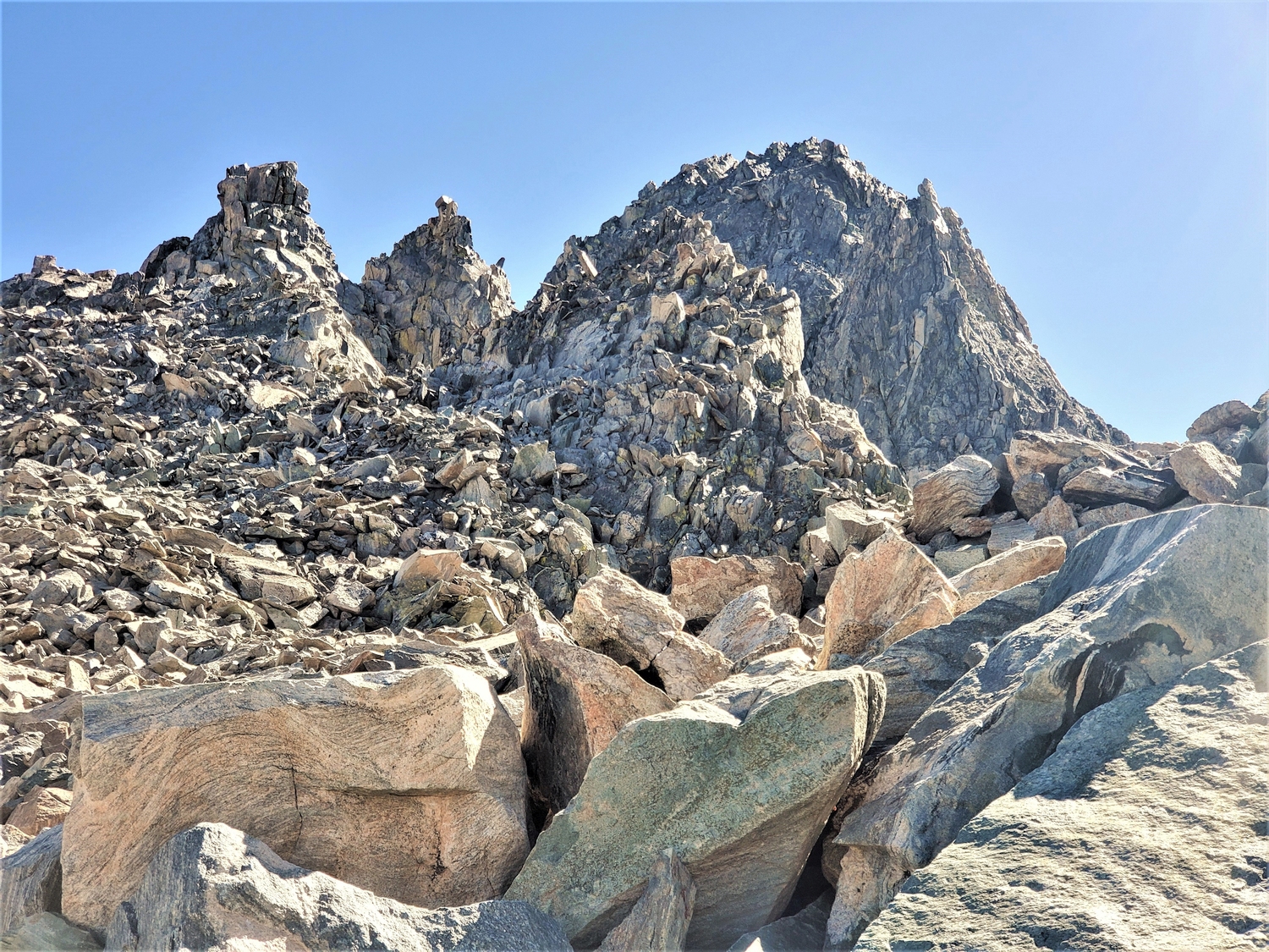
While a number of serious technical routes have been climbed on this peak, the only routes with sufficient beta to write a description are three distinctive couloirs. The reclusive and shady north couloir, which rises from the Mammoth Glacier with a mixture of ice, snow, and rock, is the author’s preferred route and usually the easiest way to gain the summit. Mount Woodrow Wilson is best reserved for those who are most familiar with the Wind Rivers’ fickle alpine conditions and willing to adjust to unpredictable risks. The difficulty of each route varies so wildly depending on conditions and is sufficiently subjective that determining an exact rating is challenging; traditionally the peak has been rated class 5.1, and I use that rating generically to indicate that this is a serious peak where roped climbing is the norm.
Route 1: North Couloir – Class 5.1, Serious Snow
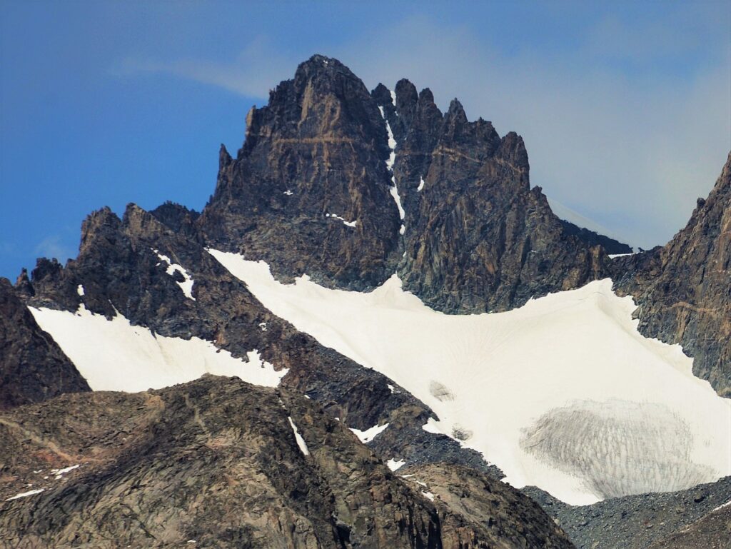
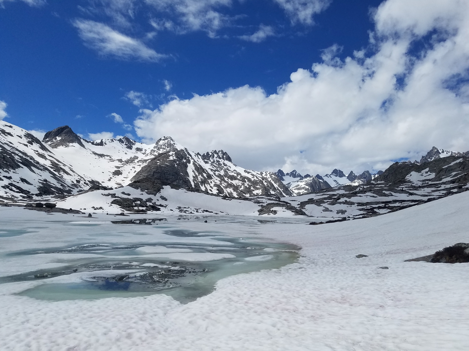
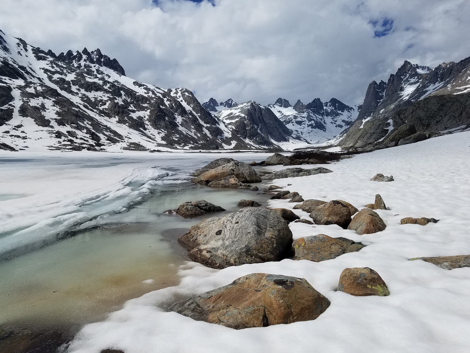
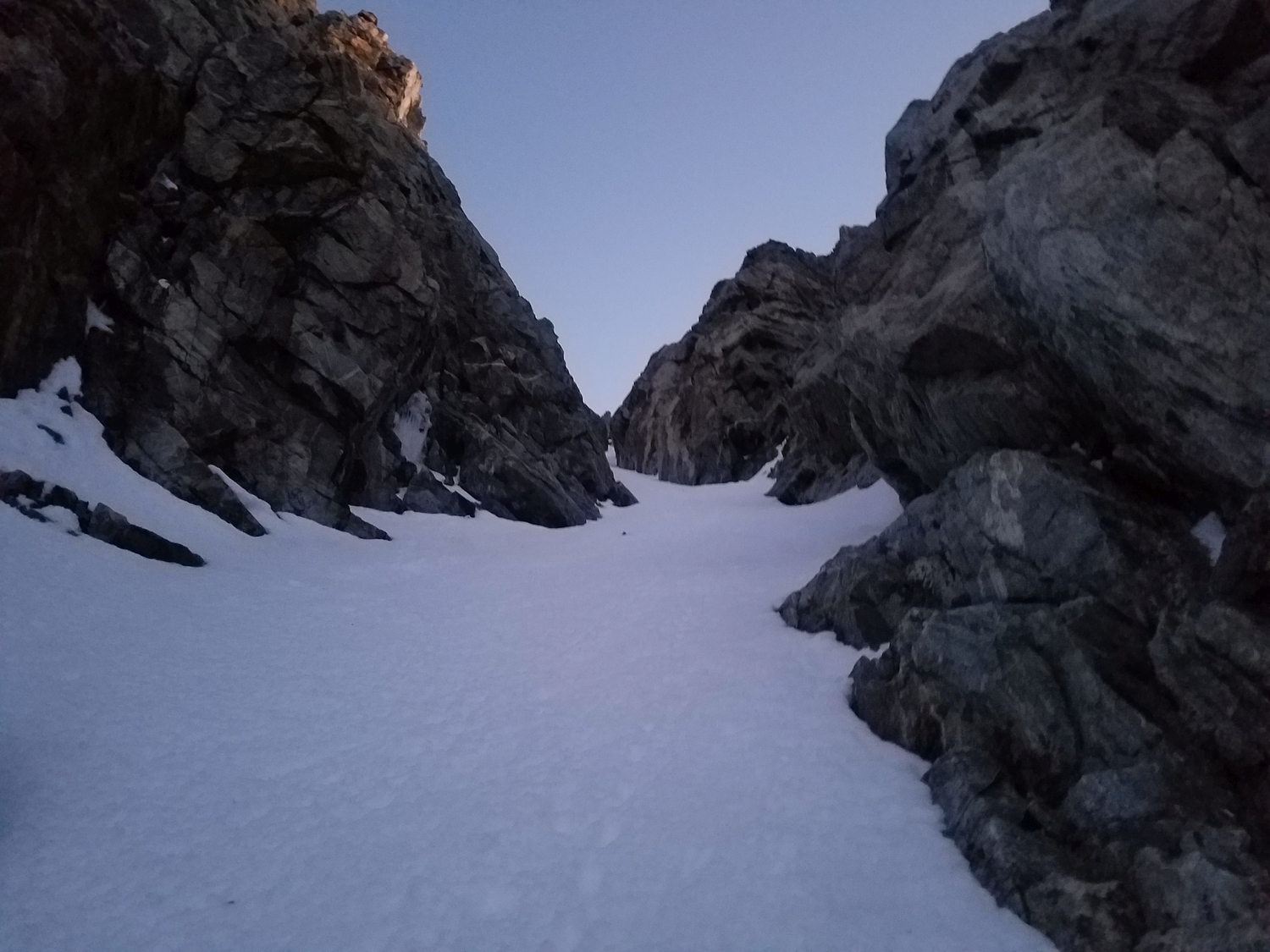
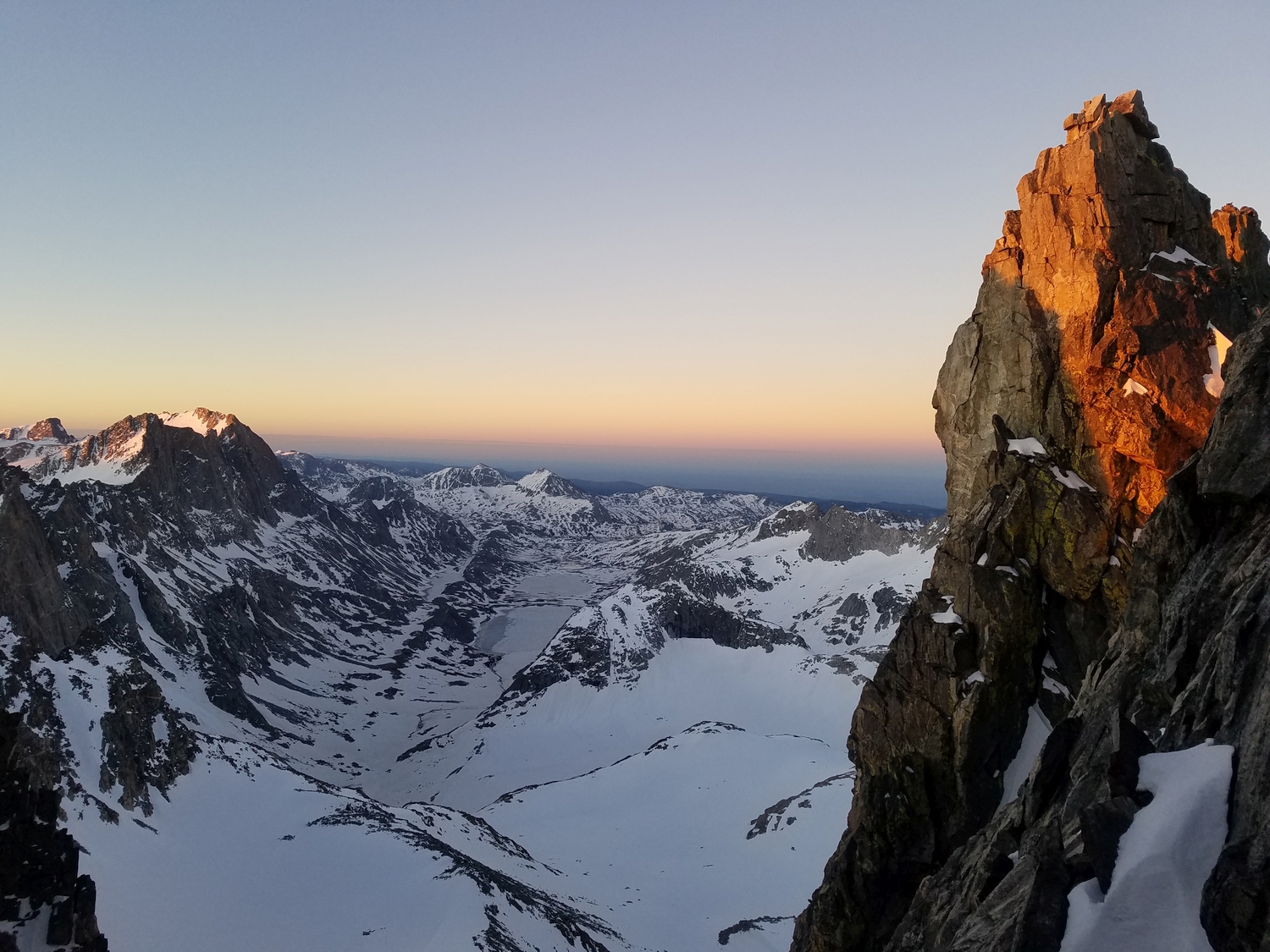
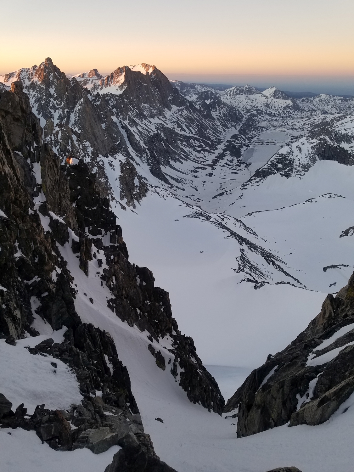
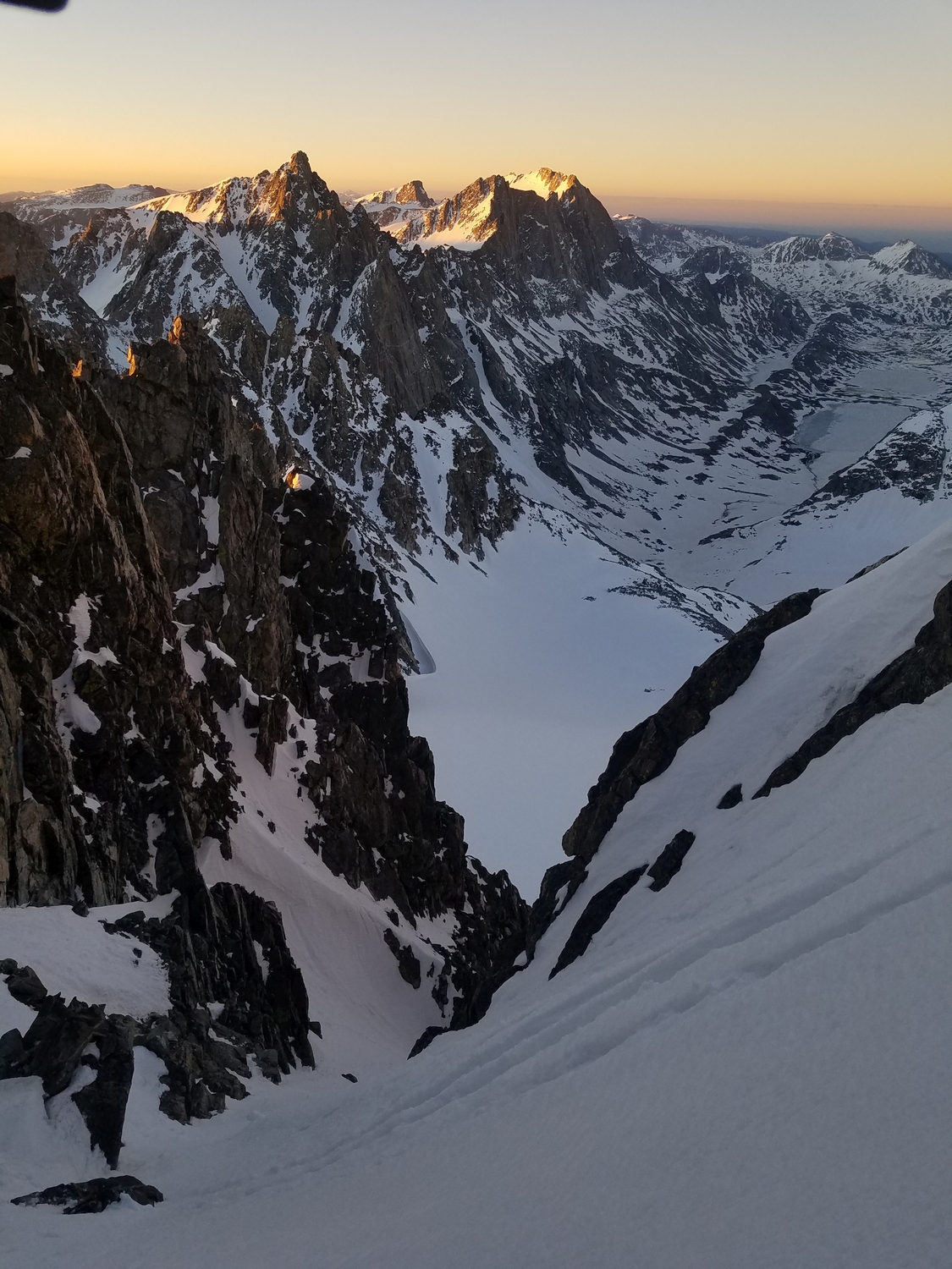
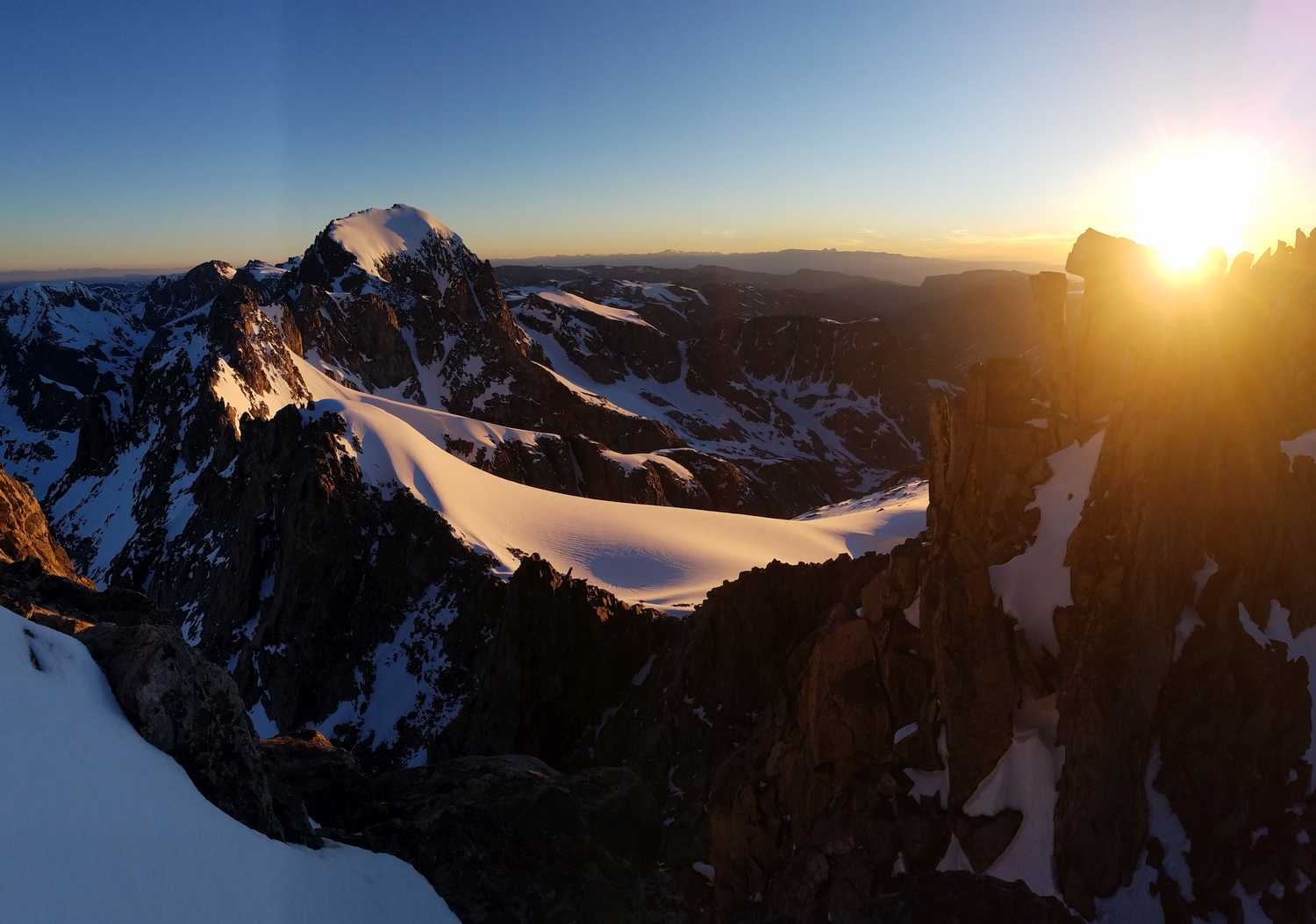
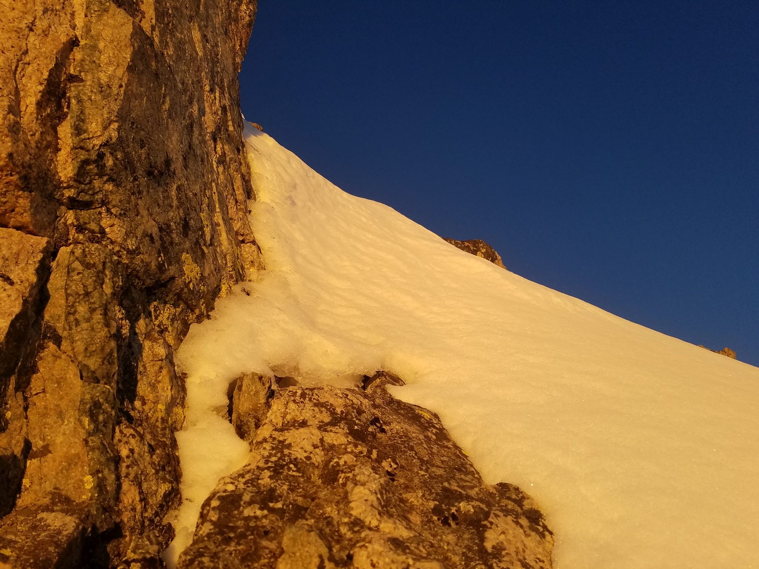
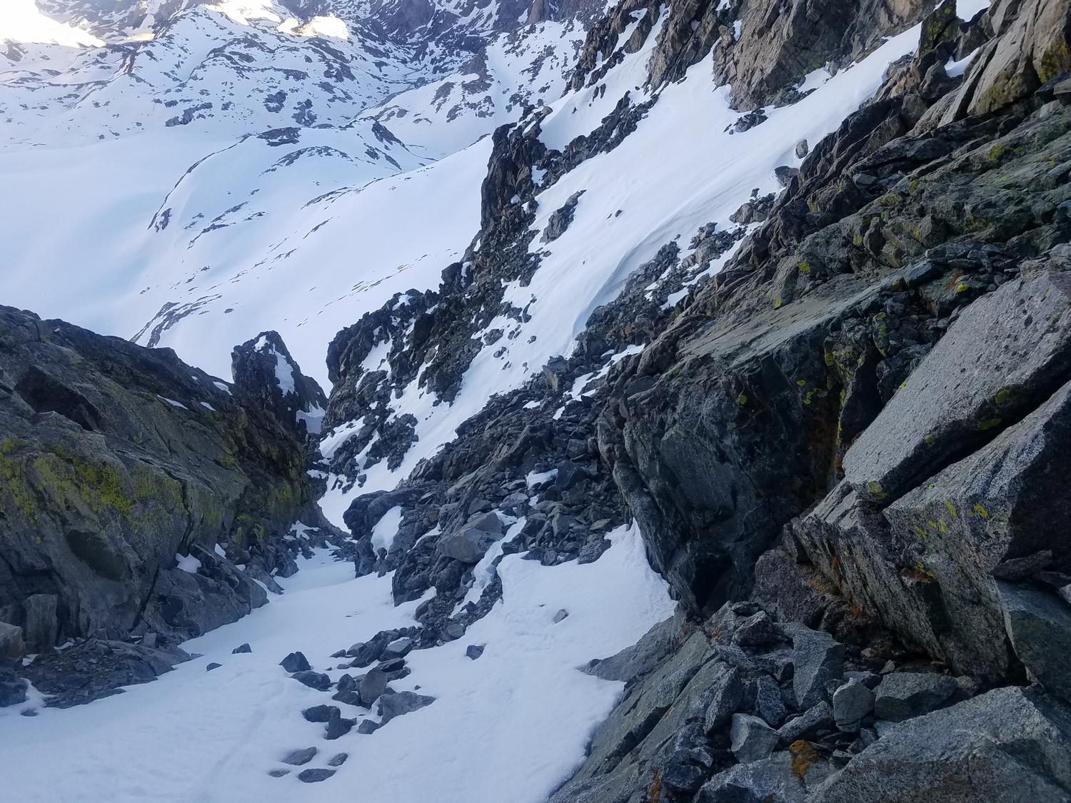
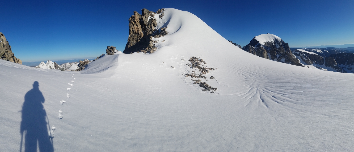
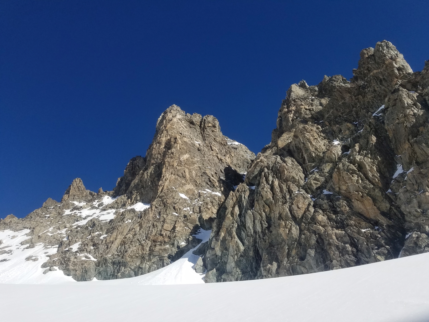
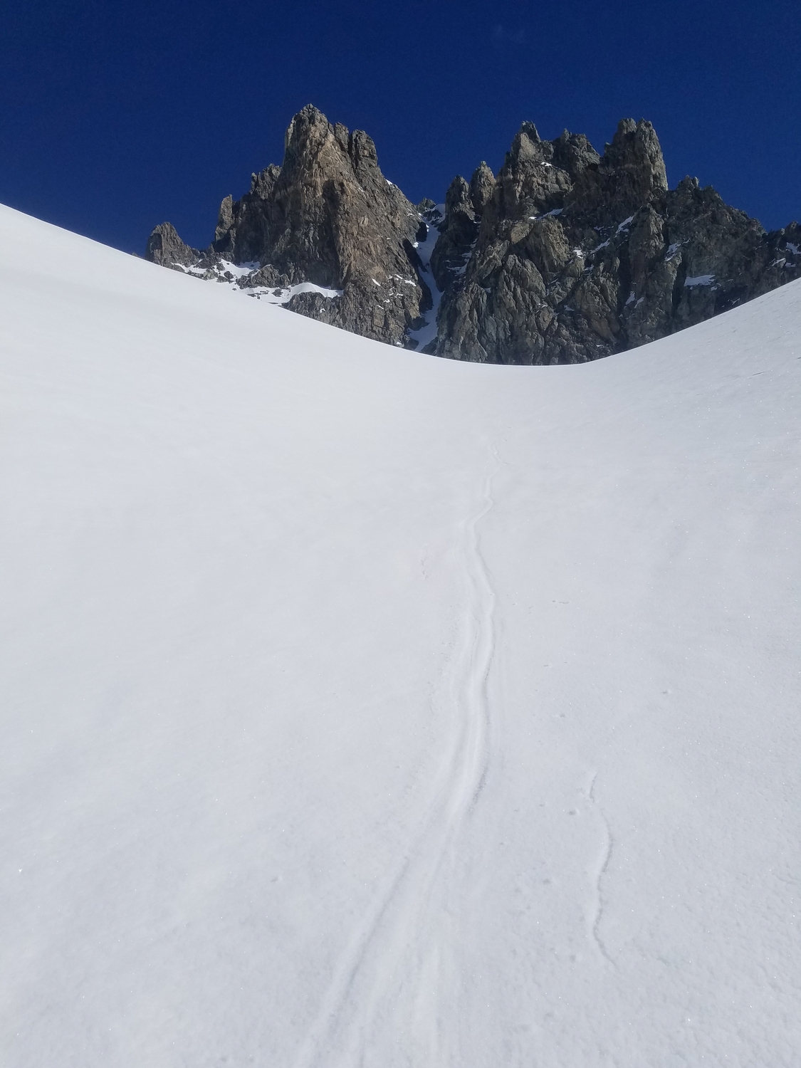
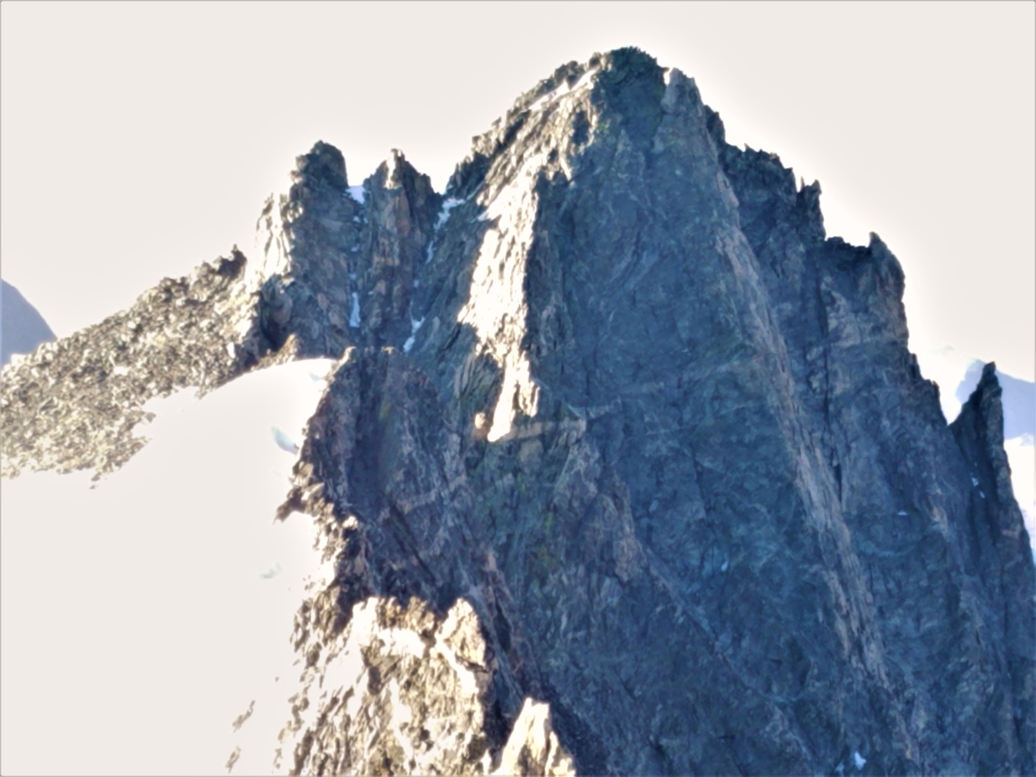
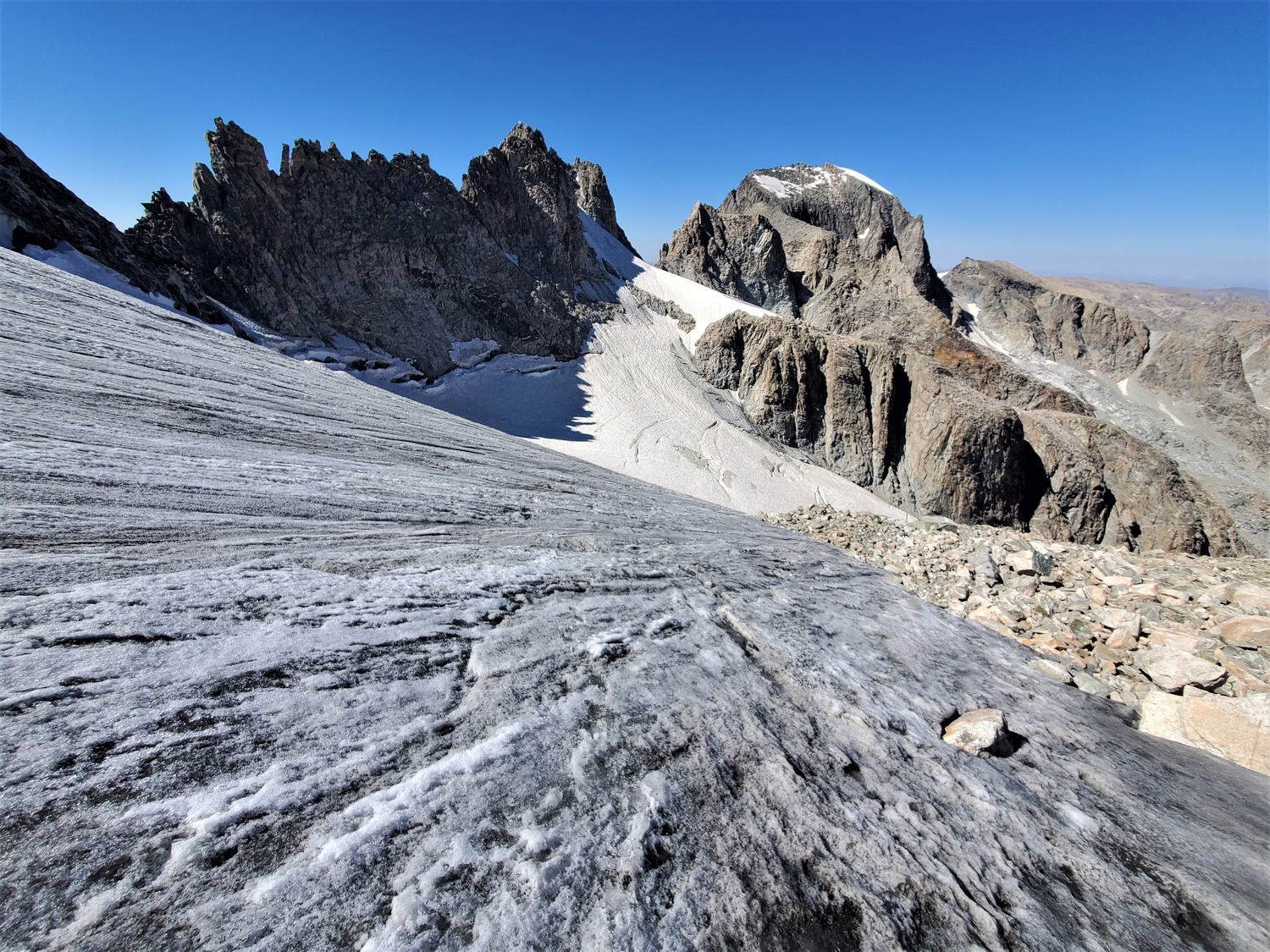
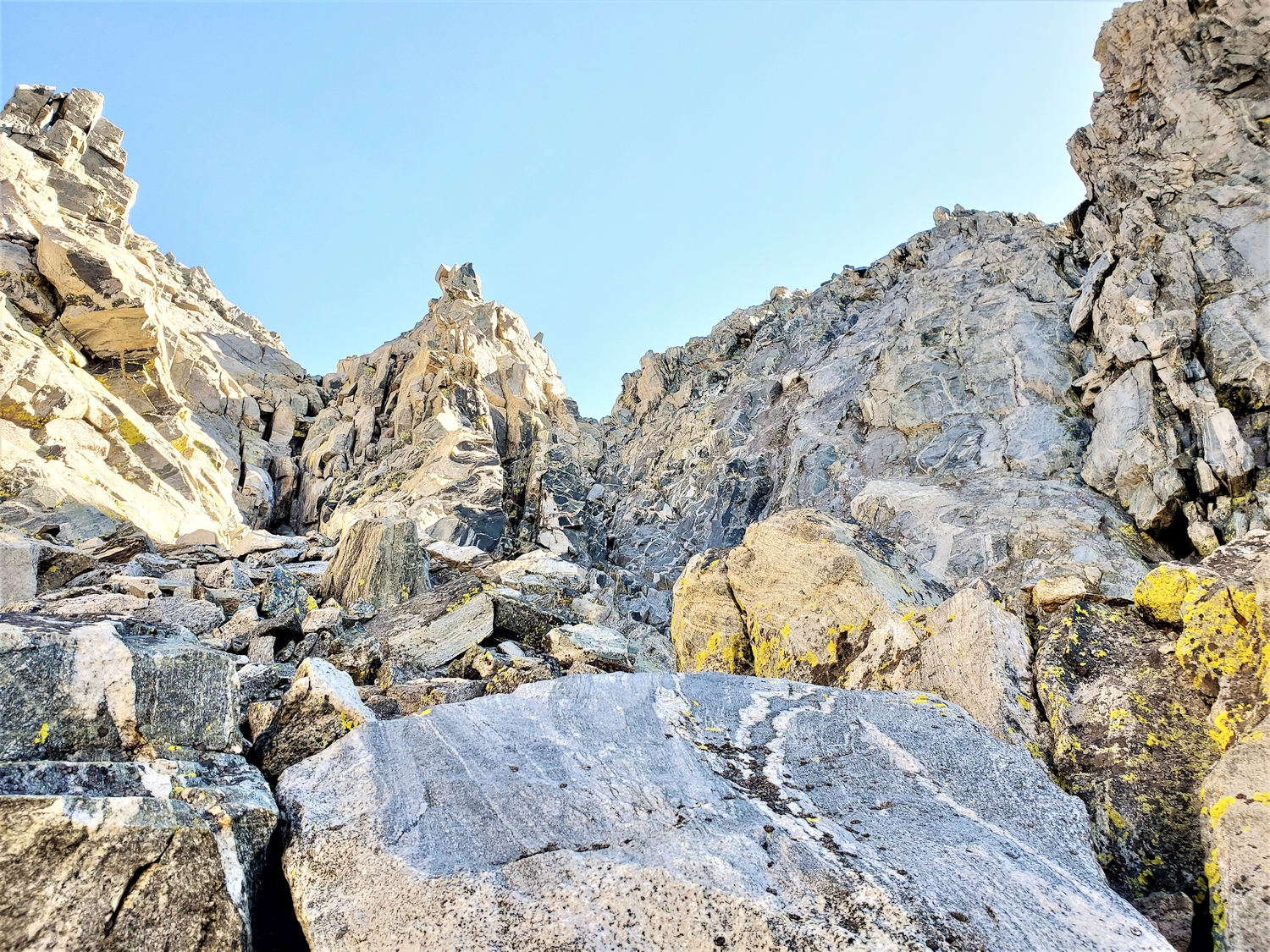
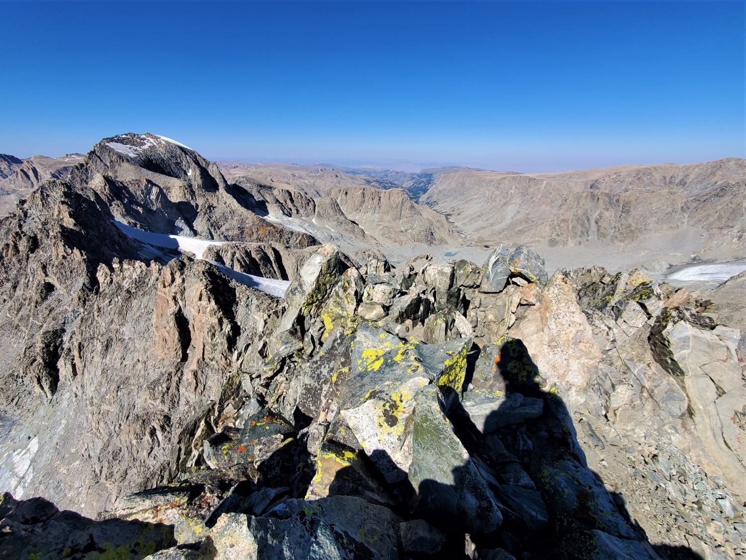
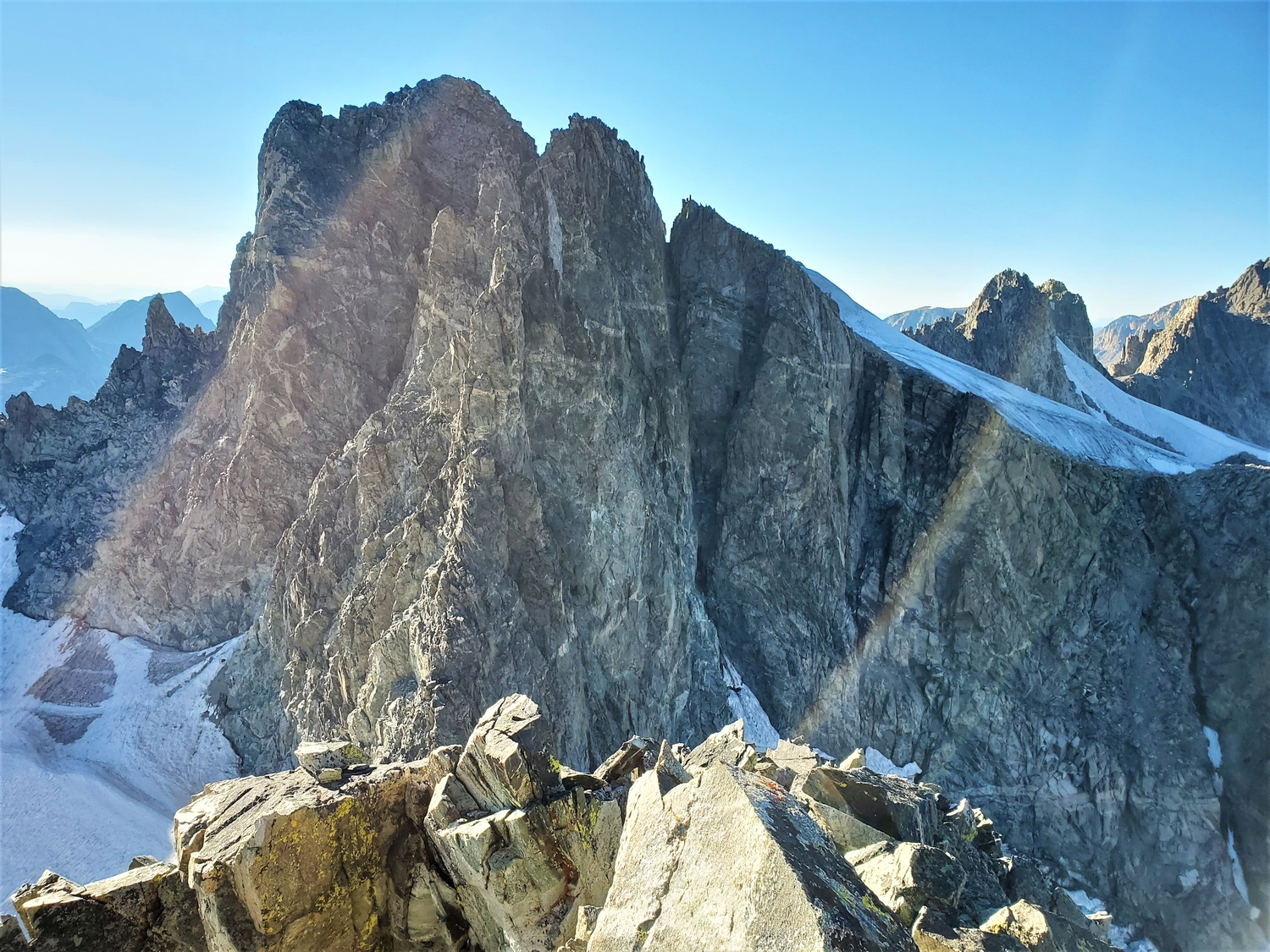
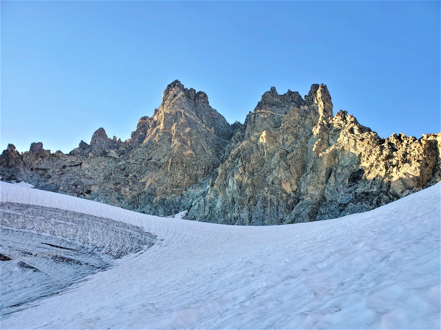
Despite its position at the head of the Mammoth Lake cirque, the author is only aware of this couloir being climbed from the Dinwoody. From the Gannett Glacier, it is first necessary to gain the high glacier arm (around 13,000 ft.) just north of the main peak (obvious from Gannett). From the Dinwoody moraine, the most direct route is to climb the arm of the Dinwoody Glacier just south of Gannett (see Pinnacle Ridge Route 1), then traverse below Pinnacle Ridge and negotiate the massive bergschrund separating the lower glacier from the upper plateau (see image below). Another option is to climb the southeast-facing couloirs which drop from the glacier plateau into the valley below the Sphinx. No matter your route, be prepared for serious glacier travel and crevasse crossings.
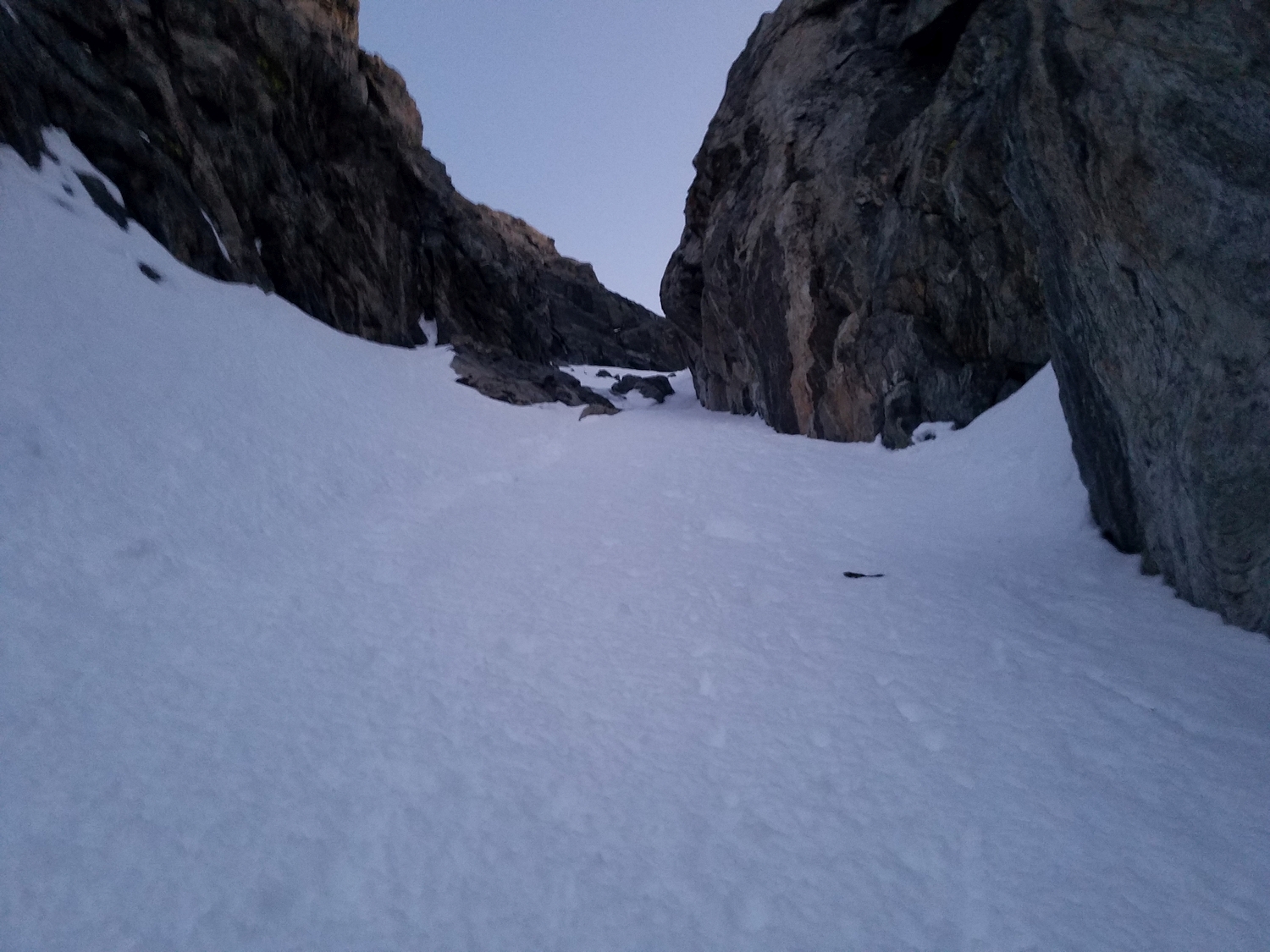
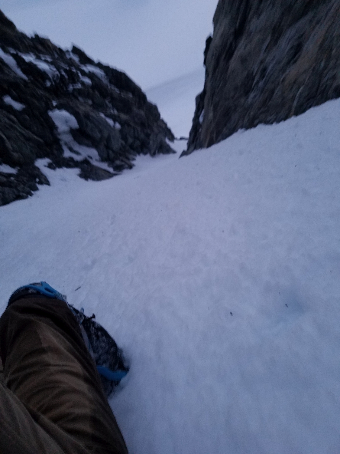
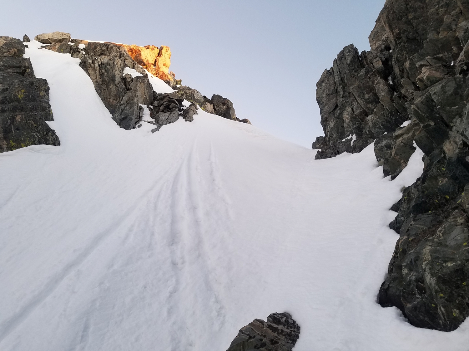
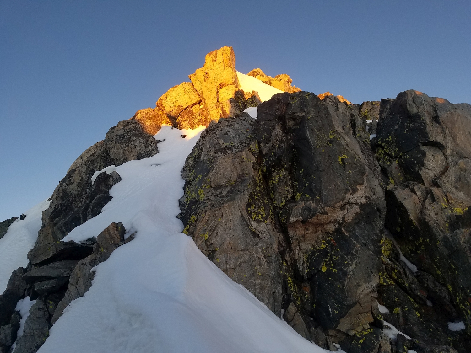
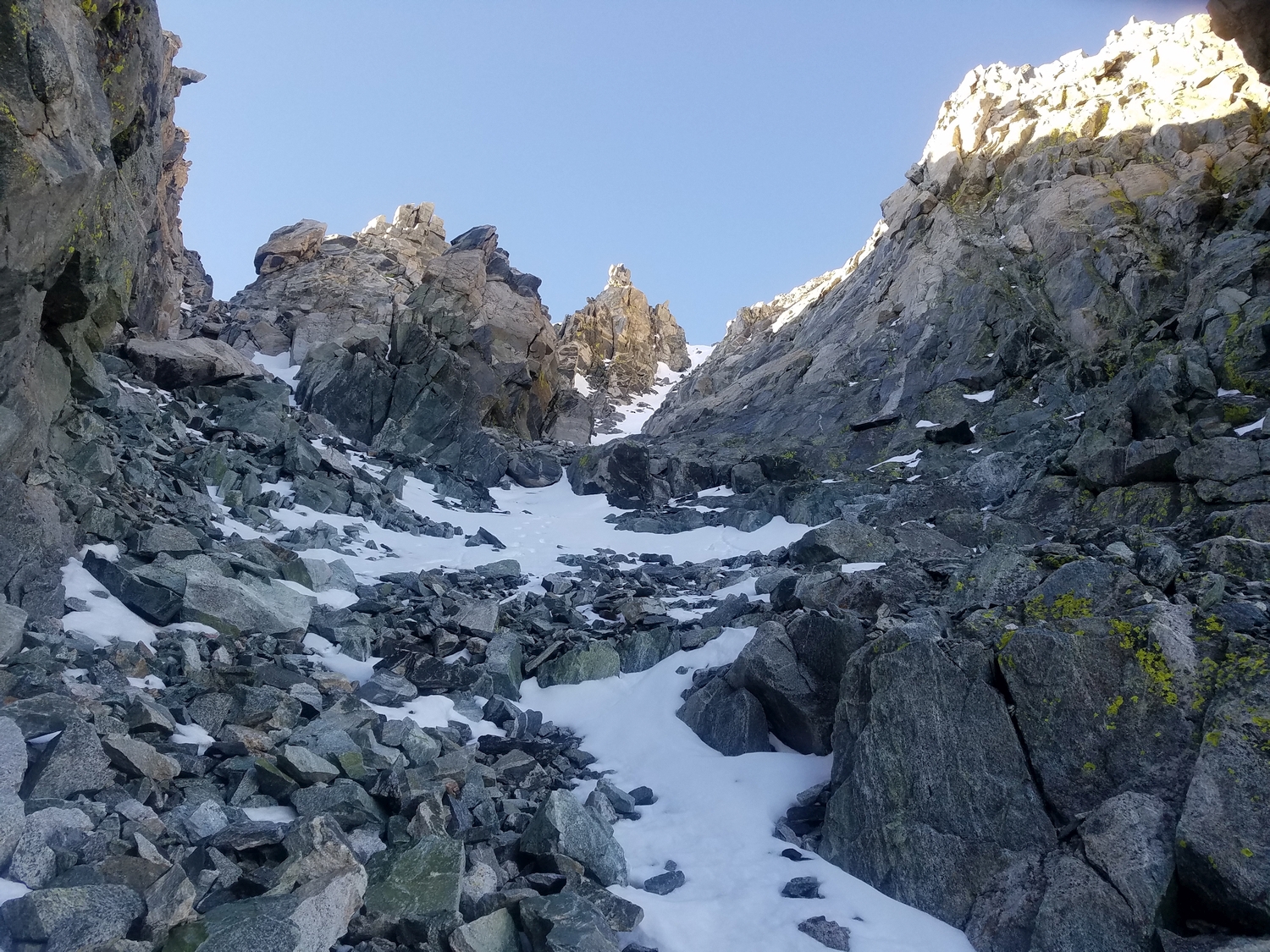
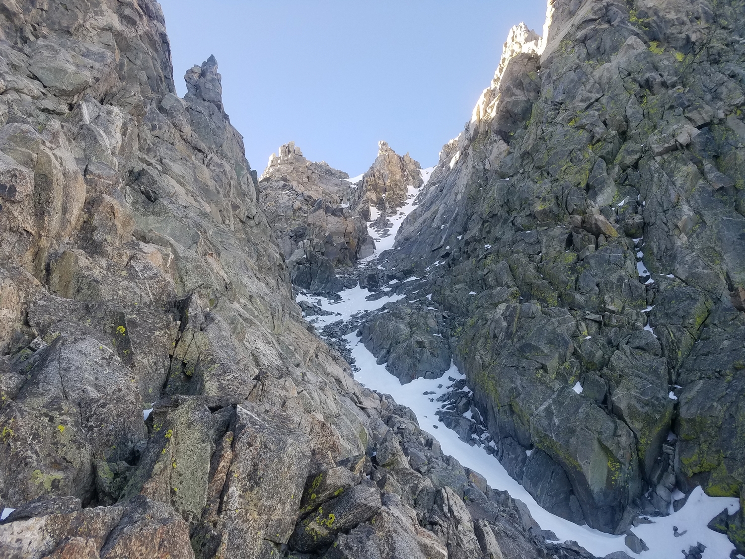
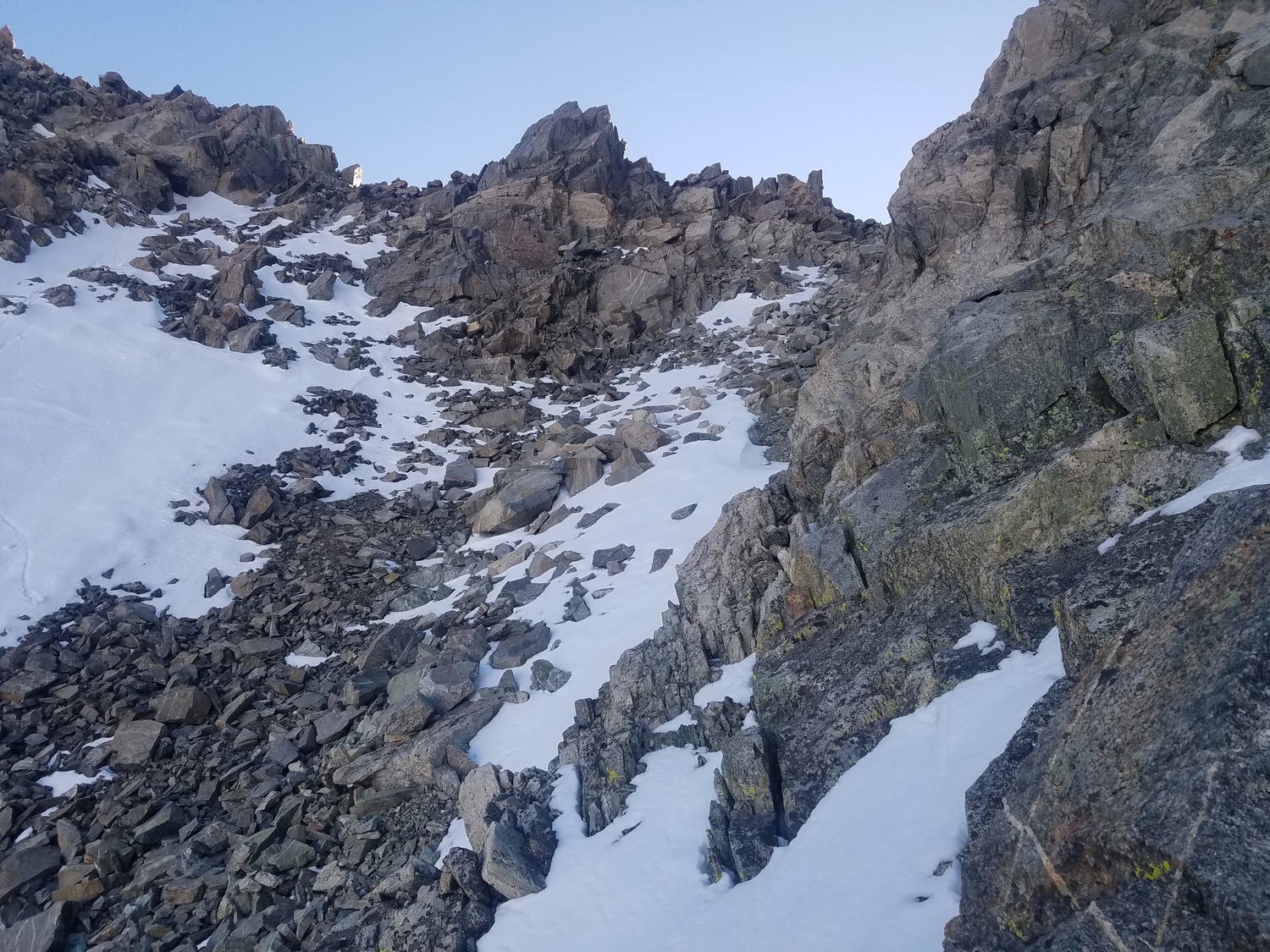
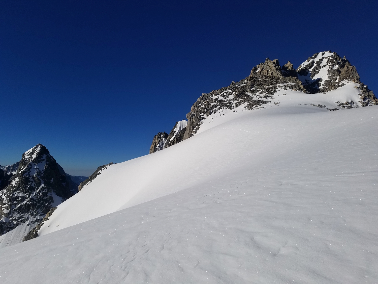
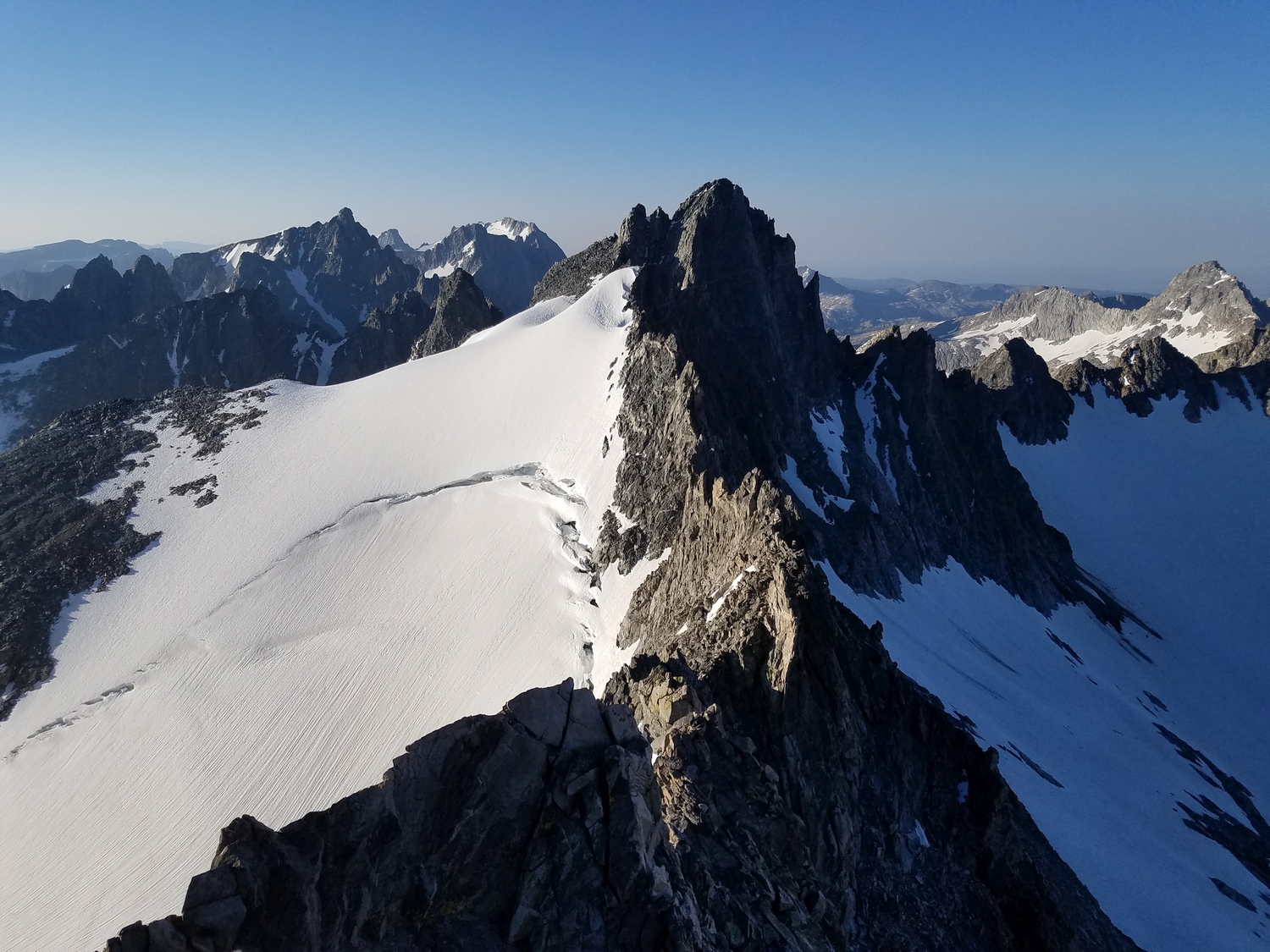
From the high glacier plateau just north of Woodrow Wilson, cross the Continental Divide on talus just south of a snow-covered bump and locate a rocky chute. Downclimb this gully until it is possible to escape south on rubble slopes, at which point you can enter the proper north couloir. It also might be possible to gain the north couloir and climb directly to this point from the Mammoth Glacier, though the author is unaware of any ascents via this route variation.
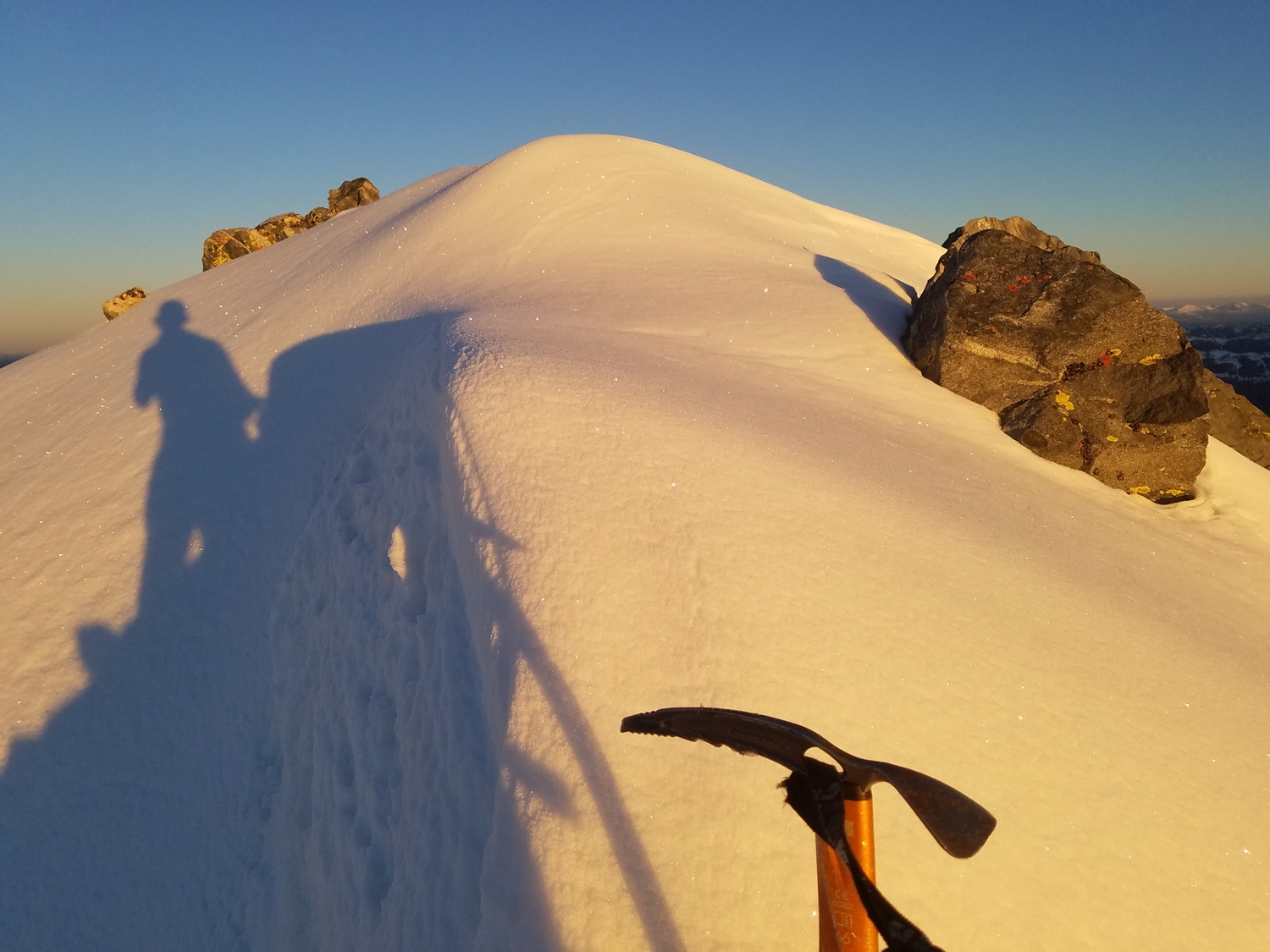
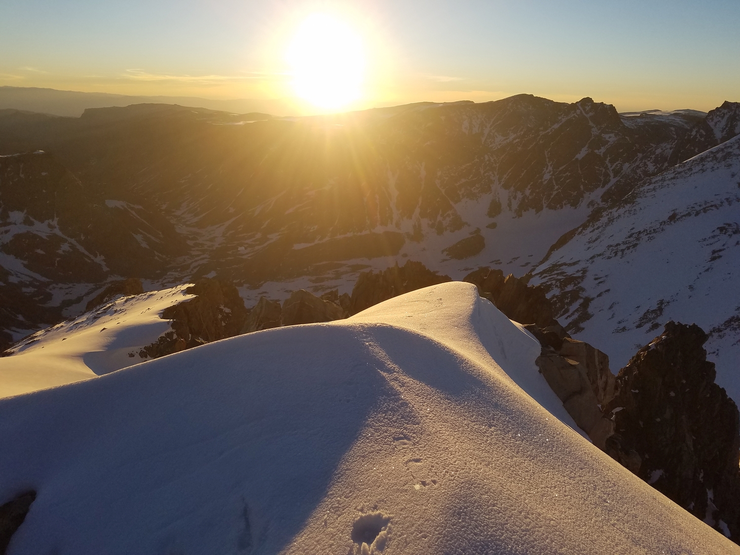
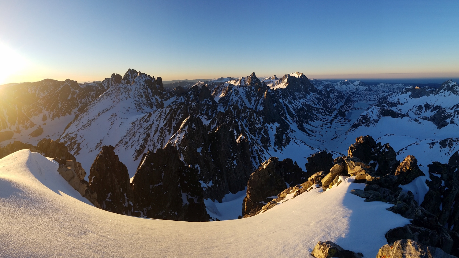
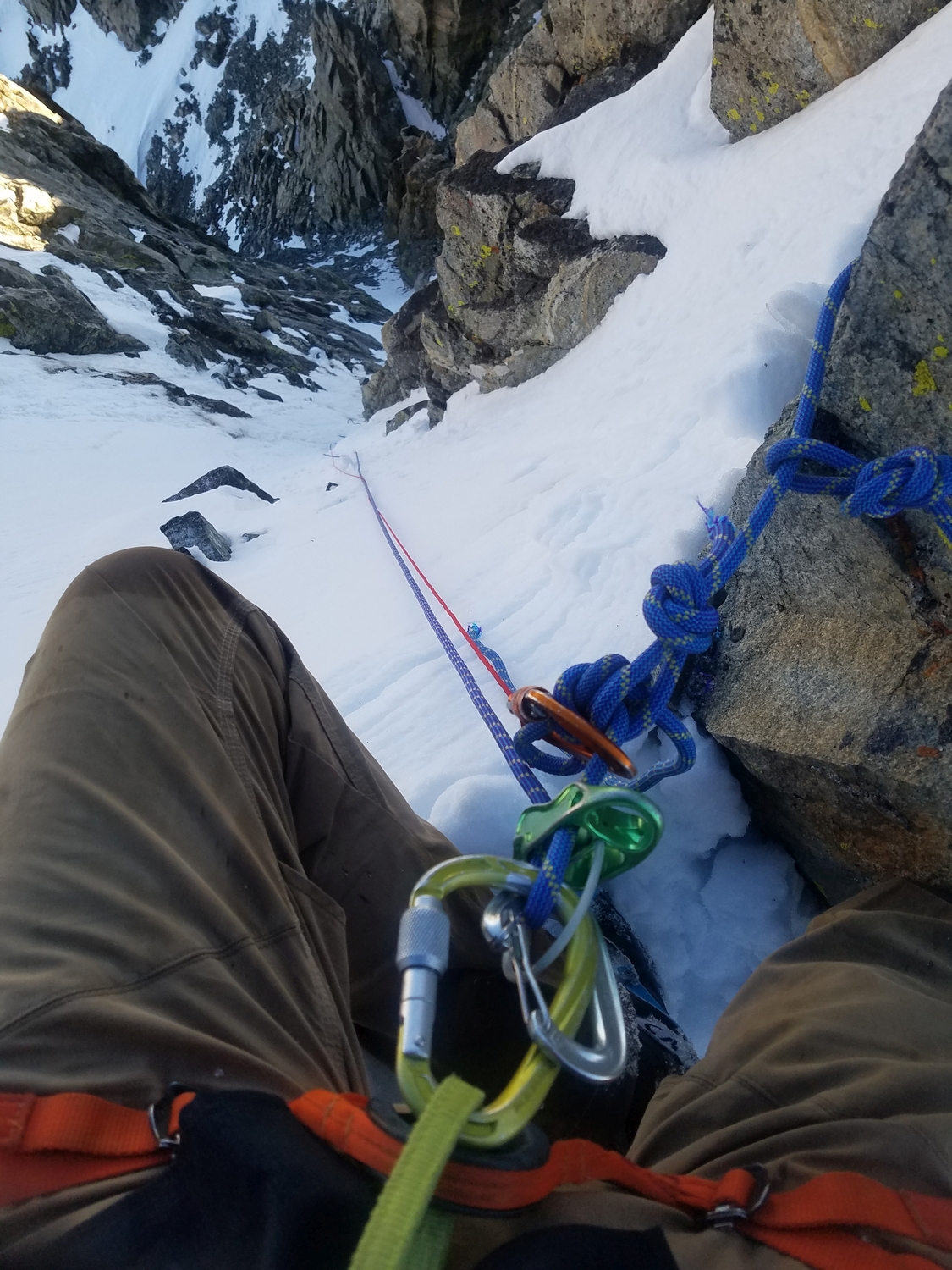
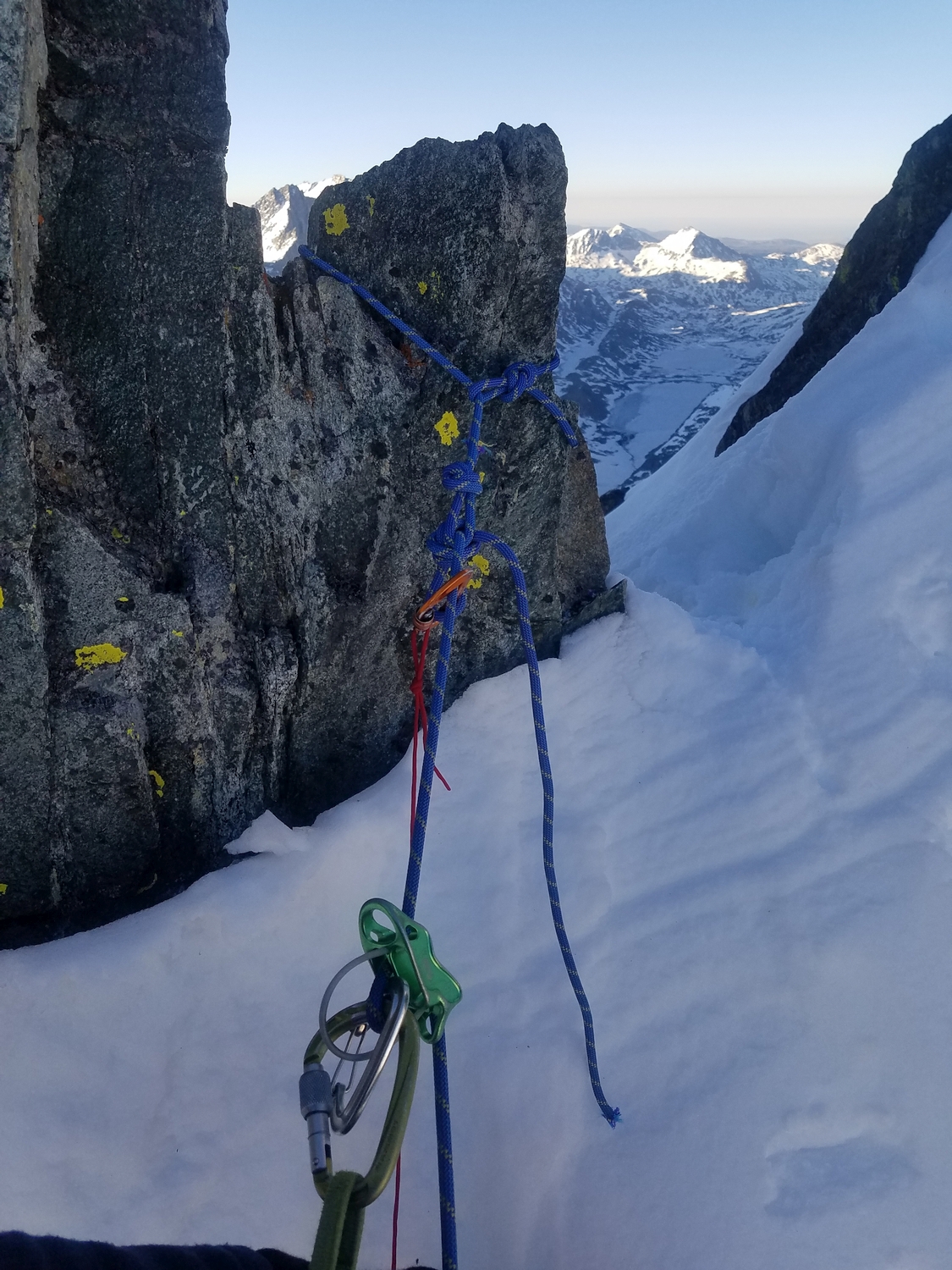
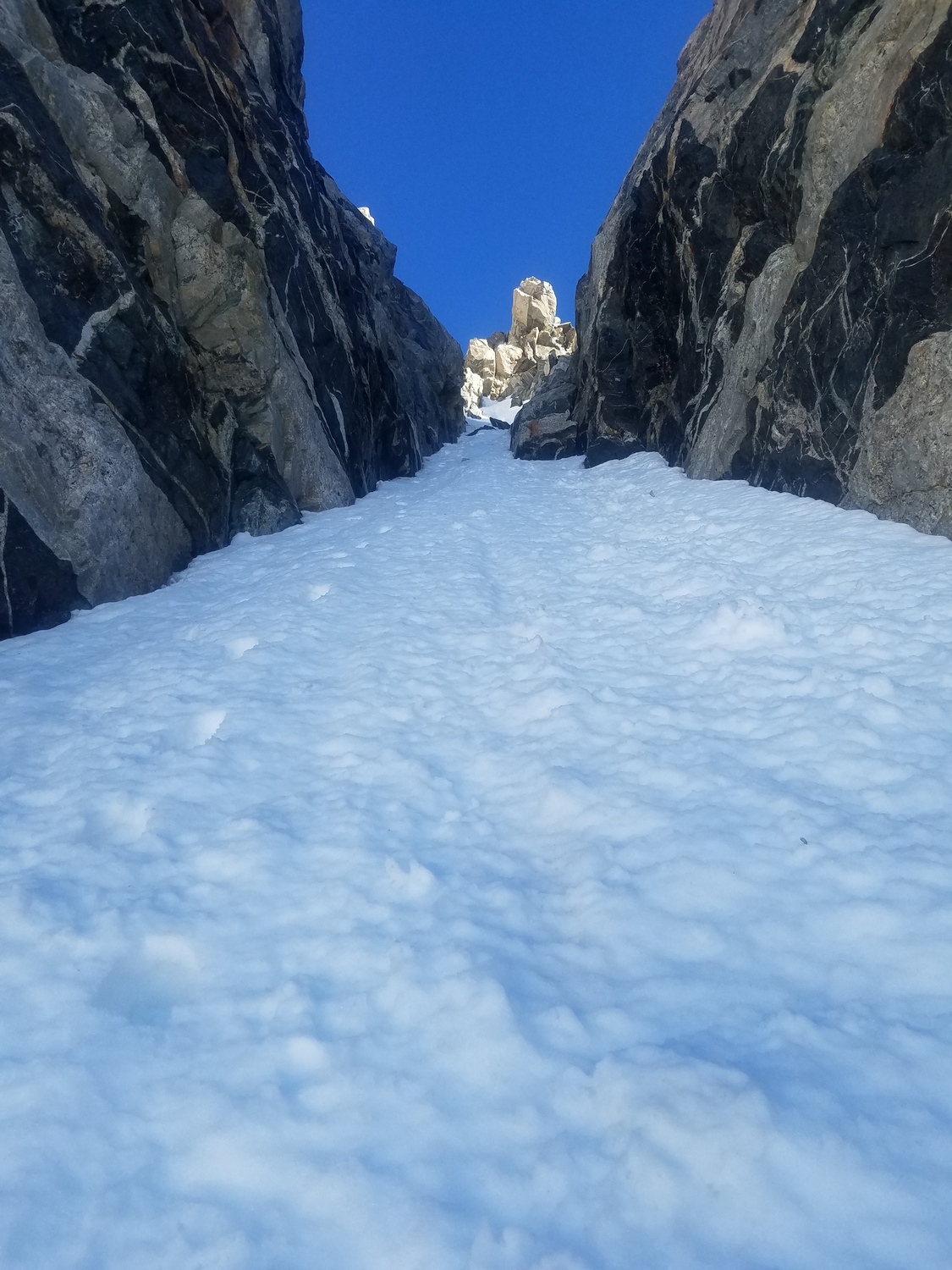
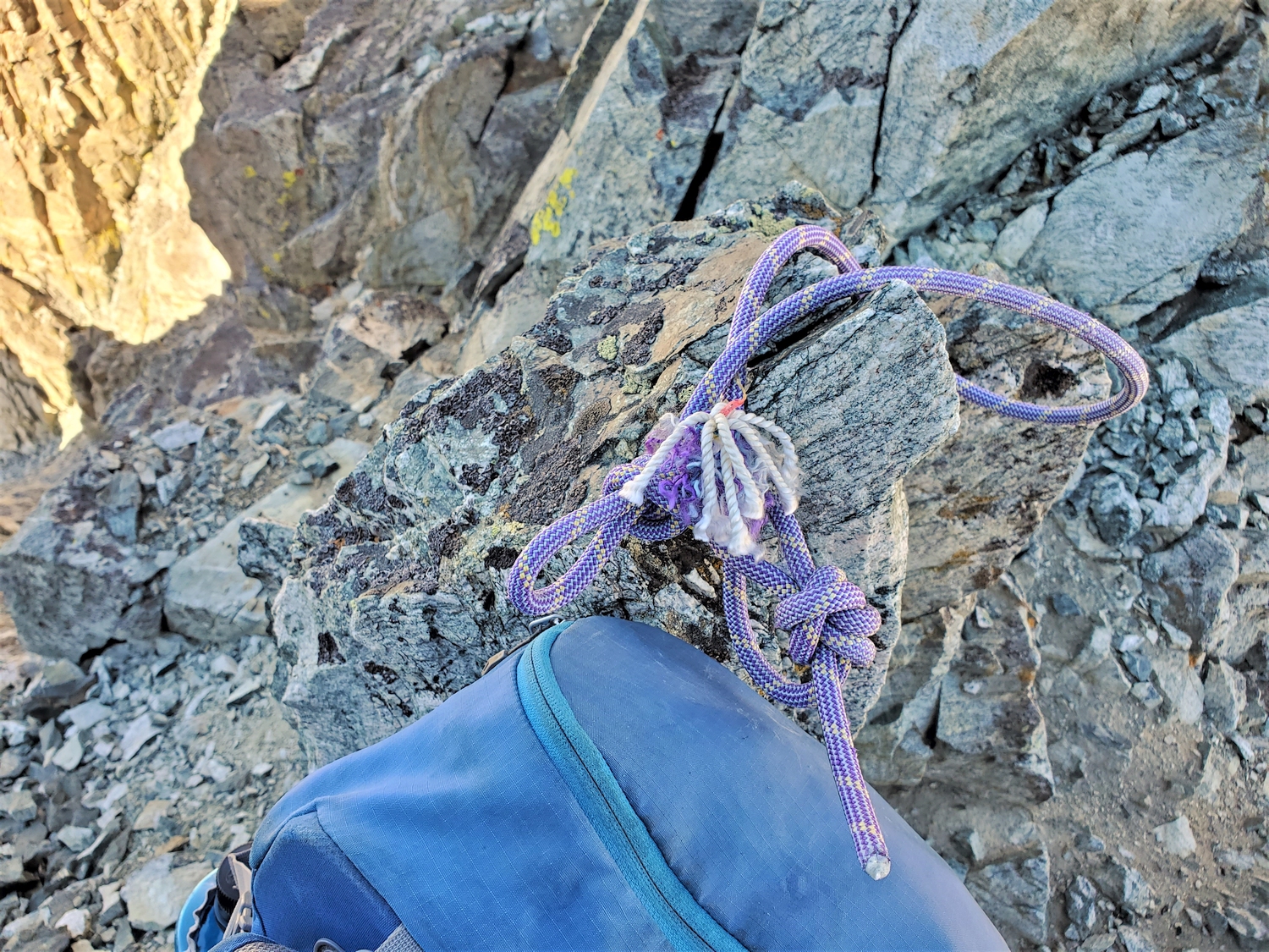
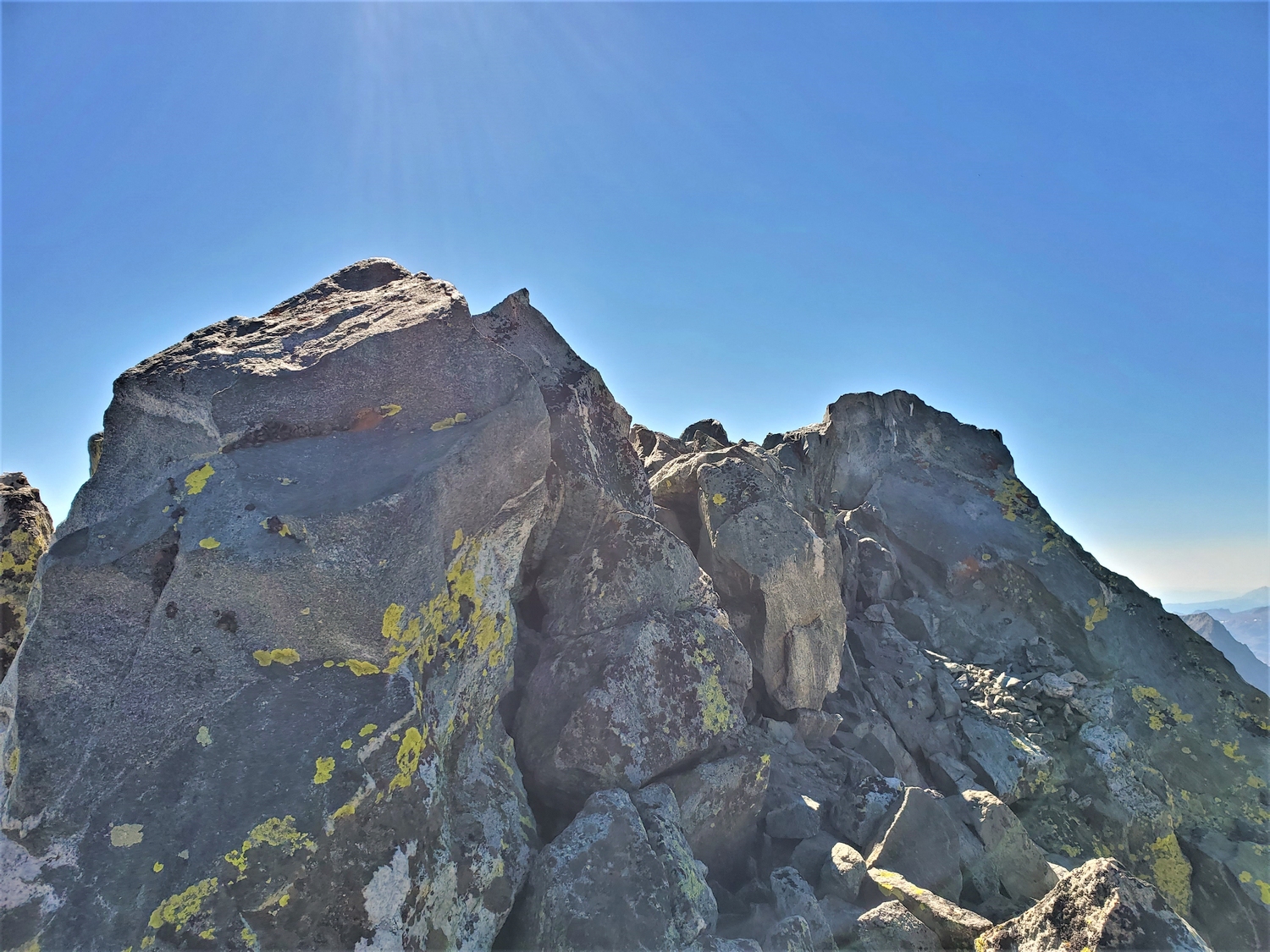
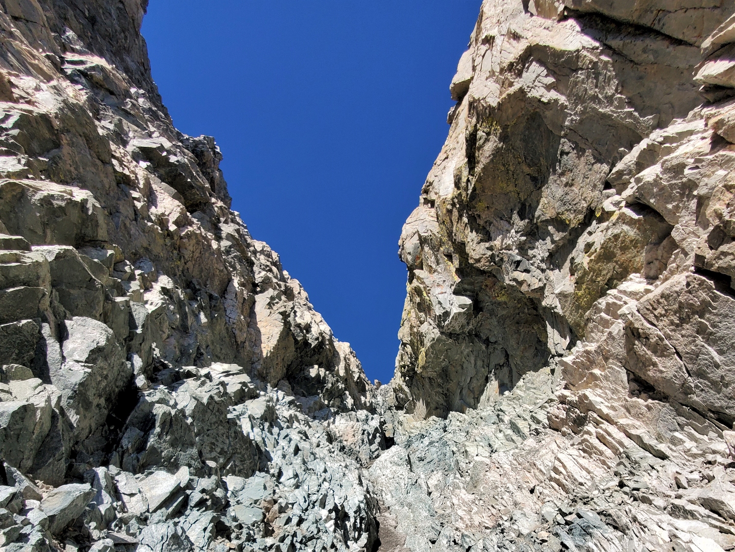
Depending on the conditions, you may encounter steep snow and/or rock and/or ice in the north couloir. The route ascends the narrow north couloir to a miniscule col on Woodrow Wilson’s summit ridge, where you can peer down the south couloir. Head climber’s right (west) along the ridge, where a short rock pitch delivers you to the hard-won summit. Most parties will rappel on the descent—bring anchor materials.
Route 2: West Couloir – Class 5, Serious Snow
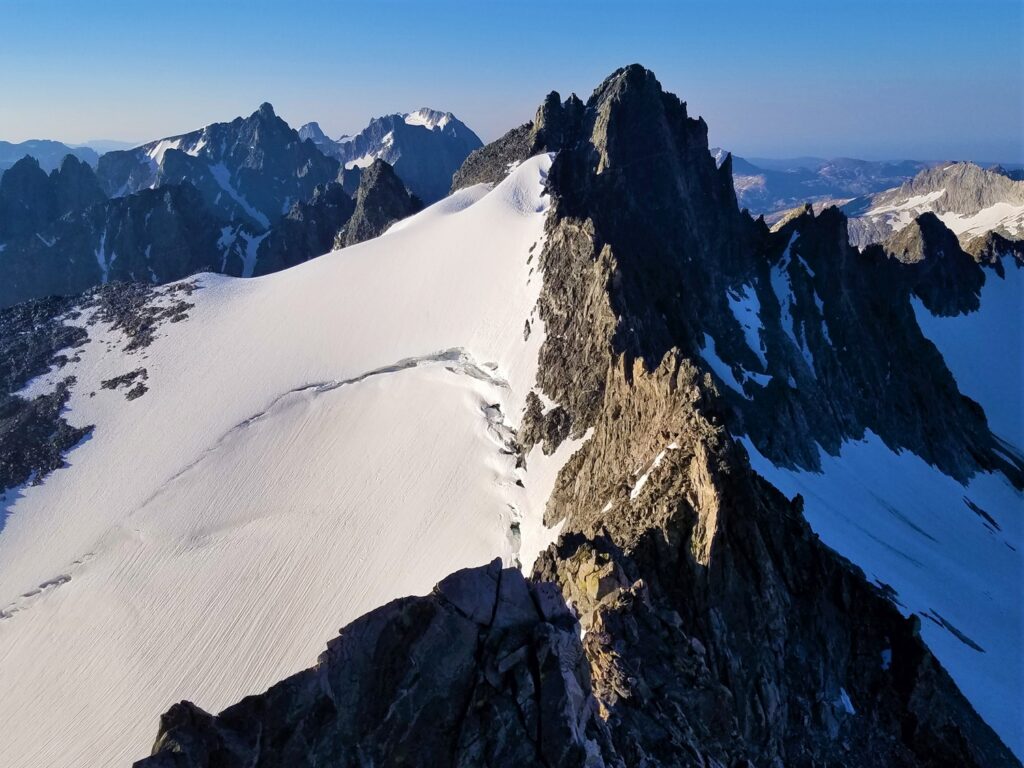
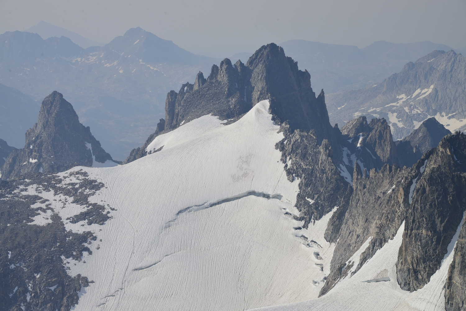
When snow-free in the late summer, this route has been used by some climbers to traverse Woodrow Wilson from Titcomb to the Dinwoody Glacier without having to climb the south couloir. In the early season, others have been turned around by intimidating and exposed snow slopes.
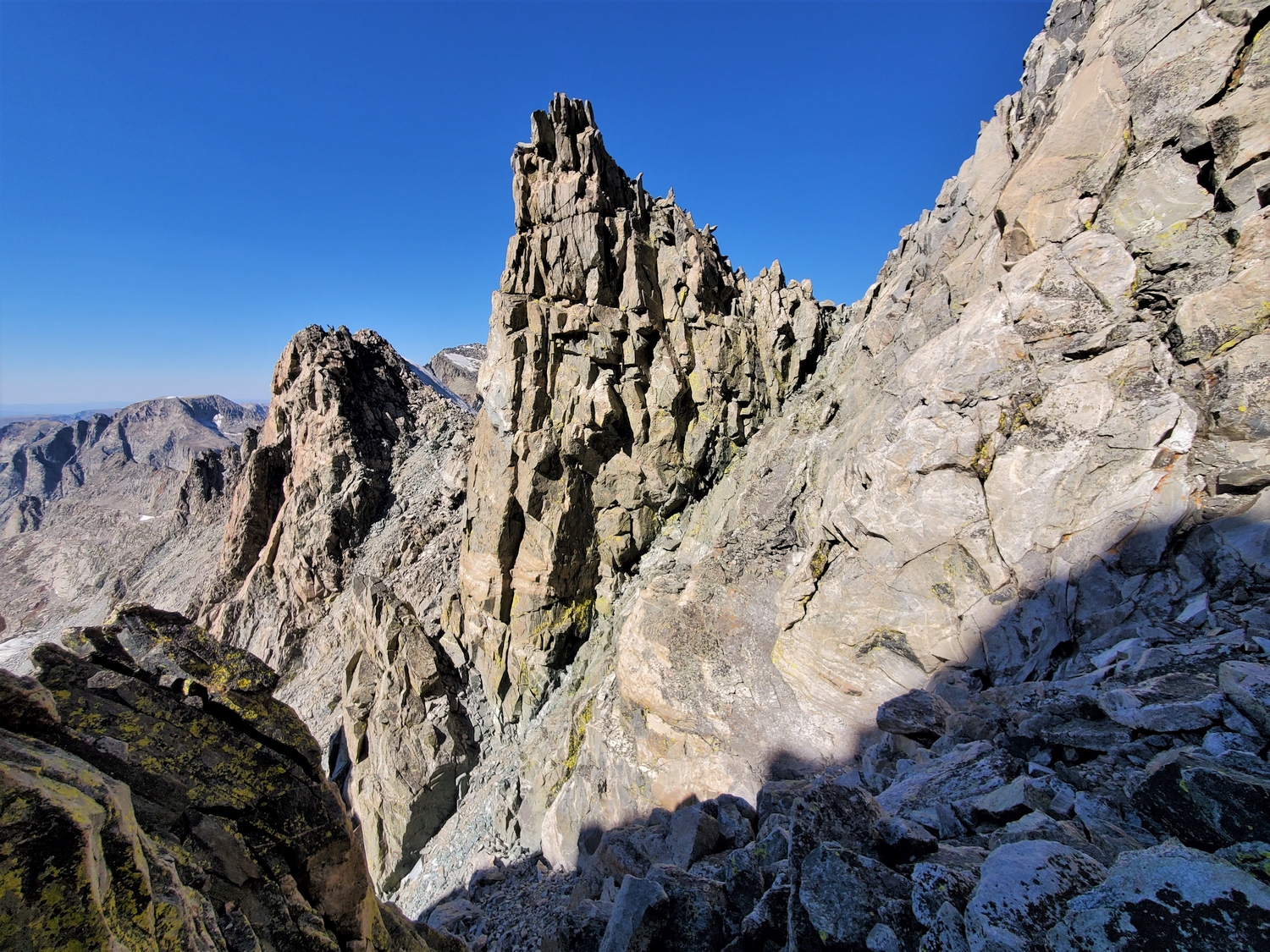
From the Sphinx Glacier (note that crevasses are reemerging) at the head of Titcomb Basin, climb to the ridge which connects Mount Woodrow Wilson with the (distant) Twin Peaks. Traverse north across the ridge to reach the base of the inset west couloir. Depending on the season, the couloir varies between steep snow, mixed ice and rock, and loose rubble. It is very steep and sustained, becoming narrow and deeply inset near the top. The last pitch at the top of the couloir is class 5, and a rappel station is established at the miniscule col where the couloir tops out (as always, bring your own rappel materials to make secure anchors).
From the top of the couloir, you can look through a notch into the intimidating south couloir. To finish climbing this route, ascend a steep slab/face (class 5, likely crux) just below the ridge crest on climber’s left (west). One pitch on this face leads back to the ridge crest just below the summit, where another rappel station is established. A short scramble leads to the top.
Route 3: South Couloir – Class 5.1, Very Serious Snow
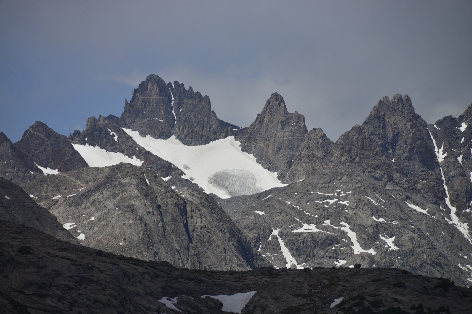
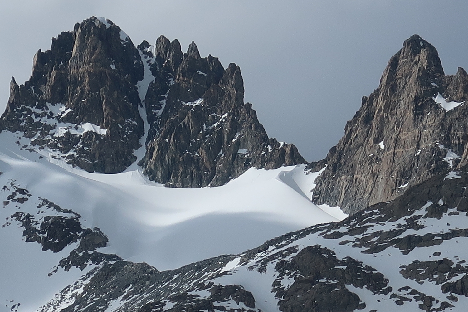
Viewed from Titcomb Basin, the south couloir is perhaps the most obvious, aesthetic, and enticing snowclimb in the whole range, as it evenly splits the mountain’s dark rock with a straight, steep white line. However, the author has never heard a favorable report of climbing this route: due to its aspect, the snow is usually rotten, thin, and icy, even early in the season. The “sweet spot” of post-winter consolidation and pre-summer melt never seems to occur for the snow in the south couloir. Some would consider this route a Wind River rite of passage, and others would consider it a death trap. Venture into the postcard at your own peril.
For those who truly desire to climb this route, little description will be necessary. The south couloir starts from the Sphinx Glacier (crevassed) and ends at the little col with the north couloir. It is very steep. The aesthetics and position are superb; the climbing may well be horrifying depending on the snow conditions. Even in June, the author encountered mixed conditions including a crux consisting of an ice-covered chockstone where the couloir narrows to only a few feet wide. The route is likely unclimbable (at least by any sane mountaineer) once melted out.
Mount Woodrow Wilson Map
Mount Woodrow Wilson Panorama
Mount Woodrow Wilson Photos
-
- The classic view of Mount Woodrow Wilson (left) and the Sphinx (right) above the Sphinx Glacier at the head of Titcomb Basin (2016)
-
- The other classic view of Mount Woodrow Wilson above the Dinwoody Glacier showing a characteristic massive bergschrund, seen here from Gannett Peak (2016)
-
- The shape of Mount Woodrow Wilson is barely discernible as I climb the Sphinx Glacier before sunrise (2020)
-
- Sunrise above a snow-covered Titcomb Basin, as seen from midway up Woodrow Wilson’s south couloir (2020)
-
- Finally topping out after a nerve-wracking climb through loose snow and ice-covered rocks in a constant no-fall-zone, aka Mount Woodrow Wilson’s south couloir (2020)
-
- Sunrise and a unique perspective on Gannett Peak, seen here from the col on Woodrow Wilon’s summit ridge (2020)
-
- I did not want to downclimb the south couloir and instead chose to perform an exploratory rappel into the north couloir (2020)
-
- After a hundred foot rappel, the rest of the north couloir was a moderate snow and rock scramble (2020)
-
- The broken snow and talus was a welcome relief from the ice and sugar snow of the south couloir (2020)
-
- Looking back at the north couloir of Mount Woodrow Wilson from a ledge I used to exit northwards (2020)
-
- A short talus slope provided passage to the Continental Divide after exiting the north couloir (2020)
-
- The top of Mount Woodrow Wilson is cut off from this mellow plateau by several severe rock gashes (2020)
-
- Looking back to Woodrow Wilson (summit on the left, south couloir in the center) while descending the Sphinx Glacier (2020)
-
- Mount Woodrow Wilson sits near the apex of the ridges separating Titcomb Basin (distant), Dinwoody Valley (left), and the Scott Lake/Green River drainage (right), commanding a central position in the northern Wind River Range (2020)
-
- Already, the next big question mark was looming in my mind: would I be able to climb the icy, crevassed arm of the Dinwoody Glacier that provides the only north-side access to Mount Woodrow Wilson? This was my first good view of the route, and it didn’t inspire much confidence.
-
- Closer view of Woodrow Wilson as I approach across the Dinwoody Glacier. On the day I climbed it, the crux was getting from the snowy glacier bowl to the rock buttress. This would involve crossing a few hundred feet of bare ice where the upper ice sheet pinches out.
-
- Overview of Mount Woodrow Wilson as seen from Pinnacle Ridge. My route would start from the lower glacier, then angle left onto the upper ice sheet while trying to avoid the lurking crevasses.
-
- Looking back at Pinnacle Ridge and Gannett Peak from the top of the ice sheet. With relief, I clambered onto the talus and hiked up to Woodrow Wilson’s north shoulder.
-
- Looking back across the ice sheet from near the end of my traverse. The terrain is convex, so the lower section is considerably steeper than seen here.
-
- A typical axe placement. I believe this section was about AI2 in these conditions based on comparing it to photos and descriptions of more established routes.
-
- Looking up at the summit of Mount Woodrow Wilson. The last few hundred feet sticks up above the gentle plateau, requiring a bit of trickery to surmount.
-
- A rusted can in the talus is a reminder of climbers from a bygone era. Woodrow Wilson got its first ascent via this route in 1924, by Albert Bessine, Edgar Doll, and Carol Thompson Jones. Perhaps they enjoyed a snack on their way up?
-
- At last, I’m in the proper north couloir. Most of this route’s difficulty lies in the approach–the actual couloir is a short scramble, at least in the late summer.
-
- At the top of the north couloir, where it meets the south couloir at a tiny col, I found the makeshift rappel anchor I left here in 2020, made from part of my rope after my webbing fell out of my pack. I took a picture and packed it out, both for the sake of cleaning up and as a memento.
-
- Nearing the summit. From the top of the north couloir, a bit of low 5th class climbing leads up the summit ridge.
-
- Panorama north to Gannett and the Dinwoody environs from the summit of Mount Woodrow Wilson. It was so much unlike my last time up here, when everything was blanketed with June snow.
-
- Panorama south overlooking Titcomb Basin. By now, my mom had hiked all the way in and was setting up camp somewhere just this side of the uppermost lake.
-
- Sunlight and shadow play tricks on the steep topography. Here, I peer through a notch into the south couloir as I begin my descent.
-
- My second rappel starts at another established station, dropping me past some difficulties at the top of the proper west couloir.
-
- Lower down, the melted-out west couloir is only class 2/3, but it’s very loose so I proceed cautiously.
-
- The west couloir is deeply inset into a fold of the cliffs. It feels more like canyoneering than mountain climbing!
-
- After one red herring, I find the correct exit point and scramble left over the ridge separating the Mammoth Glacier and Sphinx Glacier cirques.
-
- Descending onto the Sphinx Glacier at the head of Titcomb Basin. At last, I’m home free, at least for today.
-
- Mount Woodrow Wilson as seen from the Sphinx. Neither my ascent nor descent routes are visible from here.
-
- Back on the Sphinx Glacier, I have a view of Woodrow Wilson’s south couloir, which I climbed in 2020. It was scary then and would probably be even worse without snow.
DISCLAIMER: Mountain climbing is dangerous. Activities described on this page may lead to serious injury, death, and property damage. This webpage is presented with no warranty express or implied. Pictures and text are for entertainment purposes only. No commercial use allowed; all rights reserved.