Another day–what to do? An alpine start was out of the question. Yesterday was supposed to be a partial rest day, but I hadn’t gotten back to the tent until almost 11 p.m., and I was mentally and physically exhausted. I think we set the first alarm for 5 a.m., and I awoke to the smell of smoke–apparently from wildfires in Idaho and Montana. I napped a bit more, then finally made some effort to get ready. It was already light by the time I finally rolled out of camp at half past six. Now that I was planning to use up 6 days on the northern Wind River peaks, I decided to take today a bit easier. Remember how that turned out last time? Hah.
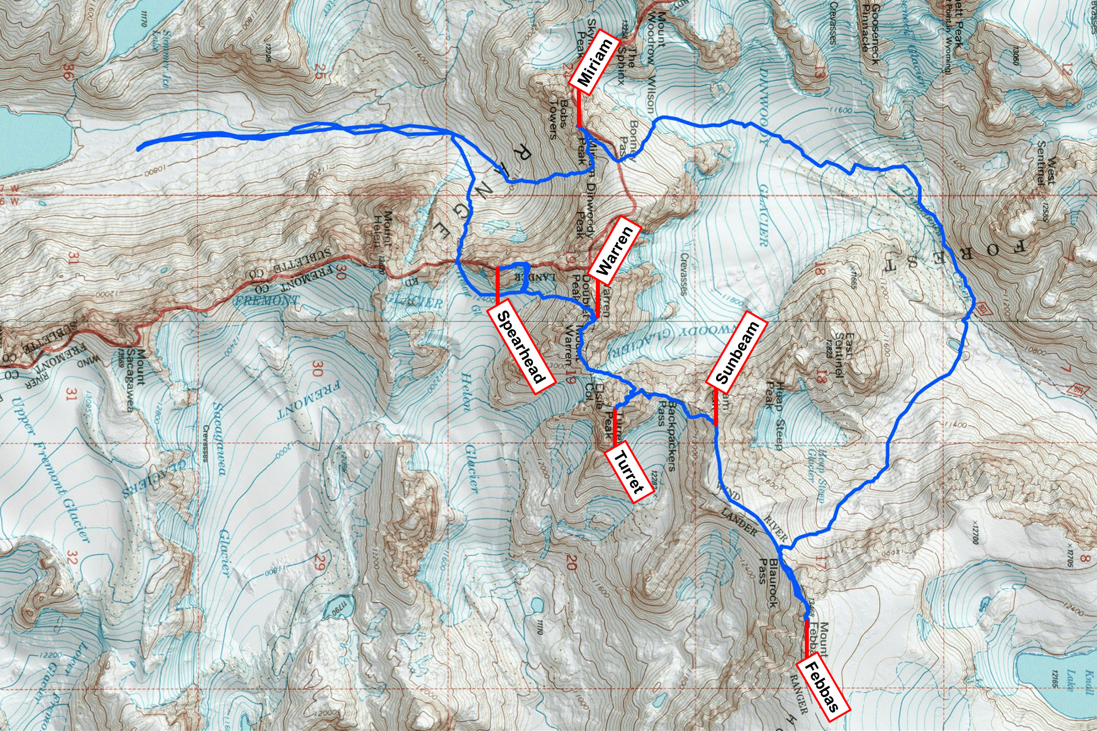
For the first time, I didn’t have a super well-defined plan. The general idea was to climb Spearhead first, then see how I was feeling and decide from there. There were two main options. The more ambitious plan would be to traverse from Warren to Febbas, returning via Bonney Pass and Miriam; the alternative would be to settle for Helen and Sacagawea after Spearhead, which would mean that the next two days would be really hard but I could still theoretically finish on time. I pondered these possibilities as I trudged through upper Titcomb Basin for the third time in as many days.
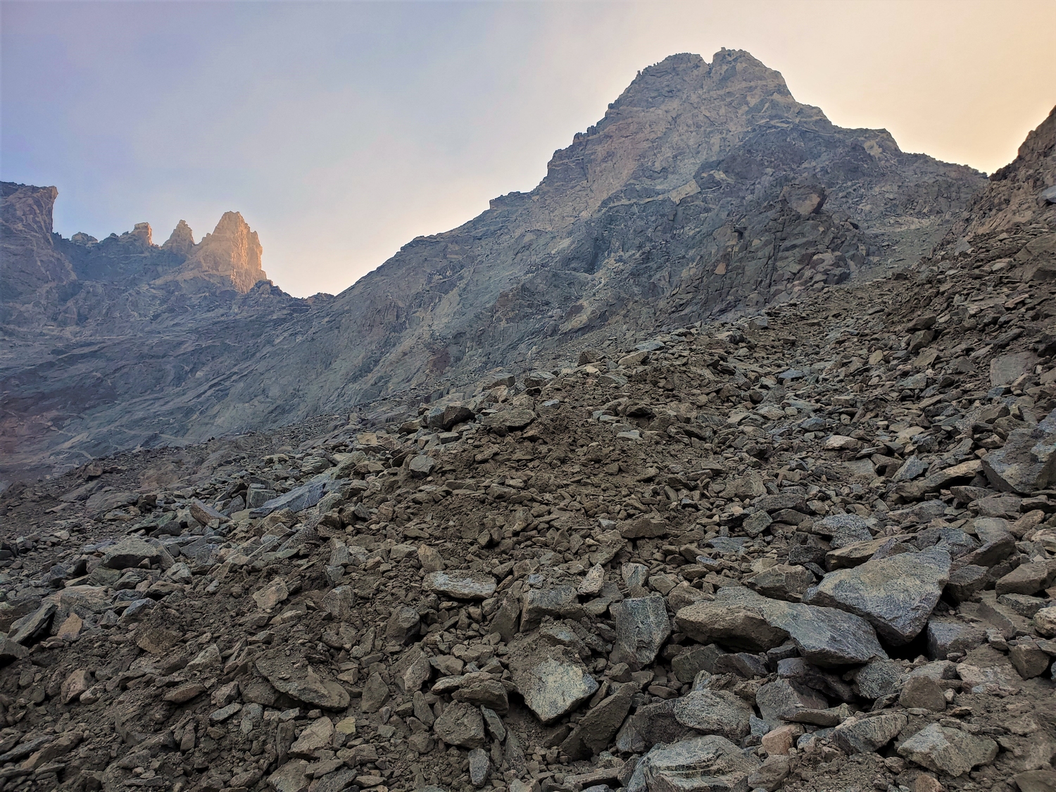
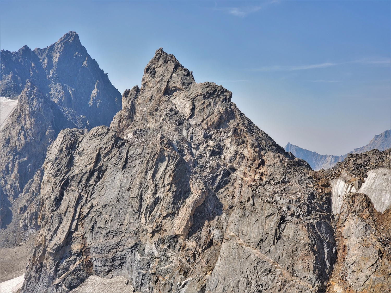
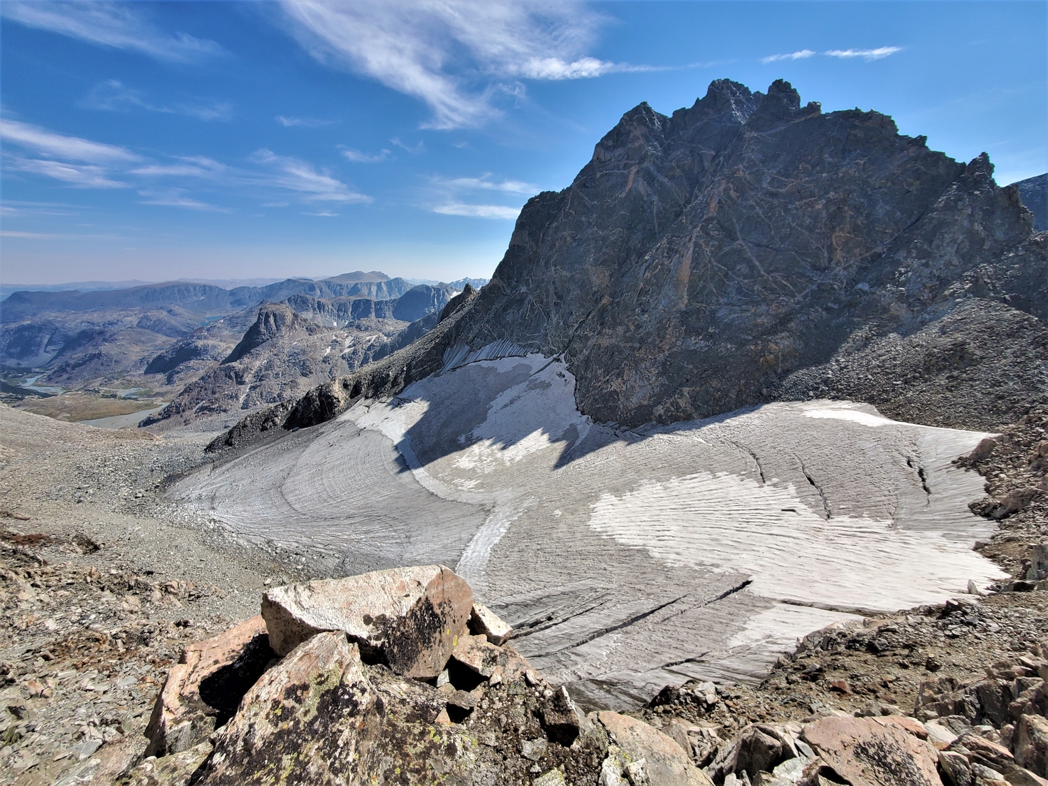
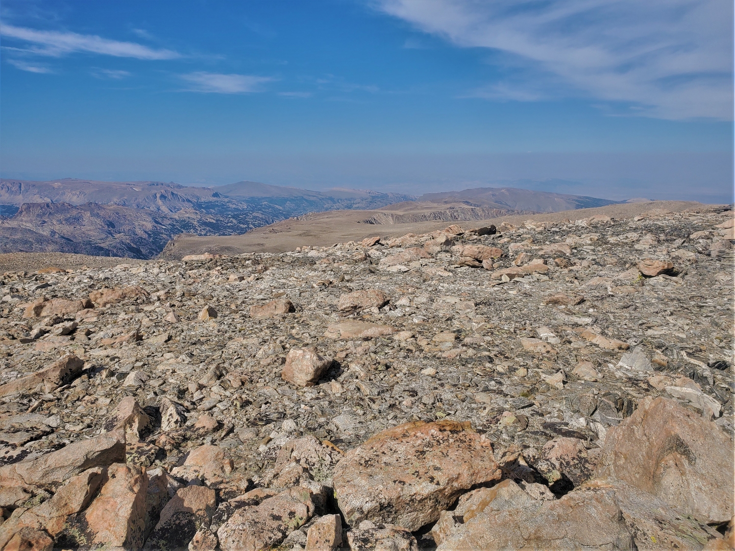
From the southeast, Spearhead is a confusing mess of towers and deep gullies. I stay relatively low on the low-angled part of the glacier and contour around to the north side.
This impressive looking granite face is actually the east buttress of Spearhead, hiding the summit and north ridge from this angle. The glacier is icy but low-angle and not too difficult to navigate.
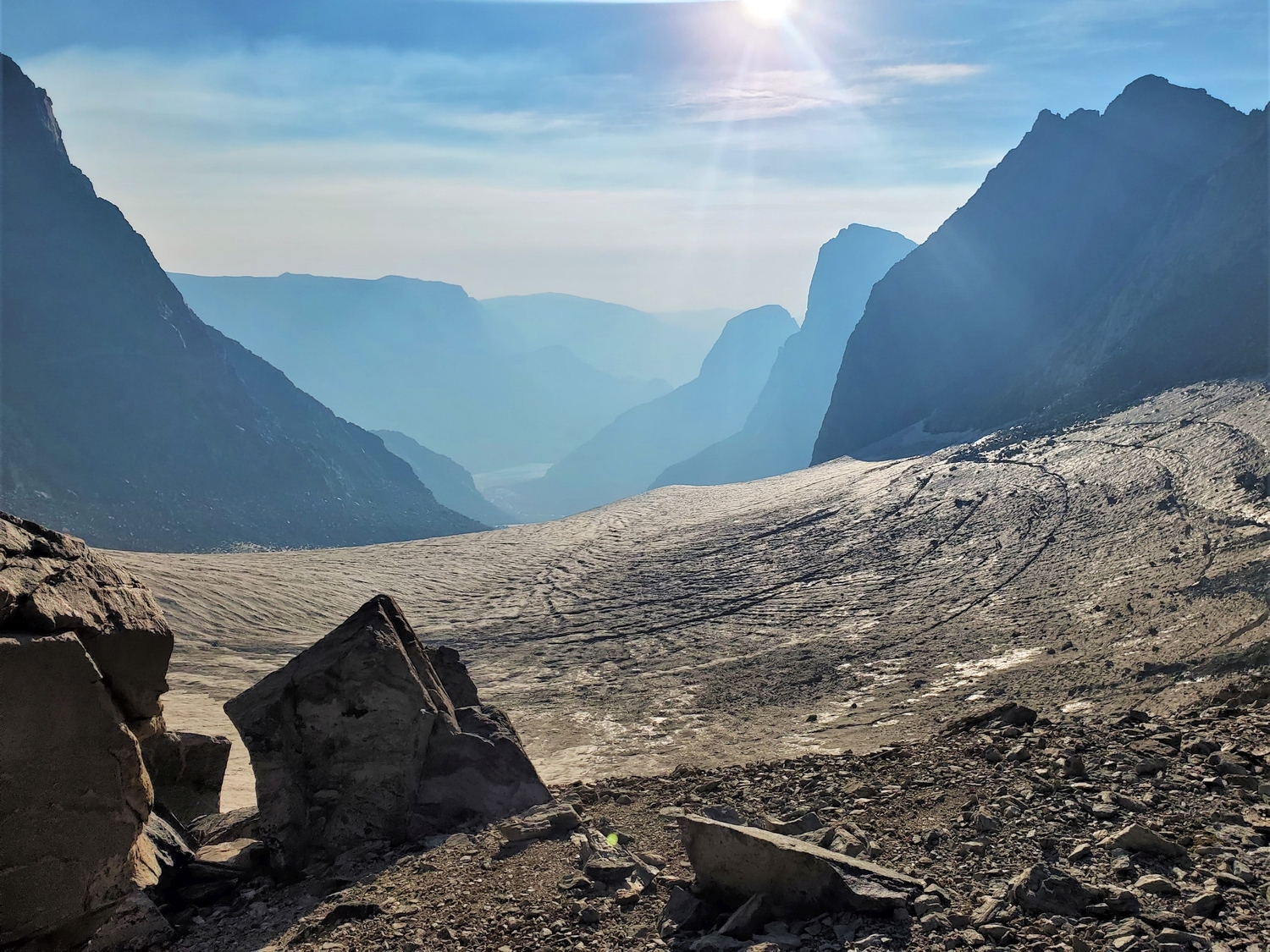
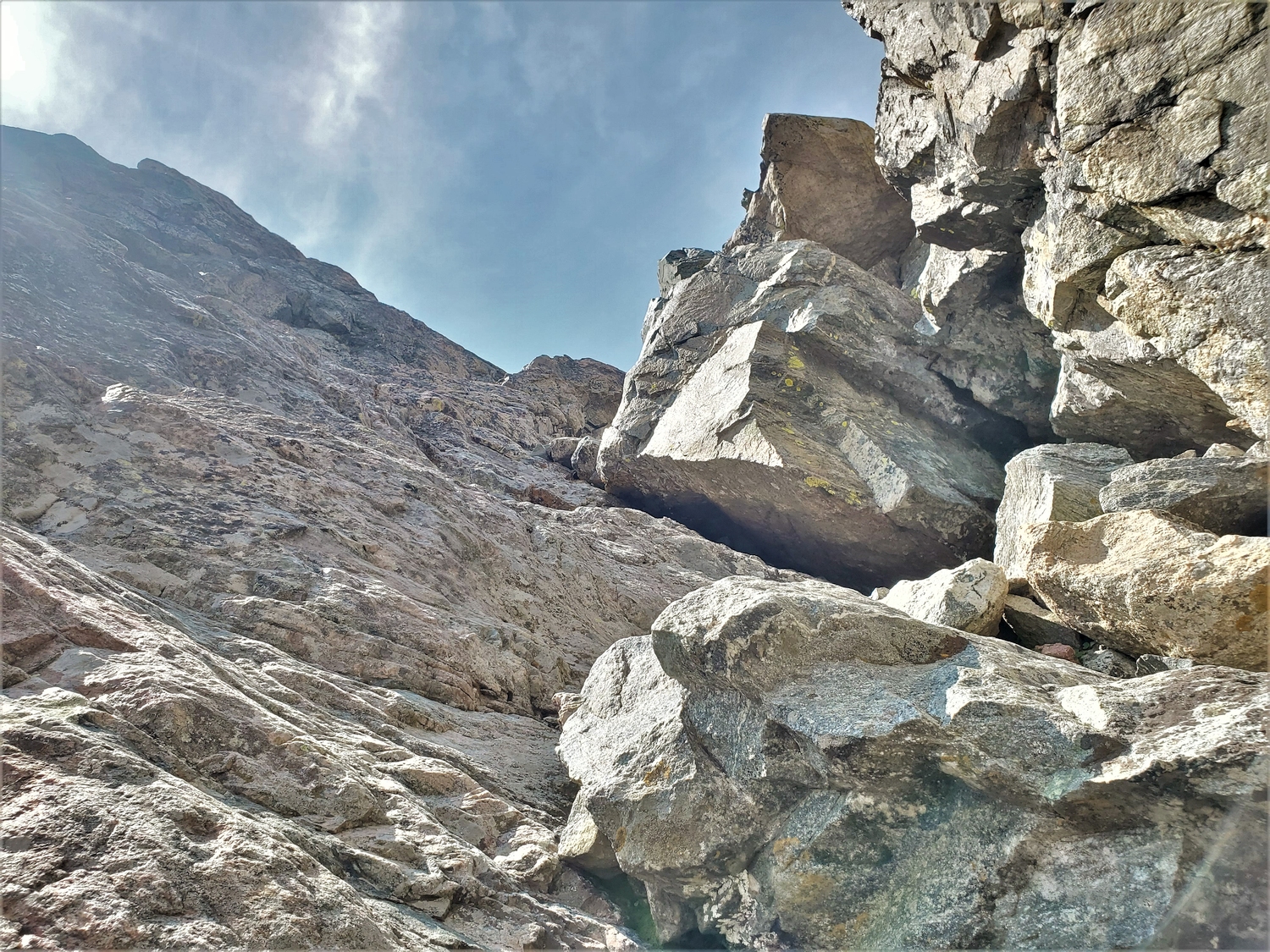
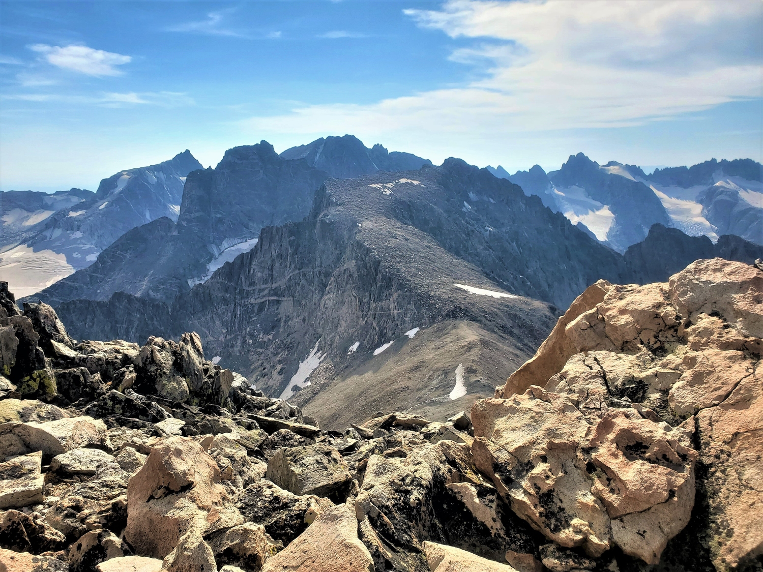
I continue contouring across the glacier until I can scramble a couple hundred feet up an annoyingly loose dirt chute to reach the north ridge. The impressive peak in the center of this view is part of Doublet, an unranked 13er (subsummit of Mount Warren).
At the base of the north ridge, I switch from hiking boots to rock shoes. Most parties seem to climb Spearhead in whatever shoes they’re already wearing, but there are a few sections where I am grateful to have the edging ability of climbing shoes. With a rope, I wouldn’t think twice about wearing boots, but solo is a different game. I also carried my 100 ft. rappel setup this day–though I ended up only using it for about a 30 ft. rappel on the crux of Spearhead, and I probably could have gotten away without it. Better safe than sorry though, and I can always write it off as “training weight.” Training for…next time I suppose?
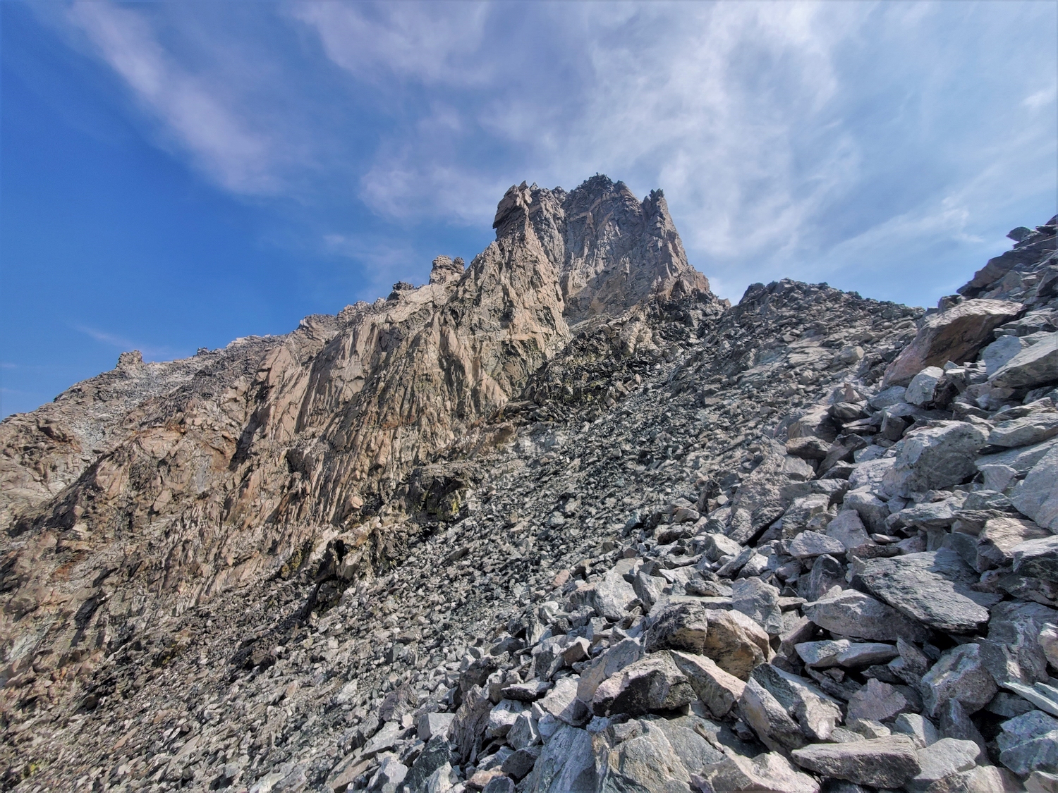
The crux of the north ridge route is a short vertical face on the east side of the crest. I found a slightly easier line this time and got up it without too much hesitation.
After the steep face, a short knife edge ridge poses the next challenge, then some slabs. It's a well-rounded, interesting climb, even though it's only a couple hundred feet in total.
Compared to the horror shows on some of the previous peaks, I'm positively enjoying dancing up Spearhead. The rock is good, I know the route, and for once there's no sketchy ice!
True to its name, Spearhead is pointy. The summit blocks require a final bit of steeper scrambling, and the high point is excitingly narrow.
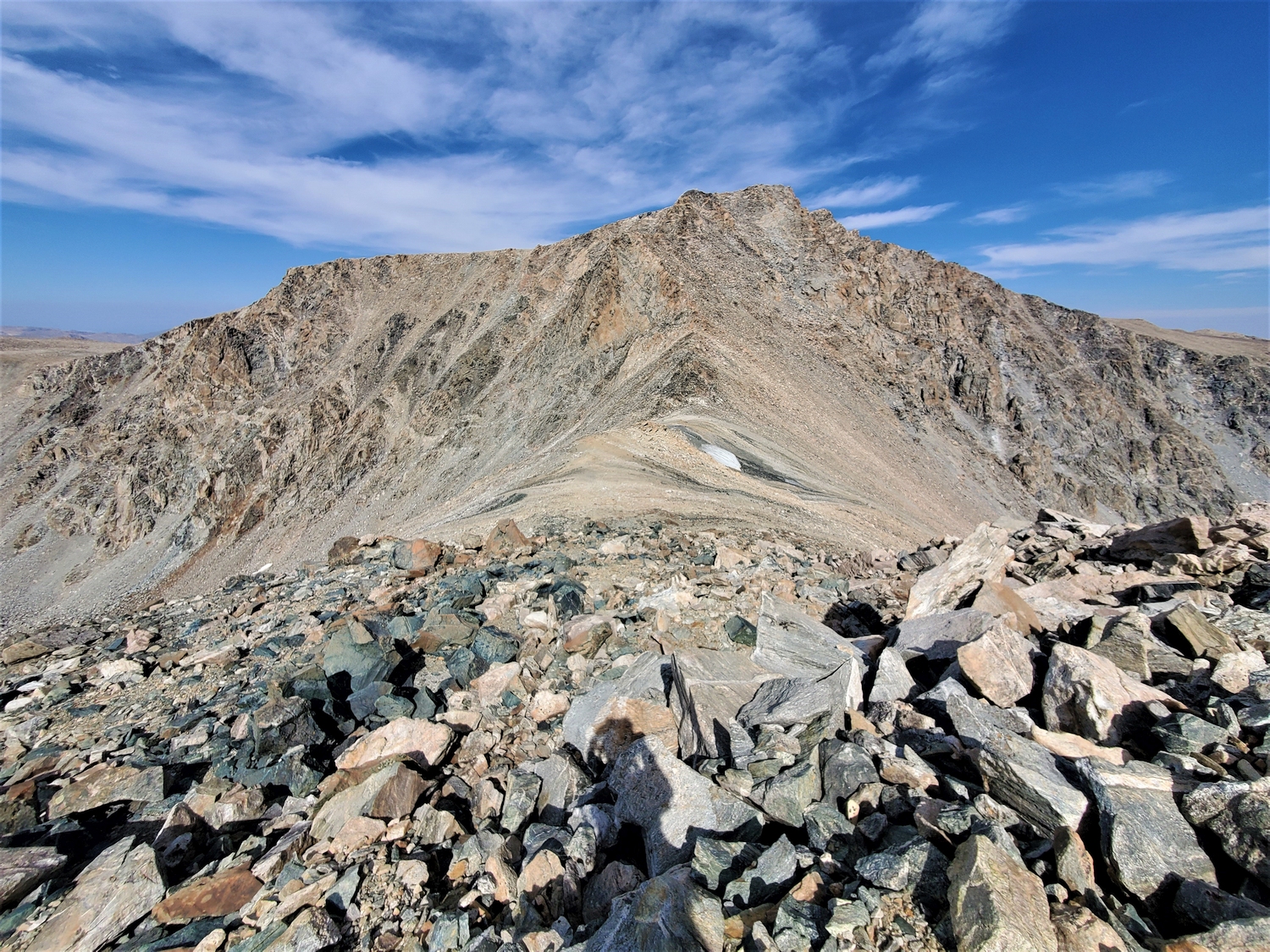
From the upper Helen Glacier, Mount Warren looks too steep to have any easy routes. However, I'm hoping to find the supposed 3rd class route on this sunlit face reported by Eric and Matt.
As I head up the face, weaknesses are revealed in the cliffs, and a moderate scrambling route is indeed possible. Most of it is loose talus, but there are a few enjoyable sections of solid rock, like this set of natural rock stairs.
The upper face turns into a broad talus bowl, and before long I'm on the summit ridge. Once thought to be class 5 by all routes, Mount Warren is a gentle giant if approached from this side.
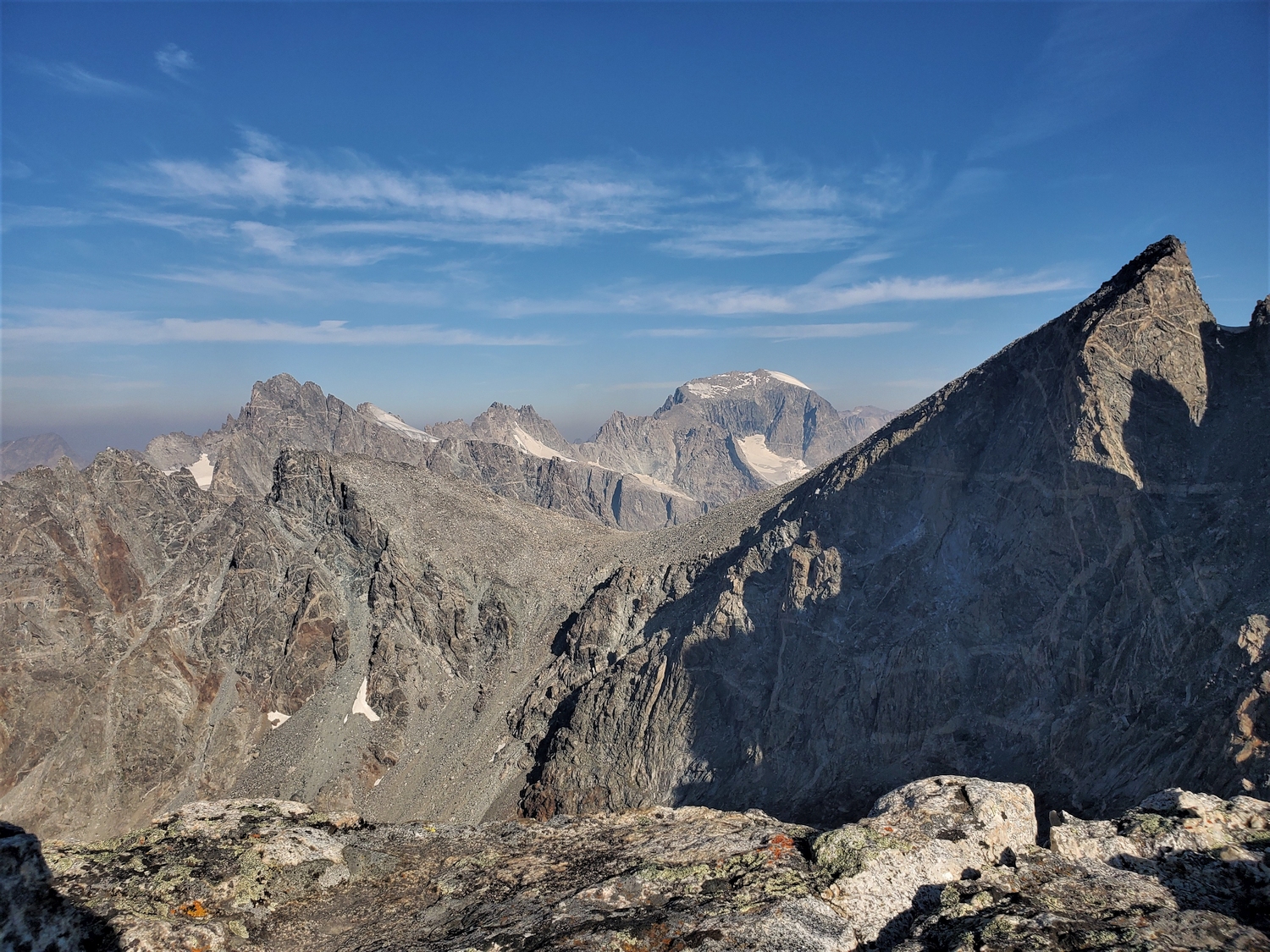
The geography of this section of the Wind Rivers is complicated, and bears a moment’s discussion. From Downs to Woodrow Wilson, the Continental Divide is a singular massive ridge. Then it makes a short jog east across Bonney Pass, narrowly misses Warren, and turns south to continue along the western wall of Titcomb from Spearhead to Fremont. From both sides of this “kink” in the Divide, great spur ridges extend east and west: the first encompasses the Twin Peaks and Peak Lake crest, and the second bears east from Warren to the peneplain plateau of Horse Ridge.
My goal was to traverse this giant spur, tagging its four 13ers: Warren, Turret, Sunbeam, and Febbas. However, the peaks are separated from each other by huge gashes, and the terrain is so severe that a direct ridgeline traverse would be inefficient. Avoiding all the difficulties by dropping down into the valley after each peak would be slow too though, so I’m hoping to find a middle ground, traversing as high as possible while keeping the difficulty in my solo comfort range.
The first order of business is to descend from Warren, which turns out to be the crux. My ascent route is on the wrong side of the mountain to continue, so I head down the east slopes instead. A few climbers have reported going this way, including Blaurock and Ellingwood on their first ascent of Warren in 1924, but details are scarce. In general, I know I need to find an inset gully, then downclimb it until I can escape north onto the ridge near Elsie Col. It would turn out to be considerably sketchier than I had hoped, with a sandy 5th class slab traverse over deadly exposure, but it didn’t feel too desperate. I wouldn’t solo this route just for fun, but it probably saved me an hour or more compared to backtracking and circling around the whole mountain.
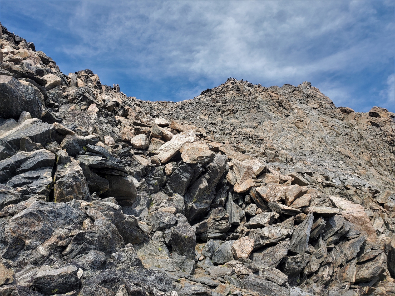
Inset gully: check! This gnarly couloir, almost like a broad chimney, starts at the base of the hanging boulder field on Warren's eastern shoulder and drops steeply towards the Helen Glacier.
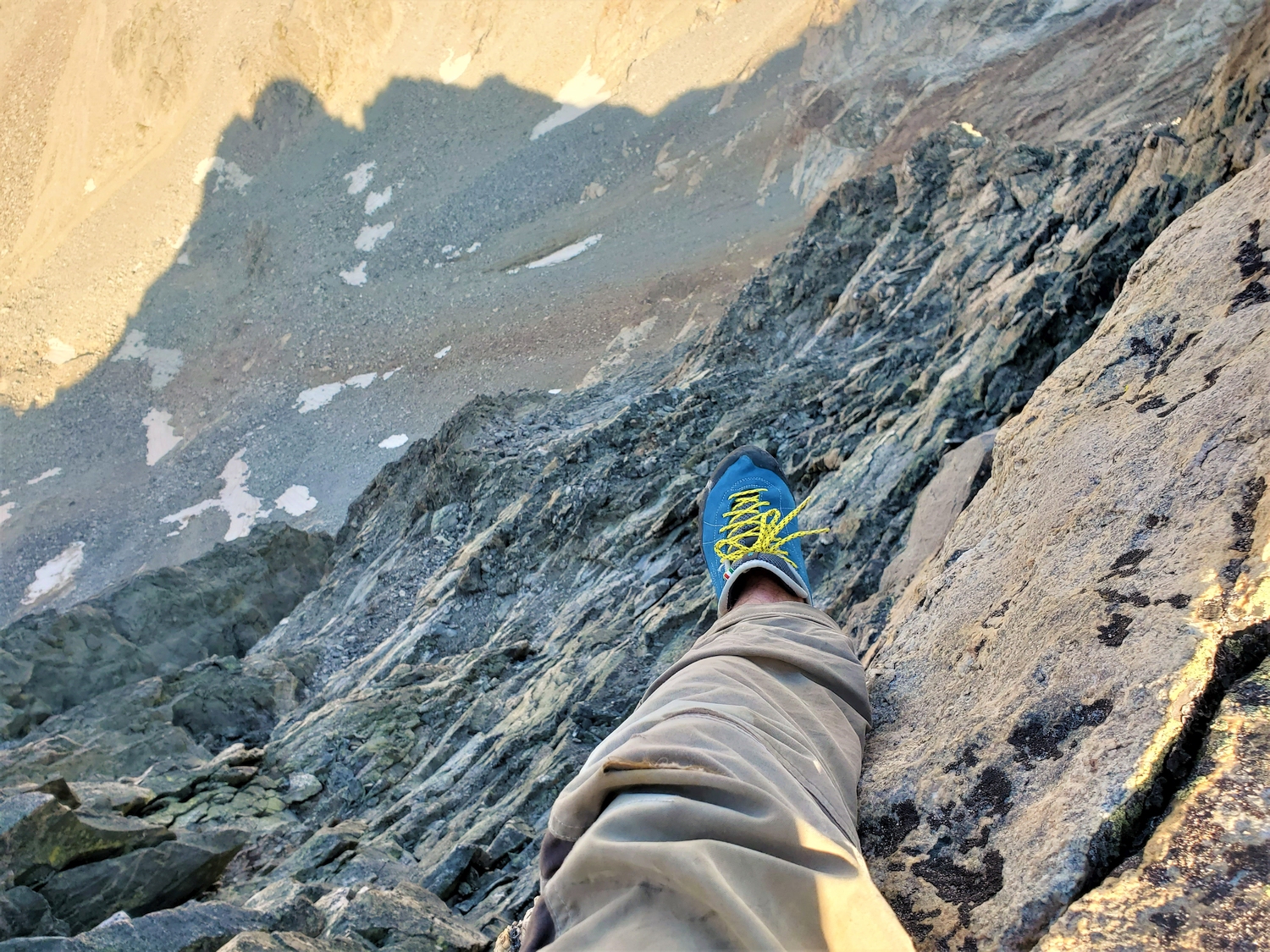
The top of the gully requires a low 5th class downclimb. The rock is good and it's not too exposed, but some care is required.
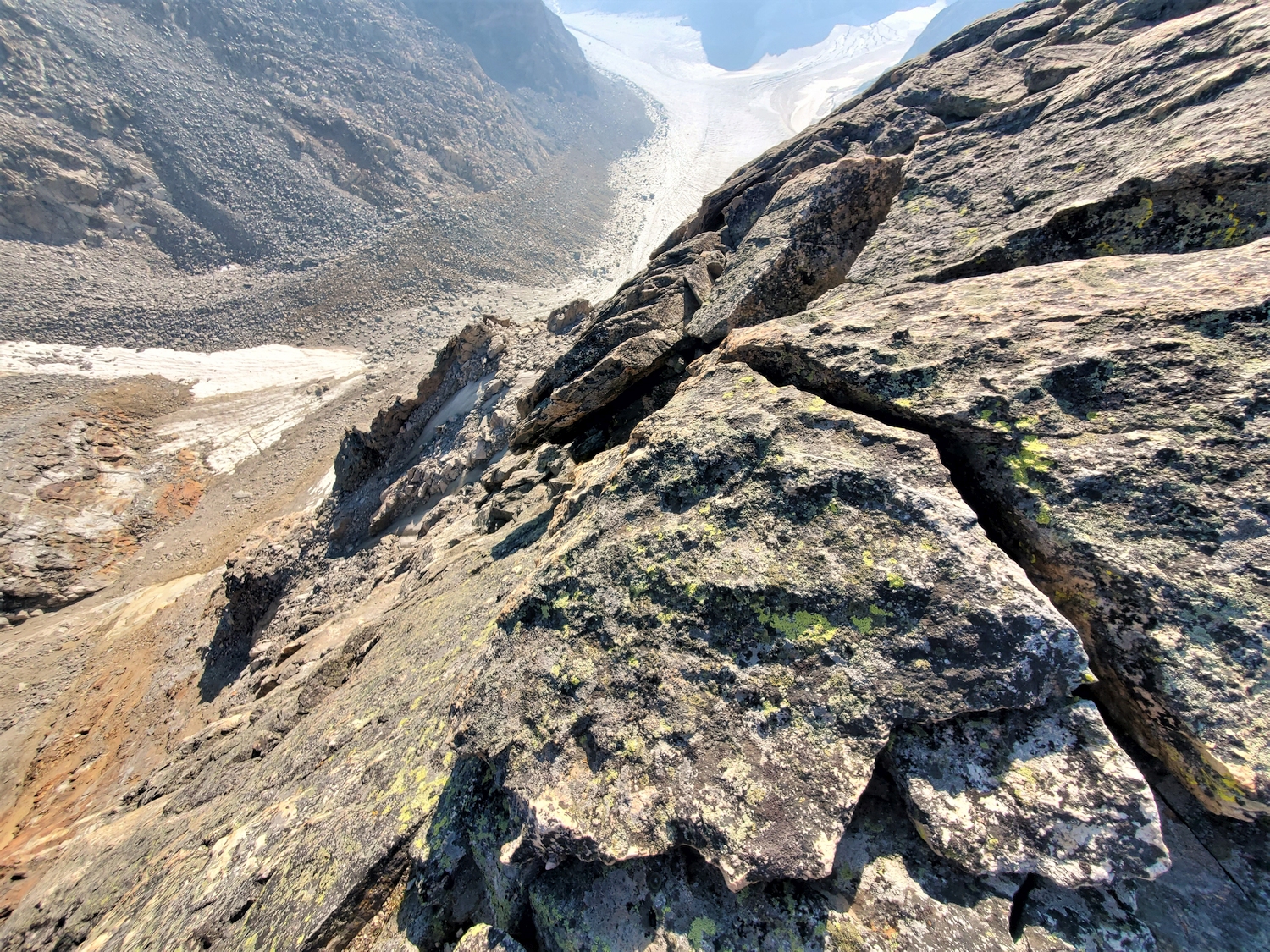
After descending the gully for a bit, it seems to be falling away to the cliffs below, which means it's time to look for an escape route. Here, I explore a ledge system to my left.
Looking back at the slab traverse from the safety of a ledge on the other side. The climbing is only 5.0-5.2, but a slip would send you into the garbage chute a hundred feet below (not visible in this view).
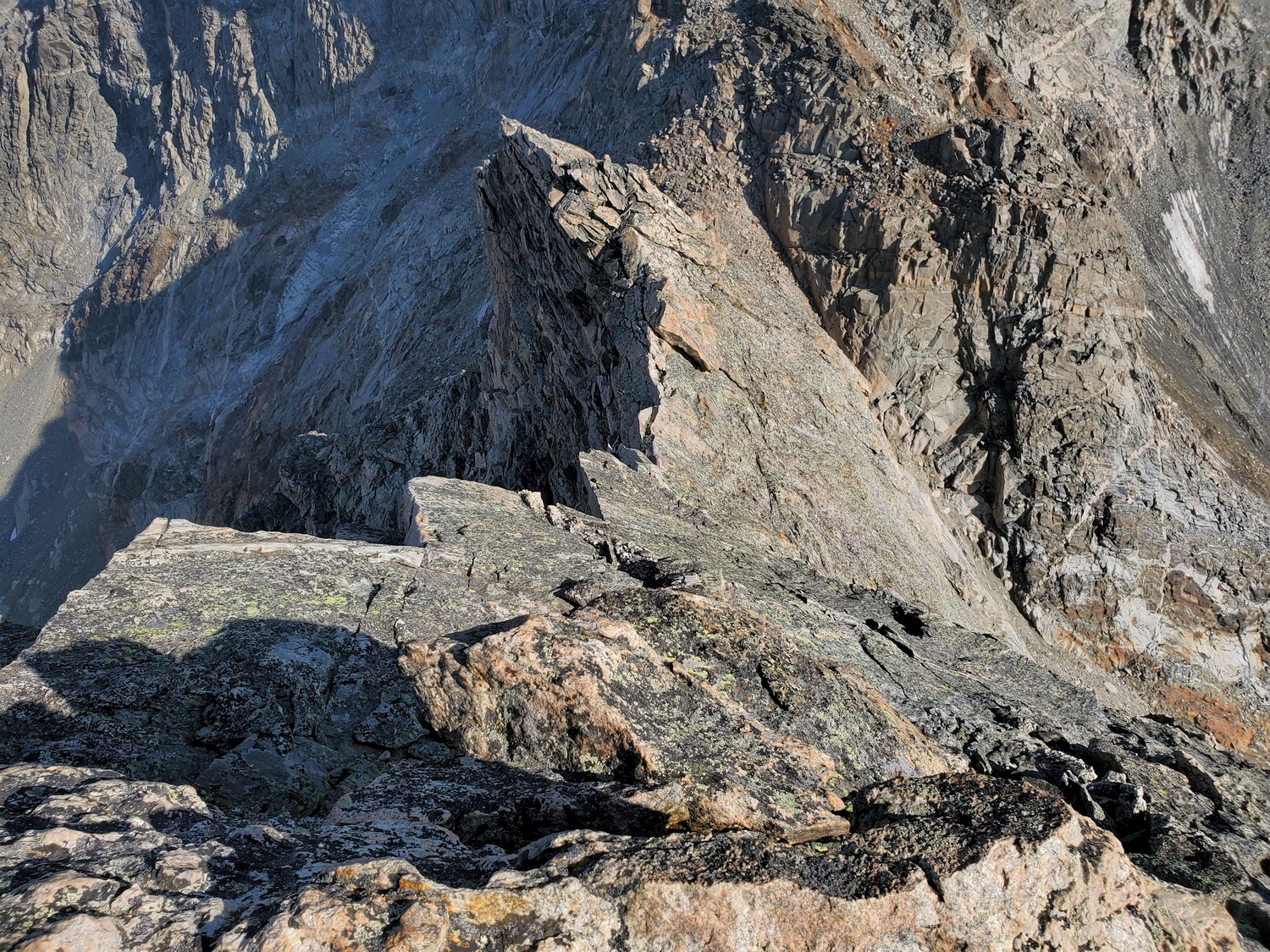
Mindless scree slopes and a bit of talus leads from Blaurock Pass to the summit of Febbas.
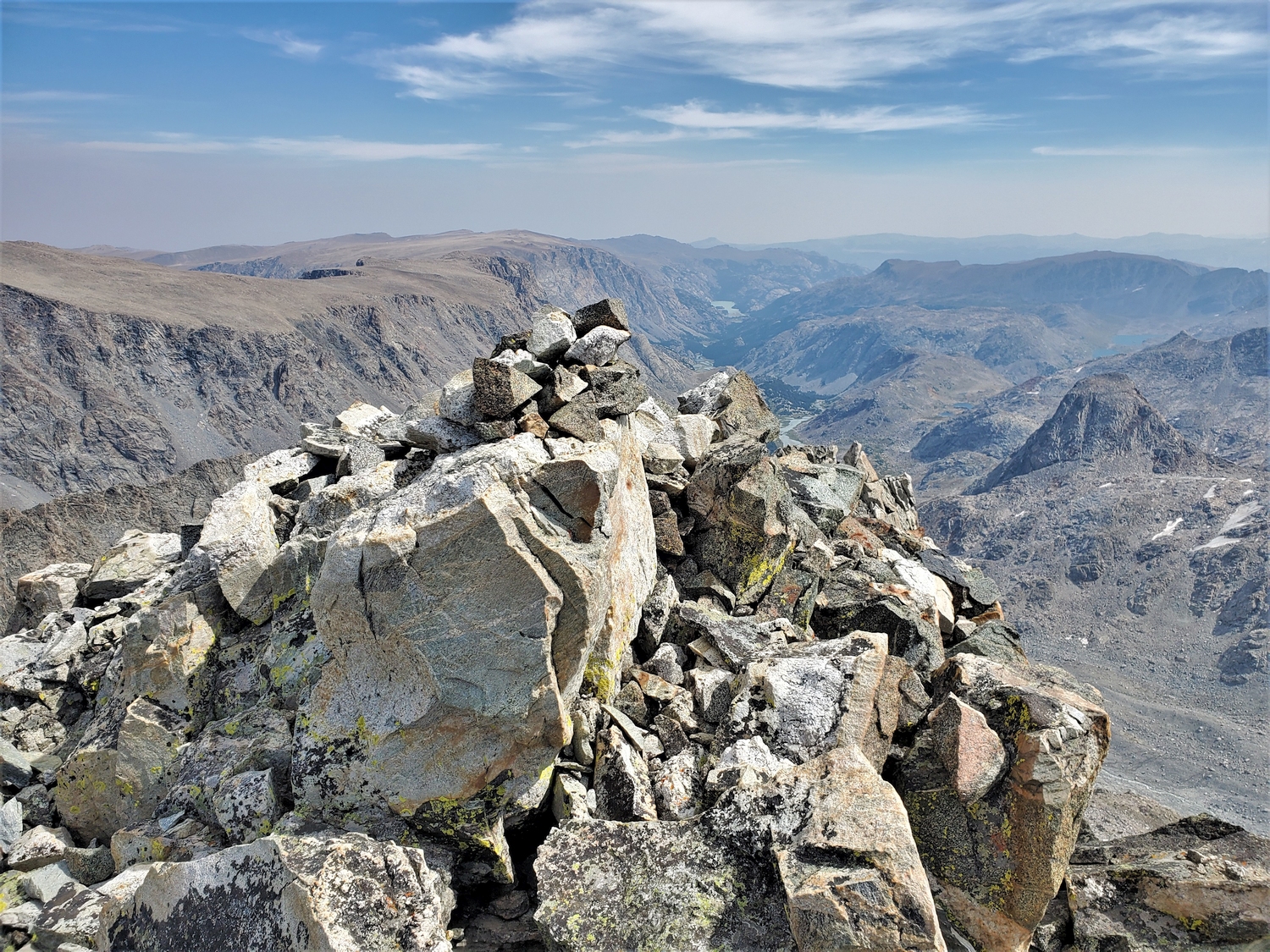
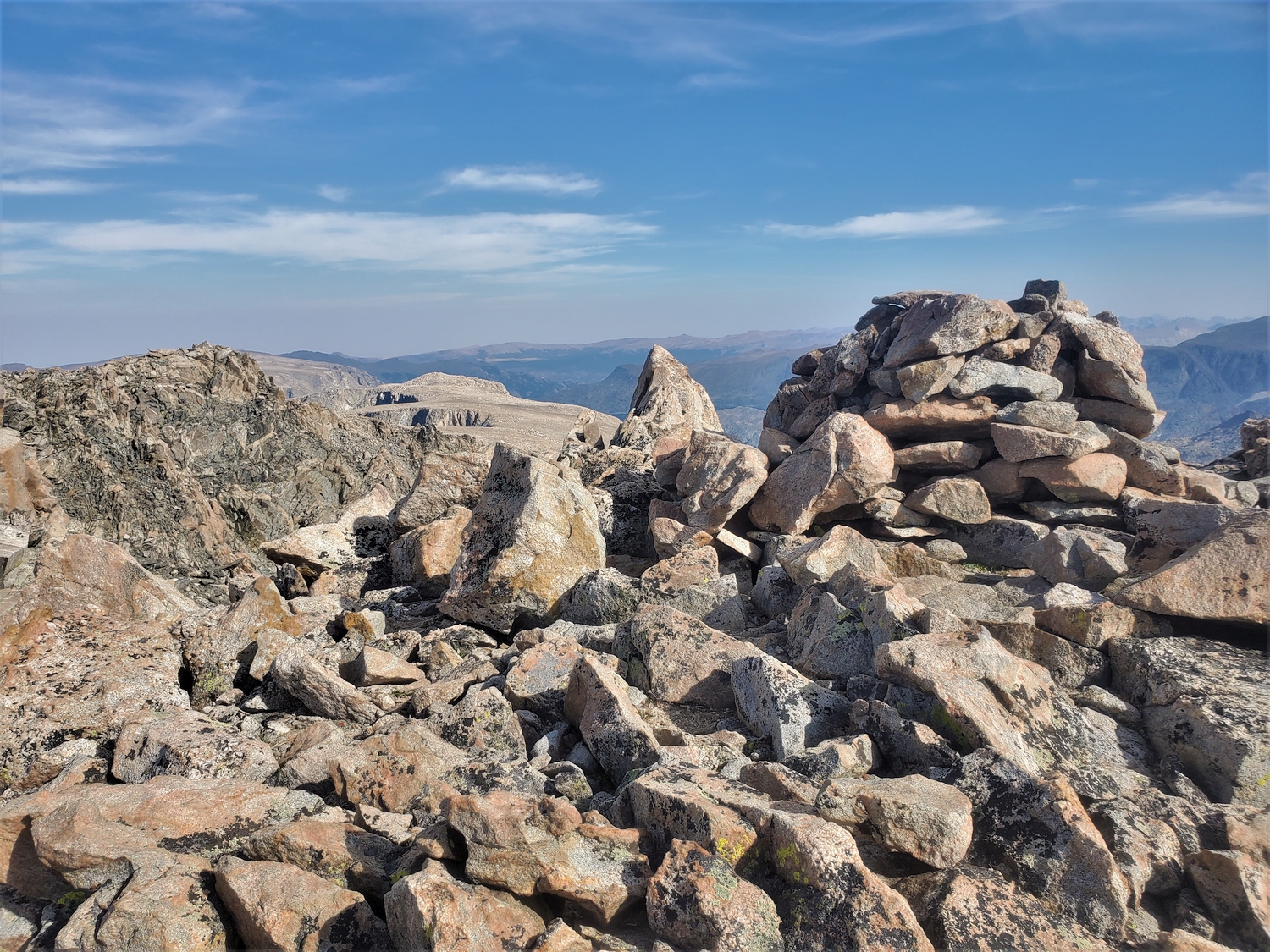
This large cairn marks the high point. The ground is rather flat, but with LiDAR and in-person scouting, I determined that the rocks around the cairn are still the highest natural ground.
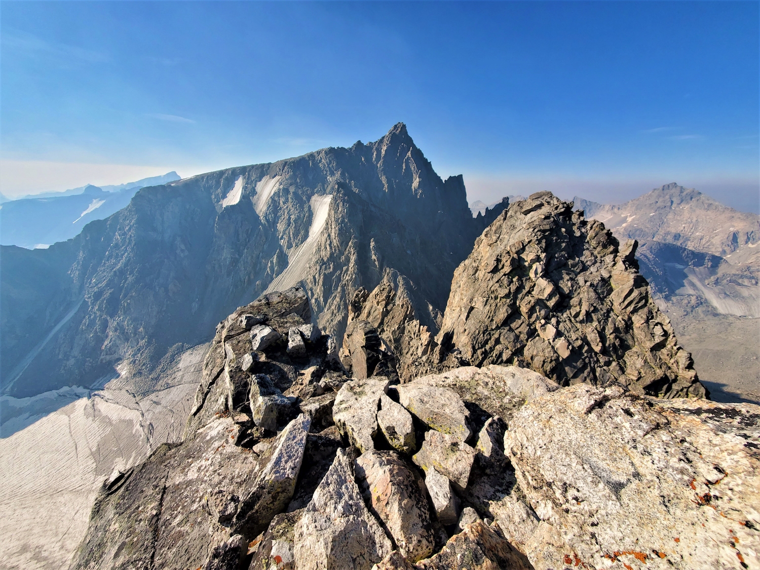
Summit view from Mount Febbas, looking out over the barren expanse of Horse Ridge, a vast plateau more than 10 miles long.
Mount Koven from Febbas.
Oddly enough, this region around Blaurock Pass is one of the best spots to view Mount Koven, even though part of the lower east face is hidden by a buttress called the Cleaver. The peak is so much shorter than its neighbors that it blends into the background from most angles, and up close it’s too steep to get a good overview of the complex faces and ridgelines.
I’m very glad that I chose to go southbound through the northern Winds, since going this direction means I’ve already climbed Koven. This way, it’s an inspiration to continue instead of a taunting reminder of the difficulties ahead. My ascent route climbed up the dark face to join the ridge just left of the largest gendarme, and I descended the serrated south ridge (left skyline).
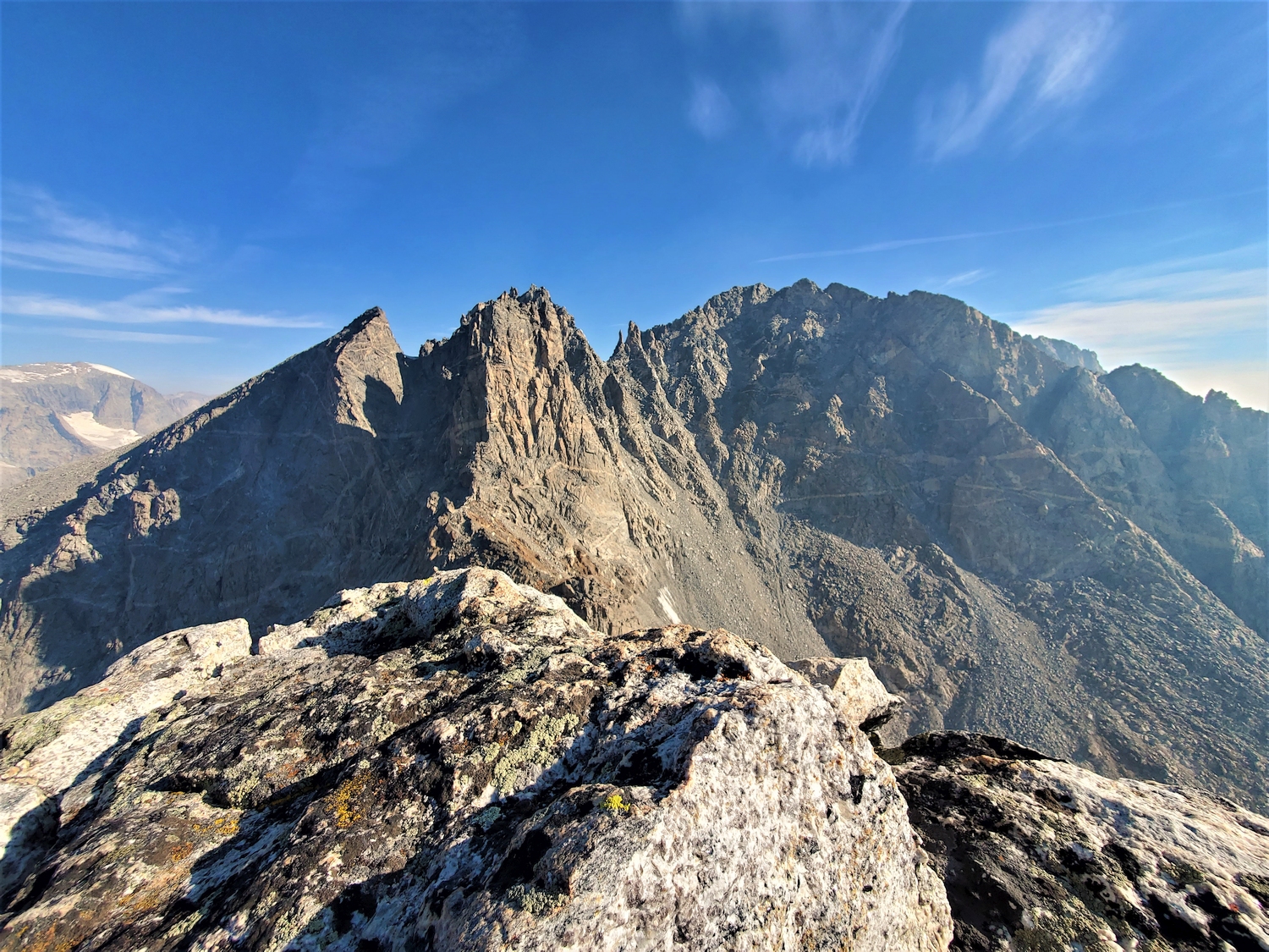
Closeup of Spearhead (left) and Forked Tongue (right, unranked). I climbed the left ridge of Spearhead this morning.
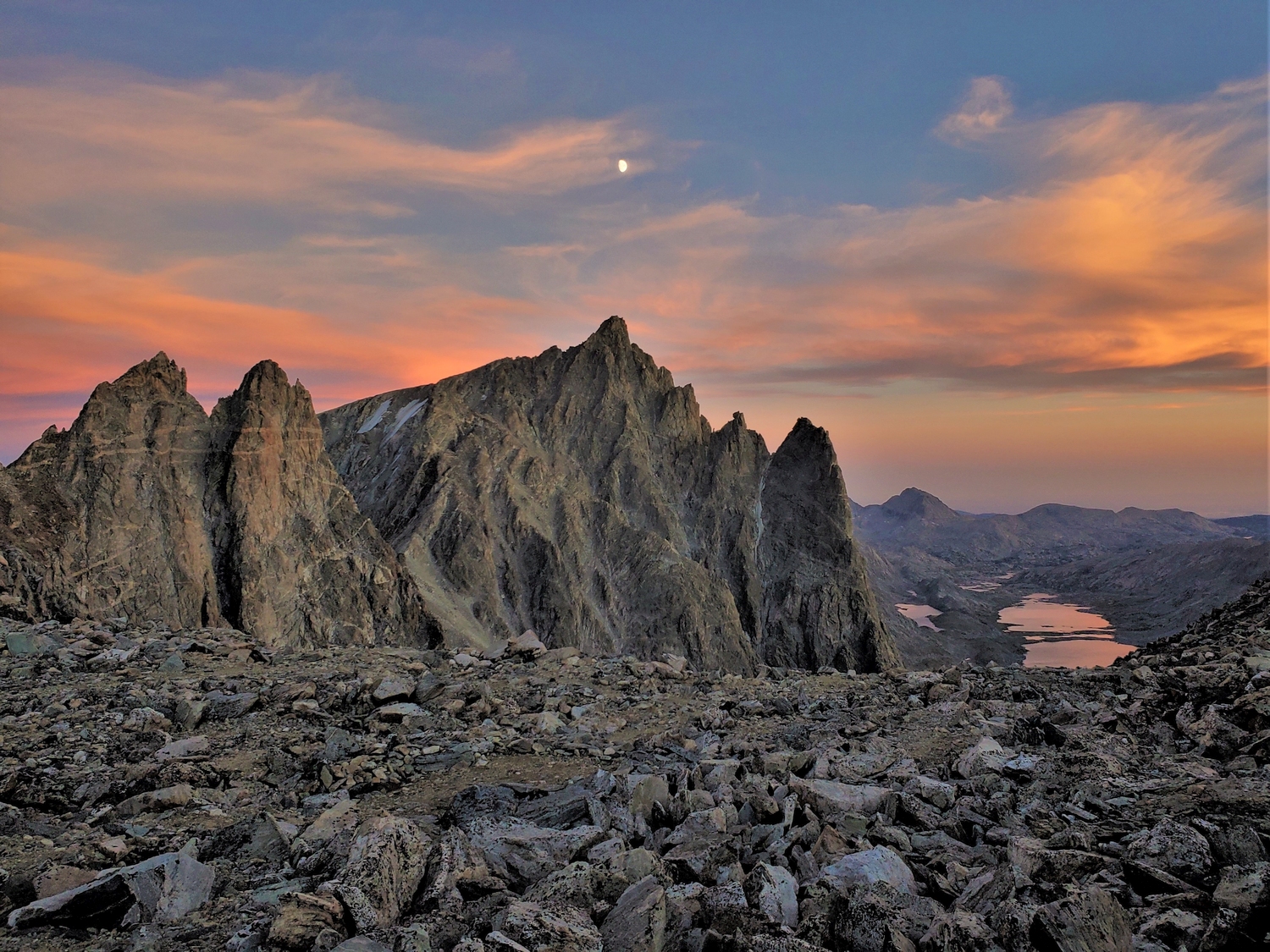
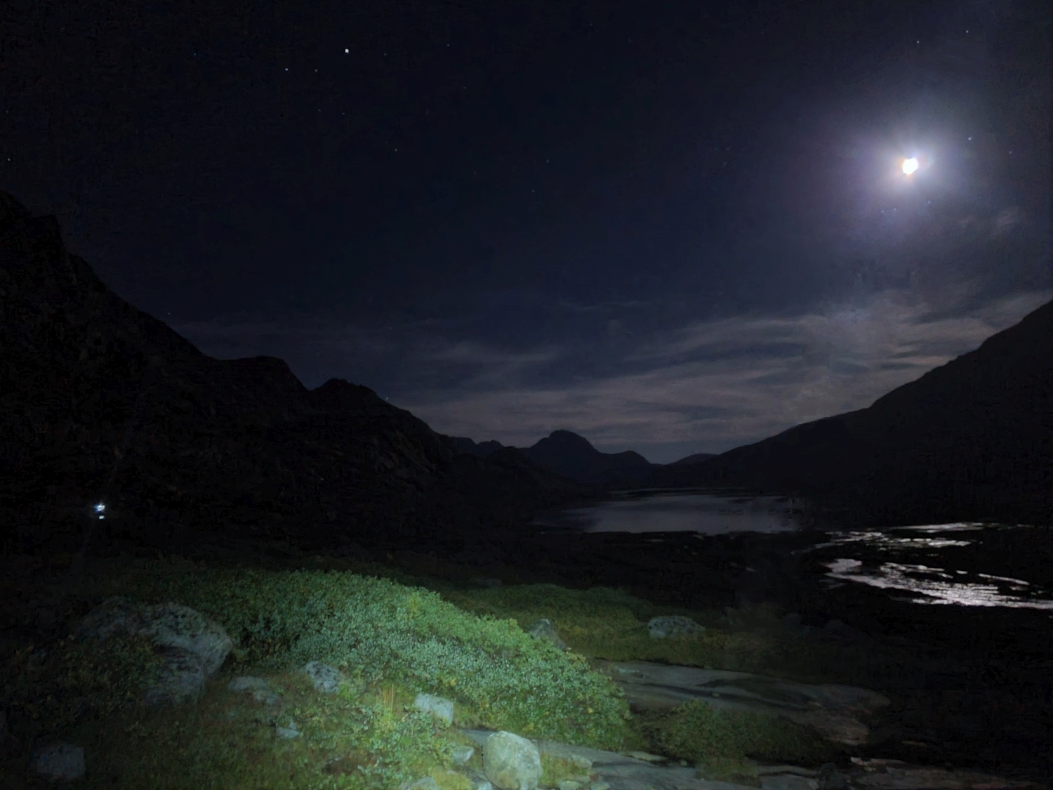
From Bonney Pass, I was rewarded with gorgeous twilight views of Helen and the Spearhead/Forked Tongue Pinnacles. The two large Titcomb Lakes glistened like peachy jewels far below, and the moon shone directly above the summit of Helen. I wasn’t quite done though–I still needed Miriam! In some weird way, the whole project hinged on this moment: the addition of Miriam to the 13ers list was a large part of the reason I “needed” to re-do my 13ers quest, so I could actually summit all of the ranked 13ers in one year this time.
Luckily, Miriam is only a short hike from Bonney Pass, and before long I made the short scramble up the summit pinnacle, reaching the top at dusk. I called my dad to catch up and debrief, noted the new entries in the summit register I placed in July, and beat a hasty retreat.
The descent from Bonney Pass went as smoothly as could be expected by headlamp, and before long I was trudging through upper Titcomb for the fourth and final time this trip. I was happy to knock off another 6 peaks, but now I had an unexpected concern: based on summit registers, I noticed that another climber, Jonathan Zaugg, was completing some of the same 13er traverses one or two days before me, and I wondered if he might actually be attempting the FKT too! I later learned that while he did put in many impressive days, he wasn’t going for the speed record and skipped the peaks north of Titcomb.
I got back to camp around 10:30 p.m. today, almost as late as yesterday thanks to my late start. I settled into my emerging evening routine: collapsing in the tent, drinking Kool-Aid to get my blood sugar back up a bit, eating dinner after I had recovered slightly, and finally falling asleep sometime around midnight. I was getting into a bad pattern of late starts and late nights, but the weather promised to hold for a few more days, making proper alpine timing less essential. With all of the hardest Wind River 13ers behind me, I started to feel cautiously optimistic that I might actually make it…
Approaching camp by headlamp and moonlight. The tent is the spot of light on the far left.