Cloud Peak
Elevation: 13,169 ft.
Prominence: 7,079 ft.
Isolation: 145 miles
Technical Difficulty: Class 2


Cloud Peak Guidebook
Introduction
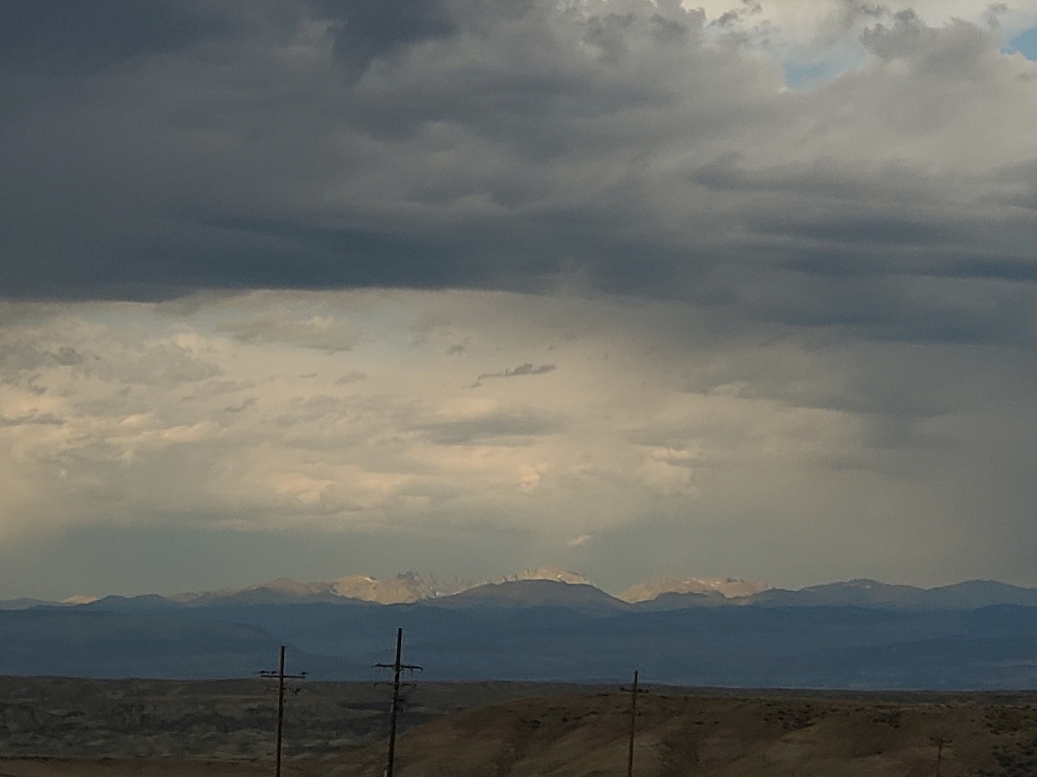
While the Bighorns are not as popular as other Rocky Mountain ranges, this area harbors just as impressive an array of alpine lakes, big walls, and remote spires as almost anywhere else in the contiguous U.S. Cloud Peak, as the highpoint of the range and one of the three ultra-prominent peaks in Wyoming, is a great introduction to the state’s mountains. It is also one of the easiest Wyoming 13ers in general, both in terms of technical difficulty and distance from the trailhead.
General Considerations
Most people climb Cloud Peak as part of a short backpacking trip, but it is also a reasonable day-hike for those who are comfortable with ~25-mile days, since most of the distance is on a good trail. Only the most popular routes are described here, but as always, there is no need to limit yourself, and accessing the peak from a different trailhead or traversing more of the range is certainly worthwhile too.
Route 1: Southwest Ridge – Class 2
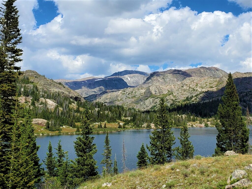
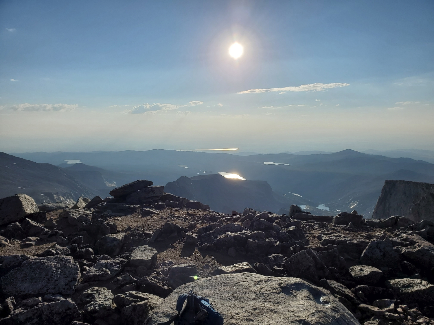
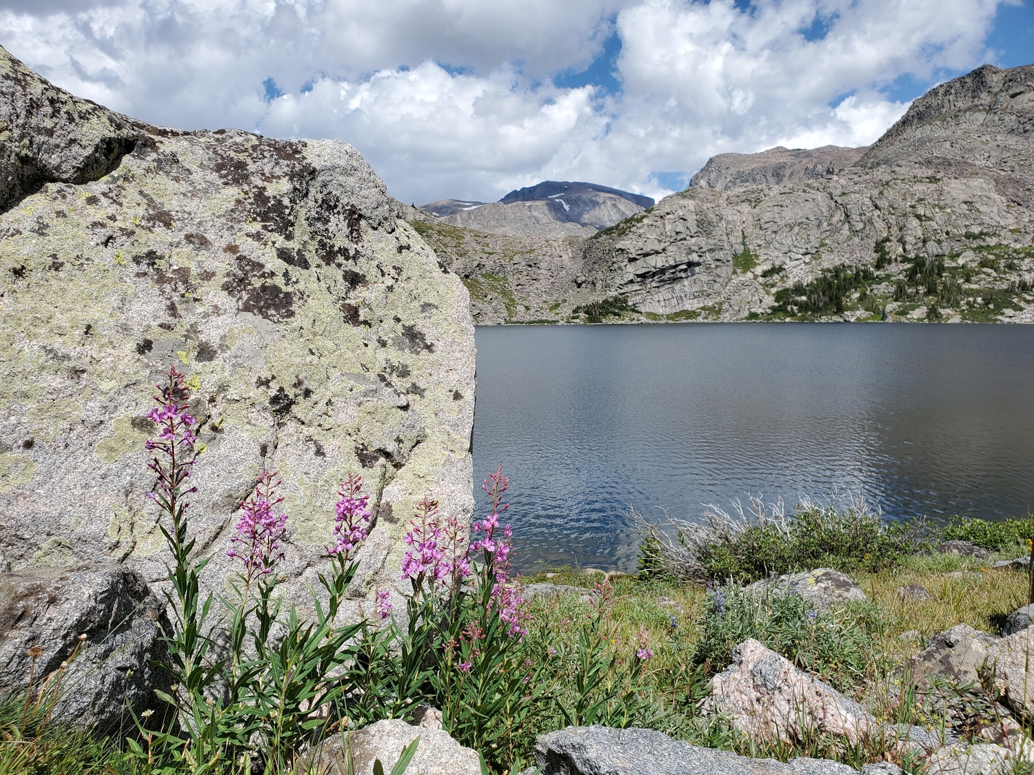
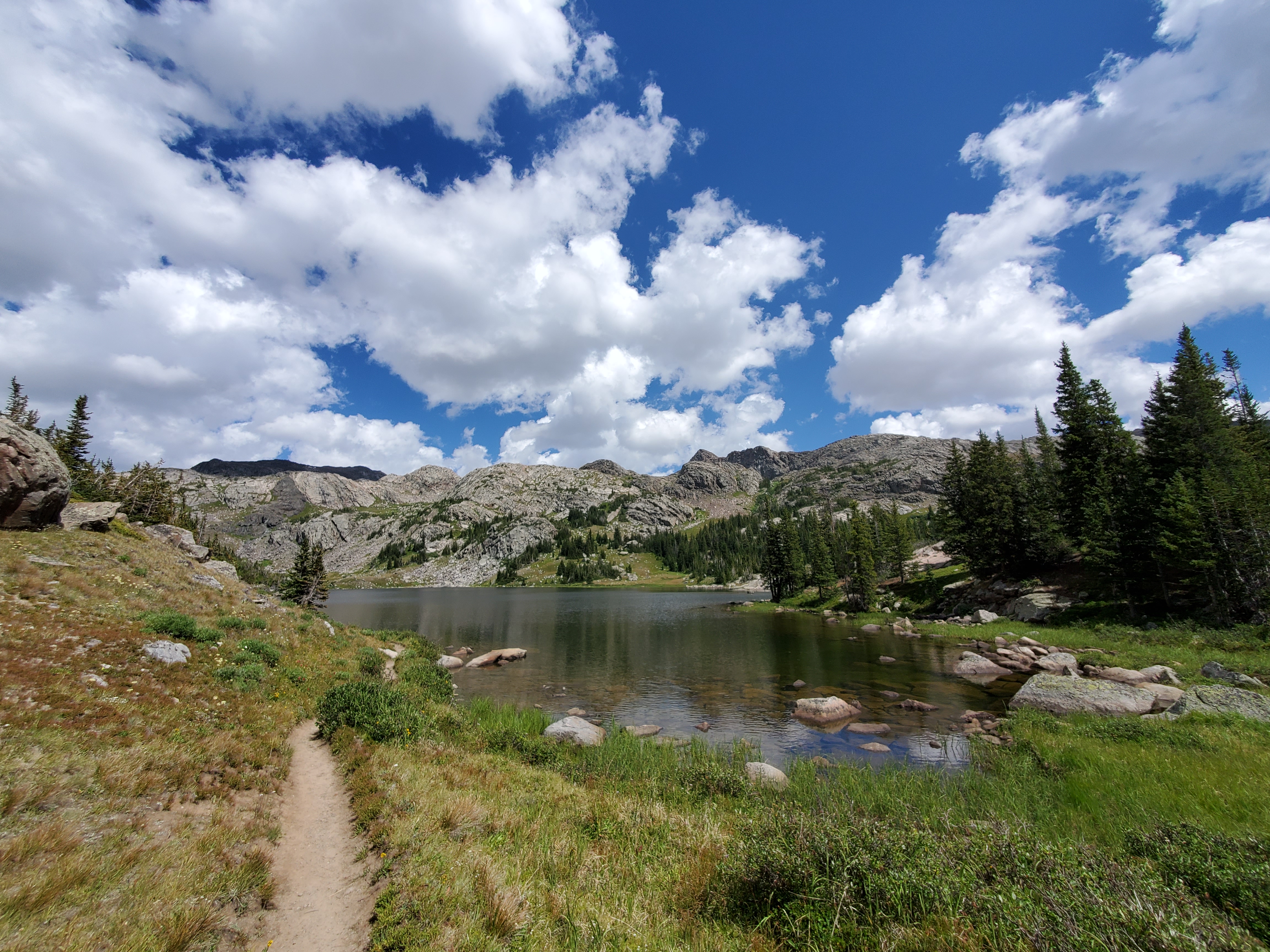
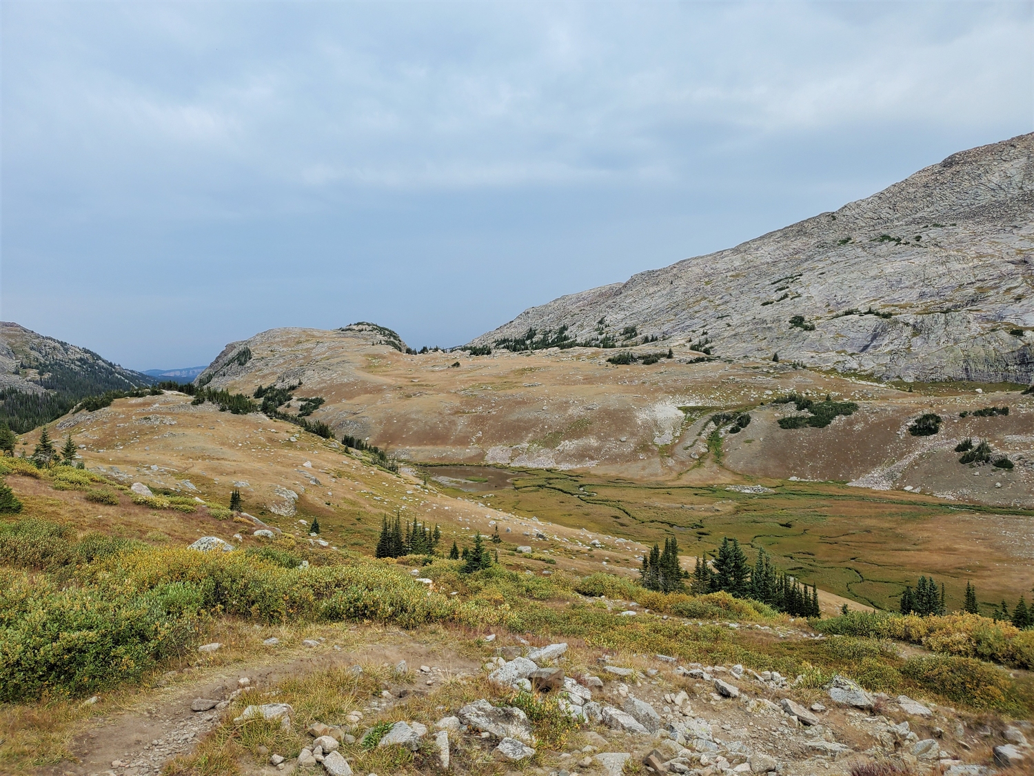
From the West Tensleep Trailhead, follow the scenic Mistymoon Trail past Lake Helen, Lake Marion, and Mistymoon Lake (each of which are popular backpacking destinations). At Mistymoon Lake, stay on the northbound trail and cross a slight pass into the Paint Rock Creek drainage, leaving the trail at a convenient point to travel off-trail across a meadow to reach Paint Rock Creek.
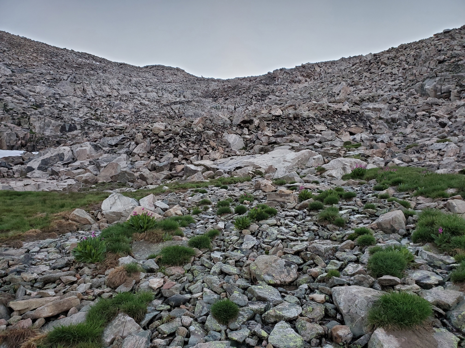
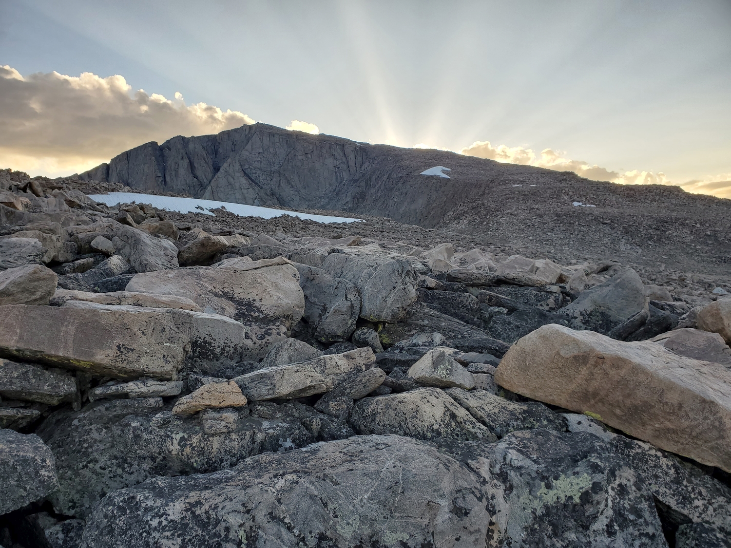
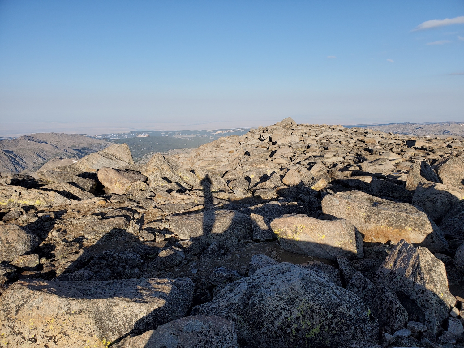
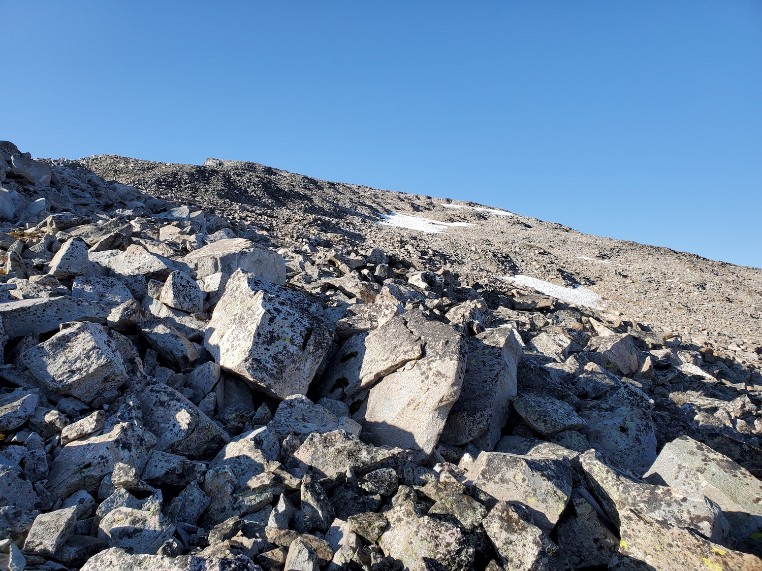
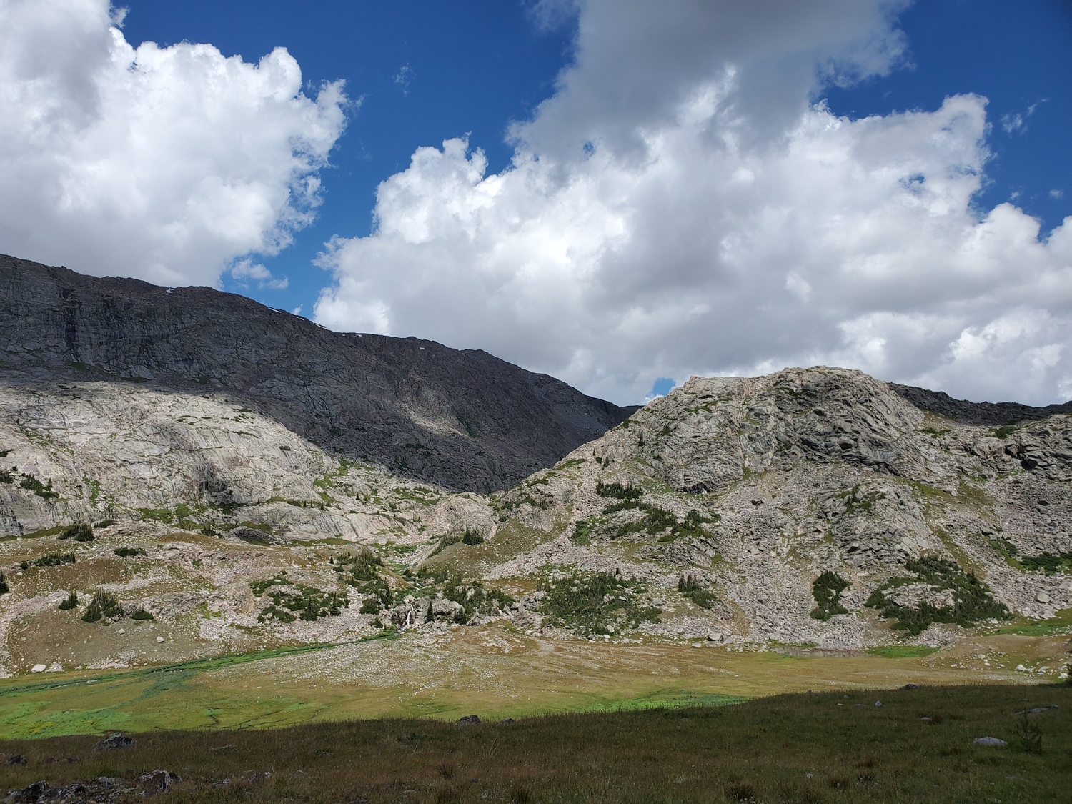
Hike cross-country up the Paint Rock Creek drainage over mixed grass and talus to about 10,600 ft., at which point the route begins climbing slightly left (northeast) away from the creek and into a subsidiary valley. Climb talus at the head of the subsidiary valley to reach Cloud Peak’s broad, talus-covered southwest ridge around 12,000 ft.
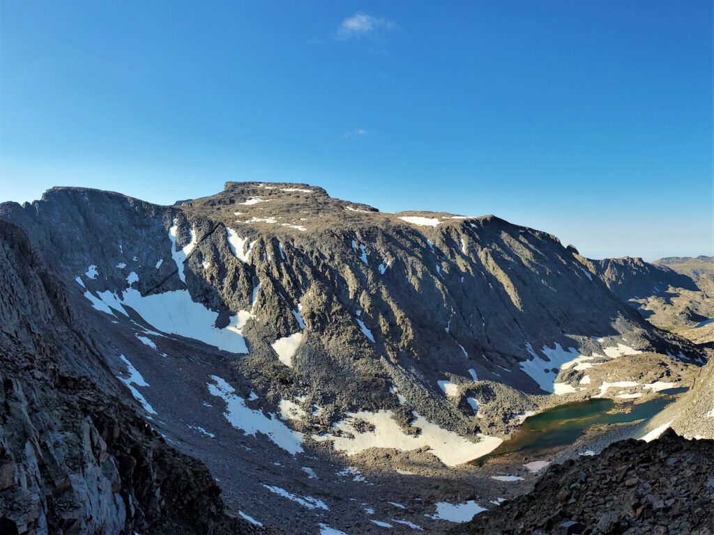
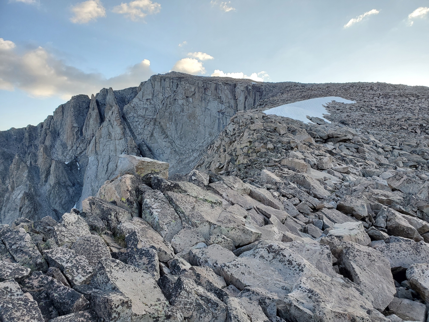
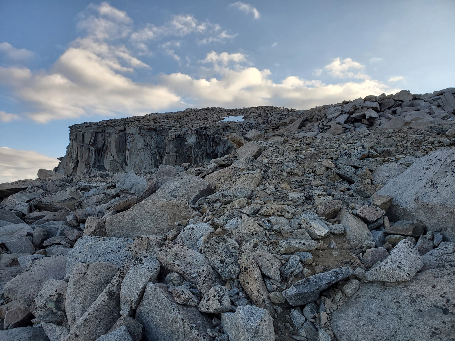
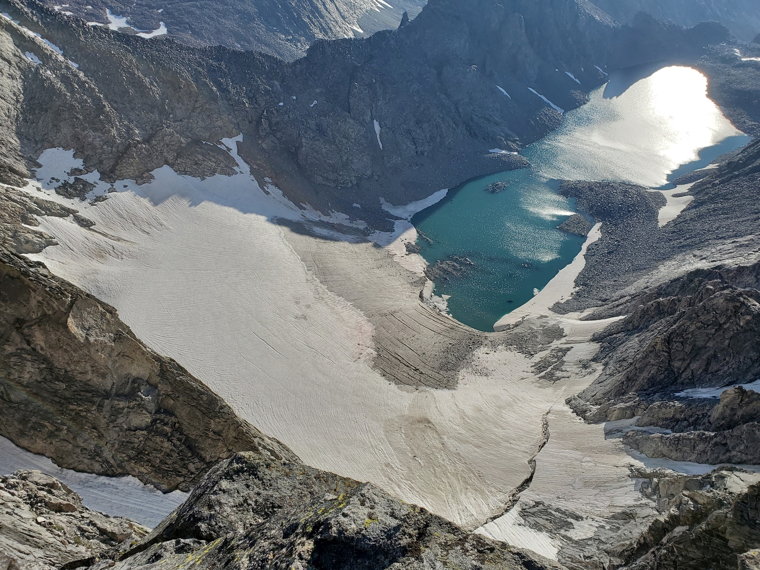
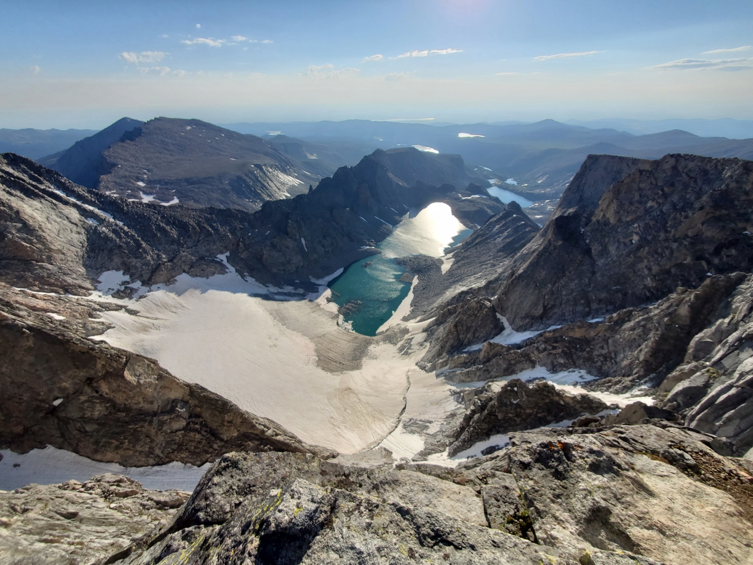
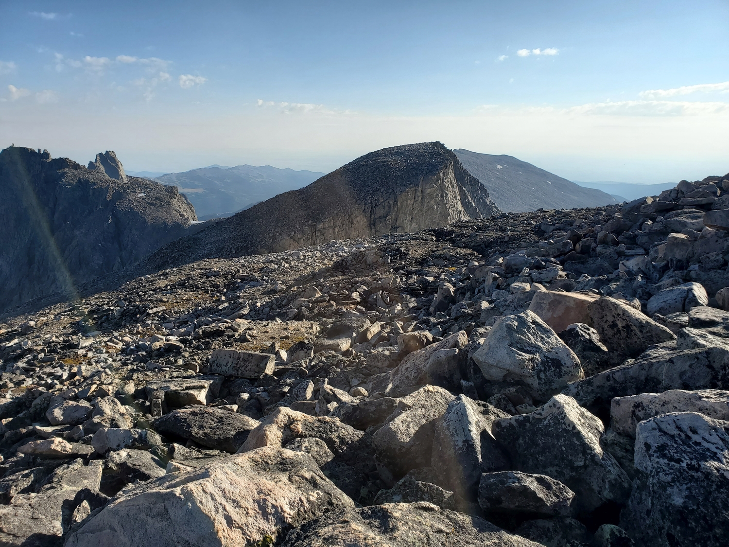
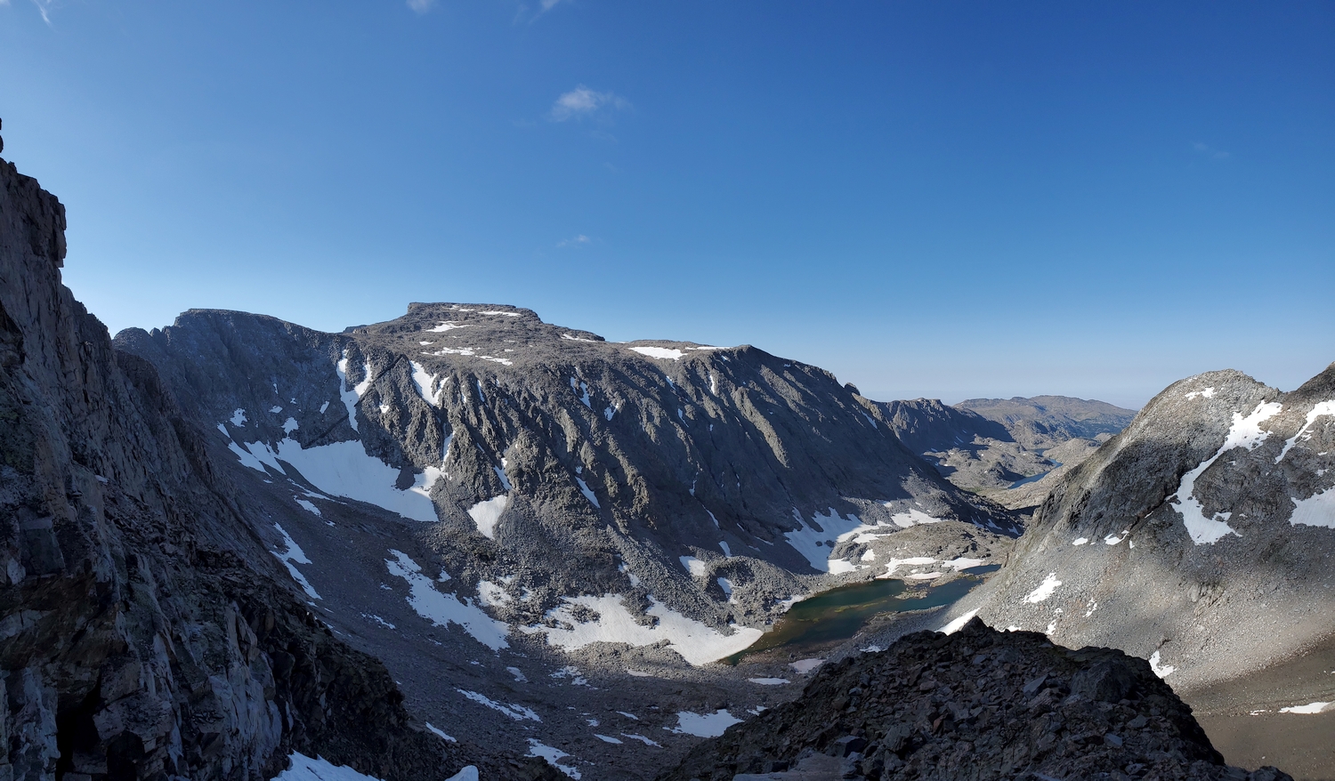
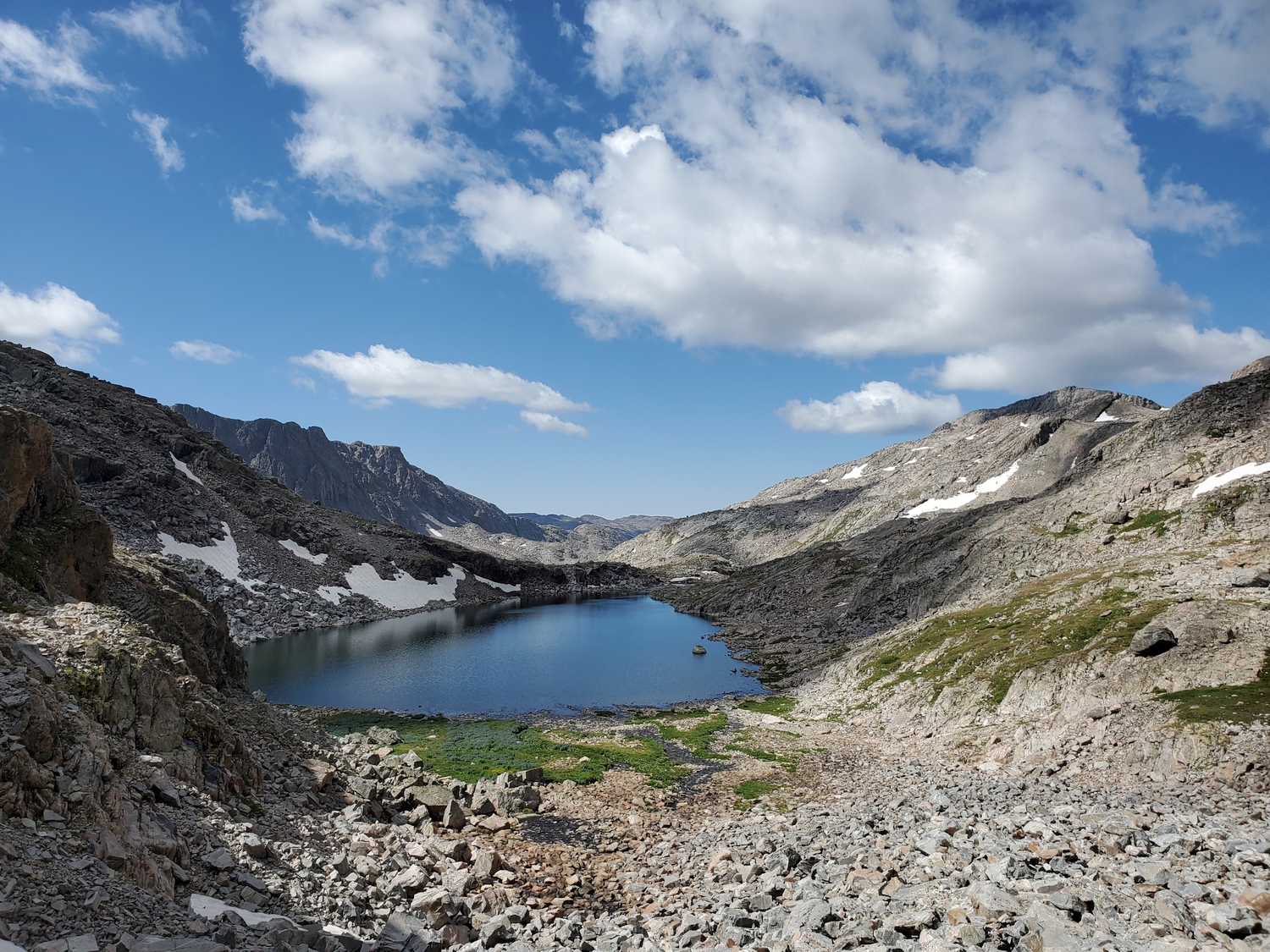
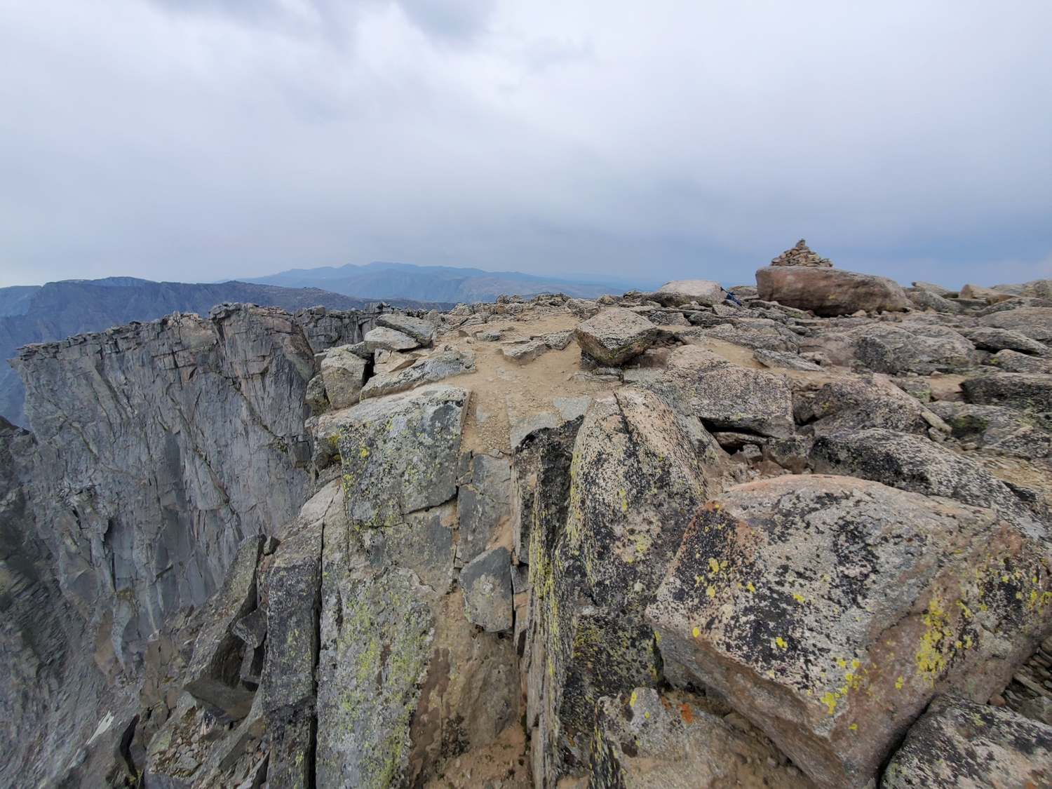
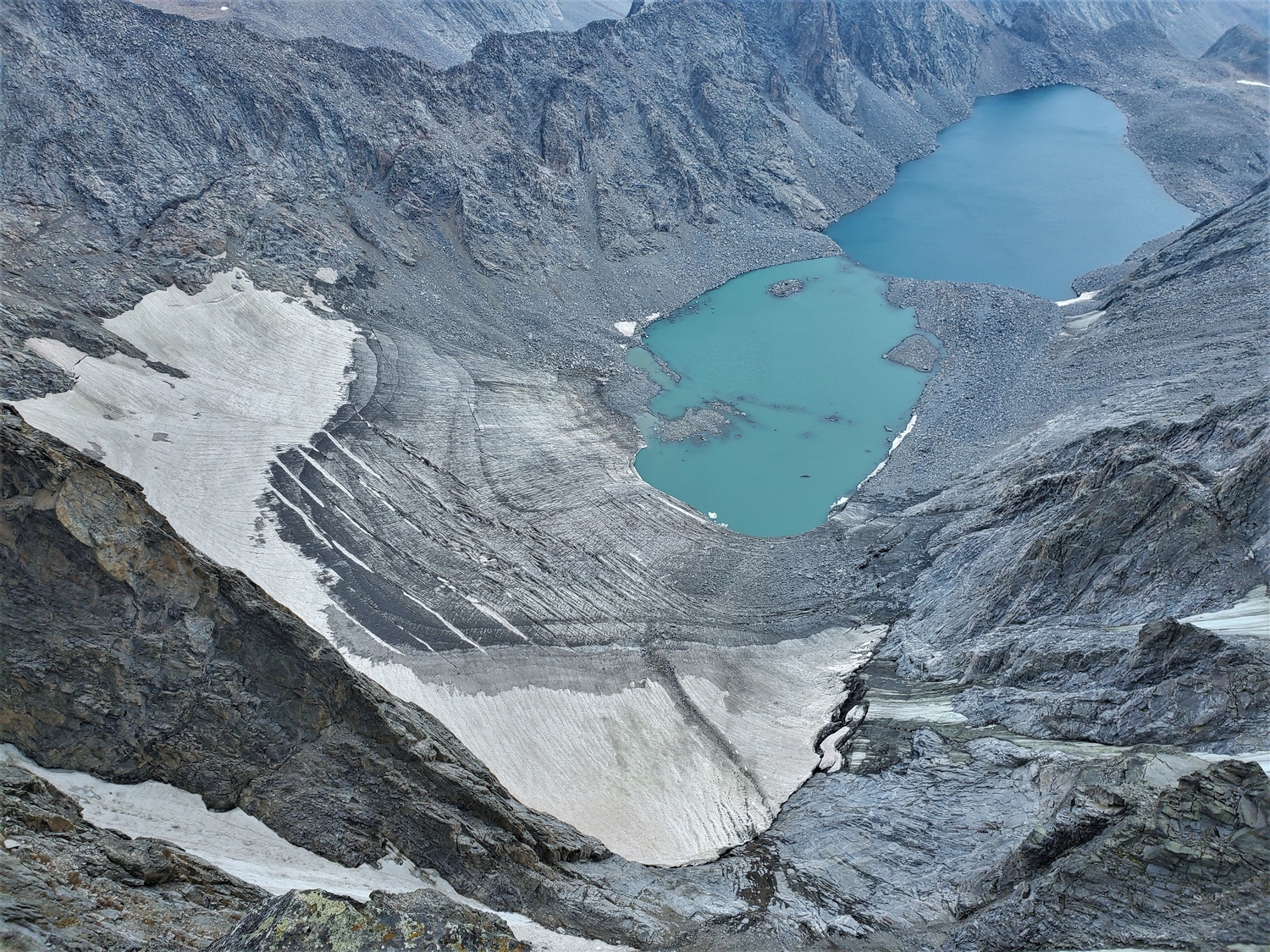
From the talus plateau at the top of the subsidiary valley, the southwest ridge narrows to a thin line of rocks which provides a connection to Cloud Peak’s upper slopes. The final ascent consists of a few hundred feet of clambering around giant boulders on the south slope of Cloud’s summit plateau. The highpoint, marked by a cairn, is located close to the precipitous east face and affords stunning views of the Cloud Peak Glacier and Glacier Lake far below.
Route 2: North Slopes – Class 3, Mellow Snow
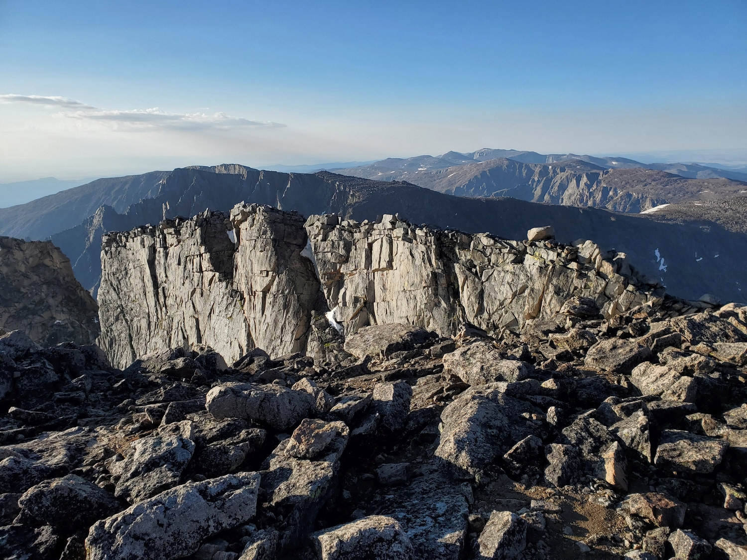
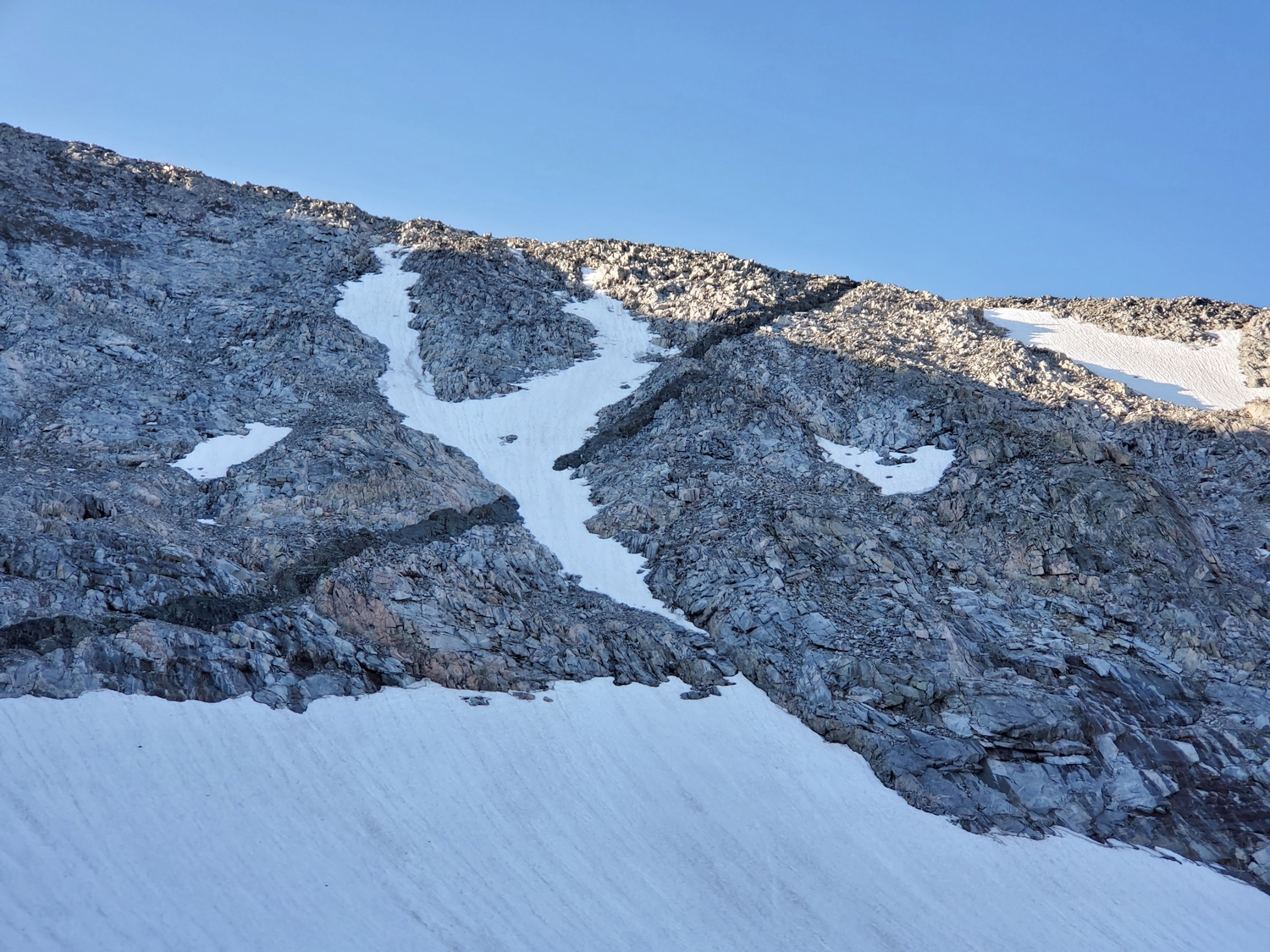
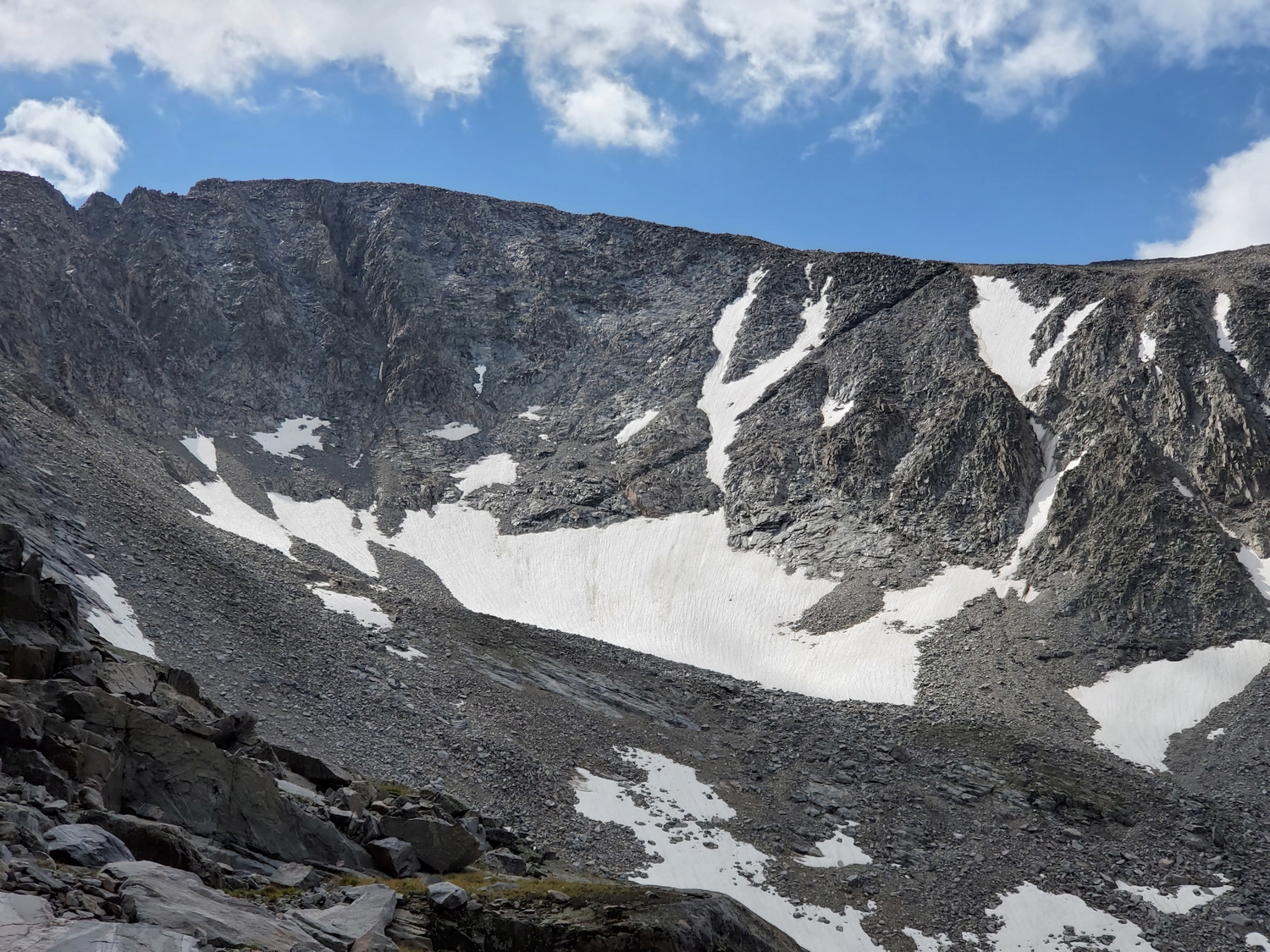
Despite its intimidating appearance from afar, the north face of Cloud Peak has a little-known route that enables an ascent from (or descent to) Wilderness Basin, which is the long west-facing valley that reaches from Lake Solitude past Middle Cloud Peak Lake to the cirque of Black Tooth, Woolsey, the Innominate, and Cloud Peak. Since Wilderness Basin has no trails, accessing this area is left as an exercise in wilderness routefinding.
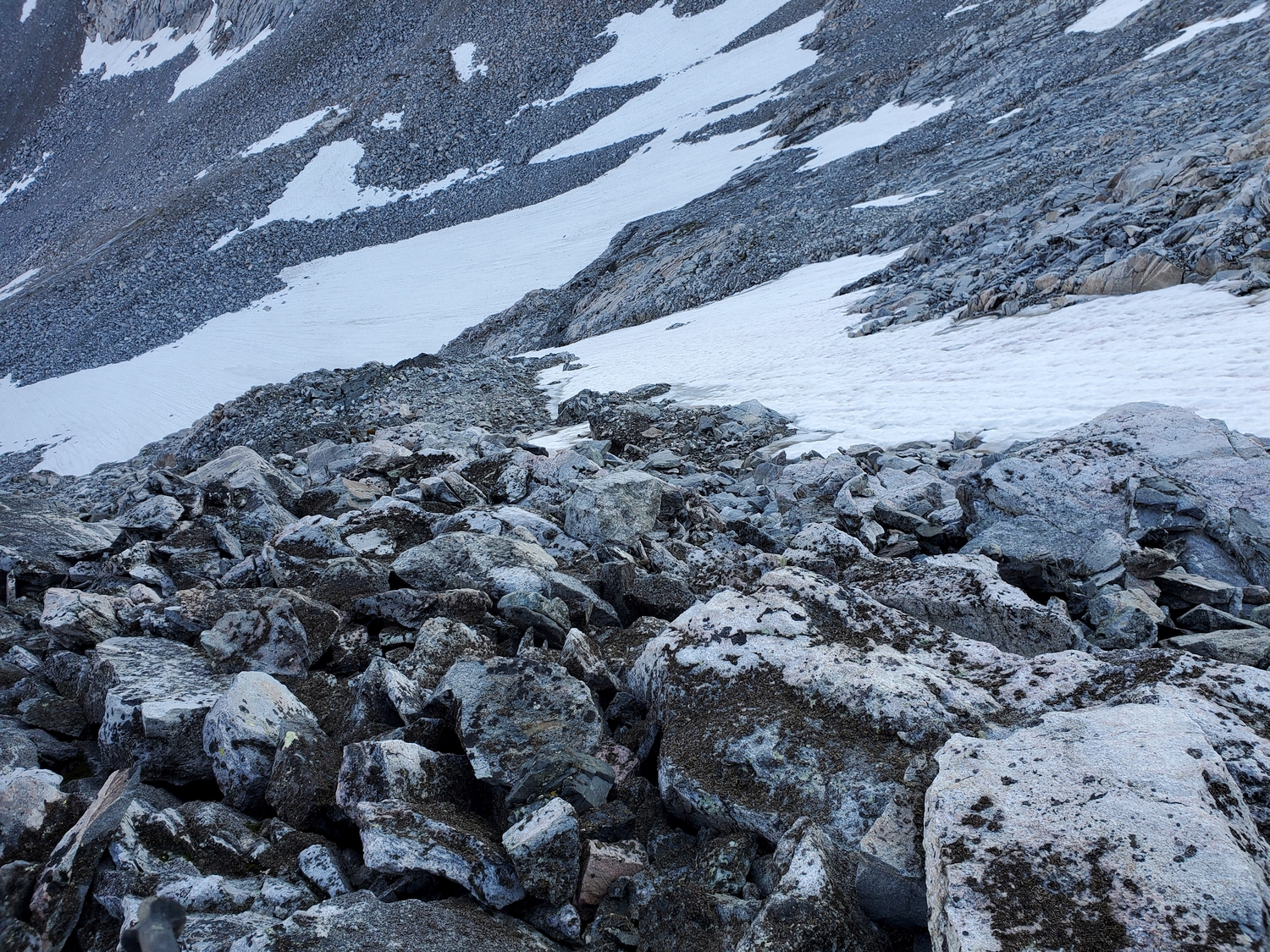
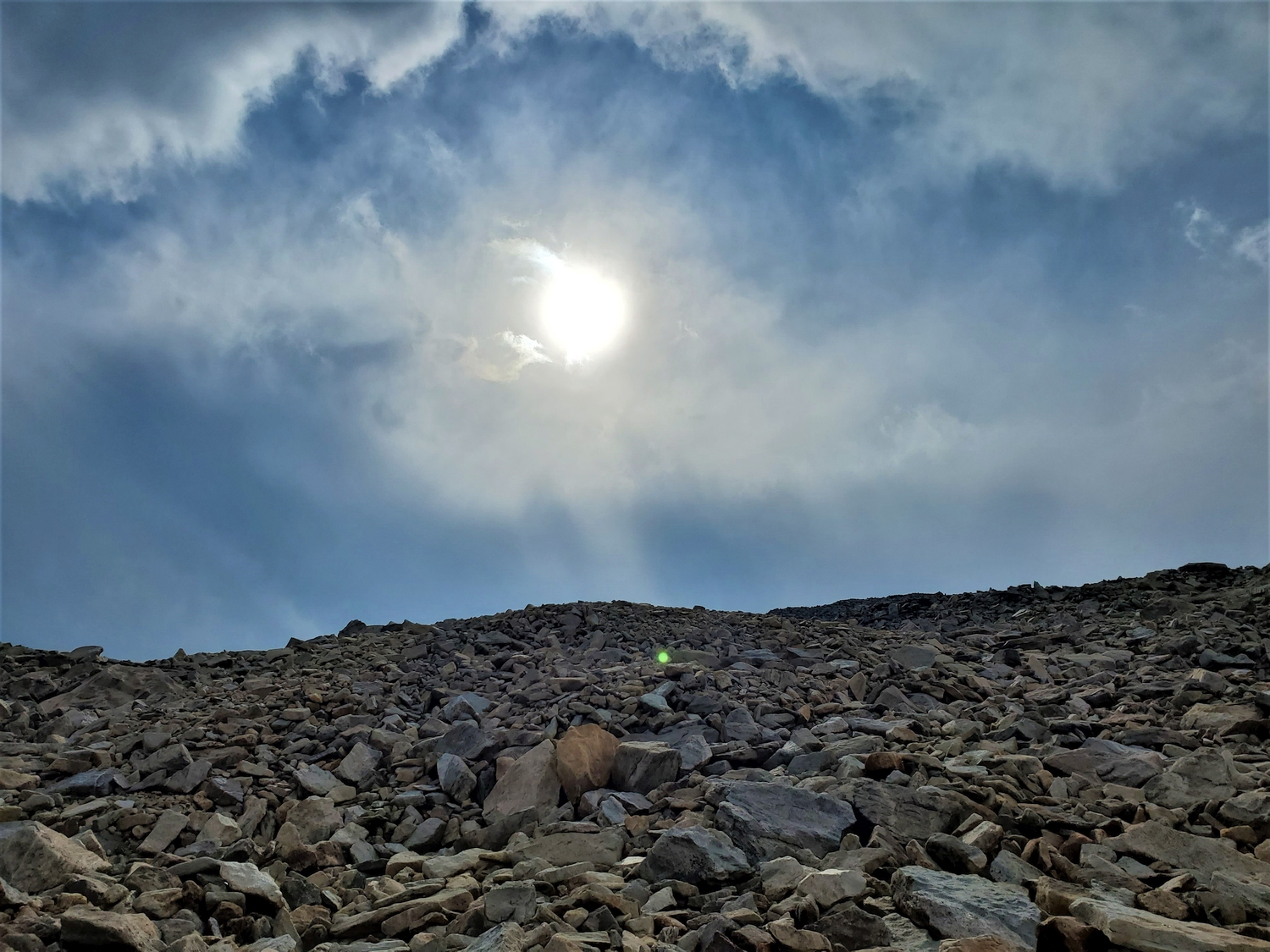
From Lake 11170 at the head of Wilderness Basin, head southeast up steepening talus slopes towards a persistent snowfield at the base of Cloud’s north slopes. The route’s general location can be identified based on a large, right-angling dike of black rock. In general, the easiest terrain is found a short distance to climber’s right of the dike. After crossing the snowfield (if it hasn’t melted yet), the route becomes straightforward and entails mixed hiking and basic scrambling up highly fractured terrain. Small cliffs interrupt easy progress, but there is always a way forward if you keep looking for the path of least resistance. Before long, the route emerges onto Cloud’s vast, low-angle northern plateau, and the summit is close by.
Cloud Peak Map
Cloud Peak Panorama
Cloud Peak Photos
-
- The Bighorn Range looms in the distance as we drive across the Bighorn Basin under moody skies (2020)
-
- After a night-hike approach on the Mistymoon Trail, I reach the first off-trail section at dawn (2020)
-
- Beginning the descent of the north face, a route that had never been publicized prior to this trip (2020)
-
- Decayed rappel webbing, proof that I am not the first person to descend this route, though the terrain is sufficiently easy that one wonders why a rappel was necessary (2020)
-
- My route descended the rock rib just right (west) of the Y-shaped couloir, angling towards the point where the couloir meets the larger snowfield (2020)
-
- The north face looks steeper from afar; my descent route crossed the black dike and followed the rock rib to the base of the Y-shaped couloir (2020)
-
- This meadow, where the Solitude Lake Trail leaves Paint Rock Creek, marks the turnoff-point for the standard route to Cloud Peak’s southwest ridge (2020)
-
- Lake Marion, another scenic spot in the Bighorns; this entire area is quite popular with backpackers (2020)
-
- The morning twilight revealed a mostly clear sky over Lake Helen, the first break in the dense forest about 4.7 miles from the trailhead.
-
- However, within a few minutes a high sea of clouds drifted in from the west. It made for a nice sunrise but dashed my hopes of a cloudless morning.
-
- The ridge narrows to a thin crest around 12,400 ft., beyond which the talus gets a lot bigger for the final ascent.
-
- The storm cell that rained on me had now moved east, where it was dramatically backlit by the morning sun.
-
- Looking back at the north face of Cloud. I was able to bypass most of the ice on loose talus and scree.
-
- By 2 p.m., stormy weather has returned, and I’m glad not to be on the peaks anymore. Black Tooth is the split summit on the far left in the distance, and Cloud is the hulking massif on the right.
-
- Stormy lighting makes for evocative autumnal views as I hike through subalpine meadows along Paint Rock Creek. I took another break near here to refill water and snack on some carob chips.
-
- The only section of the trail that gives me pause is the pass between Paint Rock Creek and Mistymoon Lake, where the trail is above treeline and relatively exposed to the weather. The first thunder rumbles as I hike through, but it’s not too close.
-
- As I descend the pass, a huge bolt of lightning strikes the shadowed ridge seen here, less than 2 miles away from me. Good thing I’m headed down–I wouldn’t want to be climbing Cloud Peak right now!
-
- At last, I return to Mistymoon Lake, having now closed the loop and made it back to treeline for the last time today. There was a lone backpacker camped at the lake, and it was comforting to no longer be the highest human in the Bighorns, but I wondered if he knew he was about to get snowed in.
-
- It sprinkles on and off as I hike down the well-maintained trail, but the rain is concentrated up higher on the peaks. I’m actually quite grateful for the humidity, since it’s easier on my lungs after so many days breathing bone-dry air.
-
- Looking back across Lake Helen, where I stopped for dinner around 5:30 p.m. (a cream cheese bagel and assorted snacks). The high peaks have completely disappeared into the storm.
-
- Looking back into the mountains from the last meadow before the trailhead. The wind stopped as the storm settled over the range, and a cold drizzle began to fall.
-
- West Tensleep Lake. The skies opened up and started pelting me with hail around here, just a half mile from the parking lot.
DISCLAIMER: Mountain climbing is dangerous. Activities described on this page may lead to serious injury, death, and property damage. This webpage is presented with no warranty express or implied. Pictures and text are for entertainment purposes only. No commercial use allowed; all rights reserved.