Grand Teton
Elevation: 13,775 ft.
Prominence: 6,534 ft.
Isolation: 69 miles
Technical Difficulty: Class 5.4


Grand Teton Guidebook
Introduction
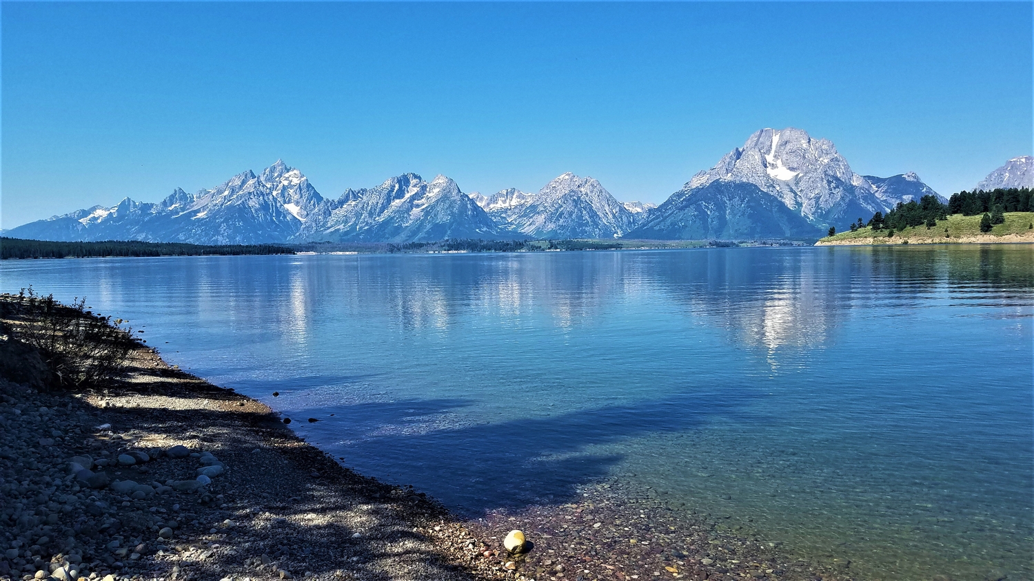
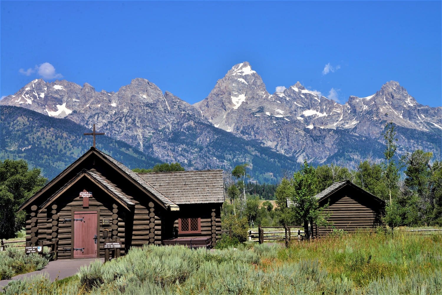
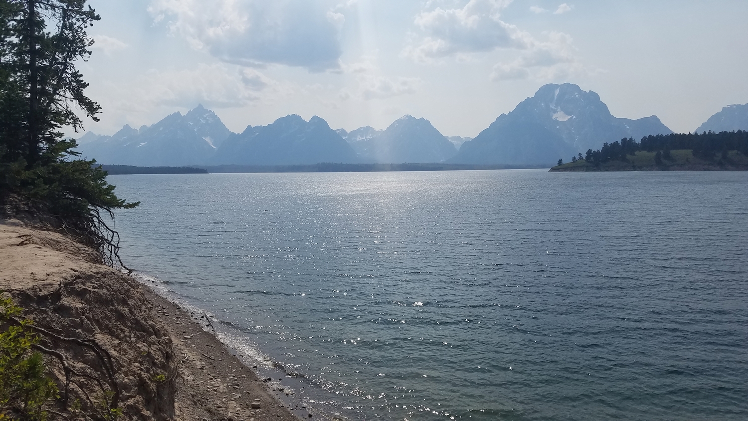
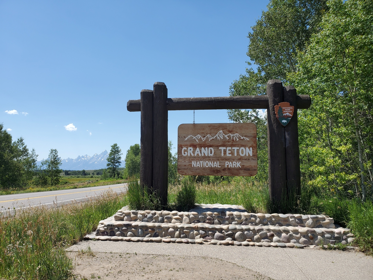
The most famous peak in Wyoming needs no introduction. Simply drive to Grand Teton National Park, park at one of the numerous pull-outs, and look up. There’s your introduction!
General Considerations
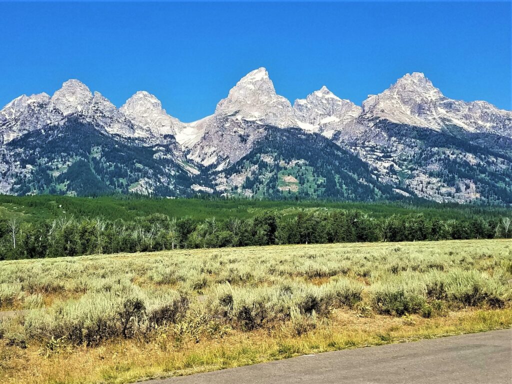
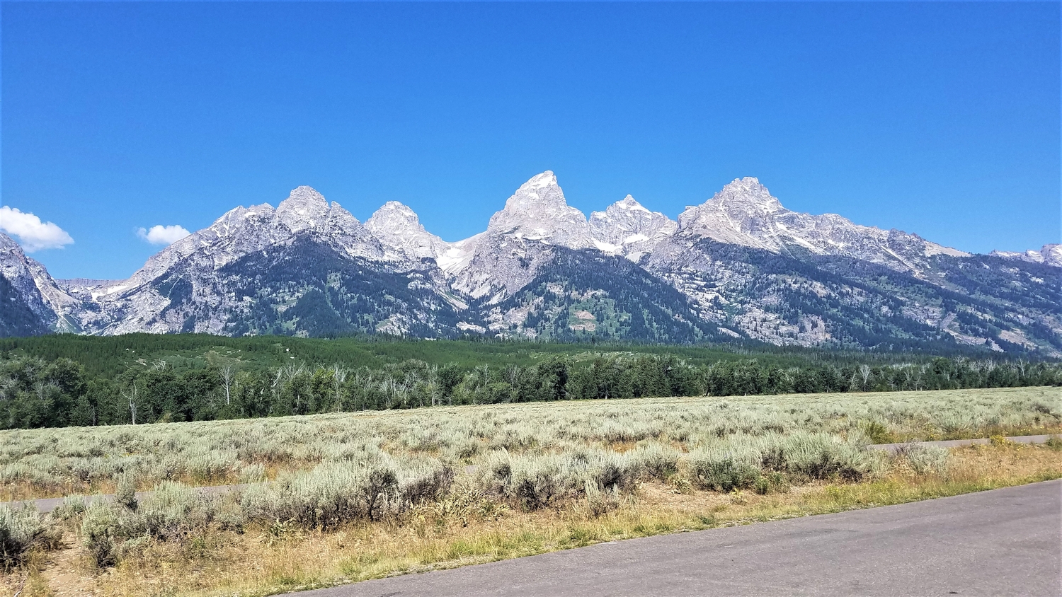
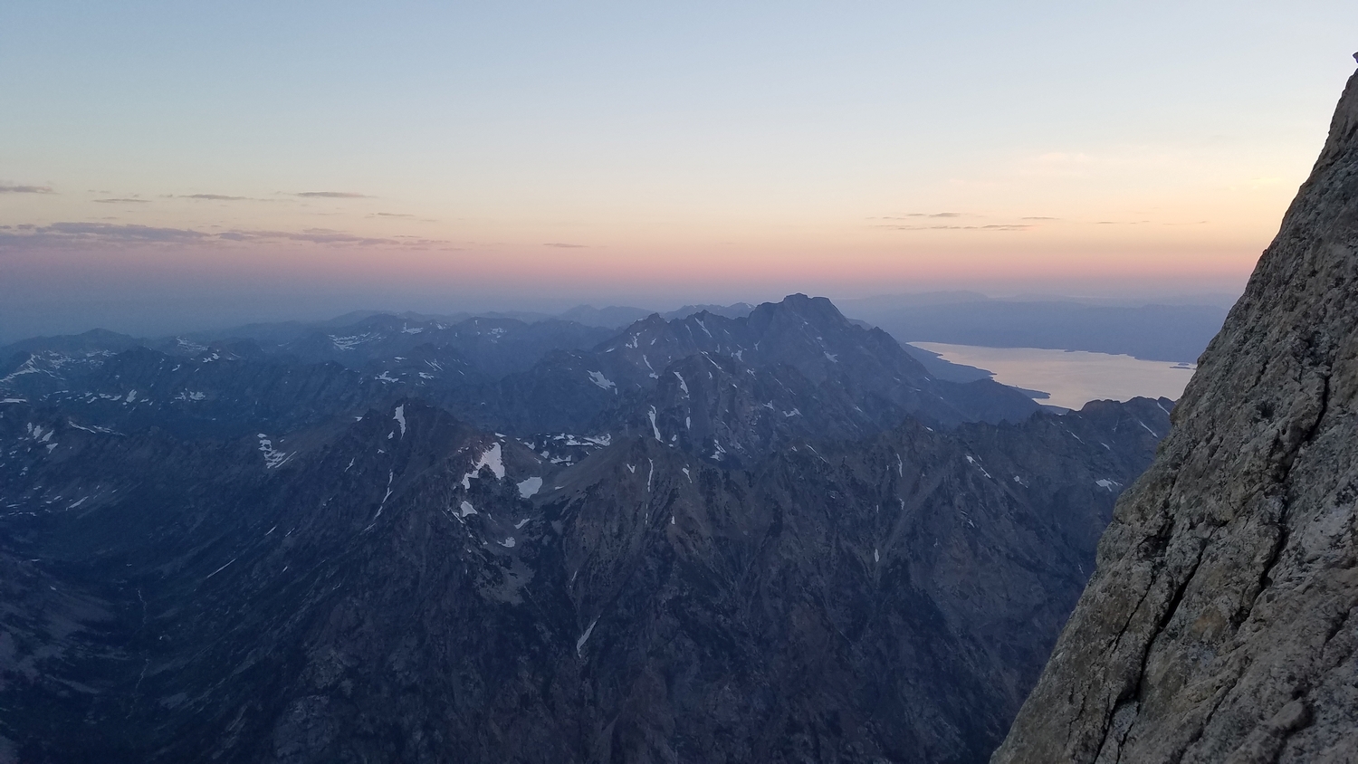
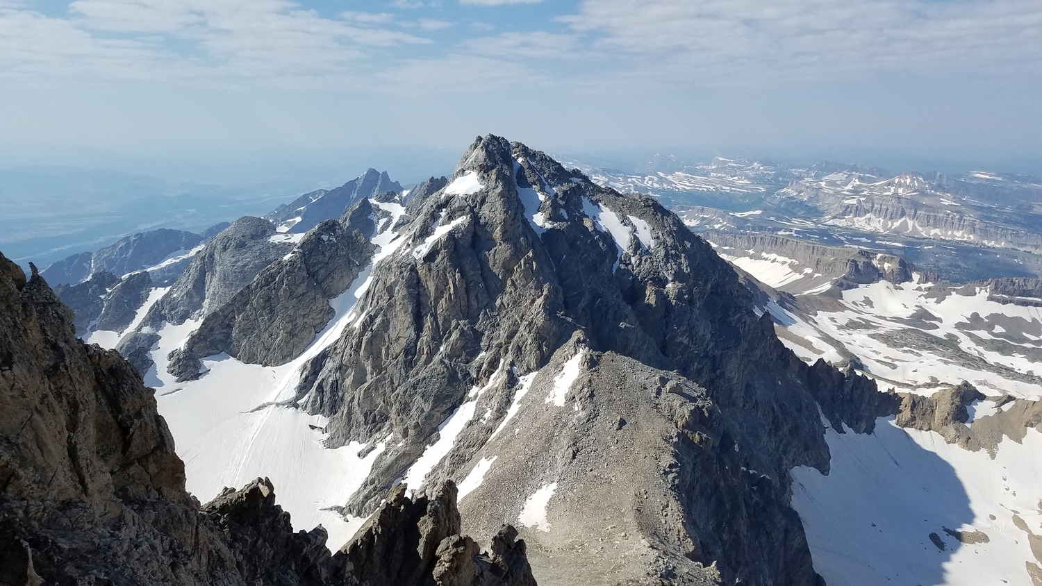
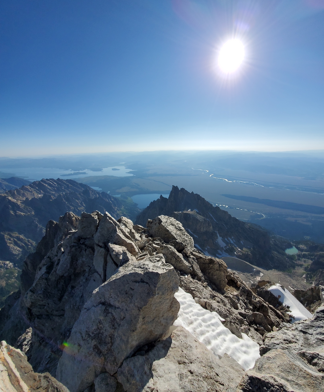
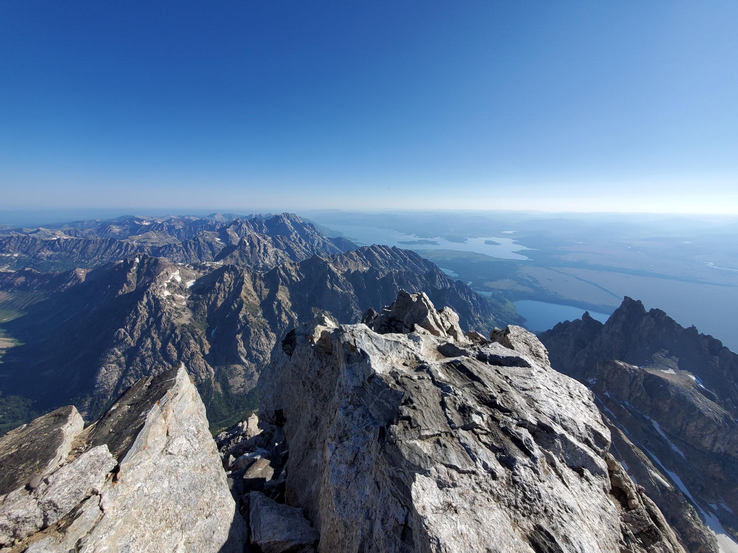
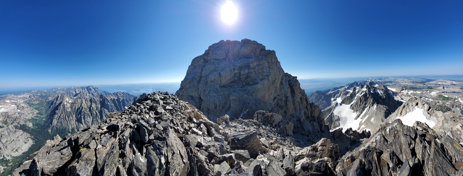
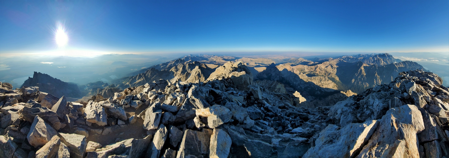
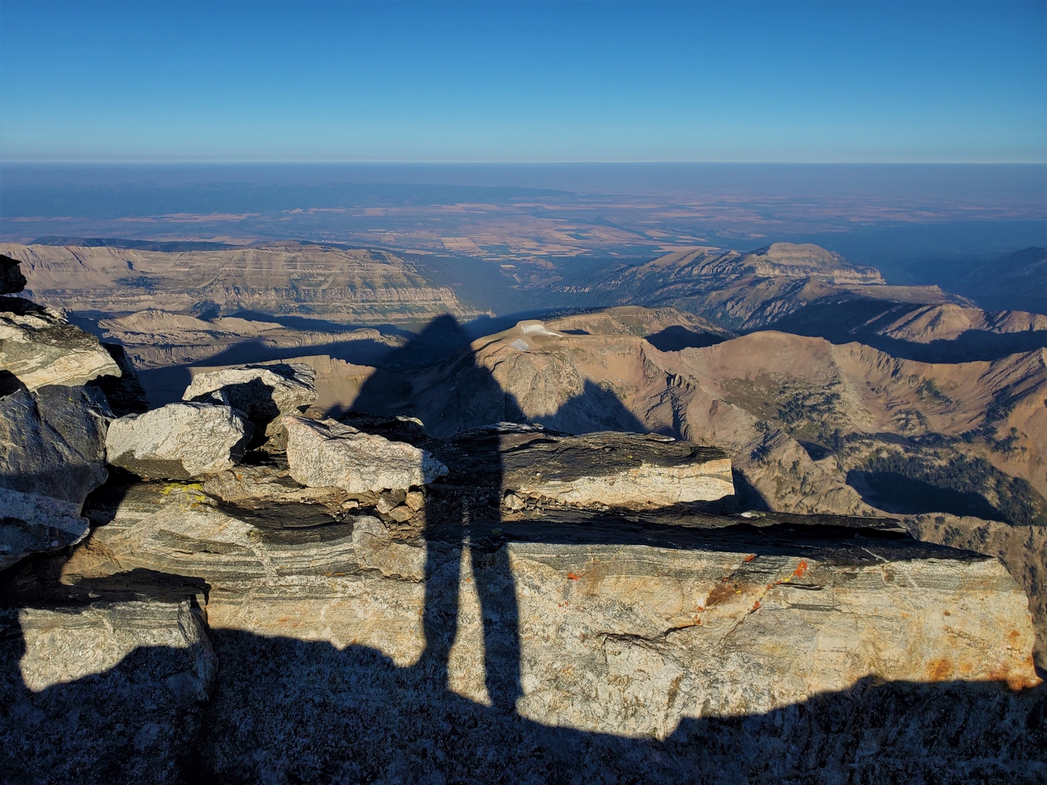
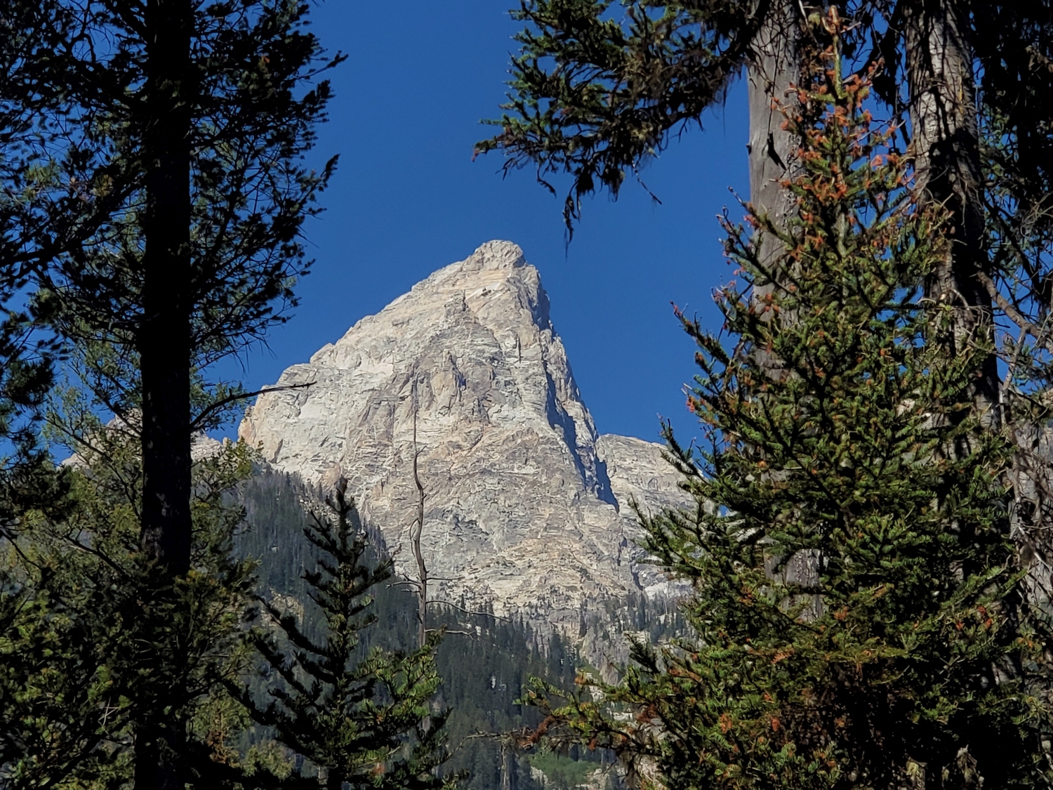
Looming 7,000 ft. above the Snake River Valley, it is clear why the Grand Teton is one of the most-climbed peaks in Wyoming. It is also one of the most technically challenging of the Wyoming 13ers, rivaled only by Spearhead Pinnacle in terms of the most-difficult climbing moves on the standard summit route.
The Grand Teton is a peak of paradoxes: difficult but frequently climbed, heavily traveled but confusing to navigate, close to the trailhead but usually climbed in multiple days. It is also the only peak in Wyoming which has a significant fraction of guided climbers, with a long tradition of guiding in the Tetons contrasting the self-reliant ethic of the Winds and other Wyoming ranges. Do not let the presence of hundreds of other climbers lull you into a false sense of security; the Grand is a very serious mountain, and people die here every year on average.
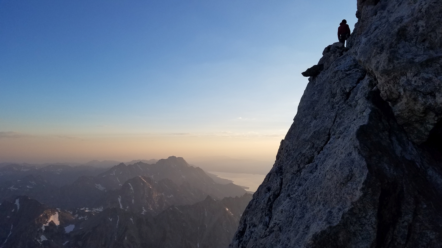
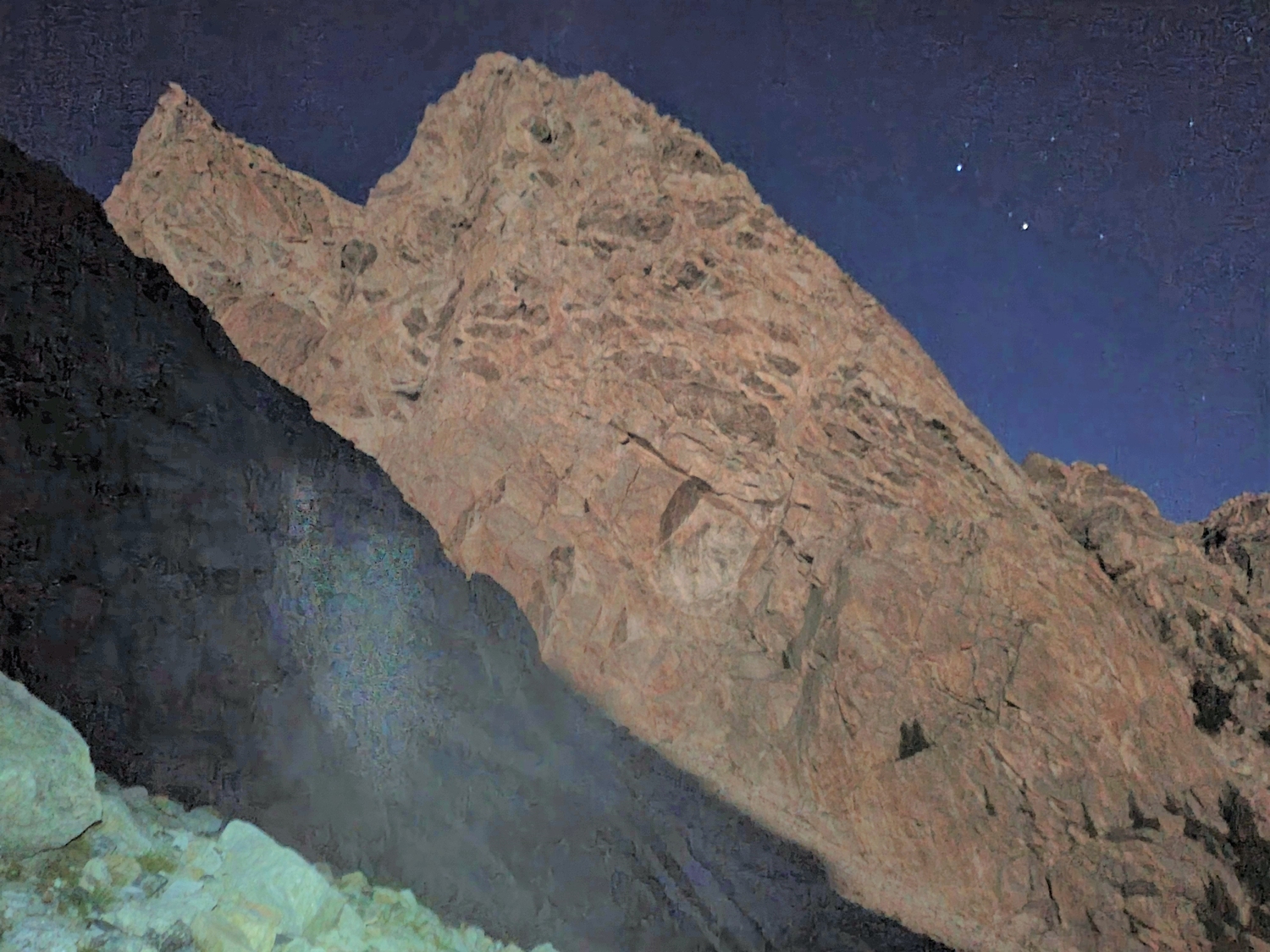
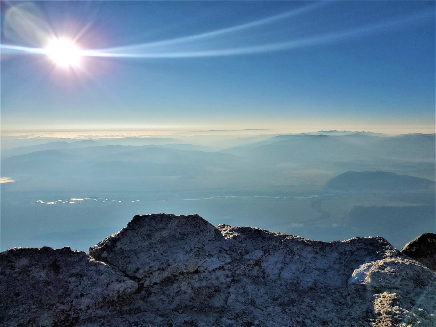
Only climbers with significant experience leading alpine trad climbs should consider an unguided ascent of the Grand Teton. Soloing this peak is beyond the scope of any guidebook description and is, in general, discouraged. One mistake or a slip on a patch of ice (common even in late summer) and you could tumble 3,000 ft. into Valhalla Canyon.
Route 1: Owen Spalding Route – Class 5.4
There are innumerable routes on the Grand, not to mention the plethora of climbing objectives in the wider Tetons, but the Owen Spalding is the sole focus here since it is the shortest and easiest route to the summit. Even for just this one route, many variations exist, and only the main variation is described here. Easiest does not mean easy, and this route is nevertheless far more difficult and exposed than most “scrambling” routes in the Winds and Colorado Rockies.
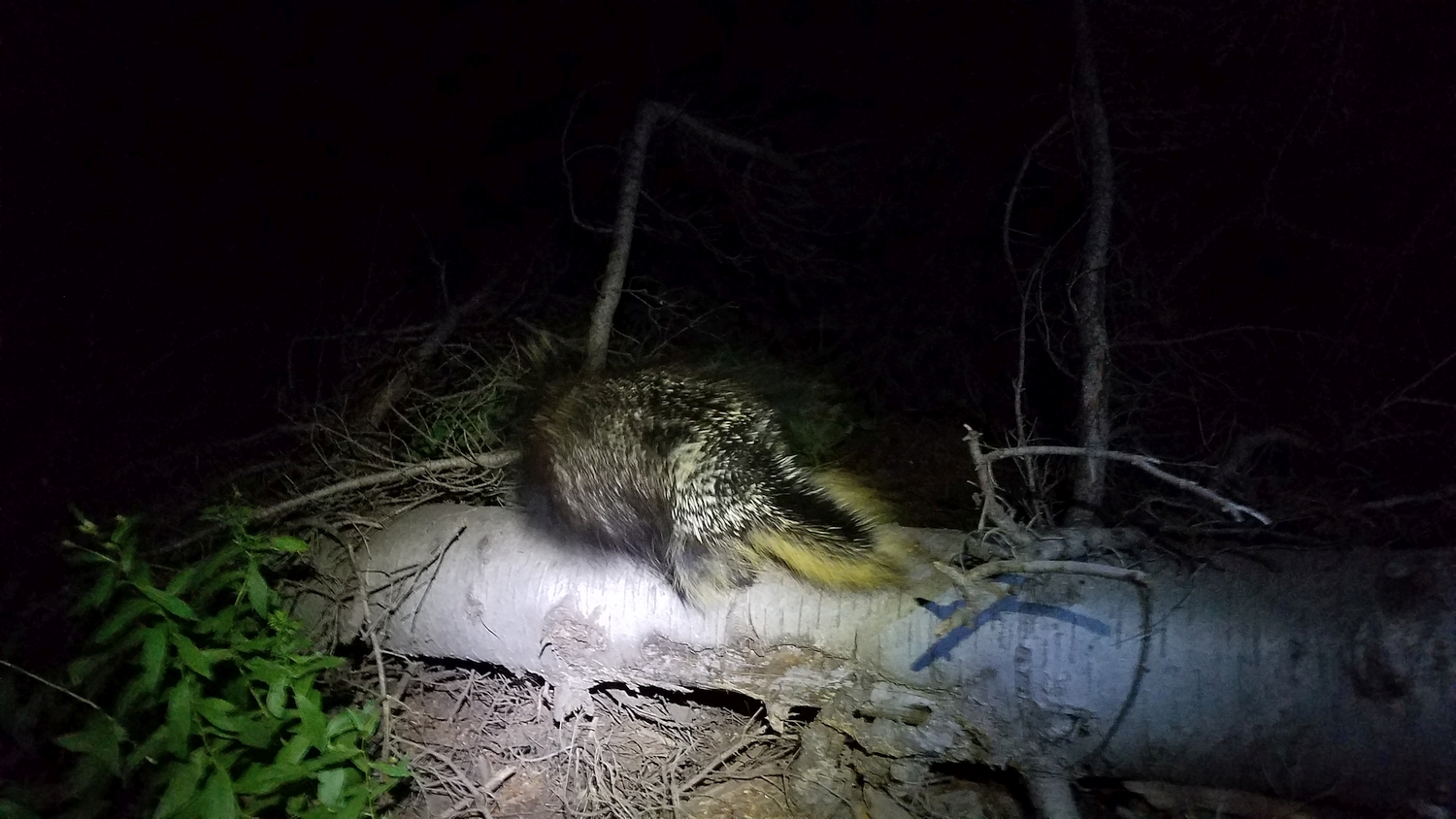
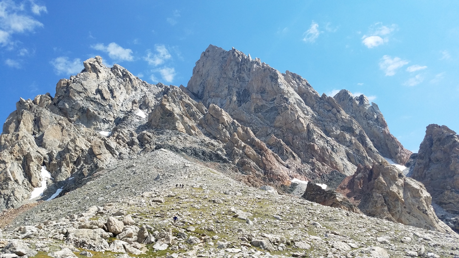
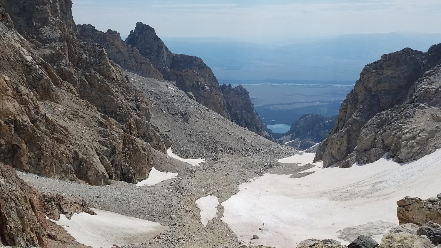
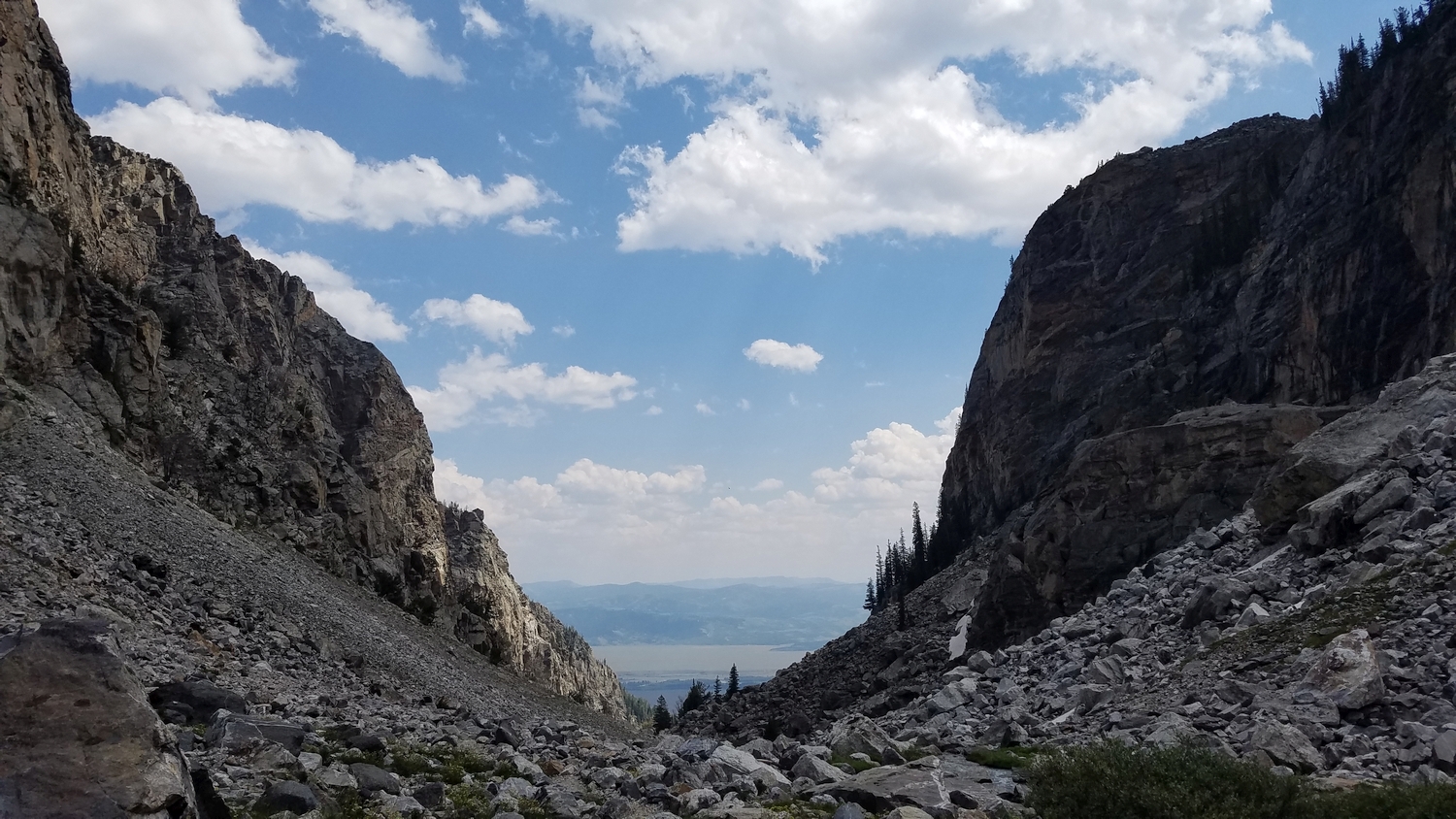
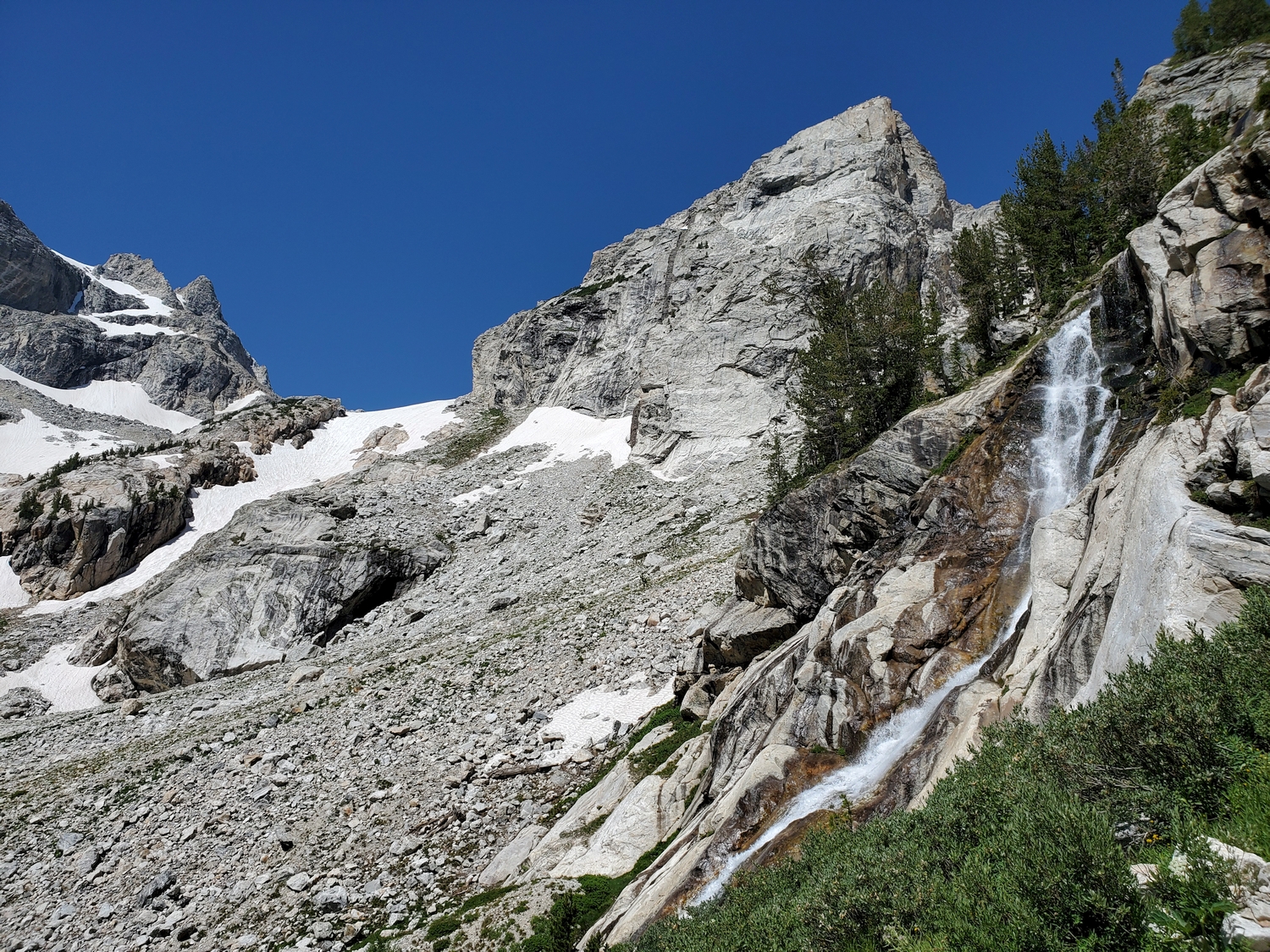
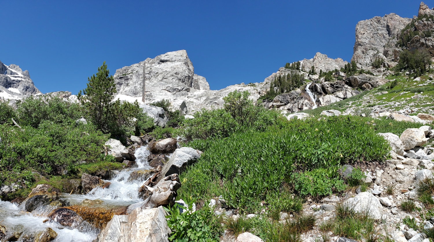
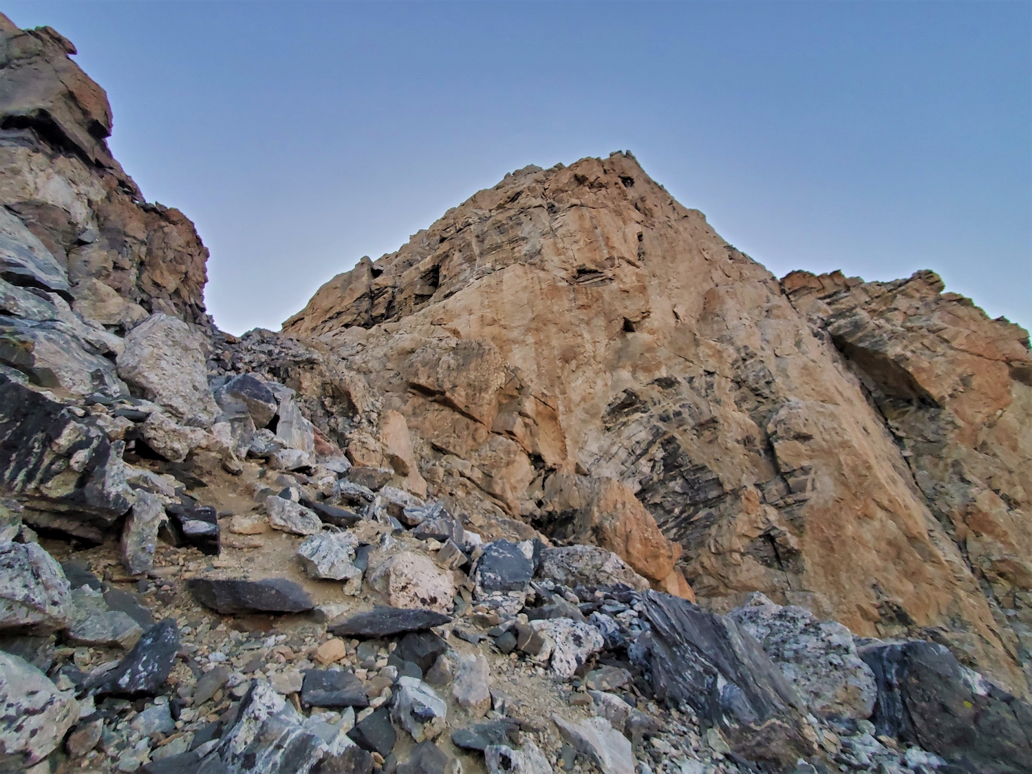
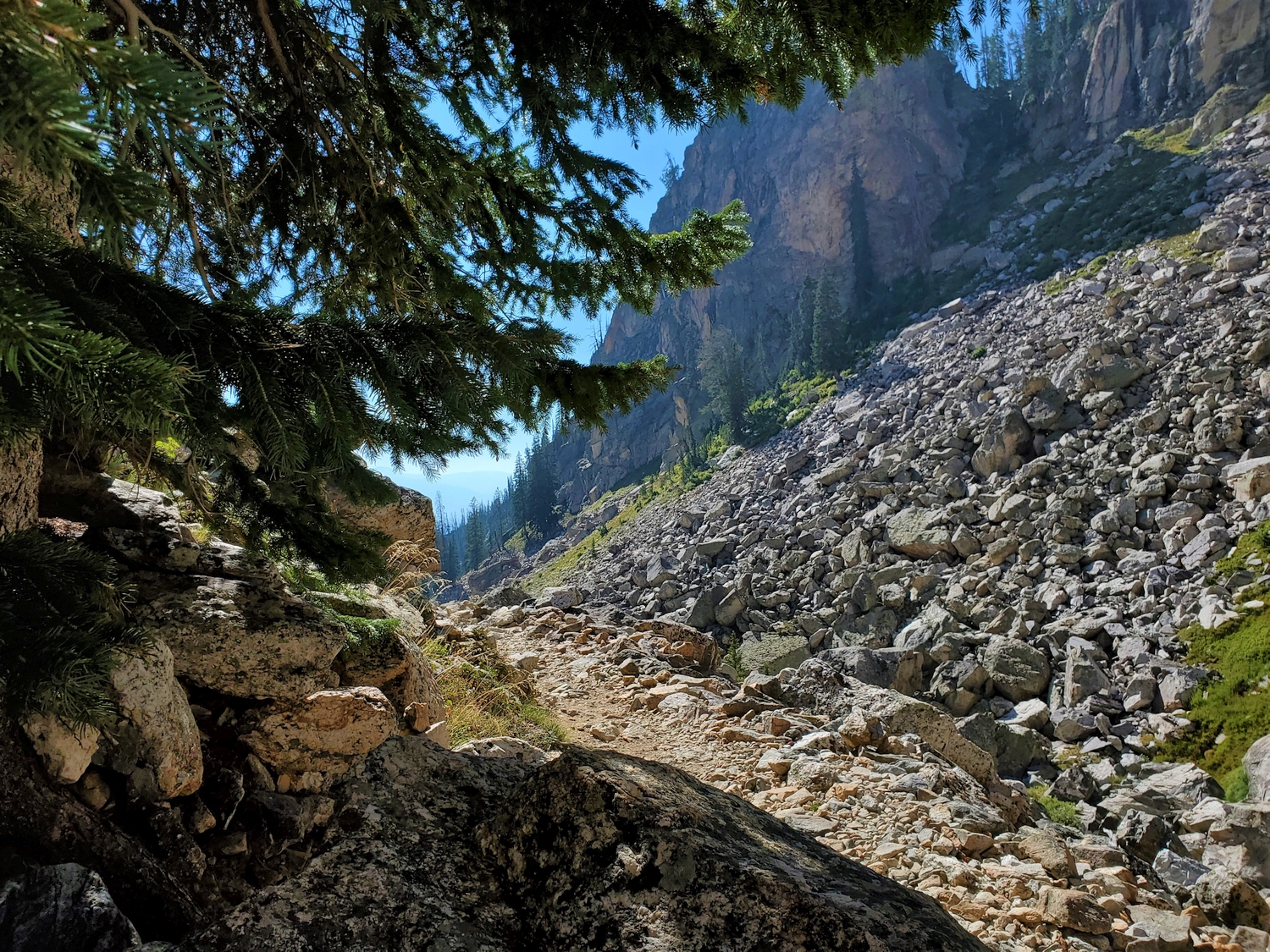
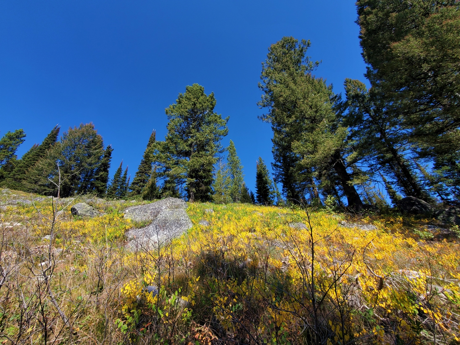
To begin, arrange any necessary permits (if camping overnight) and start hiking the Valley Trail from the Lupine Meadows Trailhead. After about 1.5 miles, leave the Valley Trail on the Garnet Canyon Trail, which switchbacks steeply up the hillside. Continue on the Garnet Canyon Trail (do not take the side-trail to Amphitheater Lake), entering the canyon around mile 3 and passing the Platforms camping area before switchbacking up a steep slope past Spalding Falls. The trail now becomes a bit harder to follow, especially at night, as you hike through a jumbled moraine, passing additional camping areas, to reach the base of a steep headwall just north of the Middle Teton Glacier.
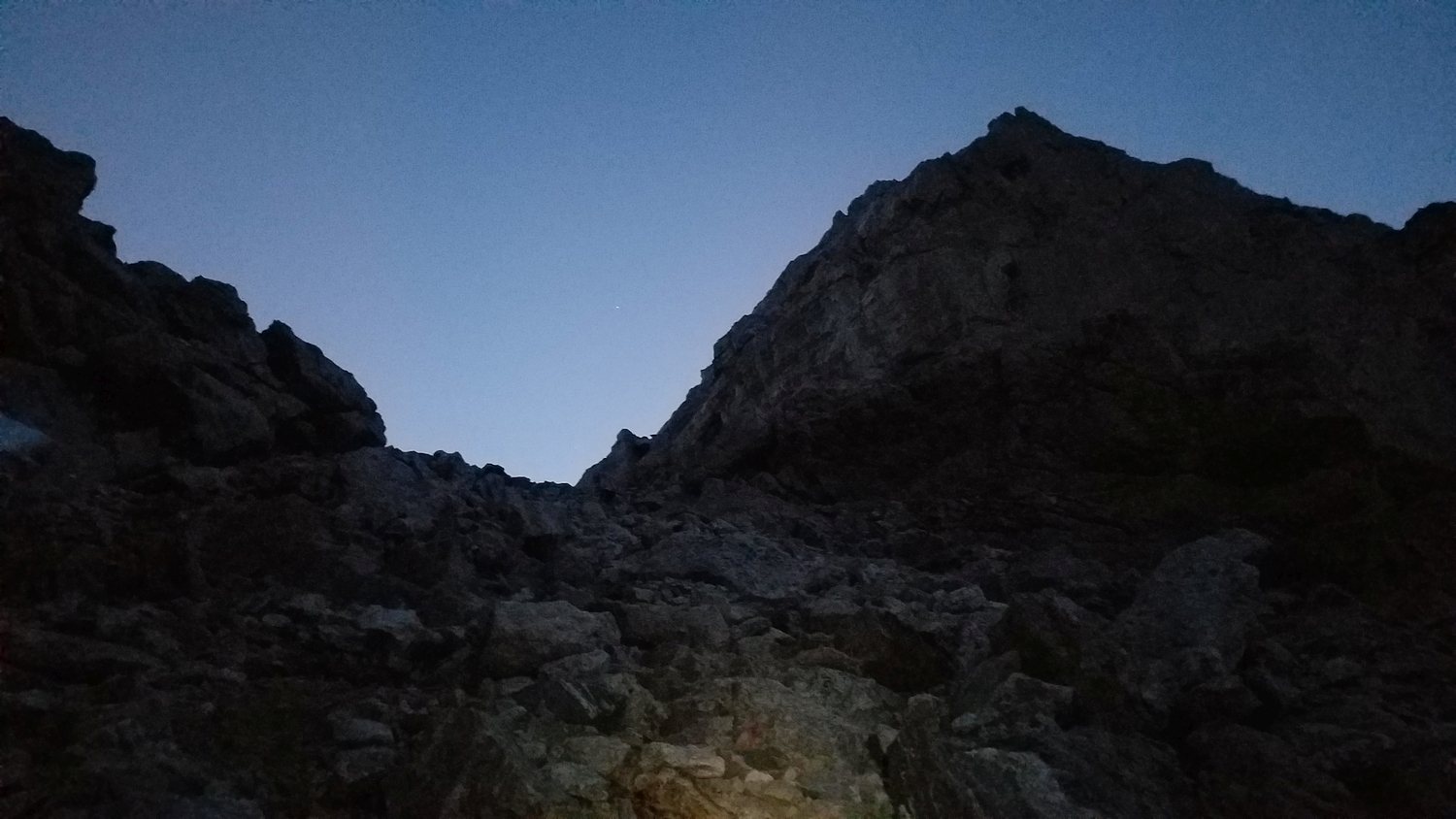
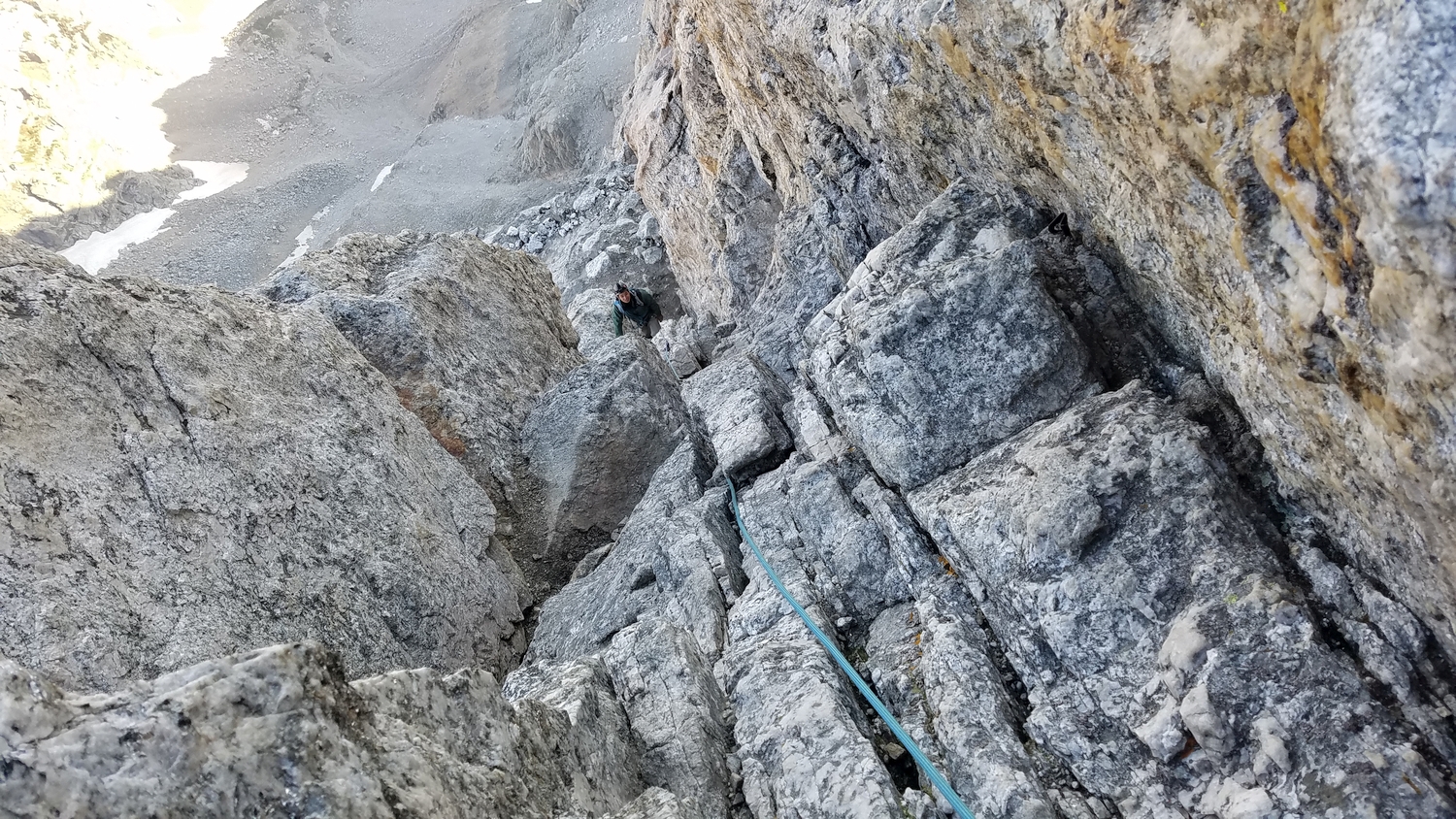
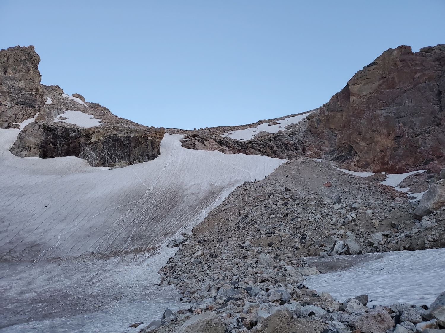
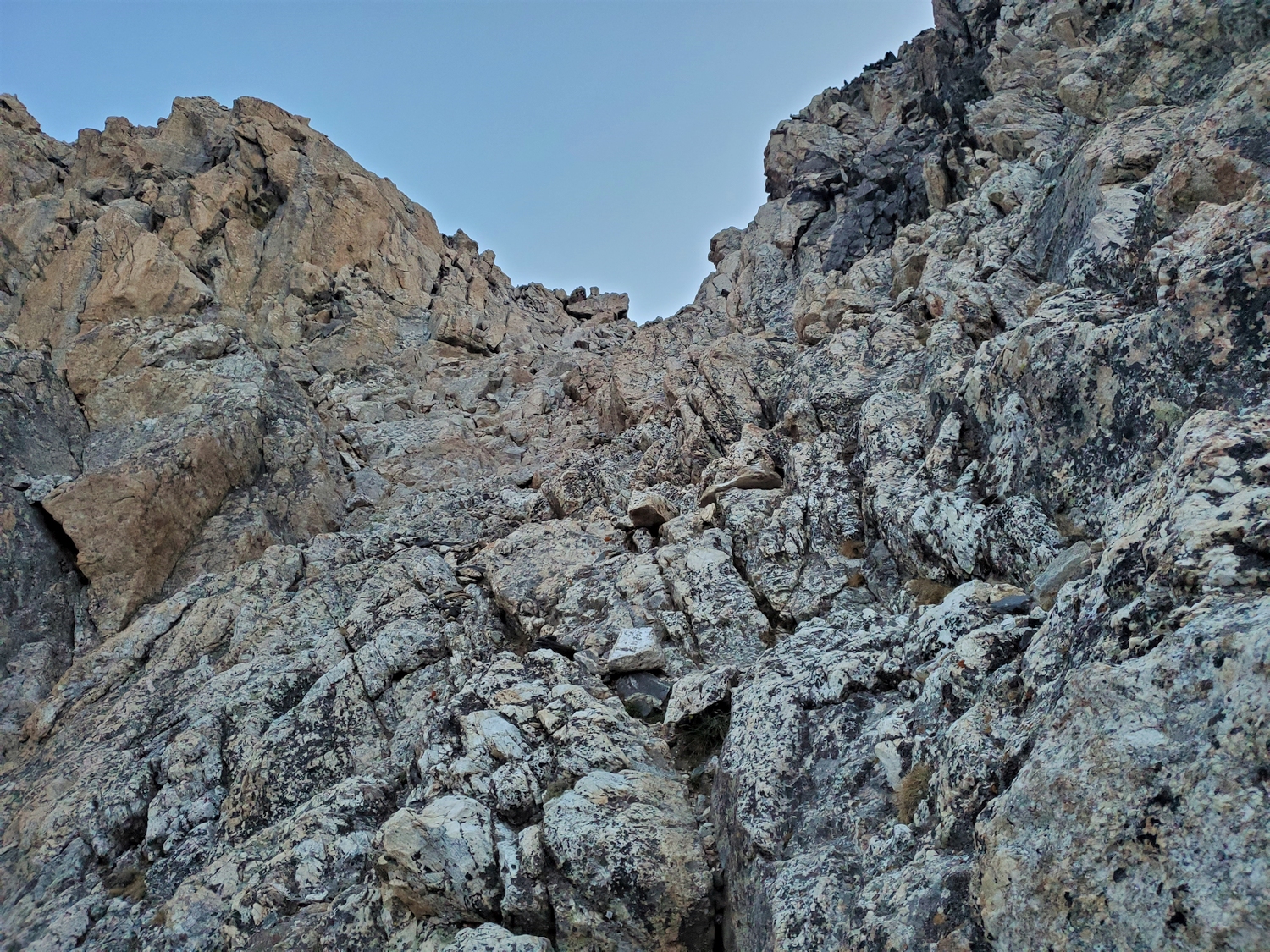
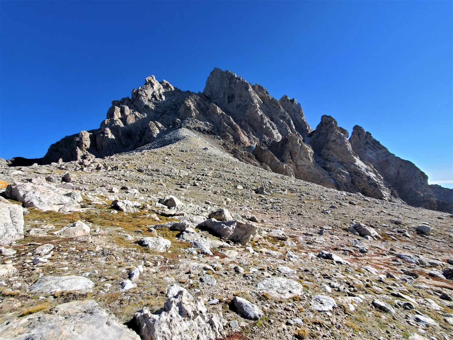
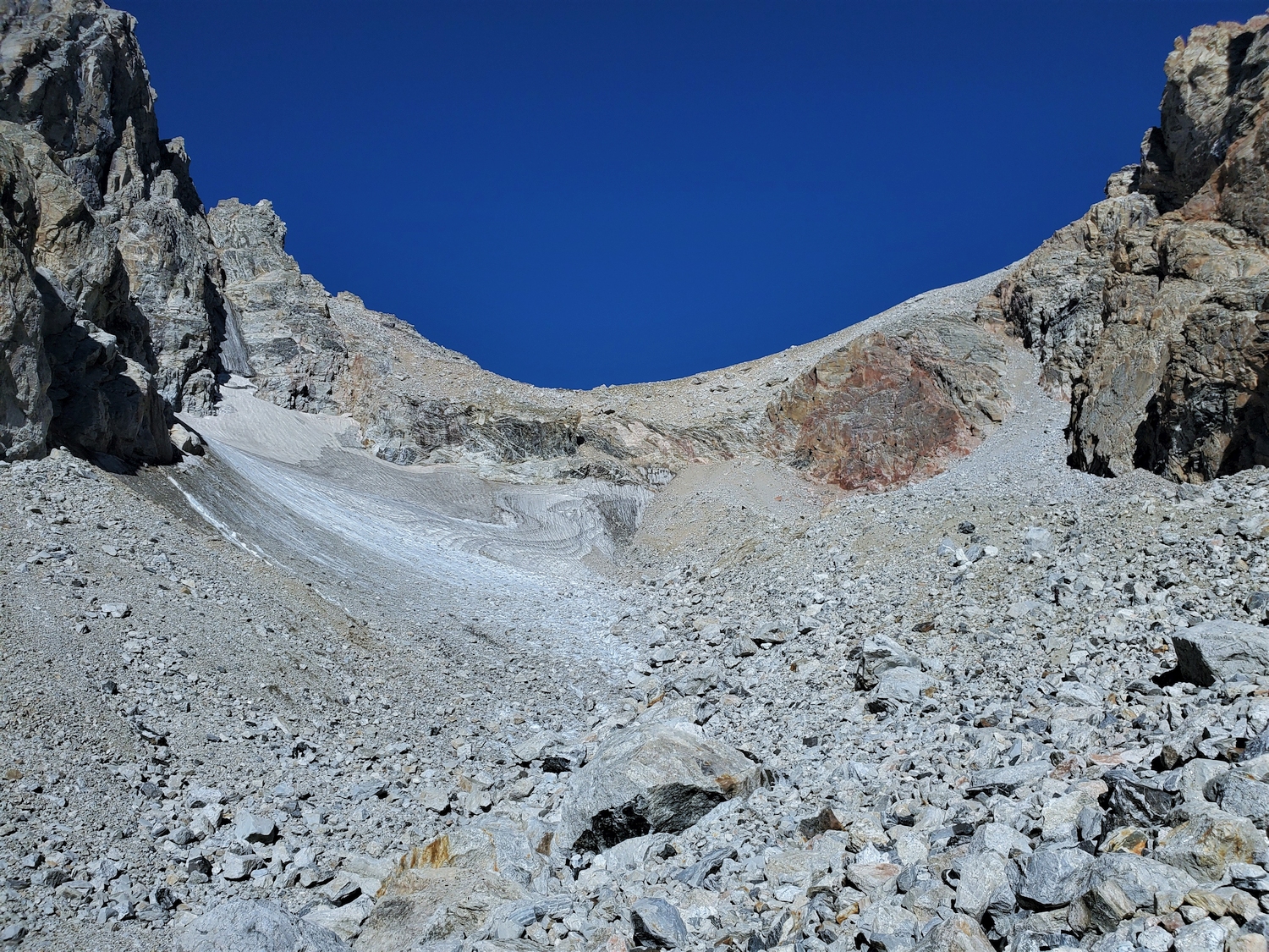
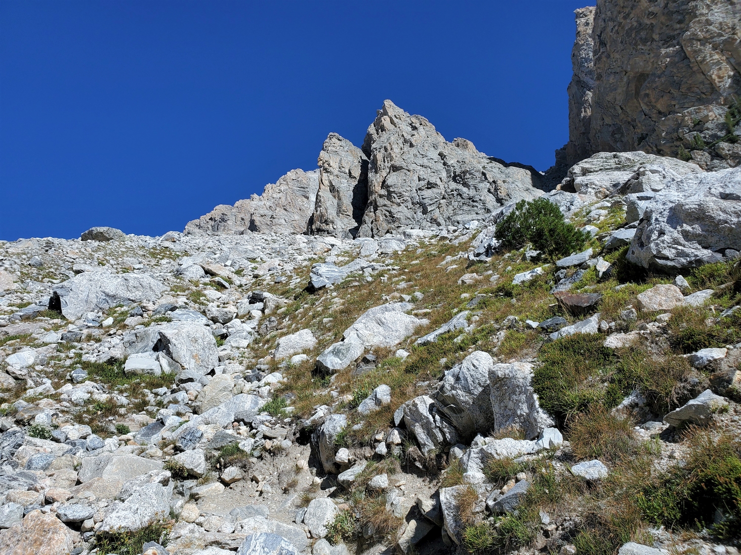
A fixed rope is usually installed her which some climbers use to aid the scrambling required to reach the Lower Saddle. A large camping area is established seasonally on the broad Lower Saddle, though it must be an exciting place to camp in a storm. At the north end of the Lower Saddle, a use-trail leads up past a black dike to enter a shallow gully, where the climbing begins.
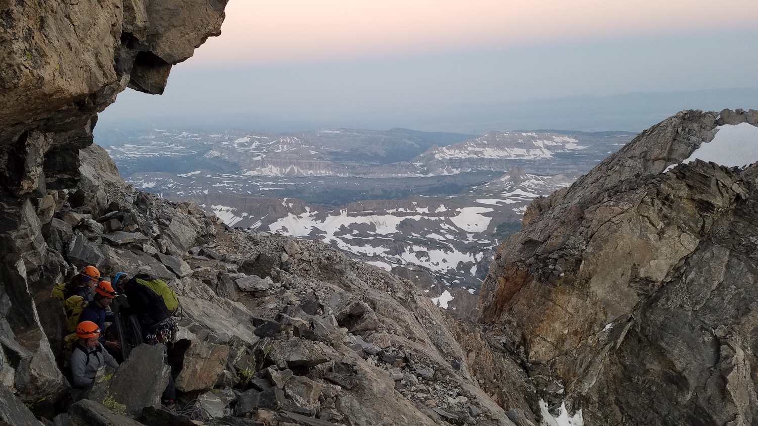
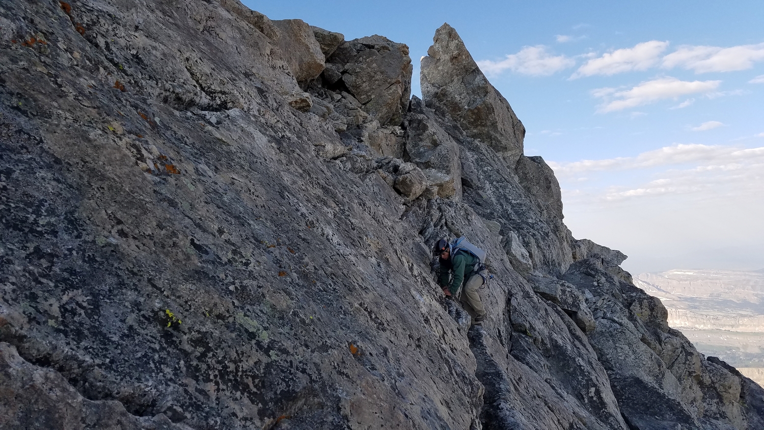
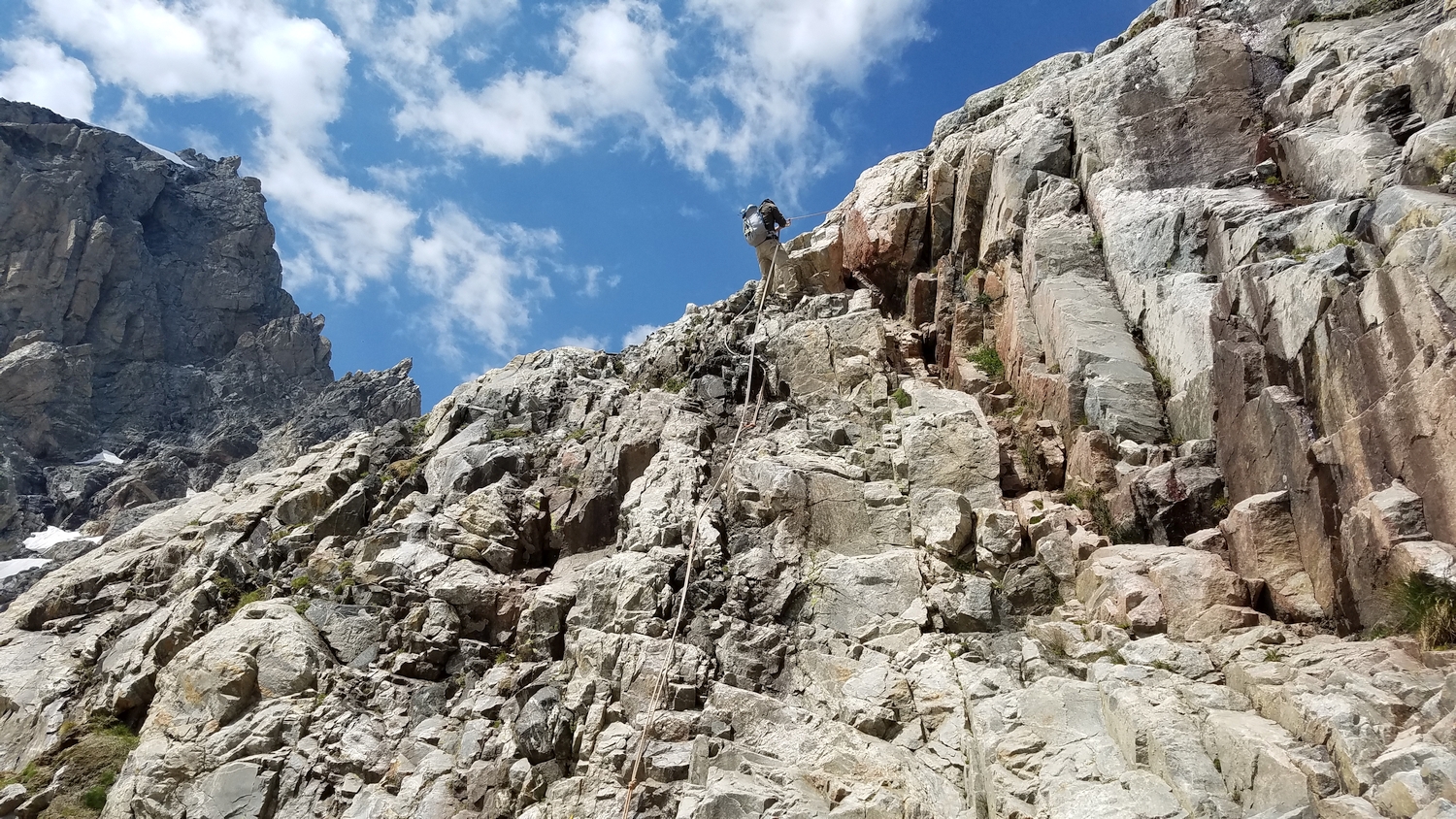
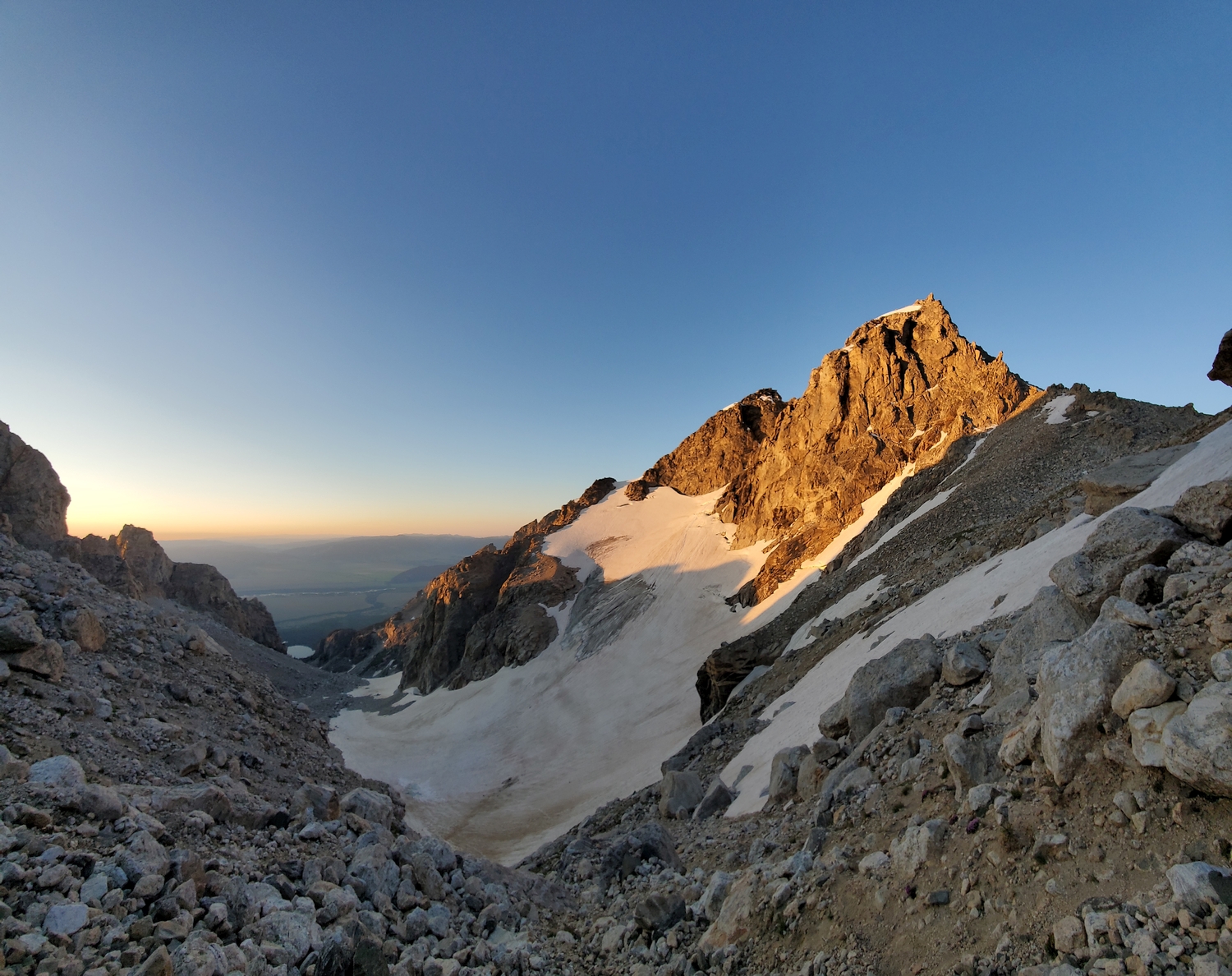
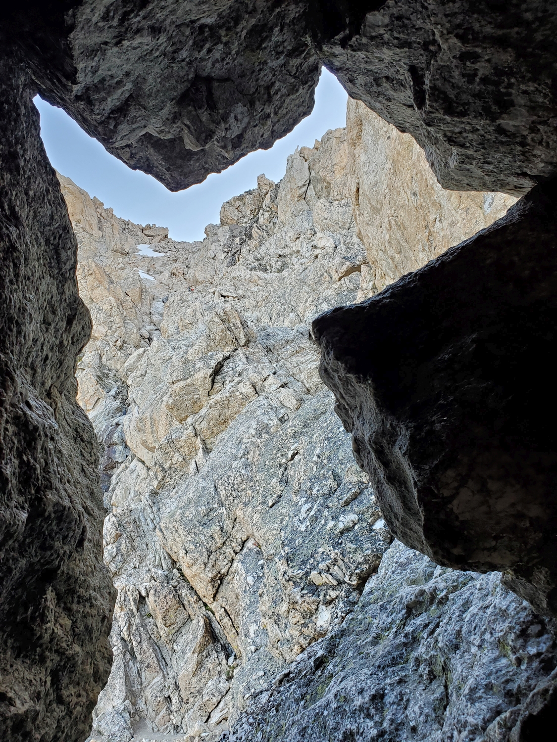
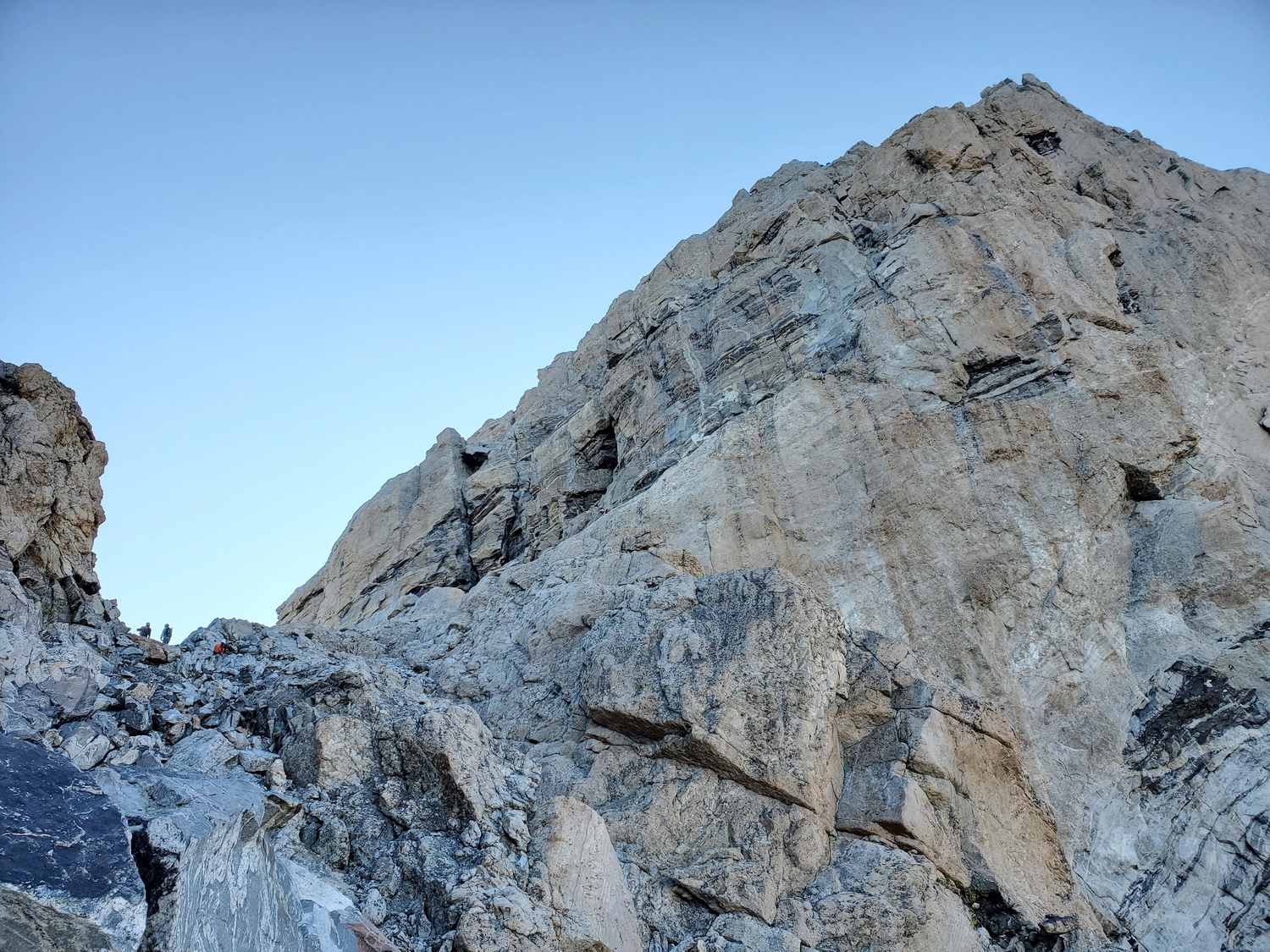
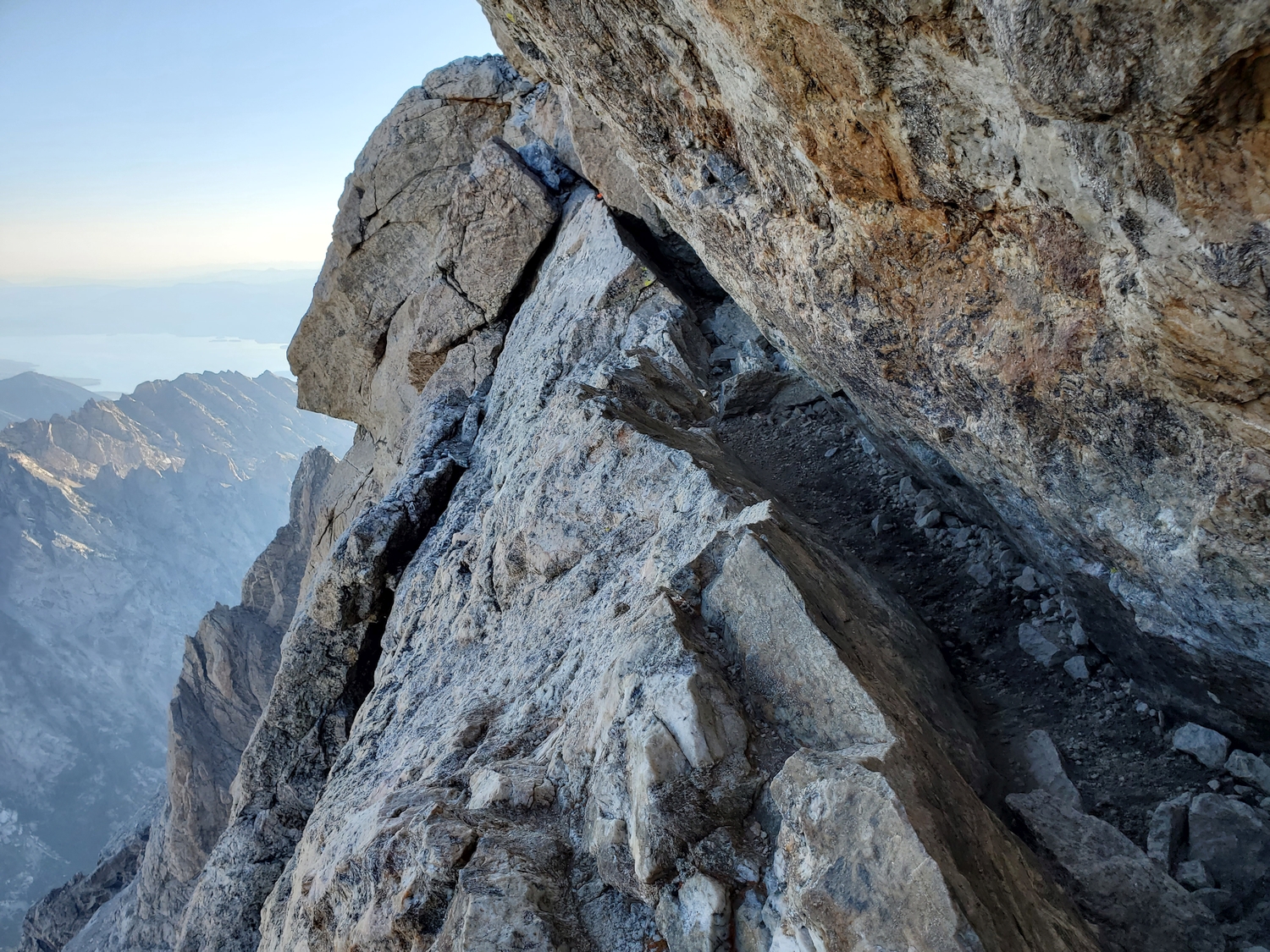
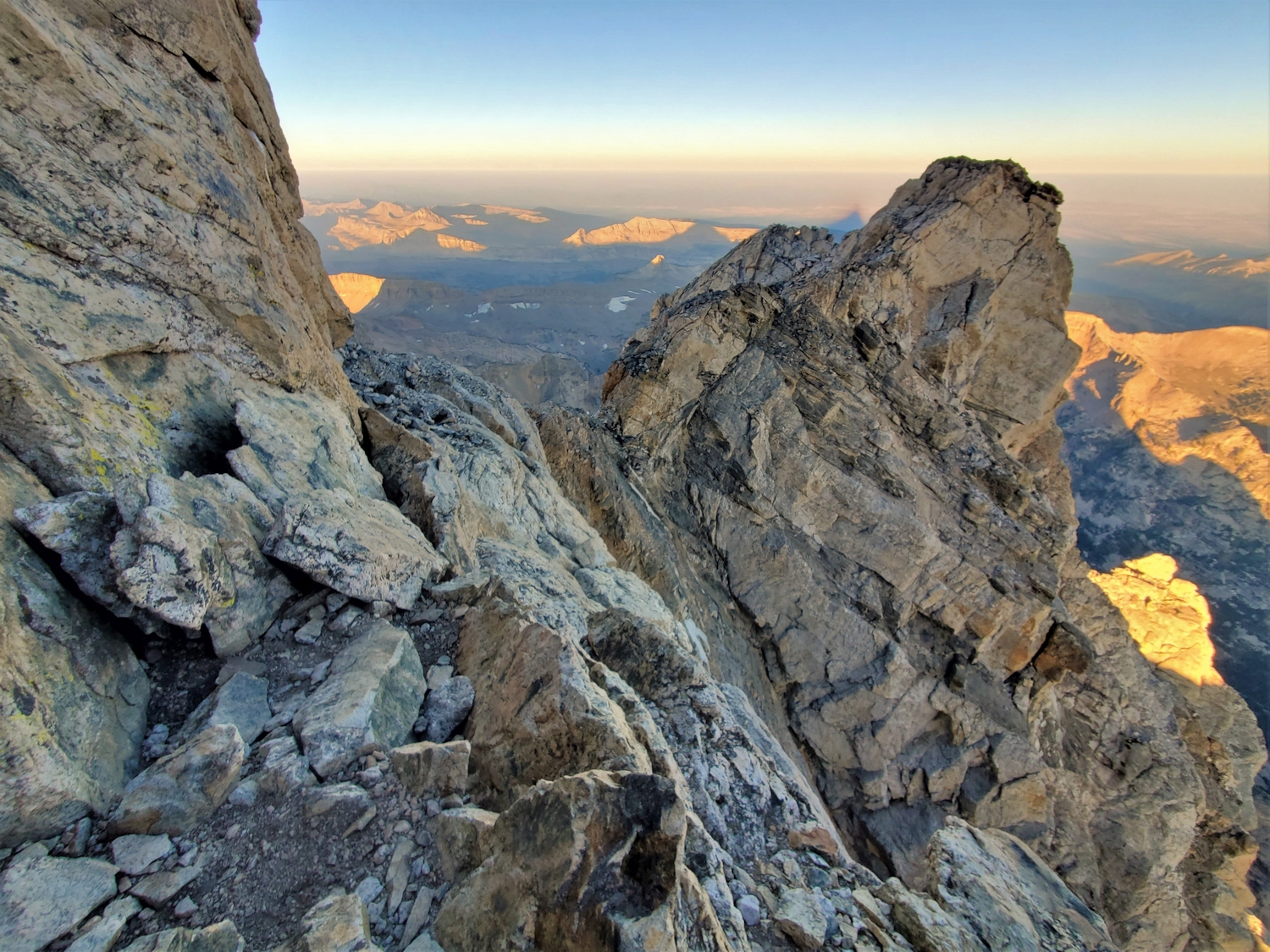
Most of the route to the Upper Saddle is class 2 hiking, but it begins to become exposed, and occasional class 4 pitches break up the easier terrain (most guided parties rope up for this section). The easiest route follows ledges up to a rock tunnel called the Eye of the Needle, beyond which scree paths alternate with rocky sections to the Upper Saddle, but many routes of comparable difficulty are possible through this section.
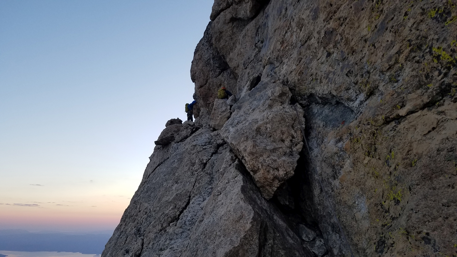
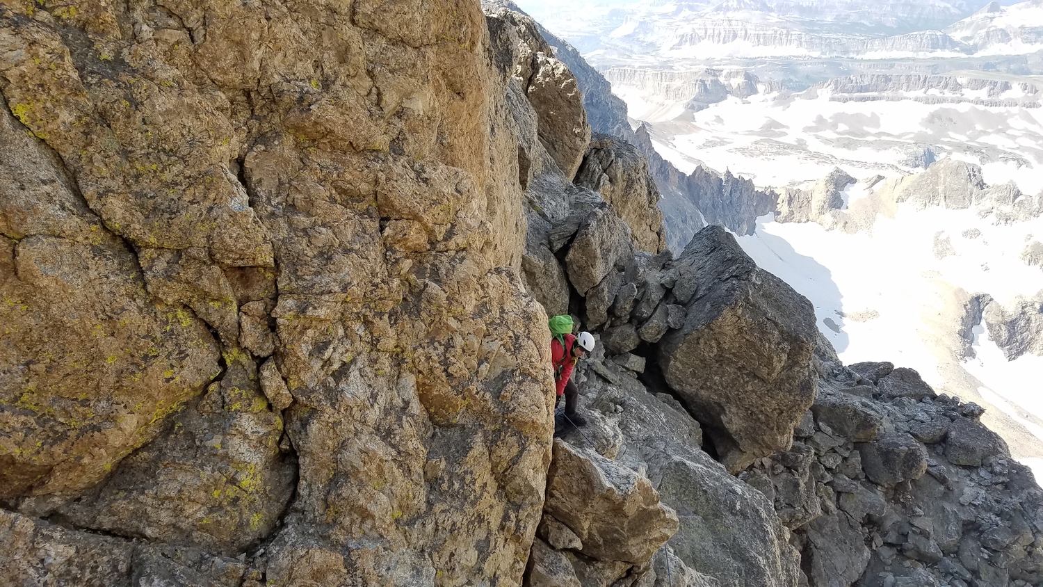
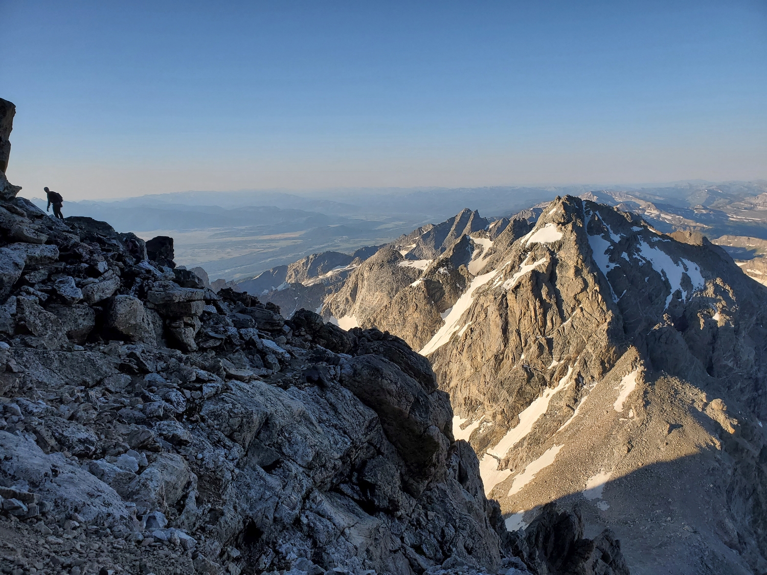
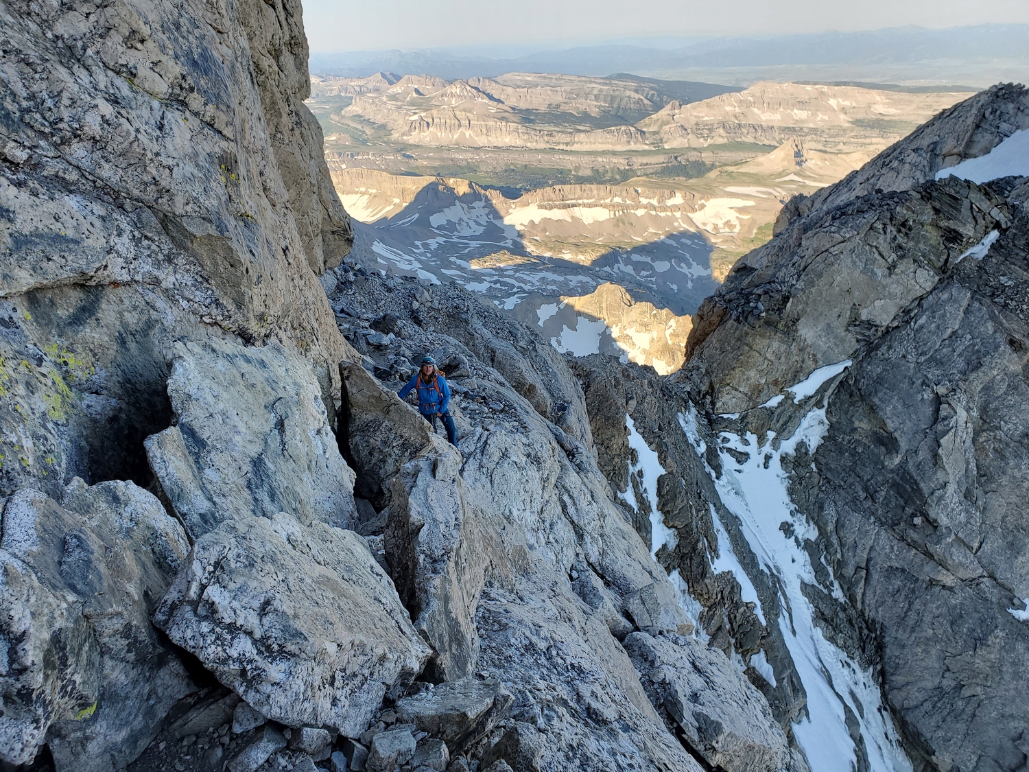
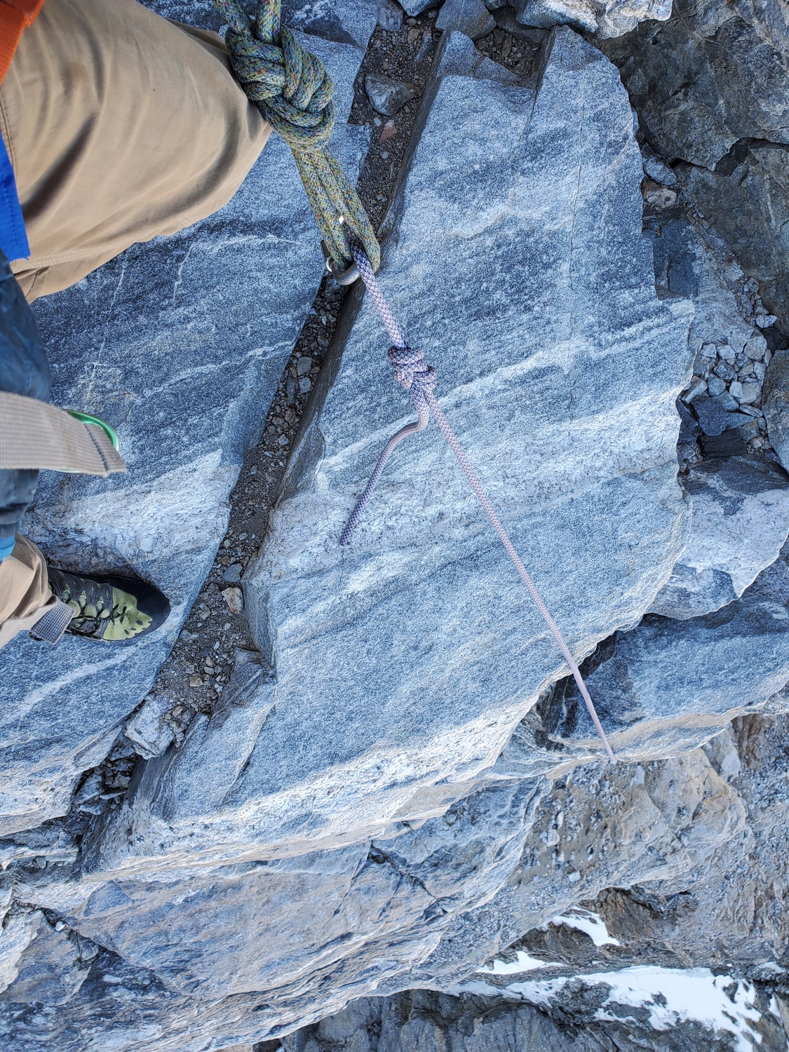
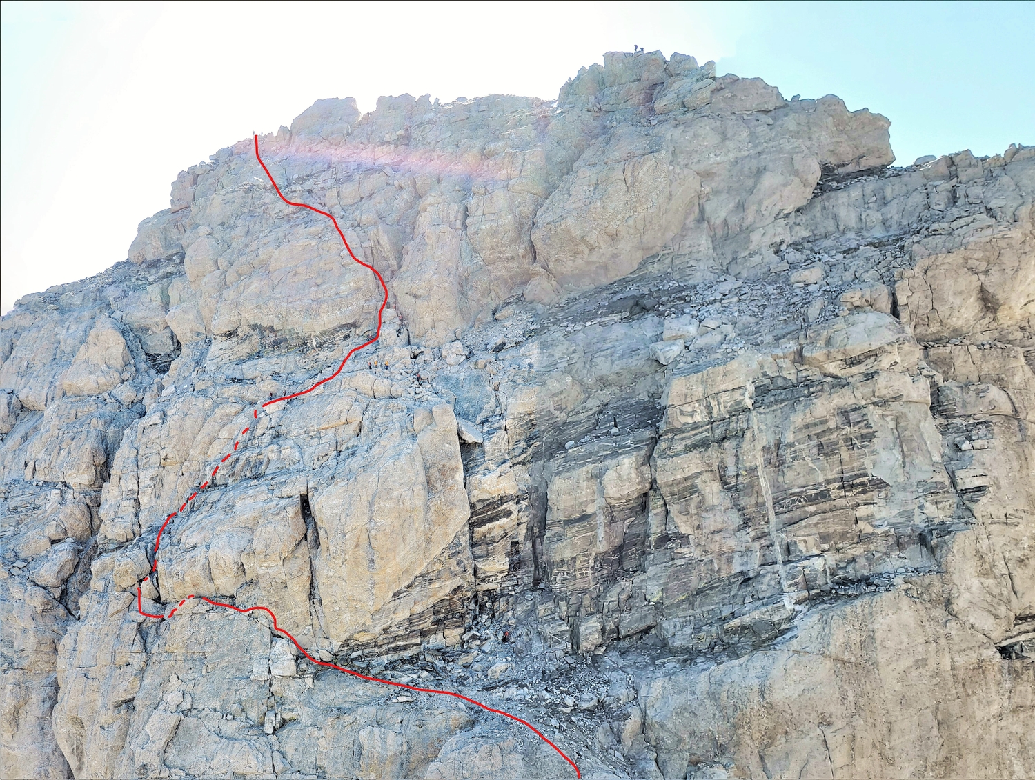
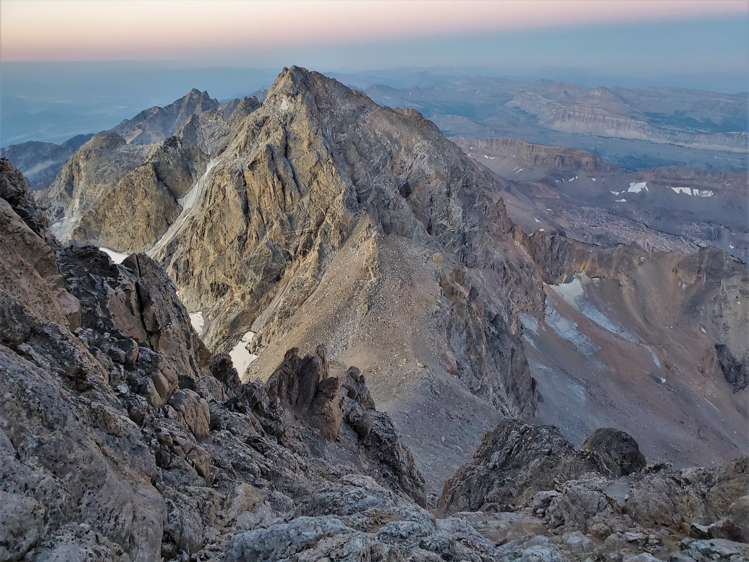
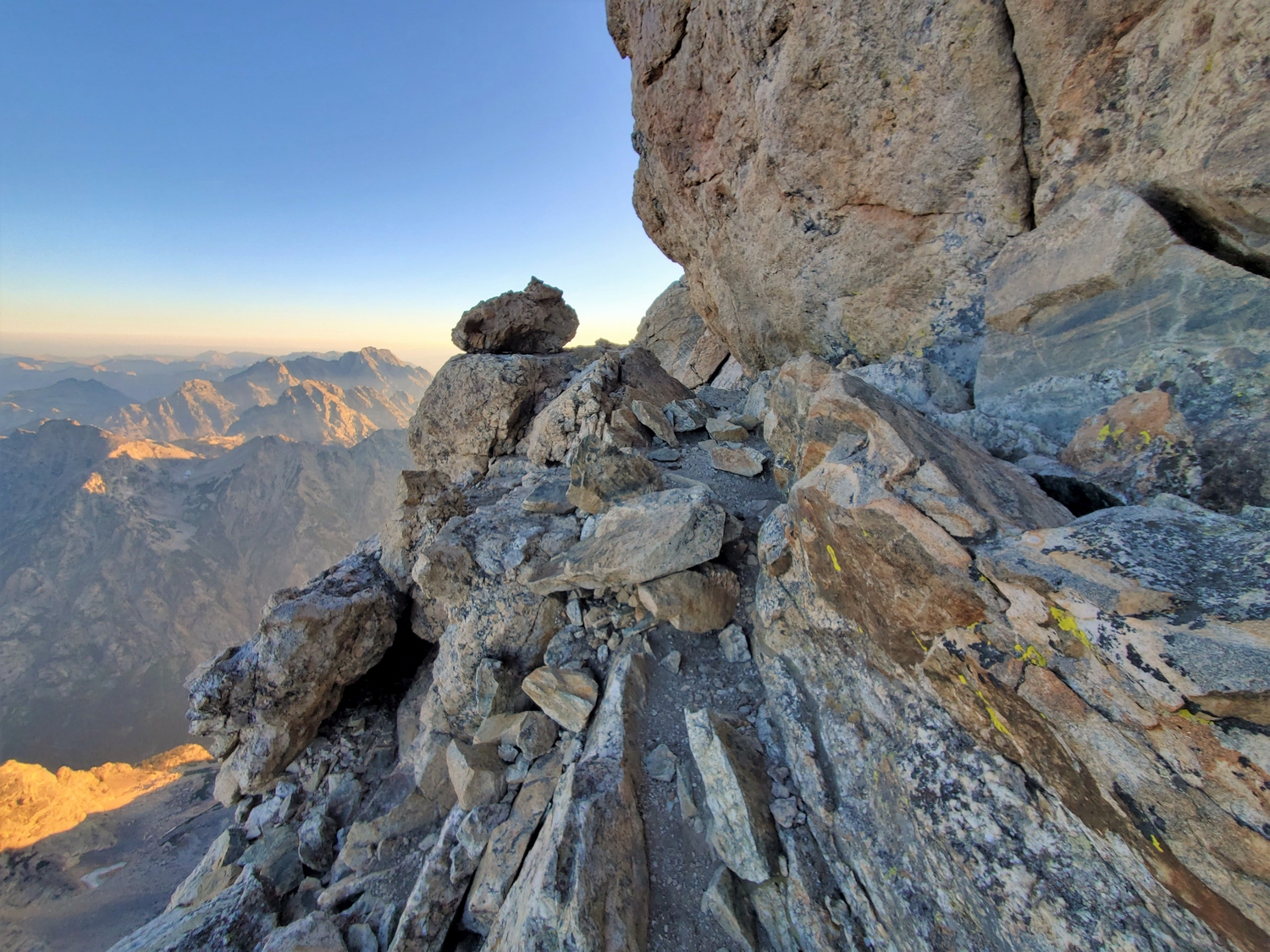
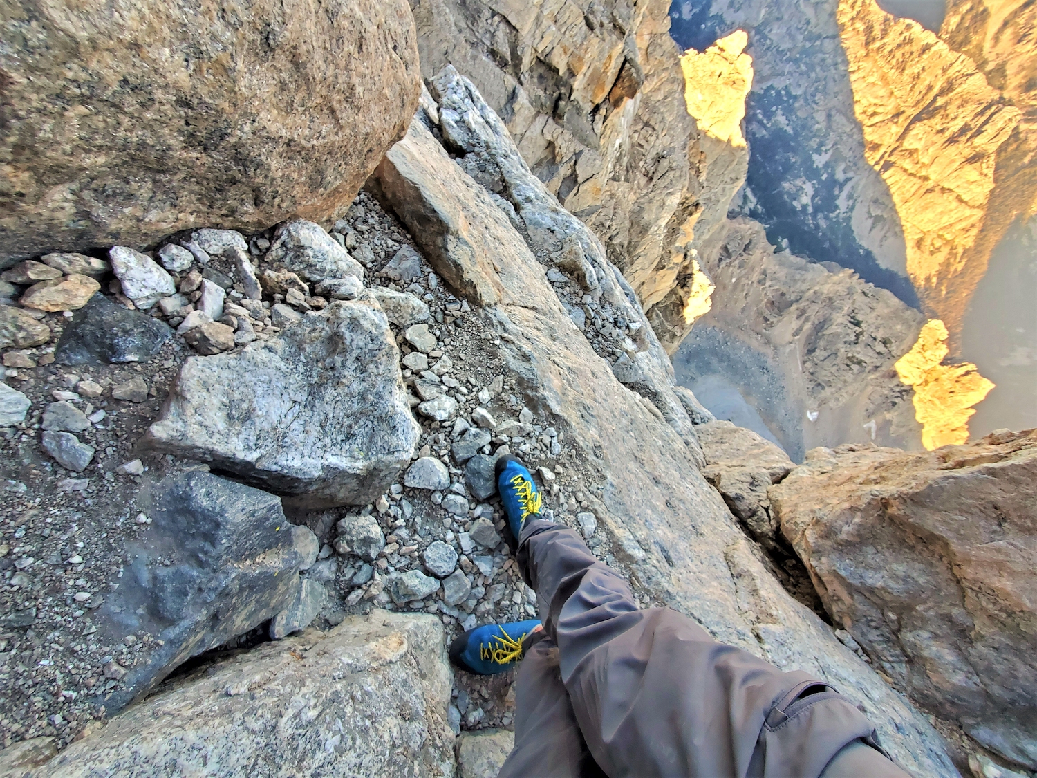
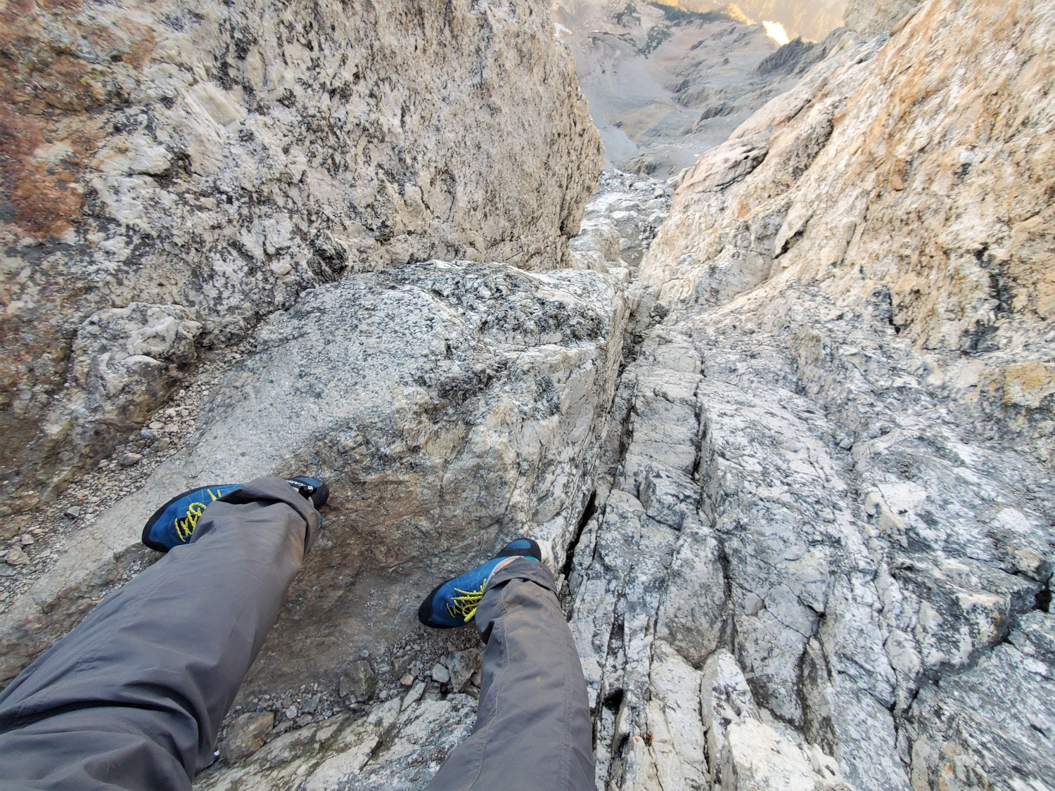
From the Upper Saddle, most groups pitch out the remaining route. The Owen Spalding Route proper starts with the Belly Roll, a wildly exposed move around a detached rock flake to begin traversing northward on a nearly horizontal ledge. In several places, the cliff face overhangs the ledge from above, and a particularly narrow passage is known as the Crawl, with thousands of feet of near-vertical exposure immediately below you to the left.
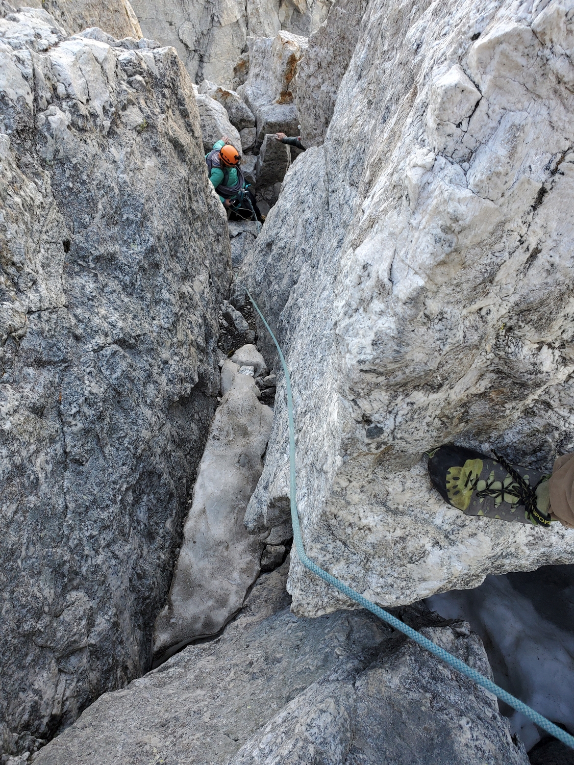
The next task is to enter the Double Chimney; after traversing below one steeper entry option, the second entry consists of a small slab below an obvious blocky chimney. Climb up the Double Chimney past a giant detached flake and cross a sloping area to the base of the narrow, inset Owen Chimney, and climb up it to another flatter area below Sargents Chimney. This final chimney is easier than the first two and can be escaped halfway up via some blocks on the left side.
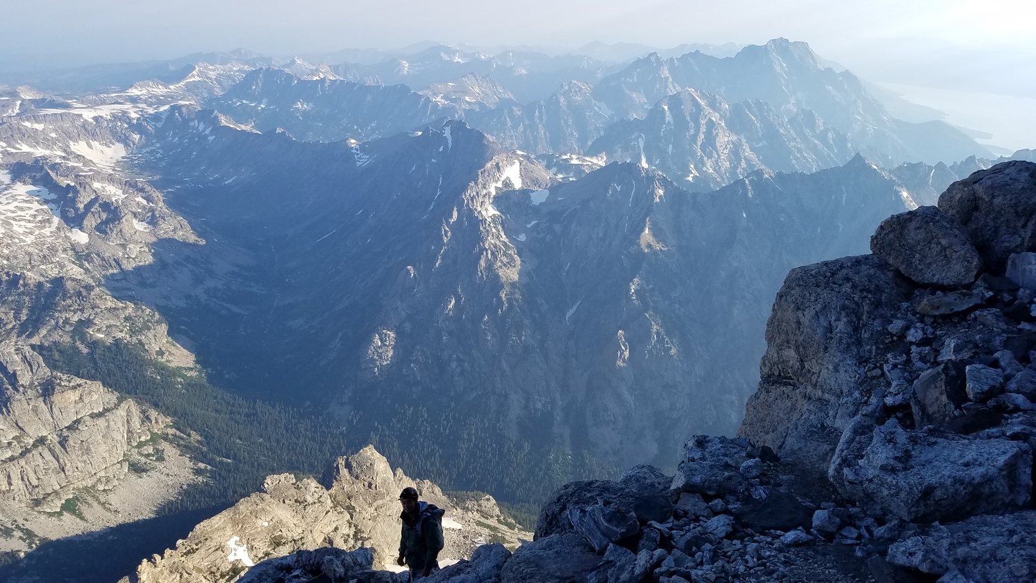
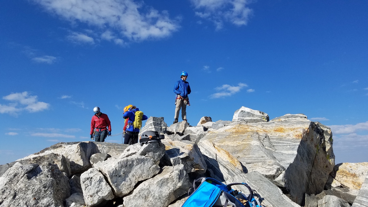
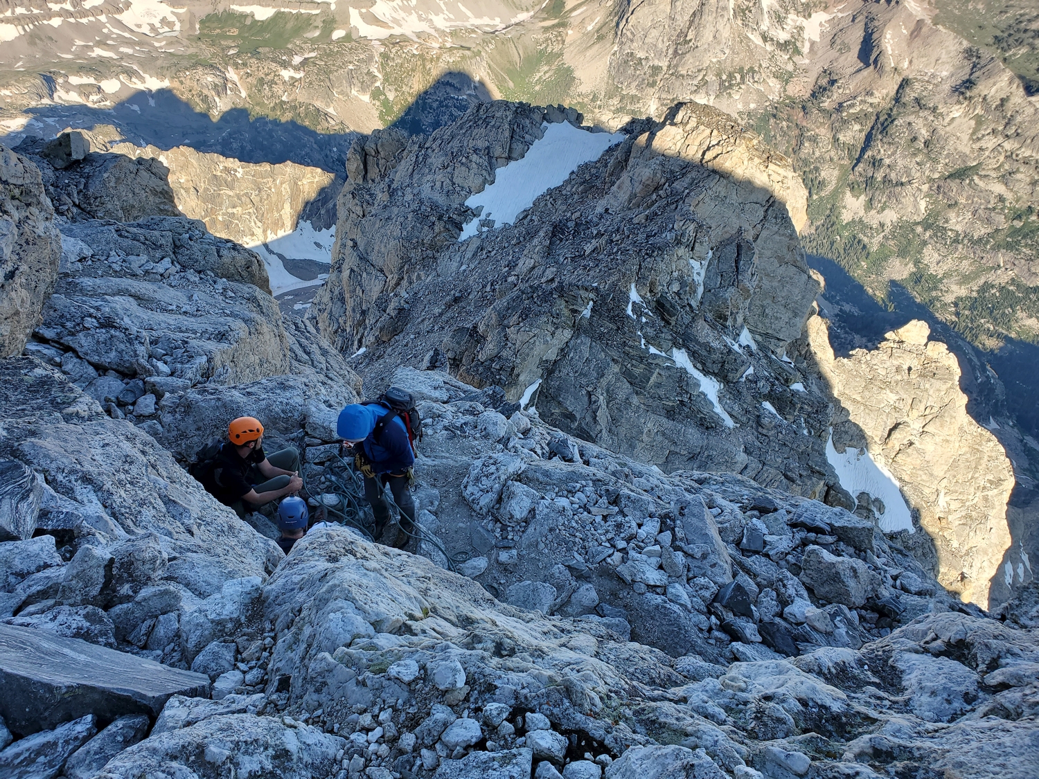
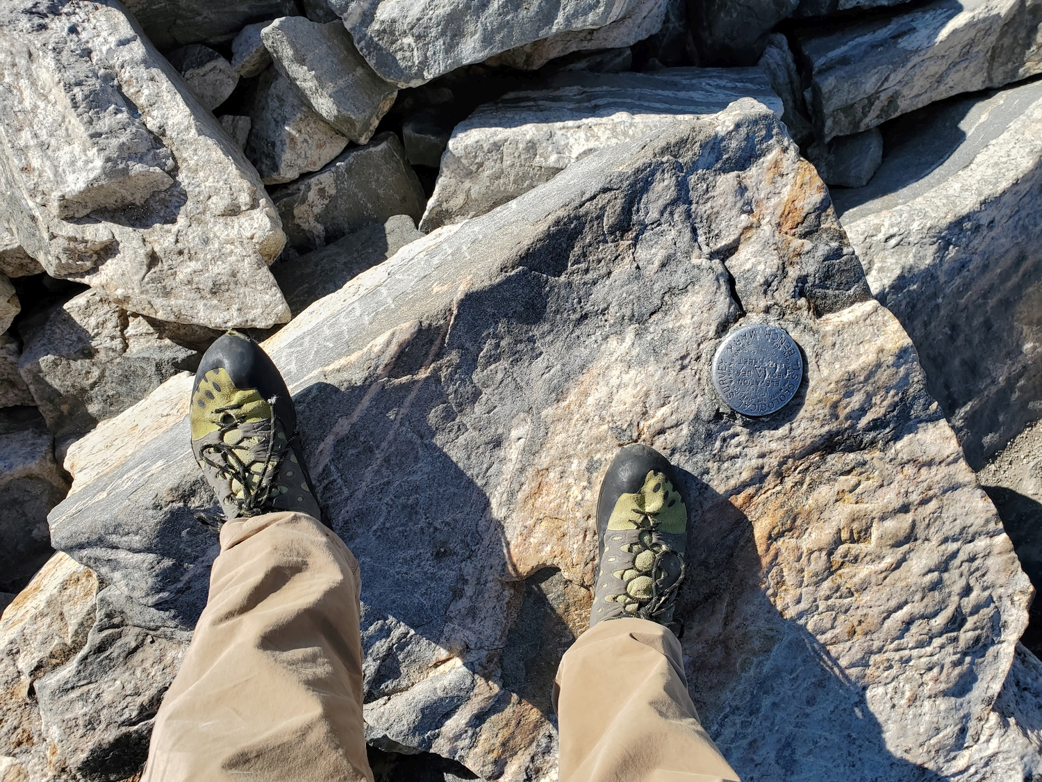
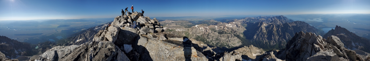
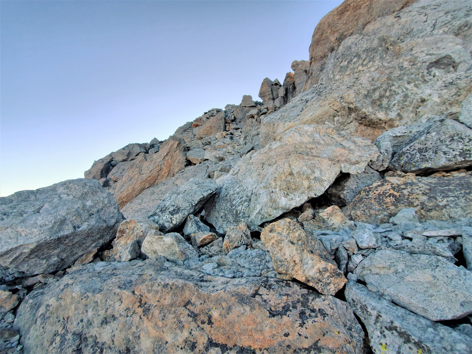
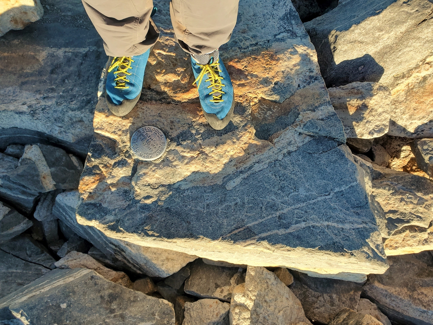
Above Sargents Chimney, scramble a few hundred feet of easier, broken terrain to the summit. To descend, most climbers rappel Sargents Chimney, then walk south (descending climber’s left) to find the permanent rappel stations atop the cliff just east of the Upper Saddle; fixed ropes are often available here, but don’t count on it. Double ropes are usually recommended to ensure sufficient length to reach the bottom of this long, free-hanging rappel.
Grand Teton Map
Grand Teton Panorama
Grand Teton Photos
-
- The Grand Teton, Wyoming’s most famous peak, seen here showcasing the difficult and rarely climbed north face (2017)
-
- The Grand Teton stands out proudly from nearly any vantage point; here it is framed by the Middle and South Tetons on the left and Mount Owen and Teewinot on the right (2017)
-
- After making quicker time up Garnet Canyon than anticipated, we climb the headwall below the Lower Saddle by headlamp light (2017)
-
- The start of the Owen Spalding Route involves bypassing this piece of rock on a narrow west-facing ledge by executing a legendary move called “the belly roll” (2017)
-
- We followed other climbers on the way down and found our way through the Eye of the Needle, a tunnel bypassing some of the more difficult scrambling below the Upper Saddle (2017)
-
- Looking back at the mess of gullies and ridges leading from the Lower Saddle to the Upper Saddle (2017)
-
- Relishing our successful 1-day ascent of the Grand Teton with some afternoon views from Jackson Lake (2017)
-
- The technical crux of the Owen Spalding Route arguably consists of entering the Double Chimney (2020)
-
- I wore climbing shoes since I was climbing without a rope and wanted the extra security; last time I wore hiking boots (2020)
-
- The Enclosure offers a superb vantage for studying the Owen Spalding Route on the Grand Teton, approximated here by the red line; note that climbers are visible in many places along the route (2020)
-
- The full moon illuminated the profile of Nez Perce as I hiked up the switchbacks below Garnet Canyon.
-
- The south face of Disappointment Peak shone bright in the moonlight as I navigated through the moraine.
-
- There is just enough light to see as I begin navigating the maze of semi-technical rock on my way to the Upper Saddle. The Grand Teton is visible on the right, and the summit on the left is the Enclosure (unranked 13er).
-
- After switching into climbing shoes and stashing a water bottle to save on weight, I began soloing along the wildly exposed Owen Spalding Route. It’s mostly class 4+, but there’s 3,000 ft. of sheer exposure above Valhalla Canyon.
-
- This view looks back toward the Upper Saddle and the Enclosure (unranked 13er on the right) from just past the Belly Roll move.
-
- The Crawl is such a cool ledge–overhung from above, with vertical exposure on the left, but easy to cross as long as you have a good head for exposure.
-
- Looking down from the top of the first crux at the second entrance to the Double Chimney, with almost 3,000 ft. of air underneath.
-
- I opted to crawl through the tunnel formed by a giant flake in the Double Chimney since the snow that usually sticks around here was almost gone and easy to bypass.
-
- The Owen Chimney is the last major technical obstacle, requiring a hundred feet or so of near-vertical climbing. It can be notoriously icy, but thankfully most of the recent precipitation had missed the Tetons, and there was only one small patch of easily avoidable ice.
-
- I partially botched my routefinding through the lower part of Sargents Chimney and took a harder-than-necessary variation, but eventually I made it to the hidden exit and onto the upper boulder slopes just below the summit.
-
- Mount Moran dominates the view to the north, with low clouds hovering over Jackson Lake to the right.
-
- The Grand Teton is one of the best peaks in the American Rockies–steep sided, aesthetic from all angles, with a sharp and well-defined summit that towers above anything else as far as the eye can see.
-
- Looking east from the top, I could just see the crest of the northern Wind River Range poking through the haze on the horizon (near center here).
-
- The summit block famously bears the inscribed names of members of the Owen-Spalding-Peterson-Shive party, who made the first undisputed ascent of the Grand in 1898.
-
- To descend, I downclimbed the upper slopes, then rappelled Sargents Chimney and made the main lower rappel back to the vicinity of the Upper Saddle. There is a fixed rope on the main rappel most of the summer, but this late in the season the rope was gone, and I was glad I brought my own. Throwing hard left and swinging as I rappelled, I just barely made it to the ground with a single 60 m rope.
-
- I started meeting other climbers at the base of the rappels and passed dozens of parties between the Upper and Lower Saddles. There was an interesting assortment of climbers, from another young soloist combining the Grand, Middle, and South Tetons in a day to a youth group with school backpacks.
-
- Back at the Lower Saddle, with the Grand looking striking as always. The Upper Saddle is the obvious notch just left of the main peak.
-
- The descent goes quickly, and before long I’m back to the moraine, where I stop to change out of long johns. It’s getting hot in the sun at lower elevations!
-
- The moraine is one of the most annoying parts of this route, and I’m glad to finally get back on a good trail once I’m through it.
-
- It’s always fun to skip down the trail past countless backpackers and dayhikers, having already summited the Grand by mid-morning.
-
- Back at treeline, I stop for a quick snack break of jellybeans and hot tamales before jogging most of the remaining trail.
-
- It’s fun to finally feel like a proper “athlete,” racing down the trail in a big hurry instead of scrambling along slowly in the alpine. While I’m still not much of a runner, I do manage to maintain a 3.7 mph average pace for the last couple miles.
-
- The Grand Teton peaks through the trees as seen from low on the trail. It looks pretty crazy from this side!
-
- These berries and colorful leaves belong to the Oregon Grape, a ubiquitous species in the Rocky Mountain foothills and one of my favorite montane shrubs.
-
- A bunch of tourists looked at me funny for taking a picture of this field of yellow shrubs, but hey, autumn is short in Wyoming, we’ve got to appreciate it while it lasts.
-
- Driving away from the Tetons with only one peak to go, and less than 13 hours left to beat the record…
DISCLAIMER: Mountain climbing is dangerous. Activities described on this page may lead to serious injury, death, and property damage. This webpage is presented with no warranty express or implied. Pictures and text are for entertainment purposes only. No commercial use allowed; all rights reserved.