Mount Sacagawea
Elevation: 13,571 ft.
Prominence: 432 ft.
Isolation: 0.9 miles
Technical Difficulty: Class 5.0


Mount Sacagawea Guidebook
Introduction
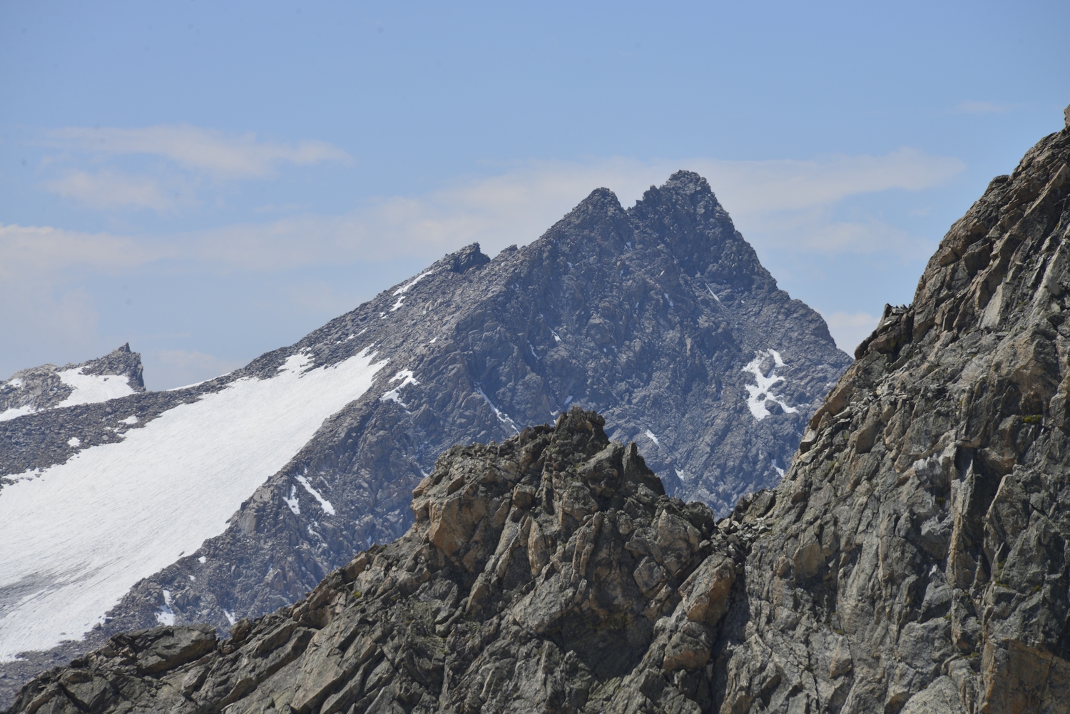
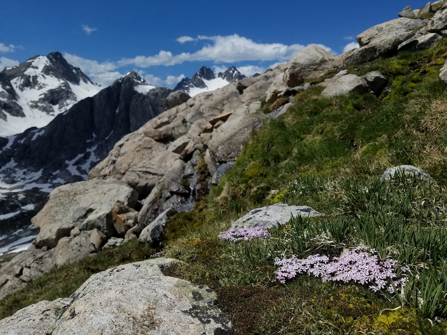
Mount Sacagawea is named for the Shoshone woman who acted as an interpreter on the Lewis and Clark expedition, likely due to the mountain’s proximity to one possible site of her burial (in Fort Washakie). Sacagawea is a strange peak: its west face is a nearly blank triangle of stone towering vertically over Titcomb Basin, but its east side is a convoluted mess of talus slopes, high plateaus, and glaciers. Still, the summit requires technical climbing to reach, since it is cut off from the eastern talus fields by a gendarme-ridden ridge. The peak itself is really just a protrusion from the north ridge of Fremont, but unlike the other numerous rises on this ridge, Mount Sacagawea has enough prominence to qualify as an independent peak.
General Considerations
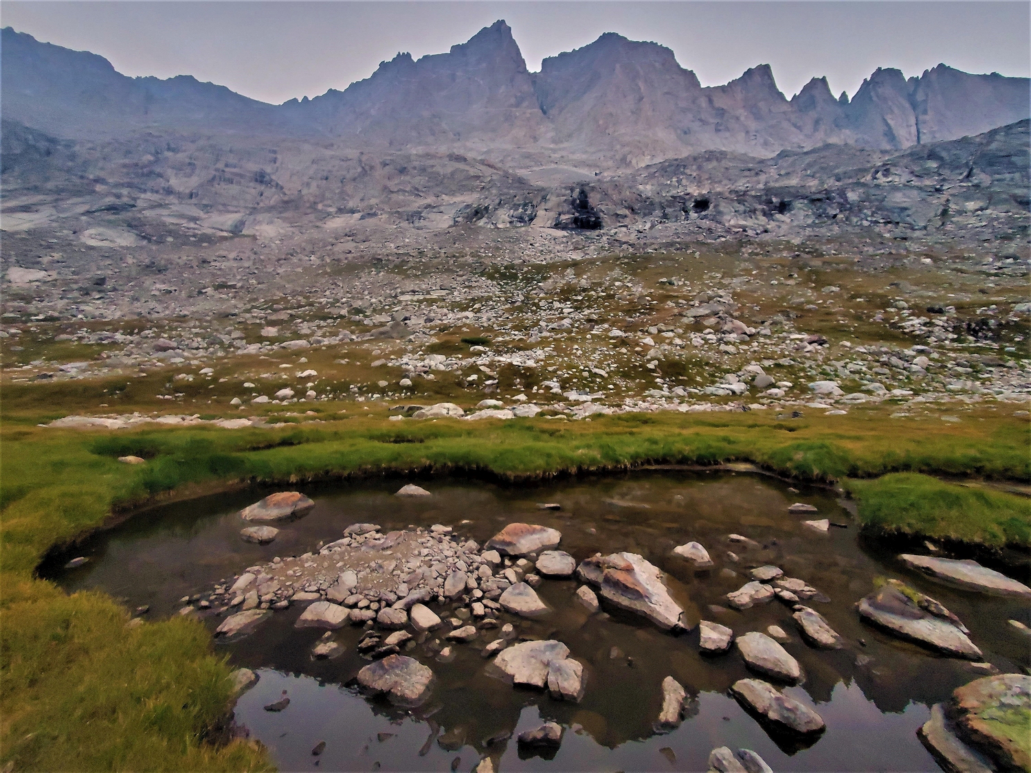
Just like Mount Helen, Sacagawea’s west faces hosts several very technical alpine rock routes, but these are sufficiently described elsewhere. To gain the summit by the easiest route, it is first necessary to reach Sacagawea’s eastern slopes. This can be done in any number of ways: see the Mount Helen chapter for information on approaching these peaks from the North Fork of Bull Lake Creek.
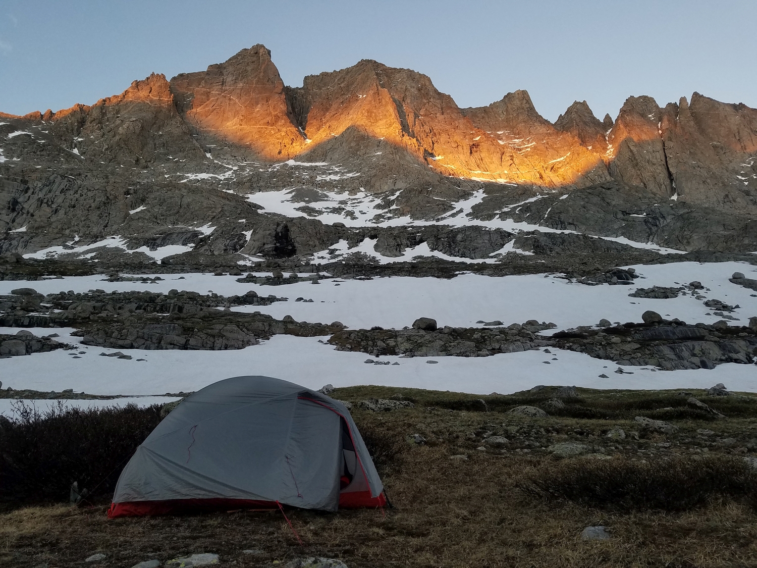
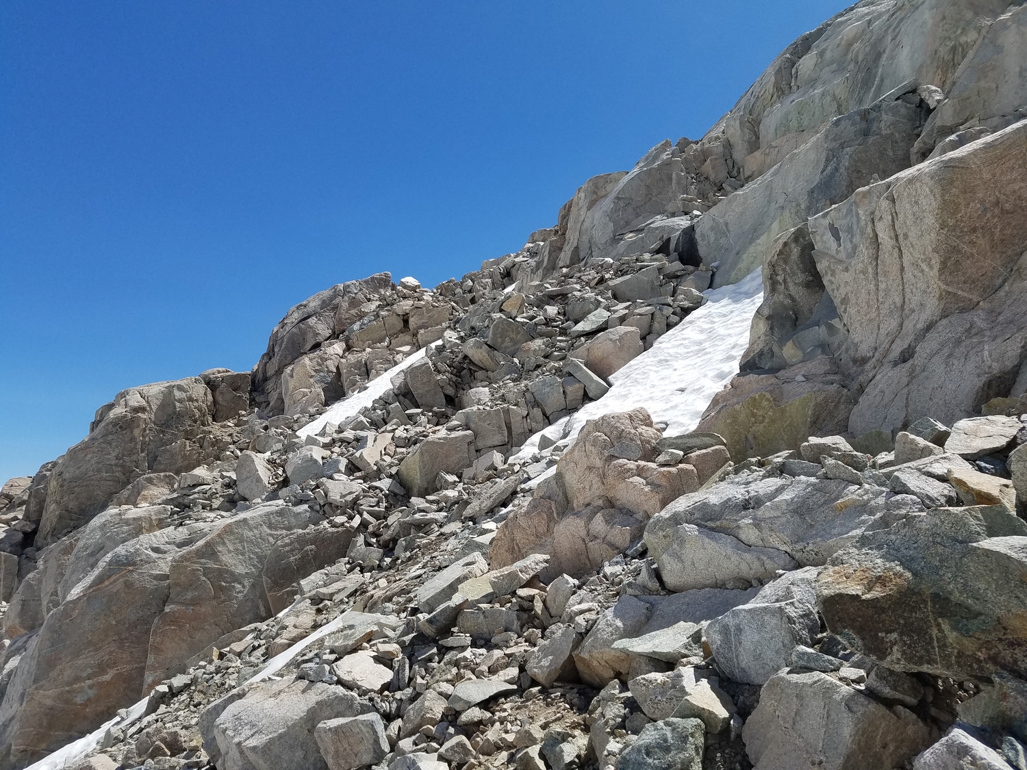
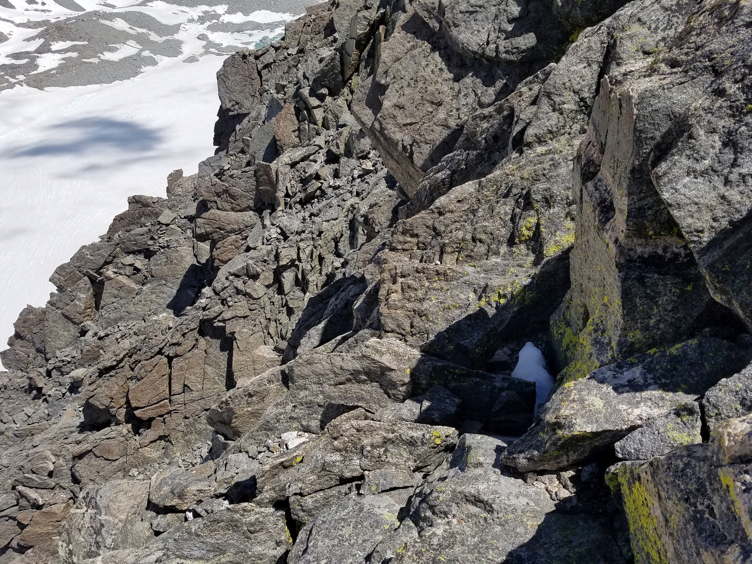
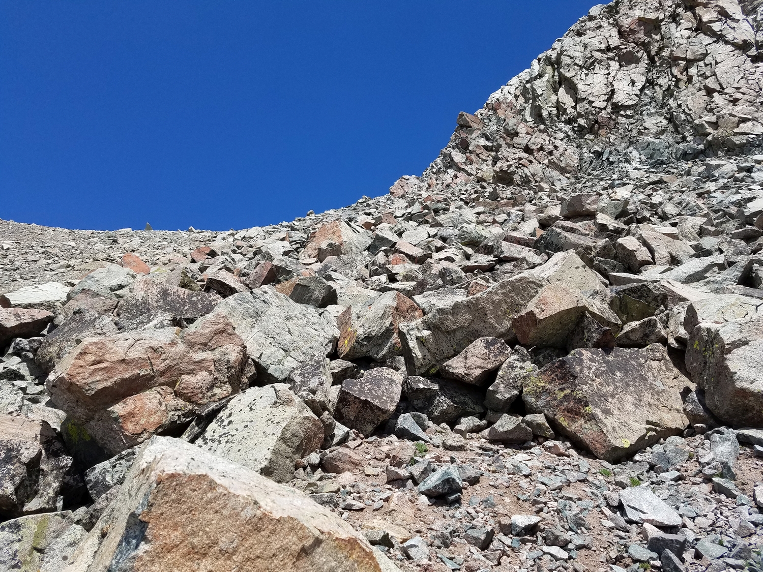
The most common way of approaching Mount Sacagawea directly from Titcomb is described below. Beware dangerously loose talus on this peak; at least one serious accident has resulted from the sudden movement of unstable talus blocks near Sacagawea’s summit.
Route 1: East Ridge – Class 5.0, Moderate Snow
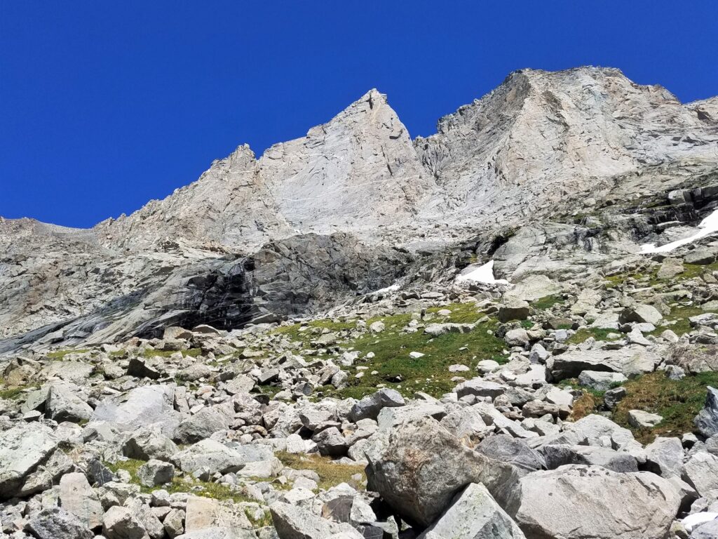
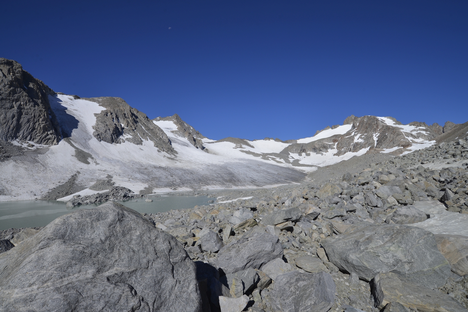
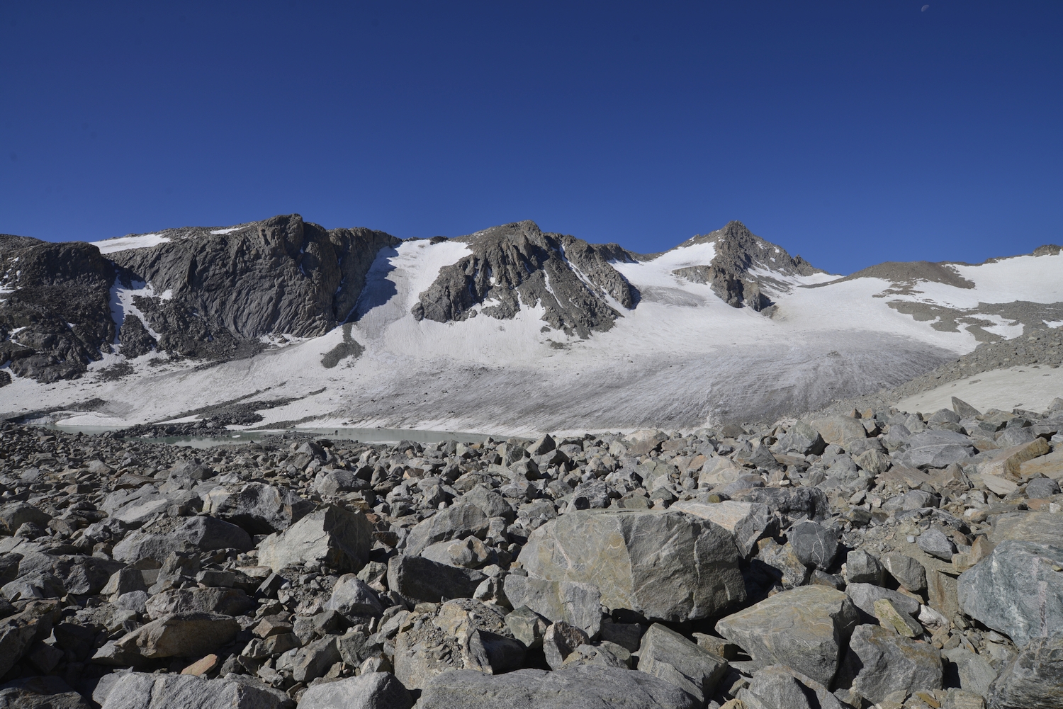
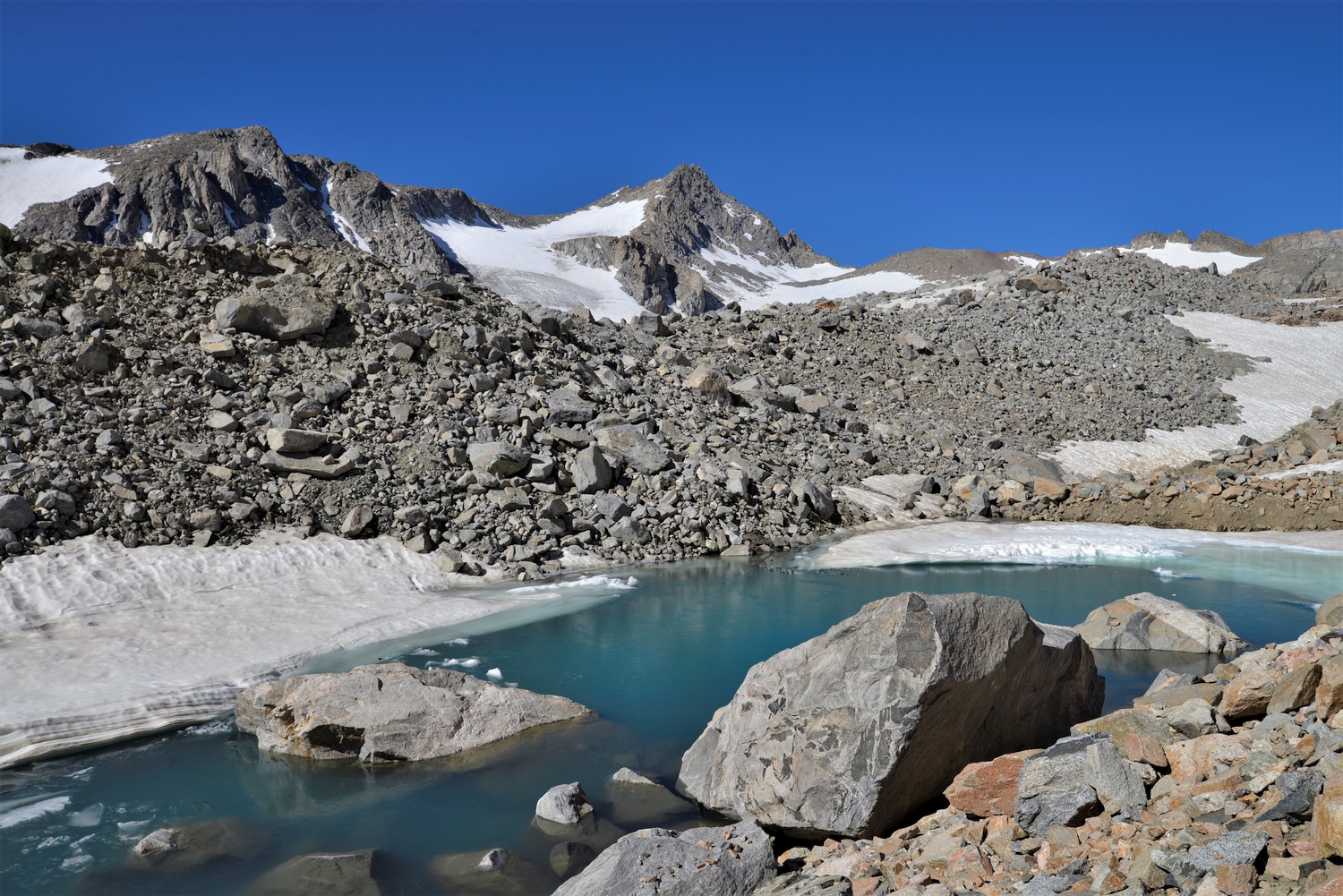
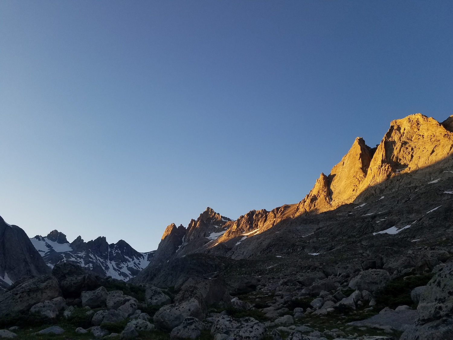
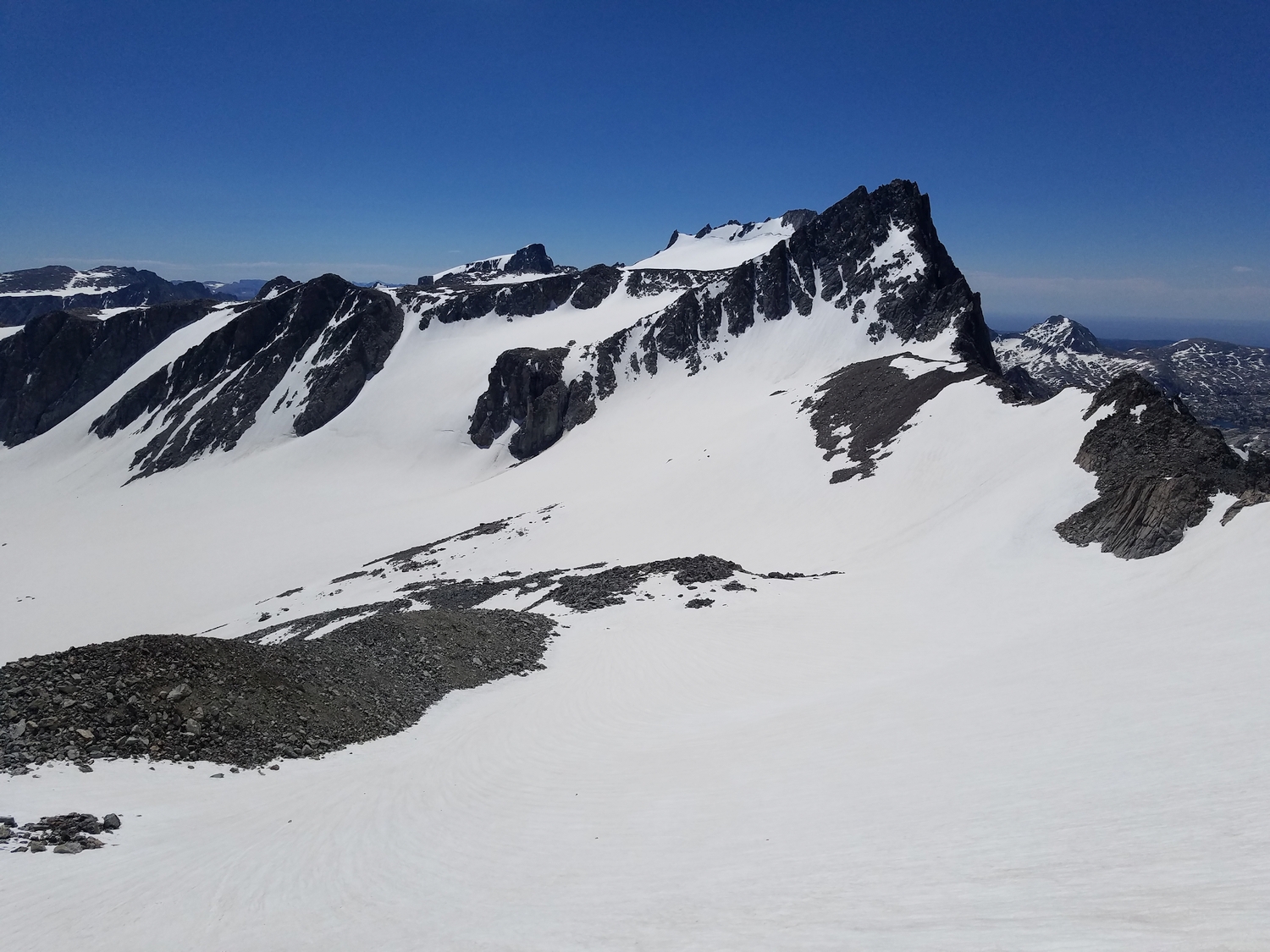
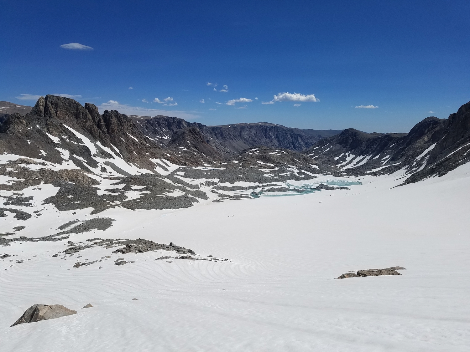
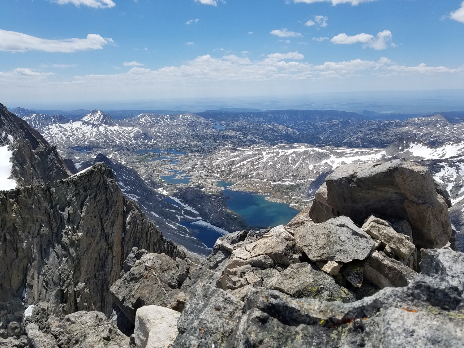
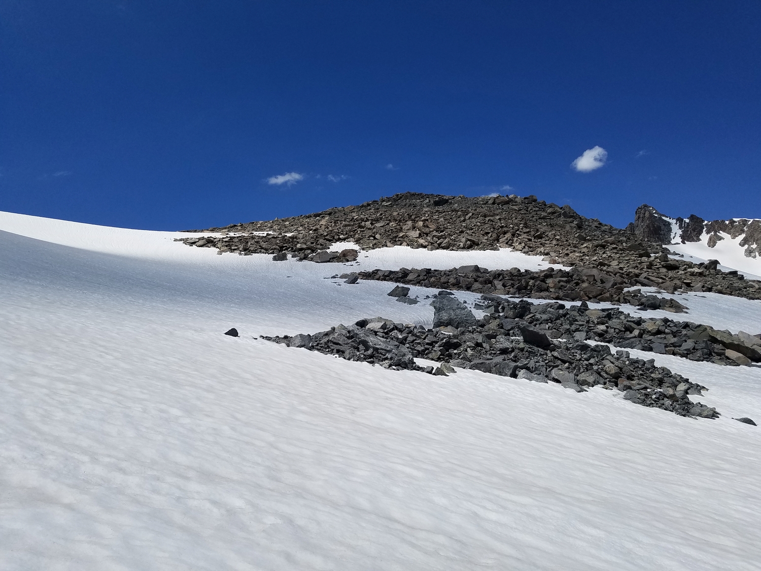
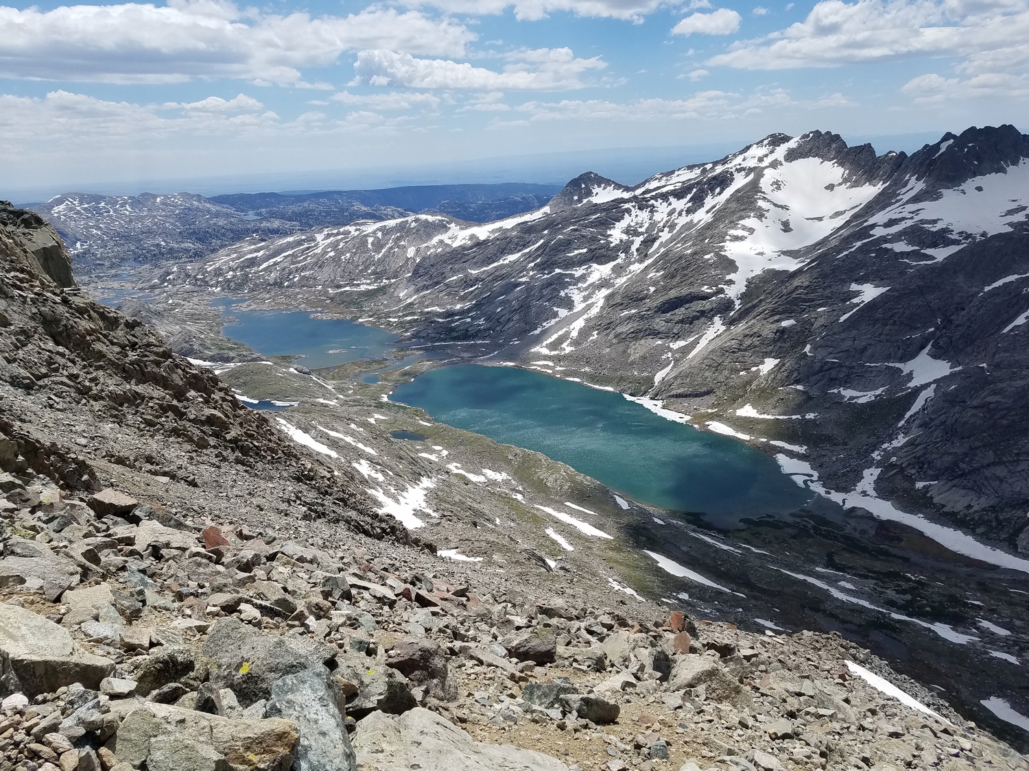
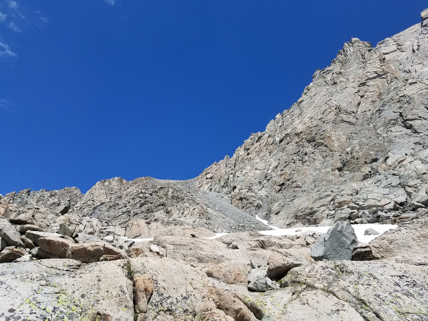
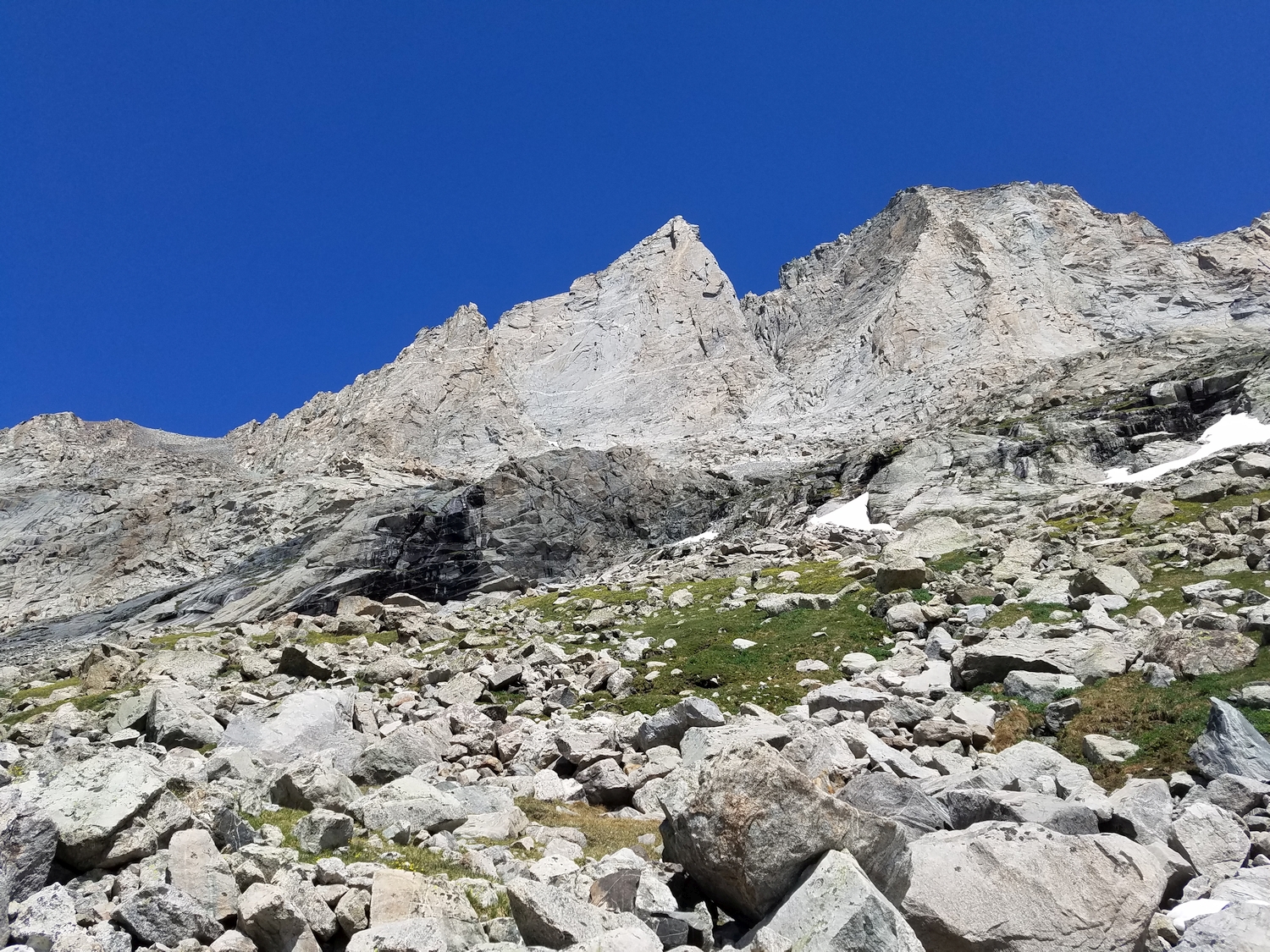
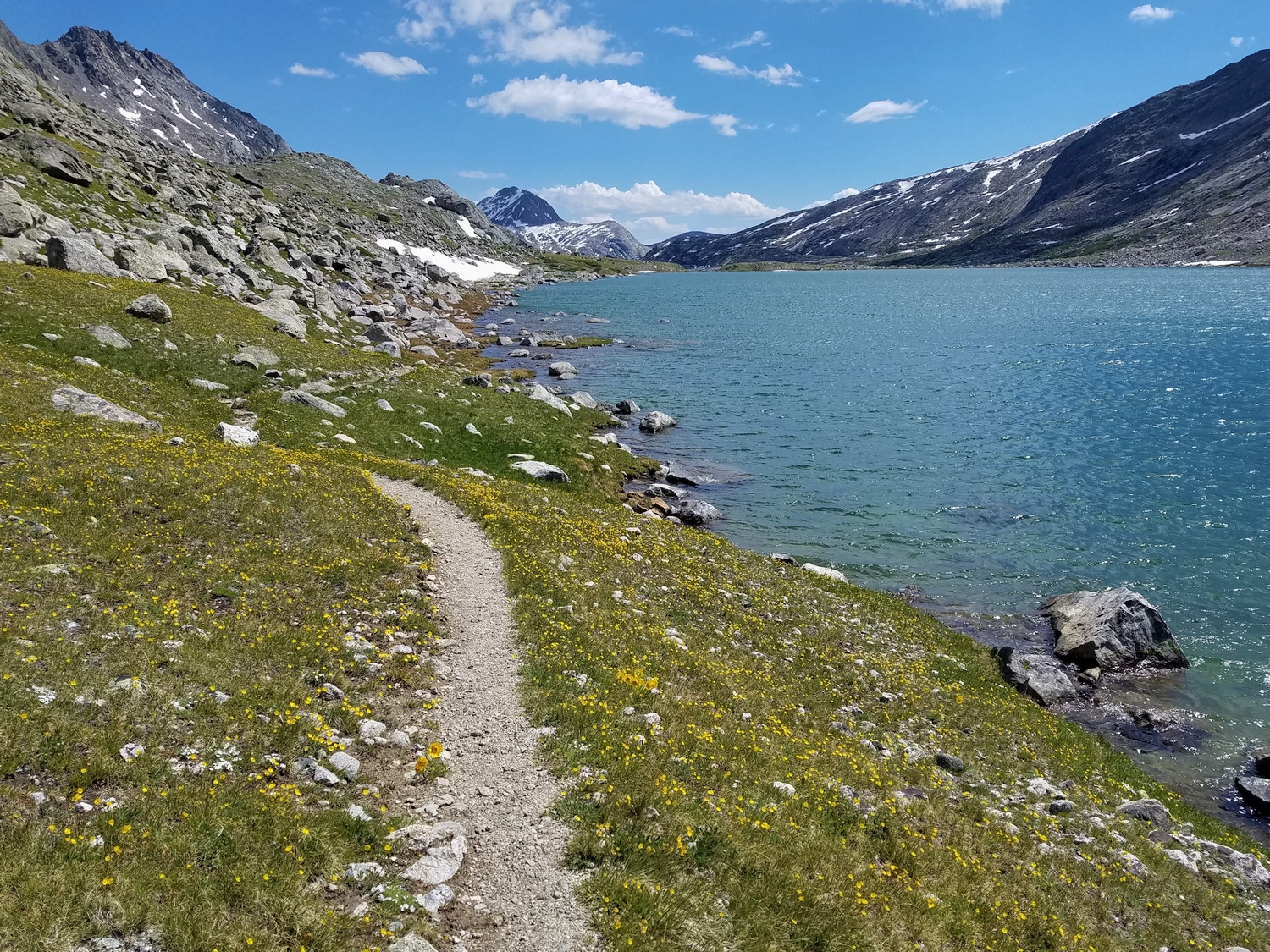
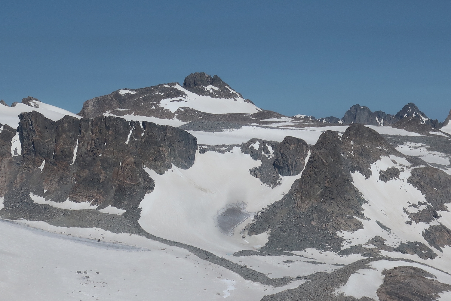
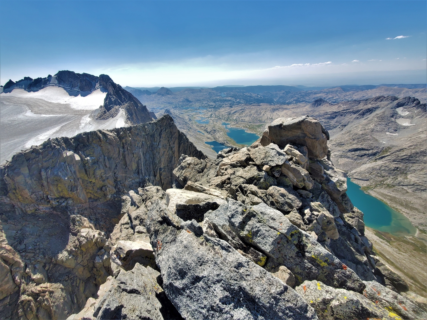
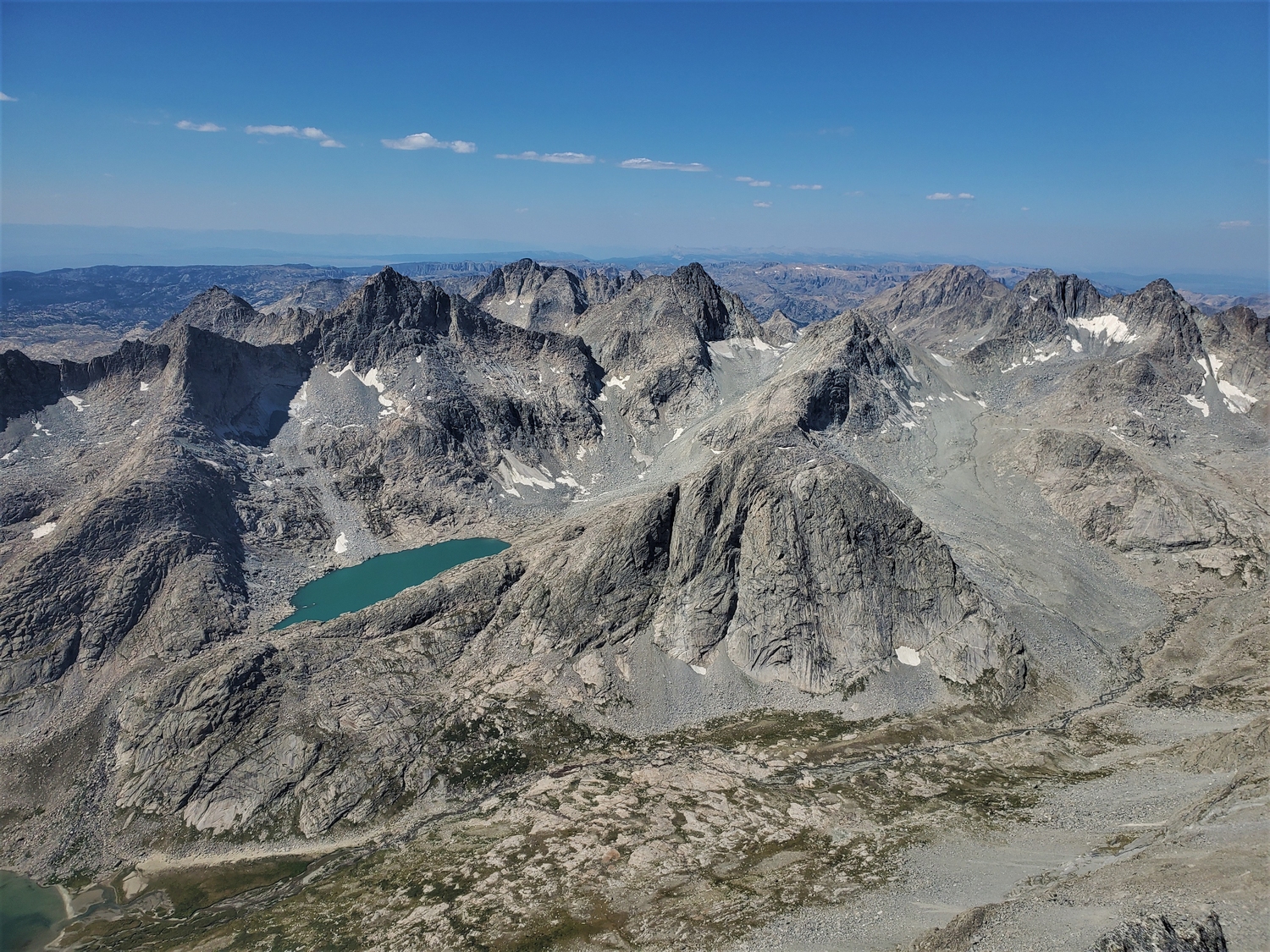
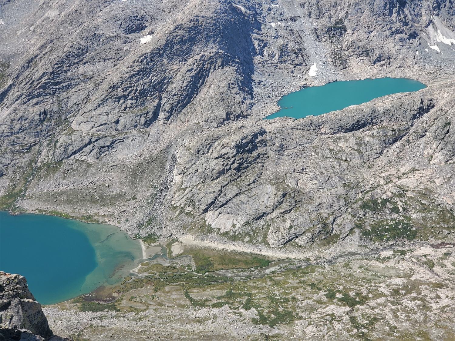
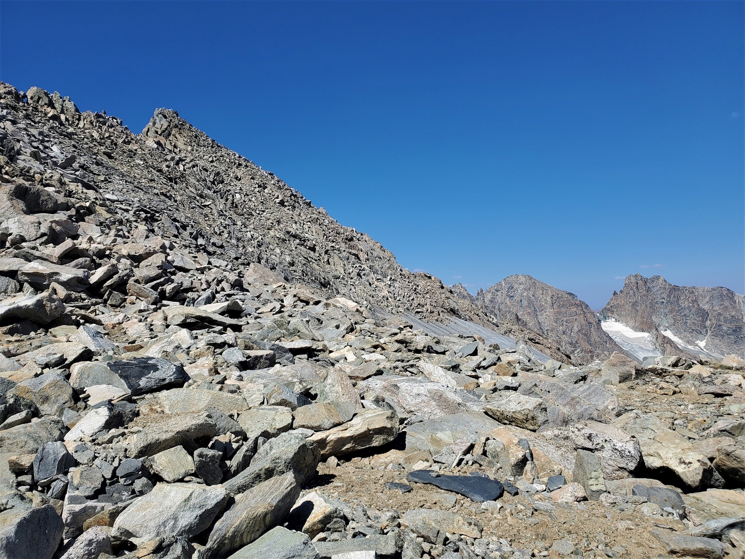
From Titcomb Basin, a talus slope leads from the bench above Lake 10598 to a point on the Continental Divide just north of Mount Sacagawea. The slope angles northeast and cuts through several serious cliff bands, offering a surprising class 2+ passage all the way from Titcomb to the Sacagawea Glacier. The lower section requires navigating some low-angle slabs and short rock steps, while the upper part is entirely scree.
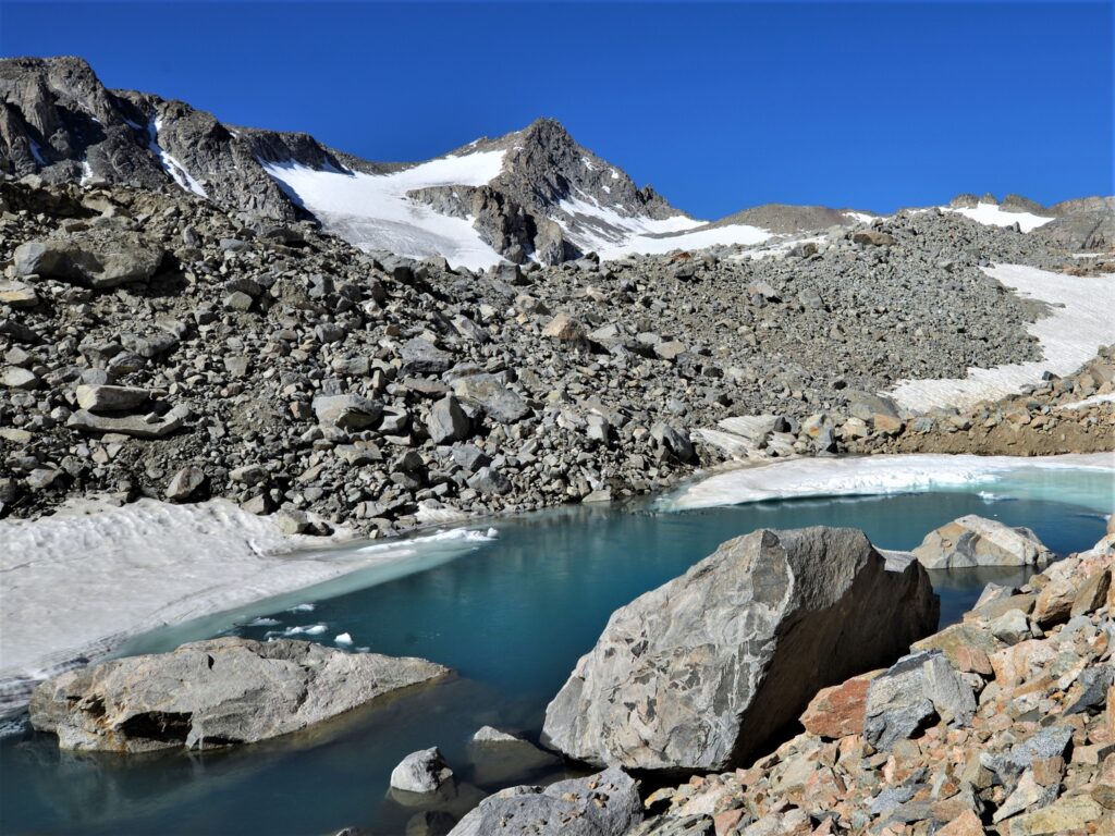
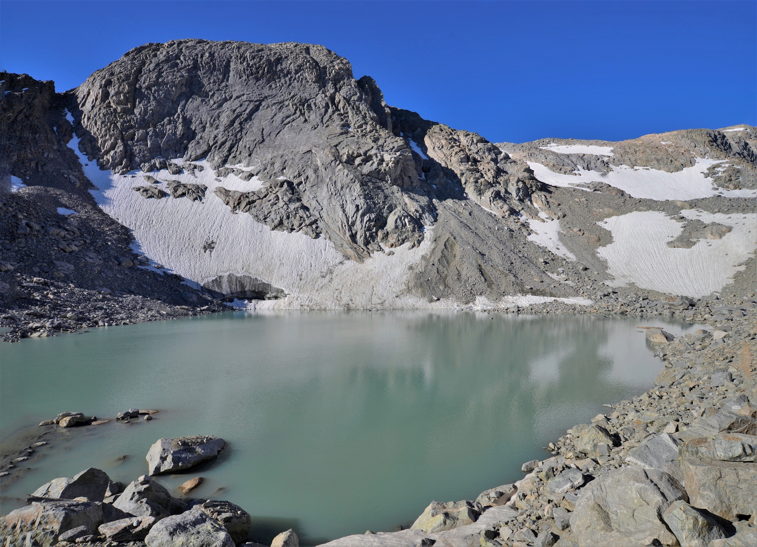
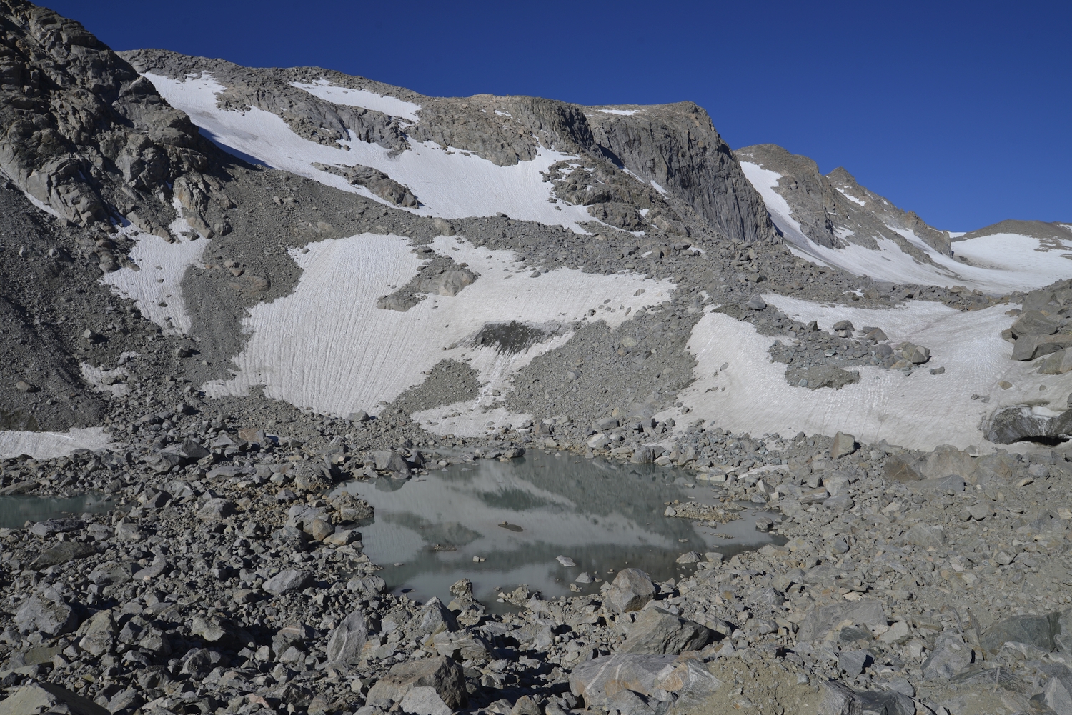
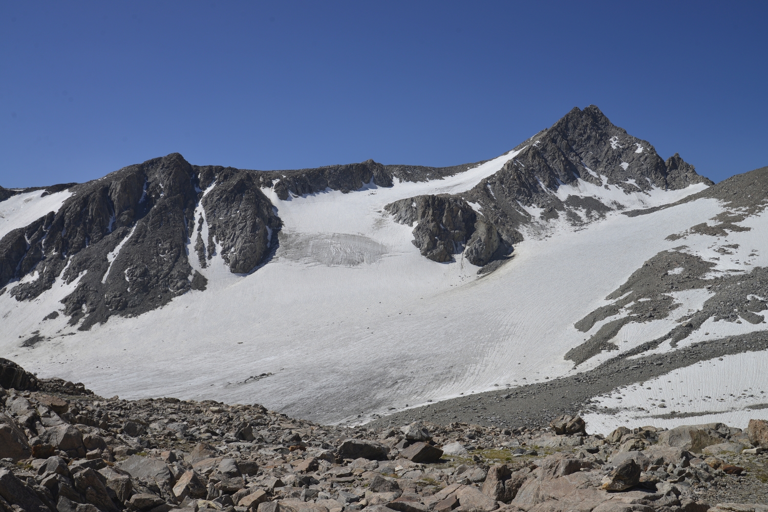
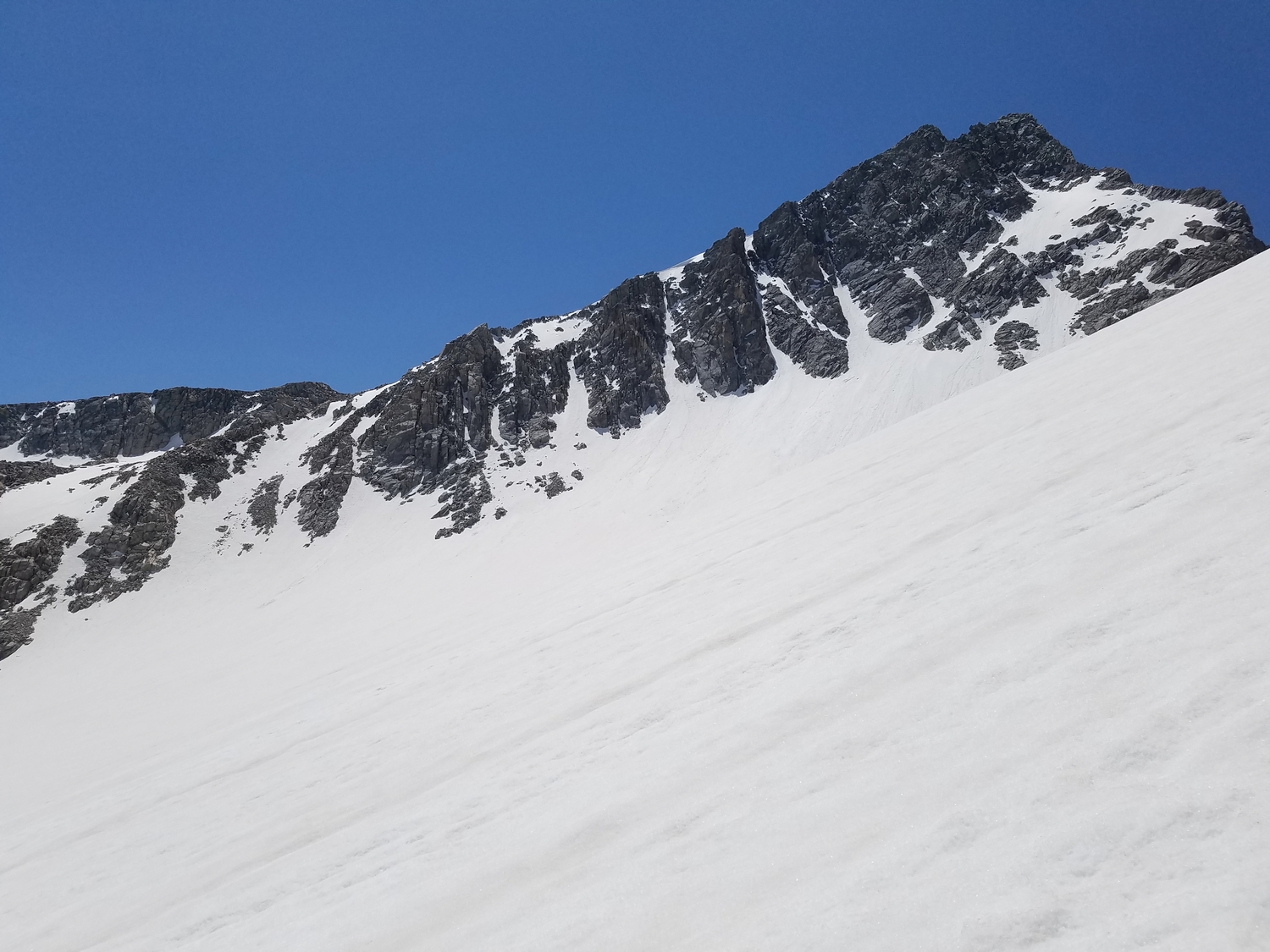
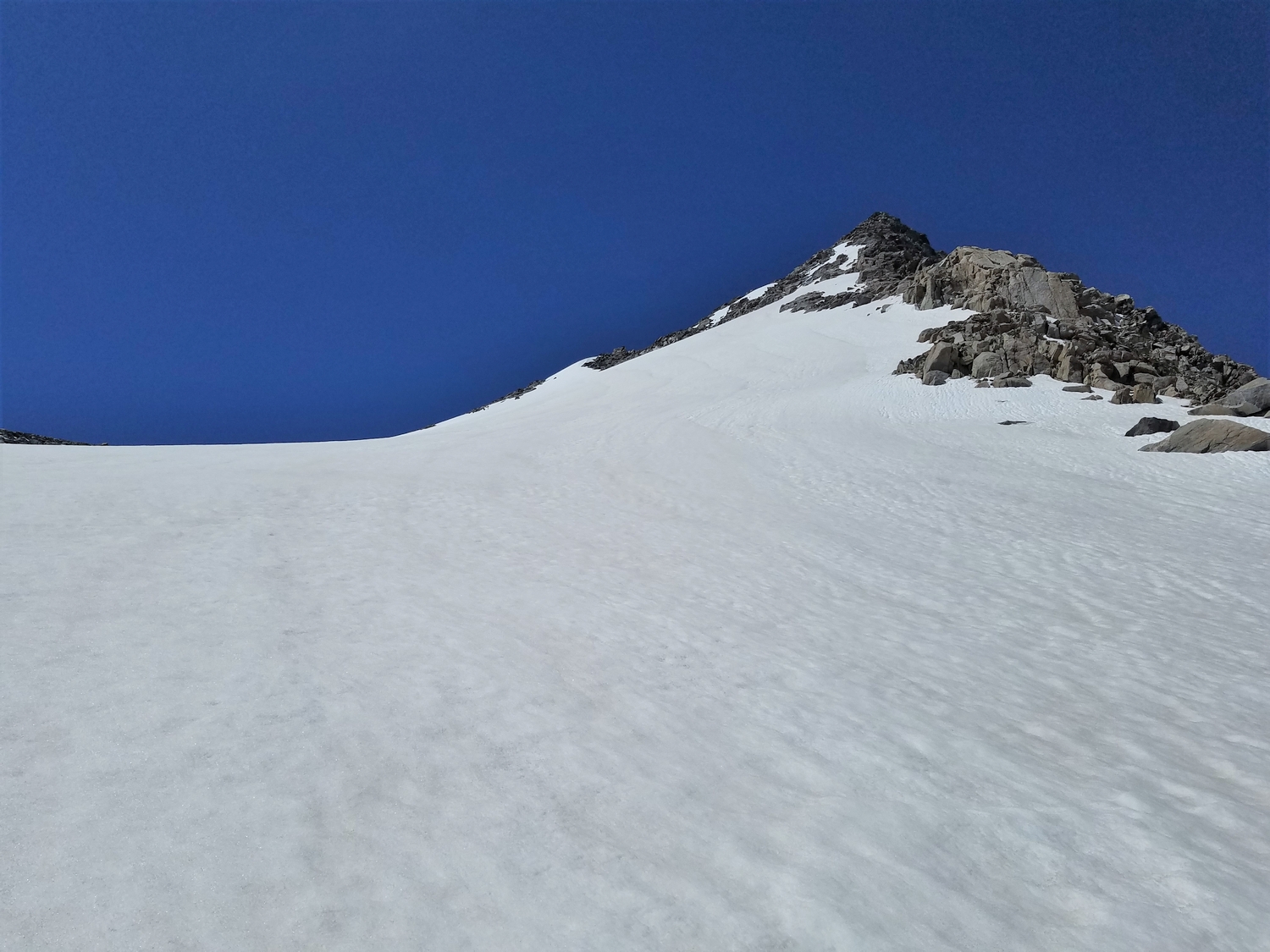
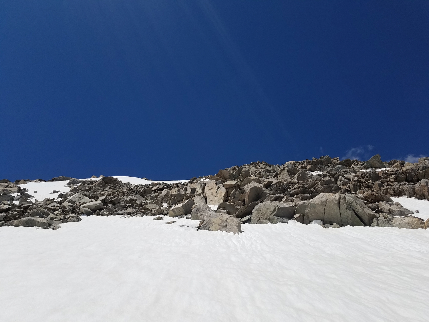
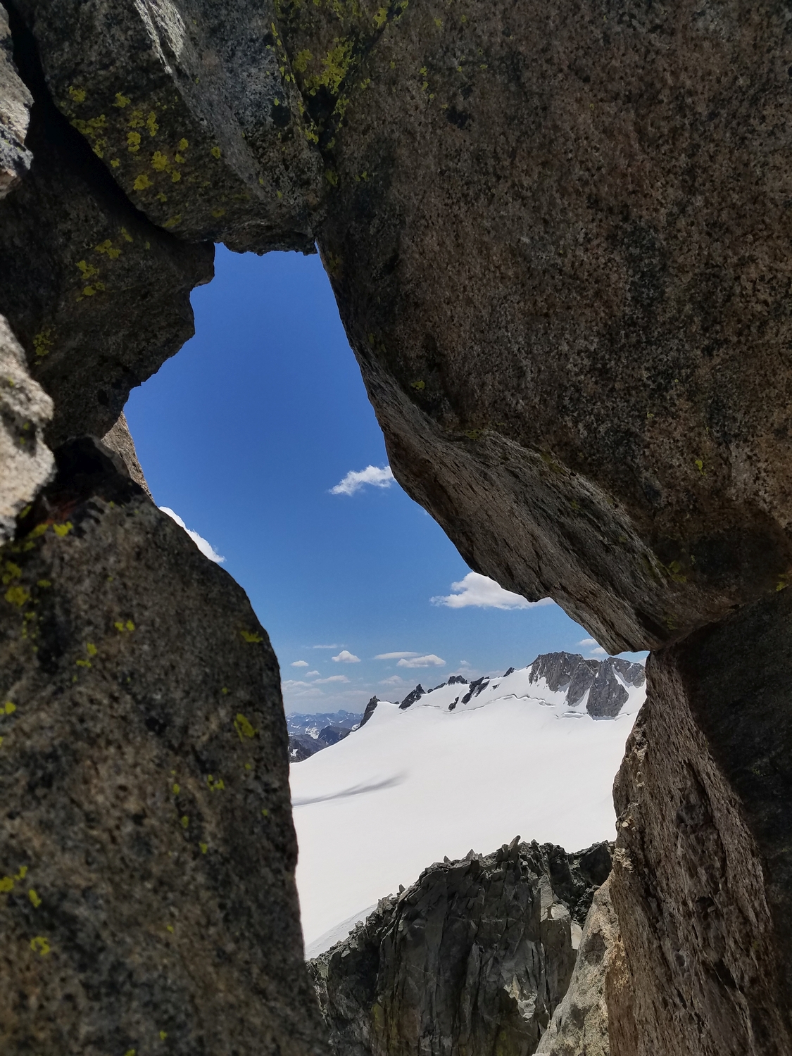
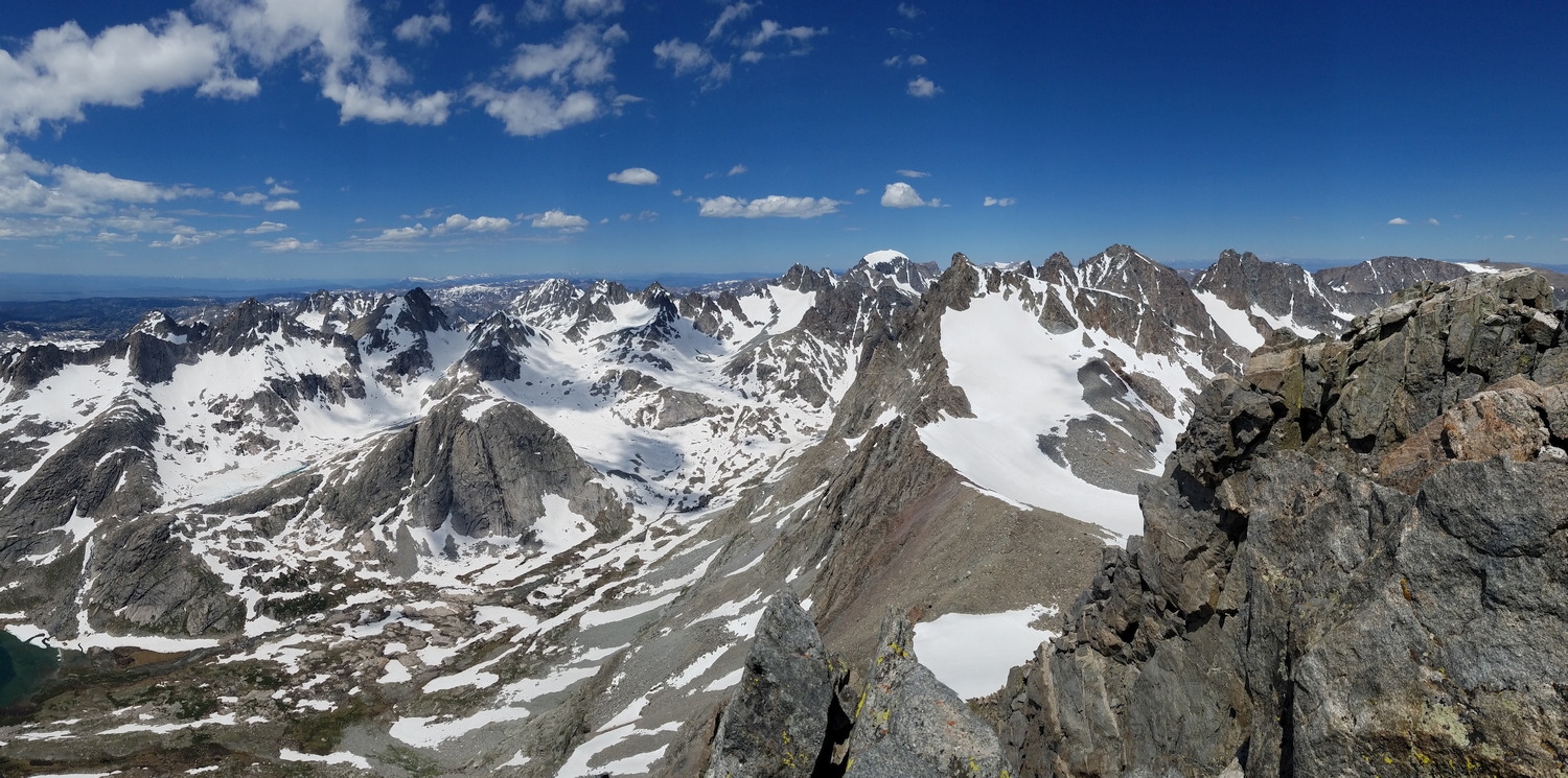
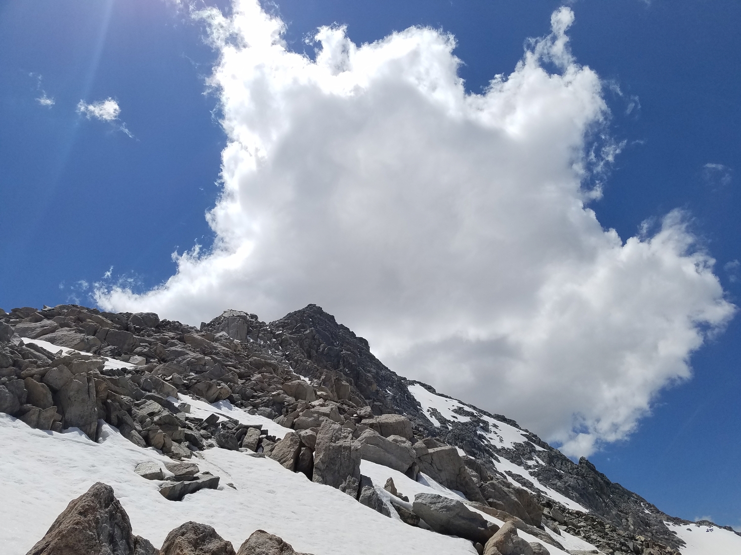
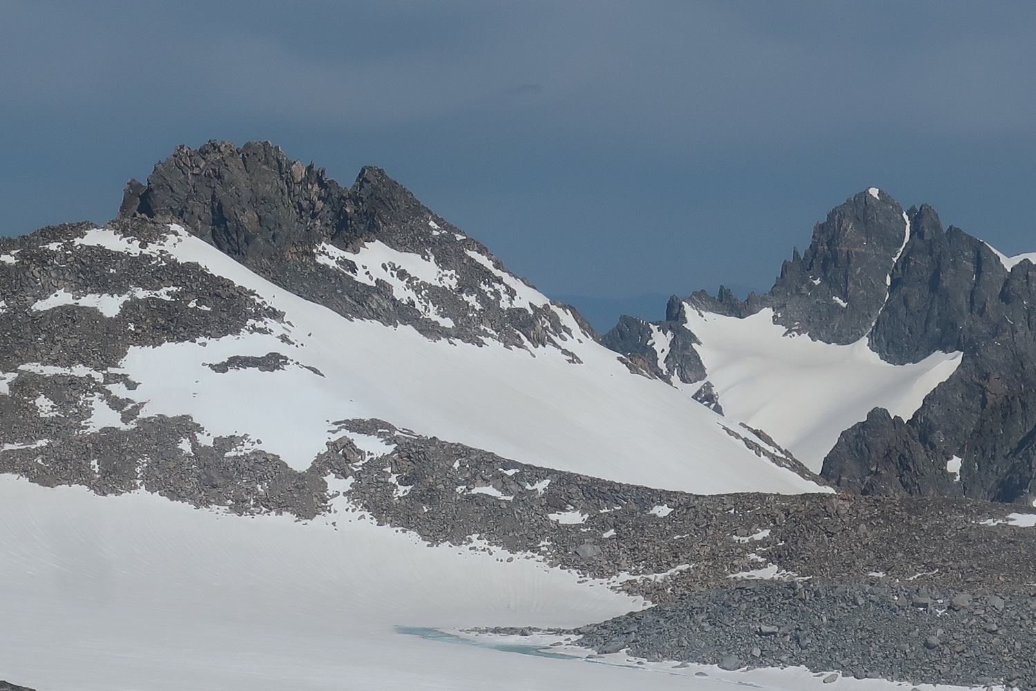
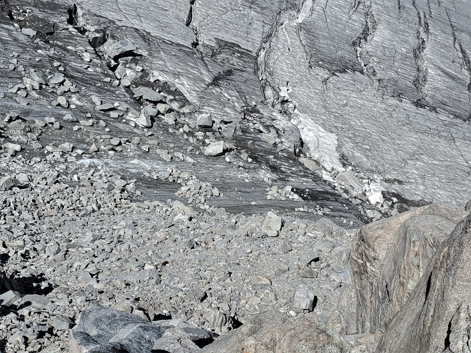
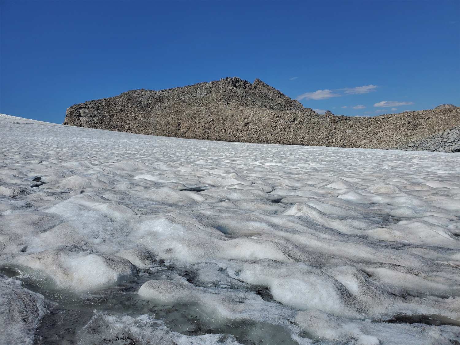
From the crest of the Divide, descend east onto the glacier (crevassed) until you can climb south up a mixed snow/talus gully through a break in the sharp ridge which leads to Sacagawea. Beware of major rockfall hazards in this area. From the top of the gullies, turn back west towards the summit, climbing moderate snow slopes or scrambling the lower east ridge to gain a fore-summit on the Divide.
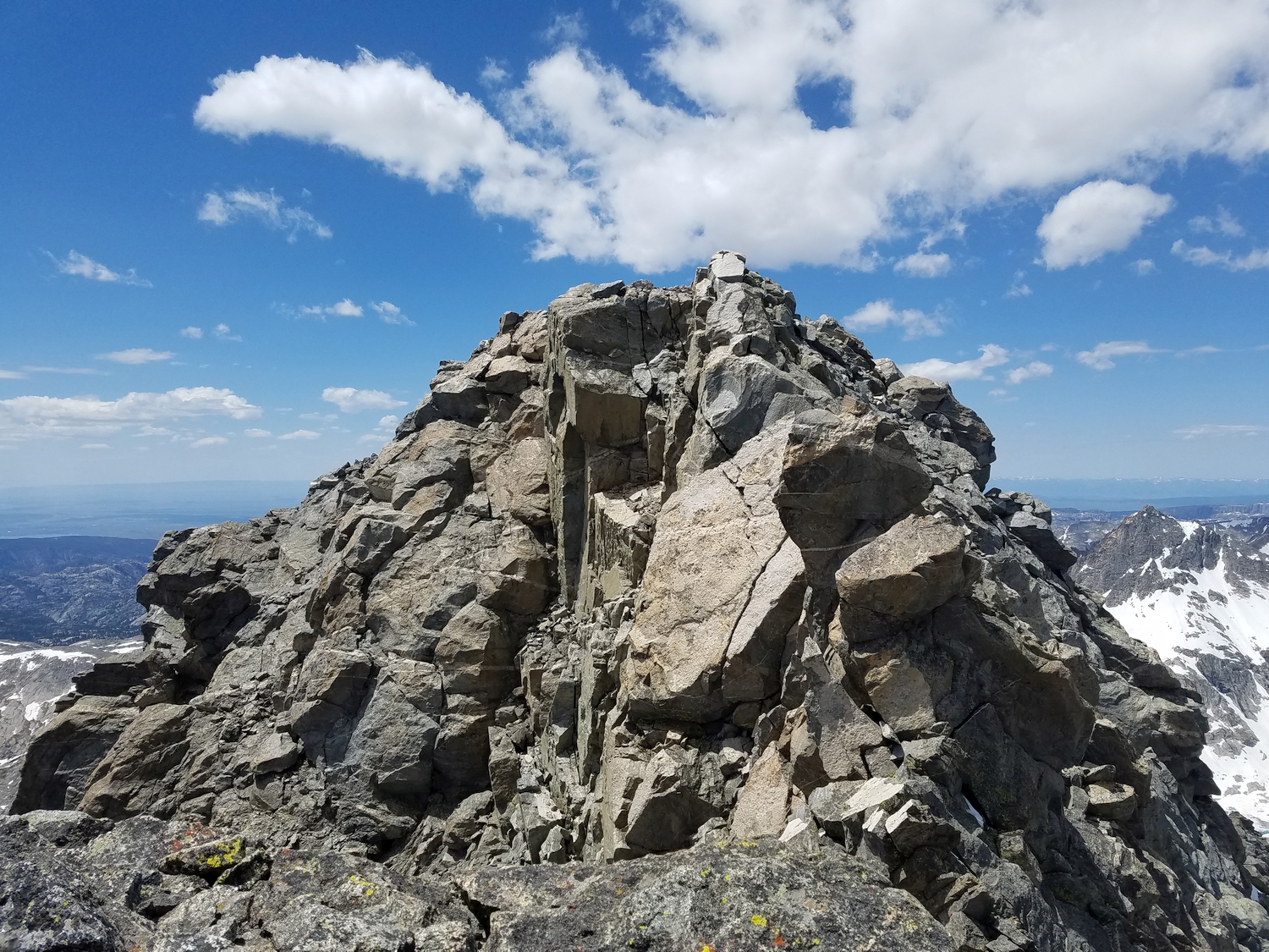
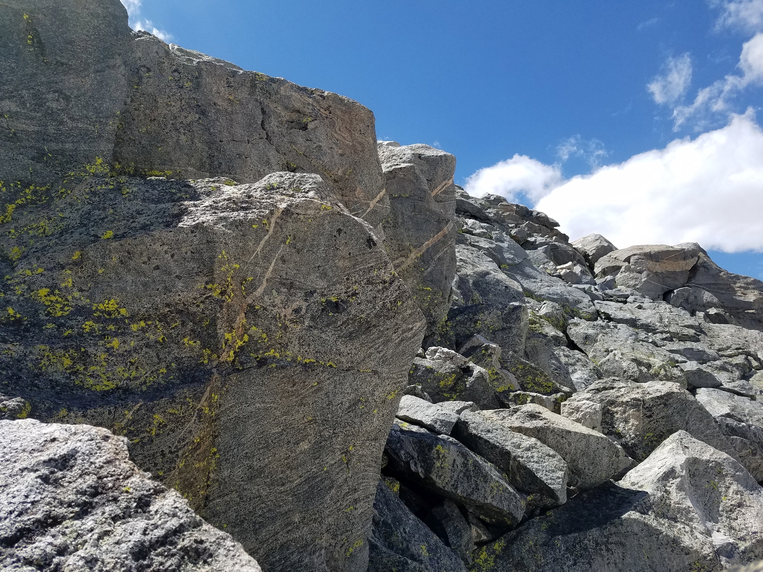
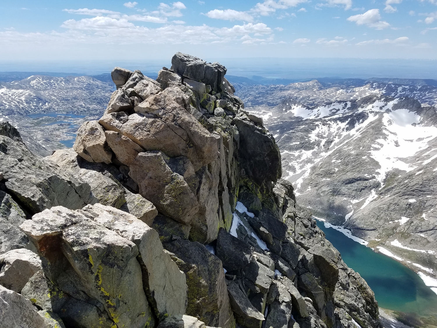
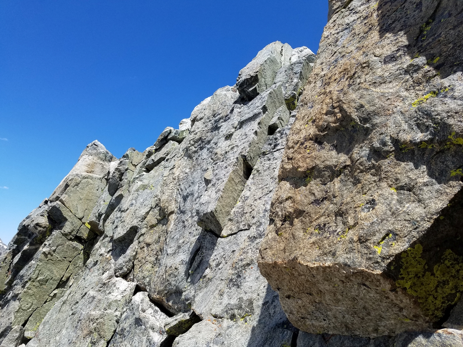
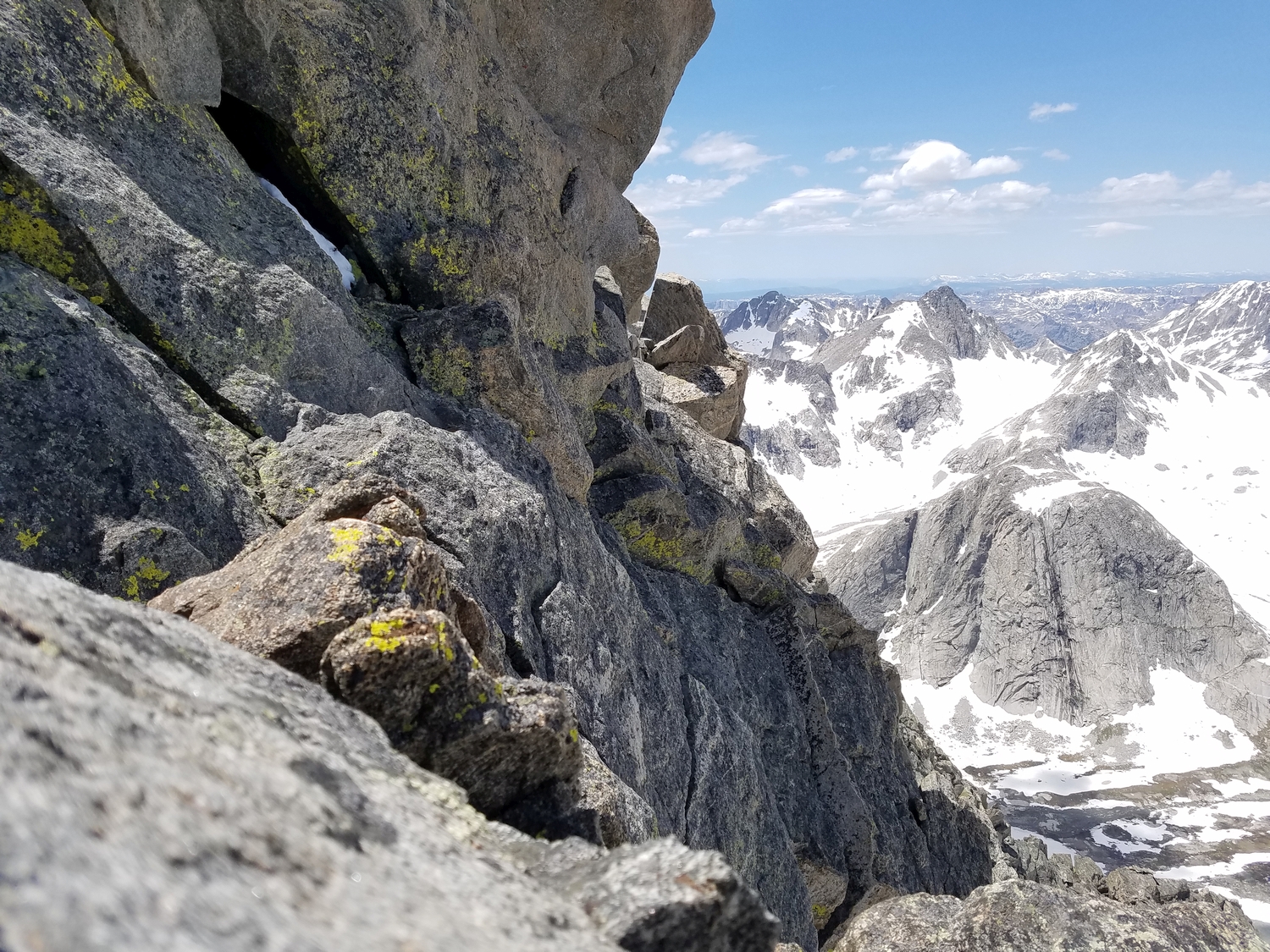
From here, a higher summit rises a few hundred feet to the west, but this too is a false summit. Regardless, it must first be gained in order to continue. Traverse down-sloping ledges and blocky terrain just north of the east ridge to climb up to the second false summit. The exposure becomes dramatic in this area.
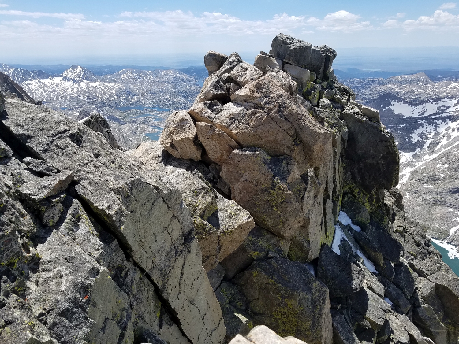
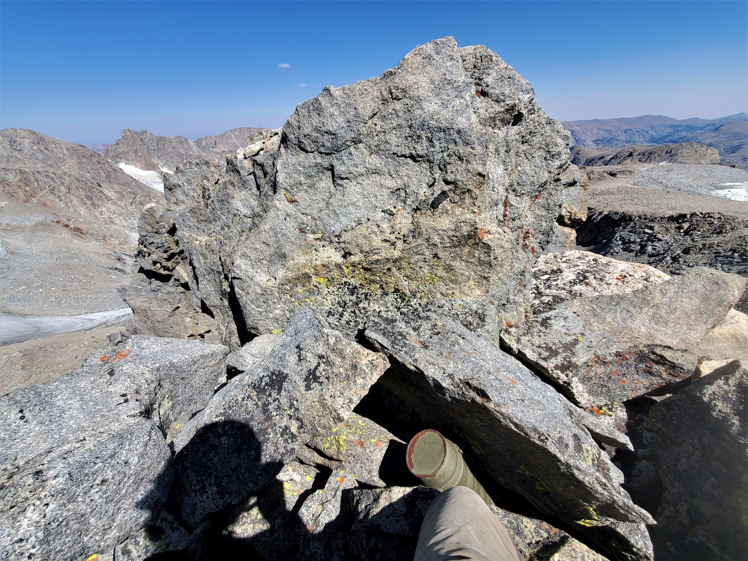
Finally, the true summit should now be in view across a disheartening gap. Downclimb tricky terrain on the west side of the ridge, bypassing giant chockstones on the summit ridge. The final short climb to the summit is incredibly exposed; while traditionally rated class 4, it requires pull-up type moves on overhanging blocks, pushing most people’s definition of the grade. You’ll know you’ve reached the true summit when there are clearly no higher summits to the east; there is also a register.
Mount Sacagawea Map
Mount Sacagawea Panorama
Mount Sacagawea Photos
-
- Mount Sacagawea, seen here with a long telephoto lens from near Lester Pass, has an eminent east face, even though the peak itself is often overshadowed by its higher neighbors on the western wall of Titcomb Basin (2016)
-
- The characteristic greenish color of granite “rock flour” produced by glacial movement is on full display in this tarn in the Sacagawea Glacier moraine (2016)
-
- The Sacagawea Glacier flows from the northeast slopes of Mount Sacagawea (left), separated from Mount Helen (right) by a desolate alpine cirque (2016)
-
- The moraine left by the Sacagawea Glacier is extremely unstable and crossing it is not recommended (2016)
-
- Looking at Mount Sacagawea and its eponymous glacier from the col at the base of Helen’s east ridge as we explore this breathtaking area (2016)
-
- The summit of Mount Sacagawea is positioned just west of the Continental Divide and is separated from the east-facing talus slope by a few hundred feet of technical rock; the view here is from Blaurock Pass (2016)
-
- Fremont Peak (center) usually dominates the view while approaching Titcomb Basin, but peakbaggers and rock climbers will also notice Sacagawea’s profile on the left (2020)
-
- My camp in upper Titcomb Basin, directly below the summit of Sacagawea, seen here catching evening alpenglow some 2,000 feet higher (2020)
-
- From this particular angle, looking down upper Titcomb Basin, Sacagawea is the only prominent summit and clearly stands out above the Continental Divide ridge (2020)
-
- Sacagawea sits between Helen and Fremont in the great chain of peaks on the western wall of Titcomb Basin (2020)
-
- Approaching Sacagawea’s northern side, heading for the small couloirs near the center of the photo which provide access to the east slopes (2020)
-
- Windswept cloud over the Continental Divide near Sacagawea; the Sacagawea Glacier almost reaches the crest of the continent (2020)
-
- Looking down across the Sacagawea Glacier, tucked in a remote corner of the North Fork of Bull Lake Creek (2020)
-
- This first section of climbing leads to a false summit; the true summit, seen here, looms ferociously a bit farther ahead (2020)
-
- Peeking through a natural window in the east ridge at the Upper Fremont Glacier and Fremont Peak (2020)
-
- These large blocks guard the summit, seen here as I begin the convoluted process of reversing my climb (2020)
-
- Tiptoeing along wildly exposed ledges and pulling my way up overhanging boulders, made extra-thrilling by the high winds this day (2020)
-
- Looking back to the true summit of Mount Sacagawea; the climbing route drops down near the bottom of the photo (west side of the summit ridge) and returns to the crest just before reaching the summit (2020)
-
- A final bit of devious scrambling is required to return from the false summit to the fore-summit (2020)
-
- The talus near the top of Sacagawea’s east face is notoriously unstable and has caused serious accidents (2020)
-
- A surprisingly friendly scree slope leads all the way from the crest of the Divide down into Titcomb Basin (2020)
-
- This scree gully meets the Divide at a slight saddle just north of Sacagawea and provides one of the only hikeable paths through this otherwise sheer wall of cliffs (2020)
-
- Despite still being more than 15 miles from the trailhead, the Titcomb Basin Trail seems quite civilized after tackling an ascent of Sacagawea (2020)
-
- Mount Sacagawea’s southern aspect is less intimidating than the shear west face, but the tricky pinnacled summit ridge on full display (2020)
-
- The west face of Sacagawea towers over a pond in upper Titcomb as I begin the tedious ascent to the Divide.
-
- The west wall of Titcomb looks steep and cliffy from afar, but this convenient diagonal ramp is my ticket to the Divide.
-
- It’s a steep climb, and my exercise-induced asthma is acting up this morning, but eventually I make it to the crest to be rewarded with a view of Mount Sacagawea in the morning light.
-
- In June or July, this hanging valley is a beautiful snow bowl and easy to cross in a few minutes. This time of year, it’s a miserable slog across unstable talus and slippery ice patches, taking nearly an hour to cross. The peak in the background is Mount Sacagawea.
-
- Looking south to the Sacagawea Glacier and Mount Sacagawea. The abominable moraine I crossed is in the foreground.
-
- I swear I must have held my breath as I climbed up the gully, as I nearly collapsed once I was back on protected terrain. This view looks back across the glacier to Mount Helen. The east ridge is the right-hand skyline.
-
- To minimize the time I was exposed to rockfall, I didn’t stop for pictures. Once I was at a safe point on the ridge, I got this shot looking back at the gully and rockfall mess on the glacier. Some of these boulders were older; the fresh rockfall is concentrated on the right side.
-
- Closeup of some of the rockfall that I witnessed. The largest piece, seen here, was the size of a small car. I walked right through this area to get to the gully, then scrambled up out of the fall line as fast as I could.
-
- Sacagawea’s upper ridge is a welcome respite, offering a mix of hiking and easy scrambling. The best thing about ridges is that they’re typically immune to overhead rockfall.
-
- Looking back down at the Sacagawea Glacier. I might have been able to climb this lobe to avoid the rockfall gully, but it’s pretty steep, icy, and crevassed at this point in the season. Not wishing a repeat of my experiences on Woodrow Wilson and the Twins, I chose to roll the dice on the gully.
-
- All 6 of the 13ers I climbed on day 3 are visible in this shot, but Sacagawea is so tall that these lower peaks blend into an nondescript sea of ridges and summits.
-
- Closeup of Summer Ice Lake and the edge of Lake 10598 in upper Titcomb. Our camp was somewhere in that meadow, but my mom has packed up for the move to Indian Basin by now.
-
- The summit of Mount Sacagawea. There is a register that I managed to sign, but the pencil is broken and needs to be replaced.
-
- The true summit sits across another gap at the end of the ridge. The scrambling is non-trivial and the exposure is attention-getting, but at least the rock is fairly solid. I feel like I have much more control over my fate here compared to gambling with rockfall on easy terrain.
-
- From the first false summit, some exposed and convoluted class 4 scrambling leads to the second false summit, pictured here.
-
- Looking back at the false summit of Sacagawea as I descend talus east of the Divide. It was somewhere near here that Teresa had a major accident caused by loose talus. Spooky.
-
- Mount Sacagawea looks entirely underwhelming from this angle. It’s really just a bump on the north ridge of Fremont, but it has over 500 ft. of prominence, making it a firm member of the 13ers list. Who would guess from this angle that Sacagawea’s west face is one of the steepest big walls in the range!
DISCLAIMER: Mountain climbing is dangerous. Activities described on this page may lead to serious injury, death, and property damage. This webpage is presented with no warranty express or implied. Pictures and text are for entertainment purposes only. No commercial use allowed; all rights reserved.