Twin Peaks
Elevation: 13,216 ft.
Prominence: 423 ft.
Isolation: 0.6 miles
Technical Difficulty: Class 3+
East Twin
West Twin


Twin Peaks Guidebook
Introduction
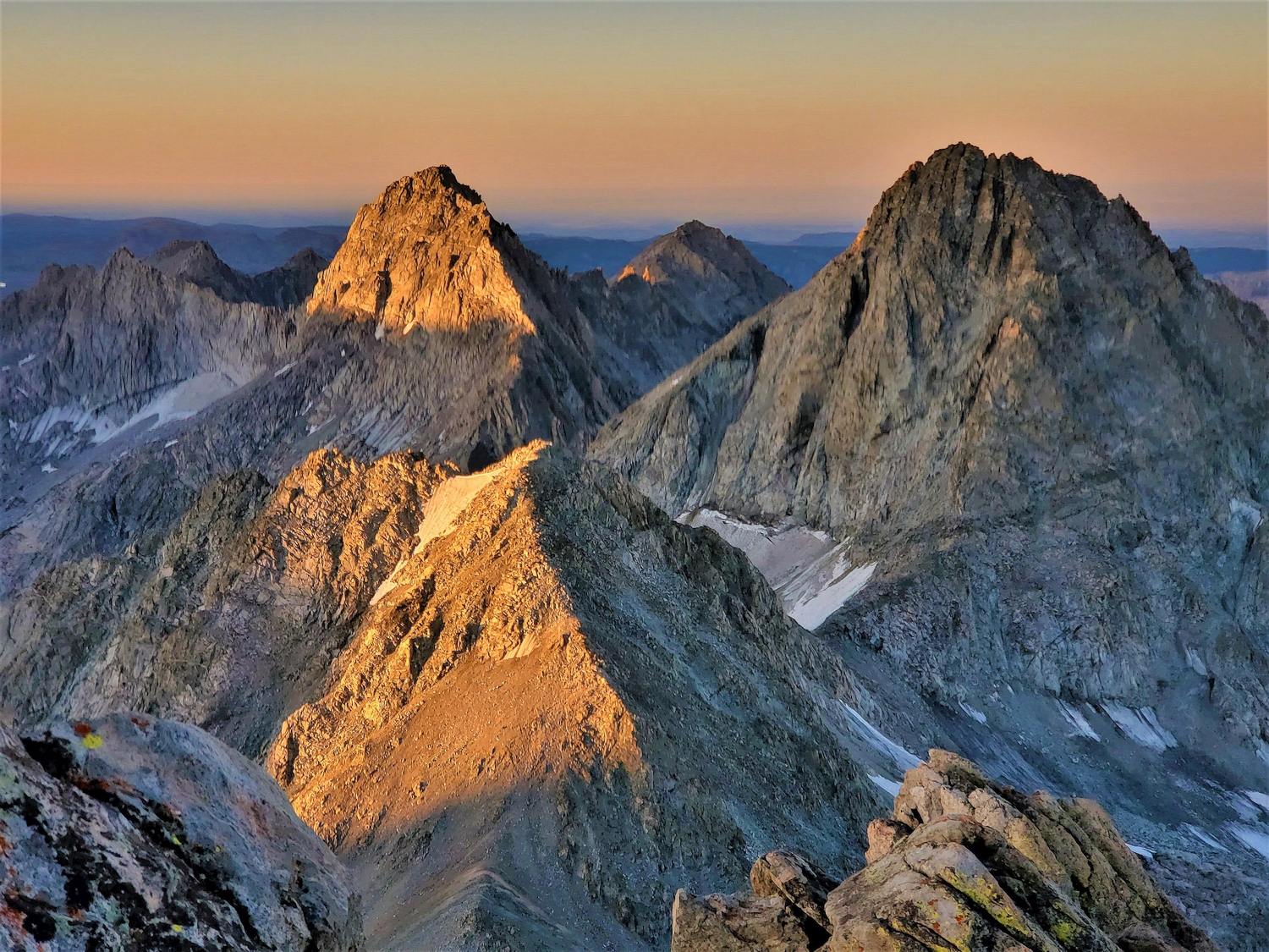
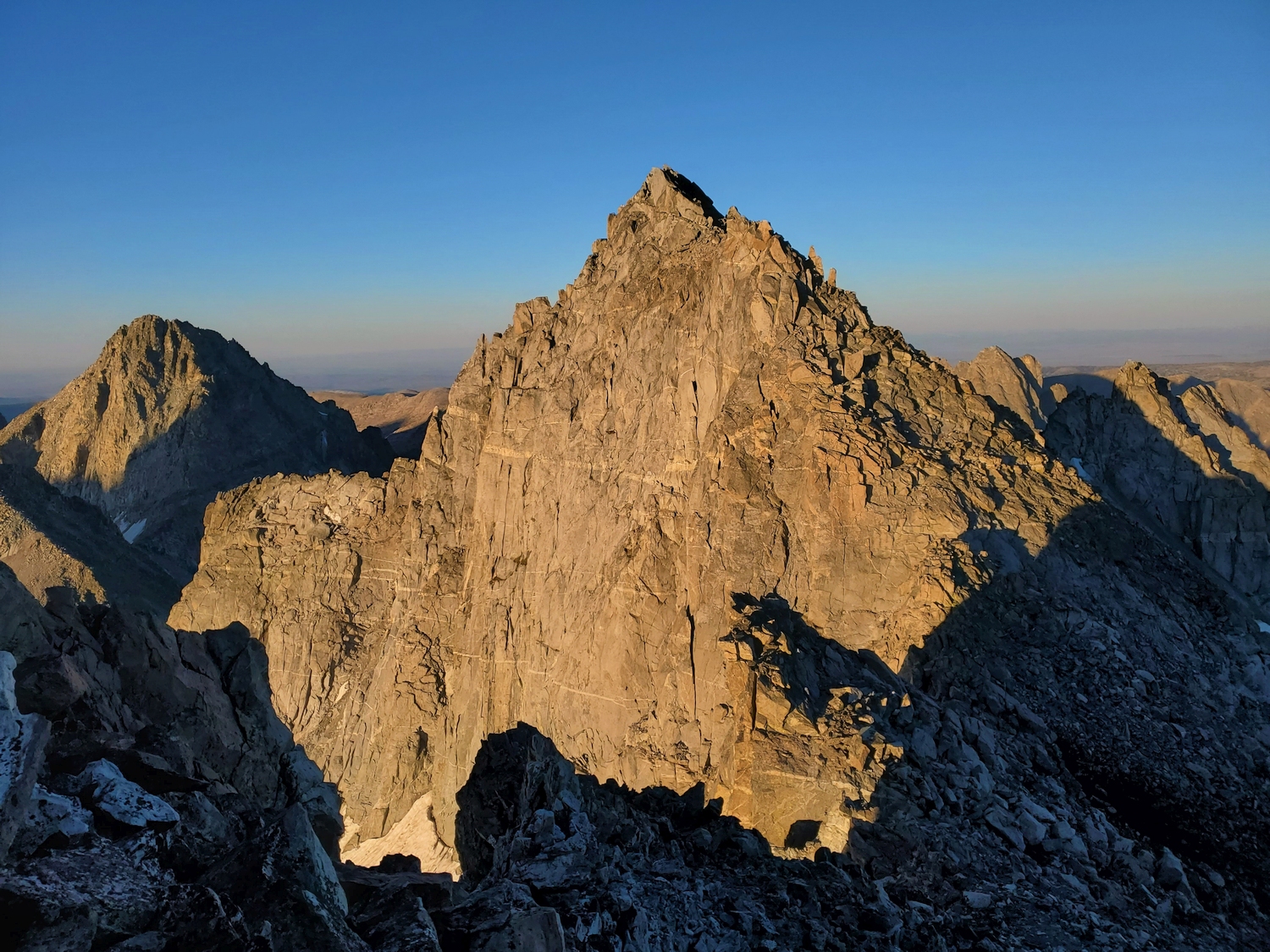
The Twin Peaks are a pair of sharp rock horns at the head of both the Mammoth Glacier and upper Titcomb Basin. They are hidden from most points in lower Titcomb, but from Fremont Peak or other nearby 13ers, these symmetric spires stand out.
The East Twin (which has a summit register) has an elevation of 13,216 ft. according to LiDAR data (coords. 43.16007° N, 109.65883° W), while the highest LiDAR point on the West Twin comes in at 13,214 ft. (coords. 43.15848° N, 109.66157° W), a difference which is within the uncertainty of the analysis due to the West Twin’s exceedingly sharp summit block. Sight-leveling and GPS measurements have similarly failed to determine which summit is higher. Thus, it is established protocol amongst all finishers of the Wyoming 13er list that both summits of the Twins must be climbed to unambiguously claim the high point.
General Considerations
As mentioned above, until a definitive measurement can be obtained, you should touch the top of both the eastern and western summits in order to claim an ascent of the Twin Peaks, even though only one of these summits is actually a ranked Wyoming 13er.
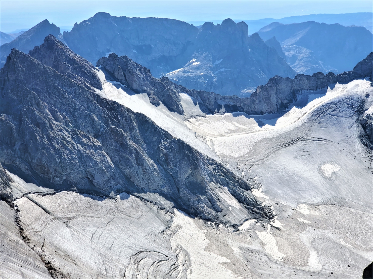
The Twins can be climbed equally well from Titcomb Basin or the Mammoth Glacier. The climb from Titcomb is a bit steeper, though the Mammoth Glacier approach has crevasses and turns to ice in the late season, so the choice of route will depend on your experience and comfort level with steep snow and rock versus crevassed glaciers as well as your other objectives in the area.
Route 1: Northwest Slopes – Class 3+, Moderate Snow
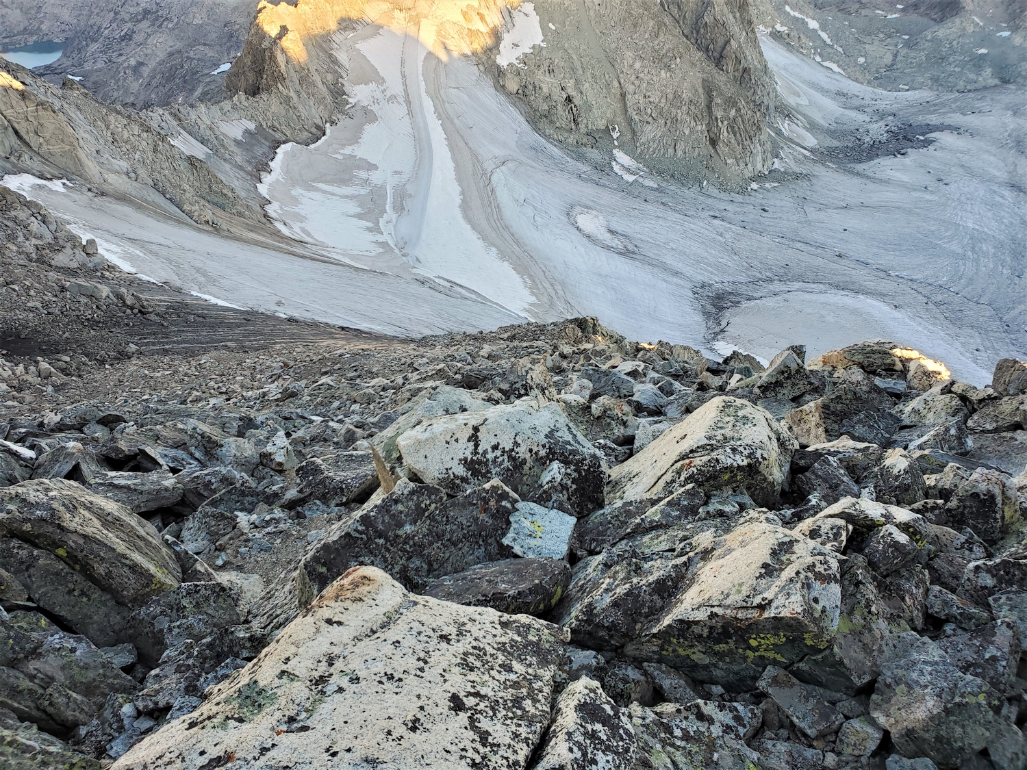
Reach the upper Mammoth Glacier by any number of routes: the most obvious approach options include Split Mountain Pass, Glacier Pass, and via Scott Lake (see Desolation Peak description). Beware of serious crevasses on the glacier. From the flattish southern arm of Mammoth Glacier around 12,000 ft., climb moderate snow slopes up a glacier lobe that reaches nearly to the saddle between the East and West Twin. In the late summer, this lobe of the glacier melts down to solid ice, and the upper section may even harbor seasonal water ice depending on the year.
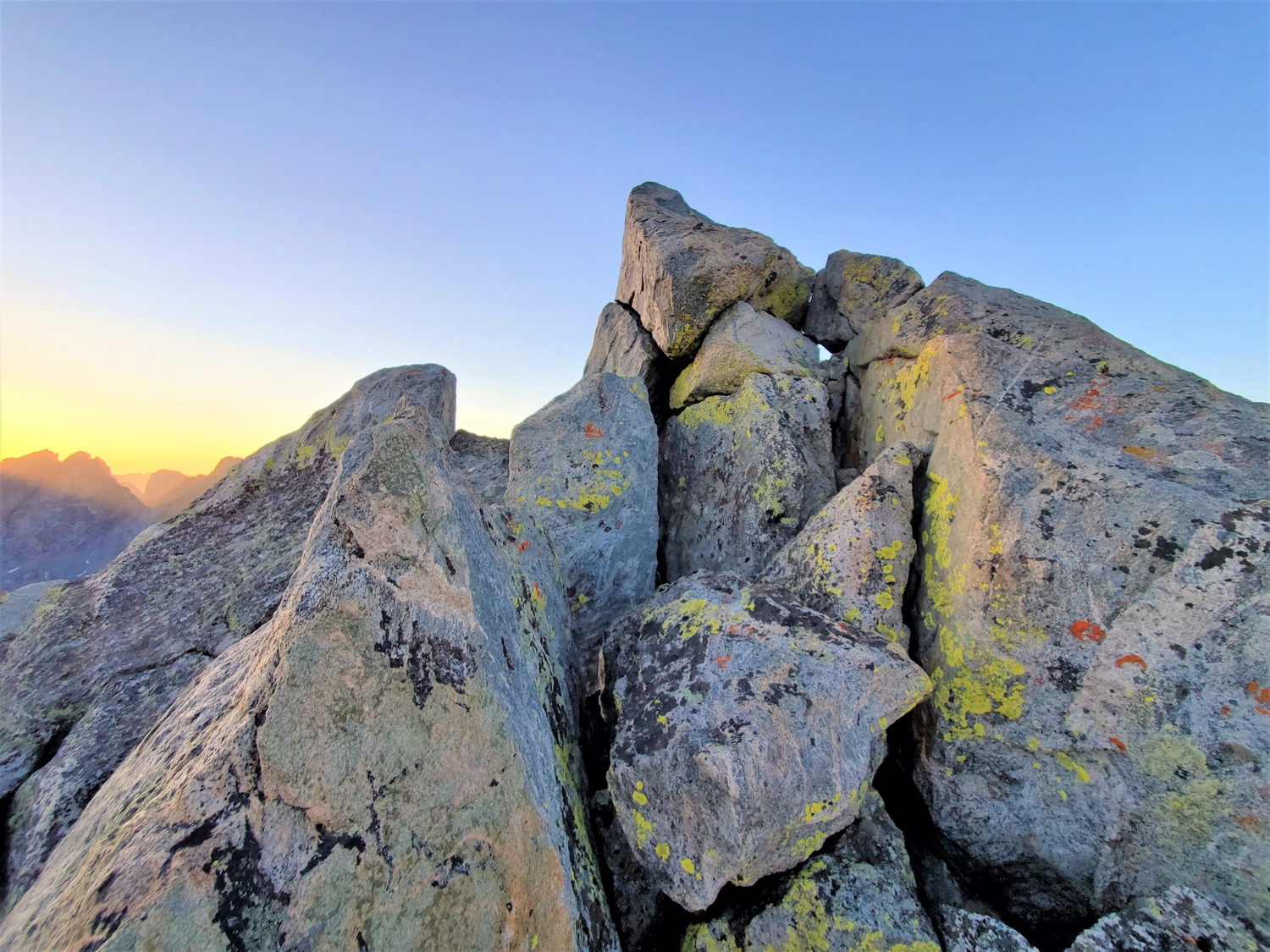
From the saddle, the East Twin can be reached by walking up talus, but the West Twin requires a bit of rock scrambling over steeper blocks near the summit.
Route 2: Southeast Couloir – Class 3+, Serious Snow
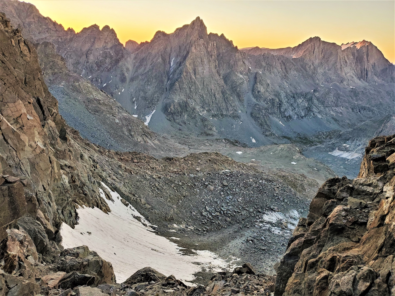
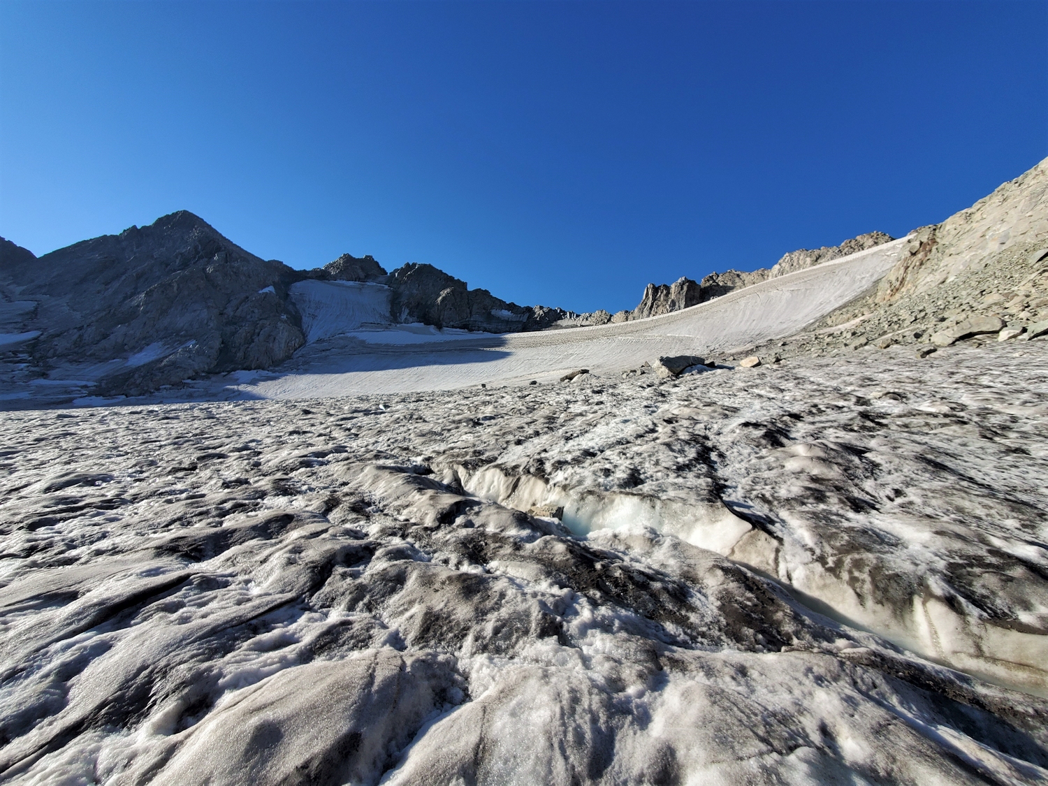
From upper Titcomb Basin, follow the usual off-trail route towards Knapsack Col, hiking over some mix of snow, scree, and grass depending on the season. Climb north up a steep scree embankment around 12,200 ft. to reach the hanging glacial remnant directly below the Twins’ southeast cirque. Alternatively, you can reach this route by crossing Knapsack Col from the Peak Lake region and traversing north into the same hanging cirque.
From the snowfield, head for the saddle between the Twins. The snowfield does not quite reach the saddle, and the final 200 ft. requires some steeper climbing up a narrow, left-angling couloir. This couloir offers a snow route in the early season, but it turns to a nasty mix of ice, scree, and dirty class 4+ cliff bands later in the summer. From the col between the Twins, the east summit is a short hike while the west summit requires a short scramble.
Twin Peaks Map
Twin Peaks Panorama - East Twin
Twin Peaks Panorama - West Twin
Twin Peaks Photos
-
- The Twin Peaks (far right) rise at the head of Titcomb Basin, but other peaks obscure their summits from most points in the lower basin (2016)
-
- The Twins’ summits can barely be seen above the rounded buttress on the left (west) side of Titcomb Basin (2020)
-
- Western summit of the Twin Peaks; sight leveling is inconslusive between the Twins, so both summits must be climbed to claim the highpoint (2020)
-
- The East Twin is marked as the highpoint on maps, but it is unclear which is actually highest (2020)
-
- East Twin has an original summit register from 1930, placed by a party of notable climbers including Carl Blaurock, one of the first people to finish the (then-accepted) list of Colorado 14ers (2020)
-
- Golden sunrise light hits the West Twin, with American Legion and Henderson looking handsome in the distance (2020)
-
- Descending the shadowed west slopes of the Twin Peaks onto an upper arm of the Mammoth Glacier (2020)
-
- The Twin Peaks sit on the ridge junction between the Mammoth Glacier, Titcomb Basin, and the Peak Lake valley, seen here from the top of Split Mountain (2020)
-
- I kept taking zoomed photos of the Twins whenever I had the chance, since I was worried about descending the icy upper section of the Mammoth Glacier. I was feeling a bit more confident after succeeding in getting up Woodrow Wilson, but the Twins did look awfully icy…
-
- First light on the Twin Peaks. My route would follow a gully from the snowfield to the saddle. It’s a snowclimb most of the summer, but a chossy gully in the late season.
-
- A short section of icy snow encouraged me into crampons for a hundred feet, and then I scrambled up the melted-out gully. Without snow, the crux was a short slabby face that I’d call 5.0.
-
- Dawn breaks over Titcomb Basin as I reach the saddle between the Twins. The elegant peak near the center is Mount Helen.
-
- Sunrise on Henderson (illuminated, left), with American Legion still shadowed on the right. The short peak catching light in the foreground is Winifred, a 12er.
-
- Behind the East Twin, the jagged crest of Mount Woodrow Wilson is backlit by the morning light. The west couloir is the dark fissure descending from just left of the summit.
-
- The summit rocks of the West Twin. The east and west summits of Twin Peaks are within a couple feet of the same elevation–and since LiDAR is not able to perfectly capture sharp spires like this, it’s still unclear which summit is the true high point. Thus, it’s conventional to visit both.
-
- Looking back at the West Twin as I hike up the East Twin. The West Twin is a class 3 scramble, but the East Twin is only class 2 from the saddle. It only takes a few extra minutes to climb both.
-
- On the summit of the East Twin. I couldn’t find the historic register that’s supposed to be on this peak–I wonder if it got lost or stolen?
-
- One of several large crevasses where the steep upper lobe meets the lower glacier. These were fairly easy to negotiate on snow bridges.
-
- The slightly softer glacier ice felt like a relief after the rock-hard water ice. Still, it was a long, steep slope, and I worked my way down slowly.
-
- Looking back up at the face. The water ice band is the thin black strip that’s barely visible at the top.
-
- This photo from the summit of Split Mountain gives a good overview of the difficulties on Twin Peaks. The shiny black ice just below the saddle was the sketchiest section. Descending the lower glacier lobe was mostly easier, albeit still quite icy.
-
- Sunrise on the Twin Peaks, which I climbed yesterday. The route follows a cleft in the rock that leads from the snowfield to the saddle between the West Twin (right) and East Twin (left).
DISCLAIMER: Mountain climbing is dangerous. Activities described on this page may lead to serious injury, death, and property damage. This webpage is presented with no warranty express or implied. Pictures and text are for entertainment purposes only. No commercial use allowed; all rights reserved.